May 17 , 2023.
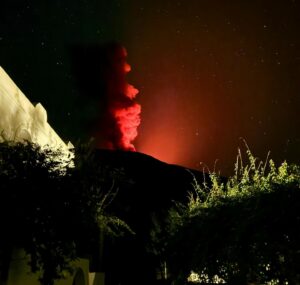
Italy , Stromboli :
WEEKLY BULLETIN, from May 08, 2023 to May 14, 2023. (issue date 16 May 2023)
ACTIVITY STATUS SUMMARY
In the light of the monitoring data, it is highlighted:
1) VOLCANOLOGICAL OBSERVATIONS: Normal Strombolian activity was observed during this period. The total hourly frequency oscillated between average values (10 events/h) and high values (17 events/h). The intensity of the explosions was mainly low in the area of the North crater and medium-high in the area of the Center-South crater.
2) SEISMOLOGY: The seismological parameters monitored do not show any significant variations.
3) SOIL DEFORMATIONS: The island’s soil deformation monitoring networks did not show any significant variations to report for the period considered.
4) GEOCHEMISTRY: the flow of SO2 is at an average and decreasing level, the flows of CO2 remain on average degassing values.
The CO2/SO2 ratio in the plume shows a decrease, settling on average values.
There is no update on the R/Ra ratio, the last sample taken on 04/17/2023 showed a value of 4.3R/Ra.
5) SATELLITE OBSERVATIONS: The thermal activity observed from the satellite was generally weak.

VOLCANOLOGICAL OBSERVATIONS
During the observation period, the eruptive activity of Stromboli was characterized thanks to the analysis of the images recorded by the surveillance cameras of the INGV-OE at an altitude of 190m (SCT-SCV) and of the Pizzo . The explosive activity was mainly produced by 2 (two) eruptive vents located in the North crater area and by 3 (three) vents located in the Center-South area.
Due to the unfavorable weather conditions of May 14, the visibility of the crater area was insufficient for a correct description of the eruptive activity.
Observations of explosive activity captured by surveillance cameras
In the area of the North crater (N), with a vent located in the N1 sector and one in the N2 sector, a low intensity explosive activity was observed (less than 80 m in height) in both sectors, the eruptive products were mainly coarse materials (bombs and lapilli) in sector N2 and fine materials (ash) in sector N1. The average frequency of explosions varied from 4 to 9 events/h.
In the Center-South zone (CS), sector S2, with two active vents, showed at one vent explosive activity of varying intensity from medium to high, emitting coarse materials mixed with fine materials while the other vent showed low and medium intensity emitting fine material sometimes mixed with coarse material. Sector S1 occasionally produces low intensity explosions of pressurized gas. Sector C did not show significant eruptive activity. The average frequency of explosions varies between 5 and 8 events/h.
Source : INGV.
Photo : Stromboli stati d’animo.
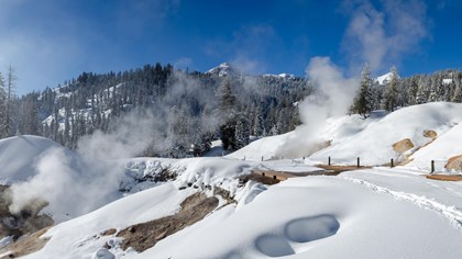
United States , Lassen Volcanic Center :
All volcanoes in California were at normal background levels of activity last week.
Recent observations:
Earthquakes consistent with background activity were observed at the Clear Lake Volcanic Field, Long Valley Caldera, Coso Volcanic Field and Salton Buttes. Typical moderate levels of seismicity were present in the Sierra Nevada range south of the Long Valley Caldera.
Since May 11, 2023, a series of M5+ earthquakes and aftershocks have rattled the area around Lake Almanor, a reservoir about 20 miles (32 km) southeast of the Lassen Volcanic Center. The initial M5.5 earthquake was followed by a M5.2 quake as well as dozens of smaller aftershocks. Because Lake Almanor is close to Lassen, CalVO received many questions about potential connections to the volcano.
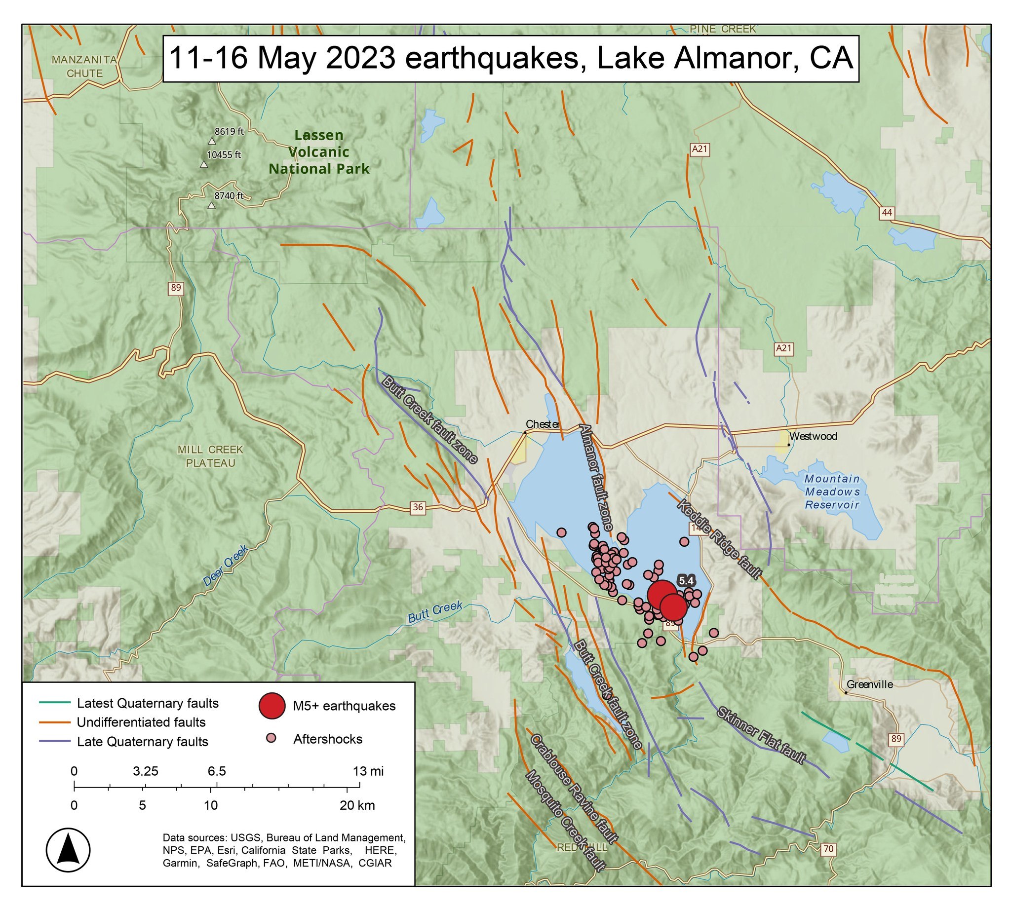
To start, the distance and character of these earthquakes tell us that they’re unlikely to have anything to do with Lassen. Focal mechanisms, a way of describing the direction of slip, tell us that these earthquakes occurred on a normal fault (extensional motion). At a volcano, we would expect seismicity to have widely varying focal mechanisms, depending on earthquake location. Volcanic earthquakes also follow a more complicated pattern than mainshocks followed by aftershocks .
Our next clue is that Lake Almanor is not in the same physiographic province (defined by tectonics, landforms, and volcanism) as Lassen. The Lassen Volcanic Center is at the southern end of the Cascades Volcanic Arc, formed by a subduction zone. But only a few miles to the east are the Modoc Plateau and Basin and Range provinces. Lake Almanor falls roughly within the Basin and Range, and its tectonic history is very different from Lassen’s. The area contains several N-S and NW-SE trending fault zones, including the Lake Almanor fault, which are active and prone to earthquakes. A similar earthquake sequence happened there in May of 2013.
Finally, many of you asked if these earthquakes could affect Lassen The short answer is no! While some eruptions might be triggered by large earthquakes, it only seems to happen when the volcano is already primed and ready – that is, there already needs to be gassy magma near the surface. We’ve seen no evidence of that at Lassen recently: no earthquake swarms, no ground swelling, and no change in the gases coming out of the volcano.
So there you have it – while these earthquakes were near Lassen, there’s no danger of eruption. It’s just part of living in a tectonically active state!
Source : USGS volcanoes.
Photos : USGS.
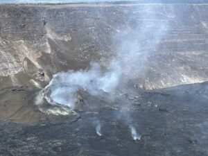
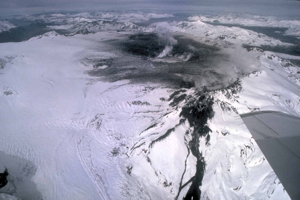
Chile , Hudson :
Seismology
The seismological activity of the period was characterized by the recording of:
208 VT-type seismic events, associated with rock fracturing (Volcano-Tectonics). The most energetic earthquake presented a local magnitude value (ML) equal to 1.1, located 5.7 km southeast of the caldera and with a depth of 5.3 km from the center of the caldera. the caldera.
93 LP-type seismic events, associated with fluid dynamics within the volcanic system (Long Period). The size of the largest earthquake assessed from the Reduced Displacement (DR) parameter was equal to 19 cm2.
20 HB-type seismic events, associated with both rock fracturing and fluid dynamics within the (hybrid) volcanic system. The most energetic earthquake presented a reduced displacement value (DR) of 294 cm2 and a local magnitude value (ML) equal to 1.9, located 2.5 km to the East-South-East and with a depth of 5.6 km from the center of the caldera.
Fluid Geochemistry
No anomalies in sulfur dioxide (SO2) emissions into the atmosphere have been reported in the area near the volcano, according to data published by the Tropospheric Monitoring Instrument (TROPOMI) and the Ozone Monitoring Instrument (OMI) Sulfur Dioxide Group.
Satellite thermal anomalies
During the period, no thermal alert was recorded in the area associated with the volcanic complex, according to the data processed by the observation of volcanic activity in the mid-infrared (MIROVA) and thanks to the analytical processing of the images. Sentinel 2-L2A satellite, in combination of false color bands.
Geodesy
According to data provided by 2 GNSS stations that monitor the deformation of the volcano, minor seasonal variations are observed and the low-speed displacement of the station located southeast of the caldera has been maintained, less than 0.1 cm / month.
Surveillance cameras
The images provided by the fixed camera, installed near the volcanic edifice, did not record any degassing columns or variations linked to surface activity.
Activity remained at levels considered low, suggesting stability of the volcanic system. The volcanic technical alert is maintained at:
GREEN TECHNICAL ALERT: Active volcano with stable behavior – There is no immediate risk.
Source : Sernageomin
Photo : Norm Banks, (U.S. Geological Survey).
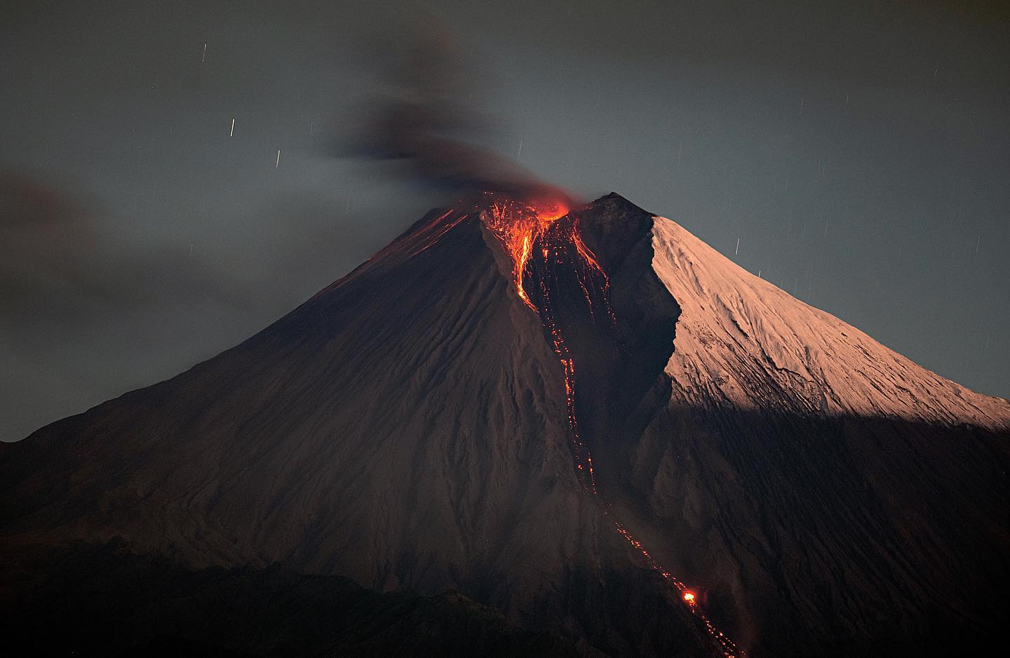
Ecuador , Sangay :
DAILY REPORT OF THE STATE OF SANGAY VOLCANO, Tuesday May 16, 2023.
Information Geophysical Institute – EPN.
Surface Activity Level: High, Surface Trend: Unchanged
Internal activity level: High, Internal trend: No change
Seismicity: From May 15, 2023, 11:00 a.m. to May 16, 2023, 11:00 a.m.:
There is no seismicity data, because, for the moment, the SAGA reference station has transmission problems.
Rains / Lahars:
There are no reports of rain. **In the event of heavy rains, these could remobilize the accumulated materials, generating mudslides and debris that could descend the flanks of the volcano and flow into the adjacent rivers.**
Emission / Ash Column:
Due to cloudiness in the volcano area, there are no observations of surface activity. Washington’s VAAC has not reported any emissions alerts detected by satellites in the past 24 hours.
Gas:
The MOUNTS system detected 33.6 tons of sulfur dioxide (SO2), measured on 05/14/2023 at 14:24 TL.
Other Monitoring Parameters:
MIROVA-VIIRS recorded 1 low, 1 moderate and 1 high thermal alert (169 MW), while MIROVA-MODIS recorded 2 moderate thermal alerts in the last 24 hours.
Observation:
The cloudiness in the volcano area did not allow direct observation of the crater.
Alert level: Orange.
Source : IGEPN.
Photo : Eqphos_fotografía.
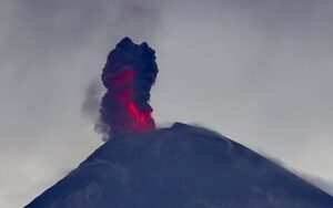
Mexico , Popocatepetl :
May 16, 11:00 a.m. (May 16, 5:00 p.m. GMT)
During the last 24 hours, according to the monitoring systems of the Popocatépetl volcano, 94 exhalations accompanied by water vapor, volcanic gases and ash have been detected.
During this period, three moderate explosions were recorded yesterday at 10:51 a.m., 12:32 p.m., and 4:13 p.m. local time. In addition, 1066 minutes of high frequency tremors were recorded.
Explosions that occur on Popocatépetl or any active volcano are accompanied by seismic and sound signals, the latter recorded by means of pressure detectors or microphones. It is possible to hear them with different levels of intensity, depending on the atmospheric factors at the time of the events or the morphological conditions of the crater. This is a normal phenomenon and is not necessarily an indication of increased volcanic activity. It should be noted that in the current state of Popocatépetl, characterized by the formation of small lava domes, and their subsequent destruction by explosions, mainly of small to moderate size, it is likely that in the next days or weeks the population near the volcano will perceive these audible phases.
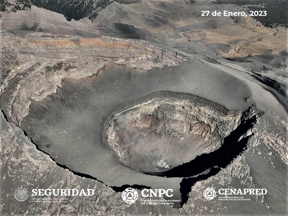
At the time of this report, there is no visibility towards the volcano due to weather conditions in the area. If a significant emission occurs in the next few hours, it will disperse to the Southeast (SE).
CENAPRED insistently reiterates the recommendation NOT TO CLIMB to the crater of the volcano, because there is the possibility of explosions, as we have seen on several occasions in the past, involving the emission of incandescent fragments. Therefore, he is required to respect the exclusion radius of 12 km. Also, in heavy rain, stay away from the bottom of ravines due to the danger of mudslides and debris.
The Popocatépetl volcanic alert traffic light is in YELLOW PHASE 2.
Source et photo: Cenapred