January 02 , 2023 .
Alaska , Semisopochnoi :
51°55’44 » N 179°35’52 » E,
Summit Elevation 2625 ft (800 m)
Current Volcano Alert Level: WATCH
Current Aviation Color Code: ORANGE
Elevated seismicity and possible explosions were detected in geophysical data over the past day. A small ash deposit was observed in web camera and satellite imagery extending ~2 km (~1.2 miles) south-southwest of the active north crater of Mount Cerberus. This is consistent with minor, low-level (<10,000 ft above sea level) ash emissions. However, clouds obscured most satellite and web camera views and no ash plumes were observed.
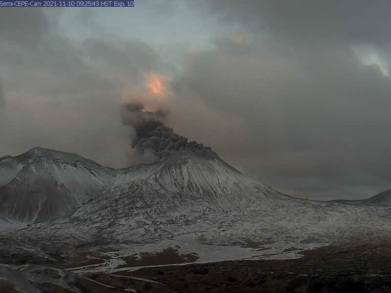
Low-level ash emissions from Semisopochnoi’s North Cerberus crater in the morning on November, 10, 2021 from the CEPE webcam.
Small eruptions producing minor ash deposits within the vicinity of the active north crater of Mount Cerberus and ash clouds usually under 10,000 ft (3 km) above sea level have characterized the recent activity and more ash-producing events could occur again with little warning.
Semisopochnoi volcano is monitored by local seismic and infrasound sensors, satellite data, web cameras, and regional infrasound and lightning networks.
Source : AVO.
Photo : Loewen, M. W.
Chile , Villarica :
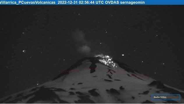
Special Report on Volcanic Activity (REAV), La Araucanía and Los Ríos regions, Villarrica volcano, December 31, 2022, 07:50 local time (mainland Chile)
The National Geology and Mining Service of Chile (Sernageomin) announces the following PRELIMINARY information, obtained through the monitoring equipment of the National Volcanic Monitoring Network (RNVV), processed and analyzed at the Observatory of Volcanoes of the Southern Andes (Ovdas):
During the night and morning of Saturday December 31, monitoring stations set up near the Villarrica volcano recorded Strombolian activity, associated with fluid dynamics within the volcanic system. (type LP).
The characteristics of the earthquake, after its analysis, are as follows:
ORIGINAL TIME: 23:56 local time (02:56 UTC 12/31/2022)
REDUCED DISPLAY: 24.7 (cm*cm)
ACOUSTIC SIGNAL: 6.2 Pascals (Pa) reduced to 1 km
Explosions observed, two events stand out with emissions of materials with either a height above the level of the crater, or projections on the flanks of the volcano. The characteristics of this activity are as follows:
MAXIMUM HEIGHT OF THE COLUMN: 20 meters above the point of emission
RANGE OF INCANDESCENT MATERIALS: 480 meters towards the North-West slope (NW)

For maximum projections, the specifications are as follows:
MAXIMUM HEIGHT OF THE COLUMN: 120 meters above the point of emission
RANGE OF INCANDESCENT MATERIALS: 150 meters towards the North West slope (NOT
COMMENTS:
Explosive activity with material emissions is recorded for much of the morning of December 31. An explosion occurred at 11:56 p.m., with projection of materials on the northwest flank of approximately 480 m and at 2:19 a.m., with a height of 120 m above the crater. The seismic activity remains within the parameters observed during the previous days.
The volcanic technical alert is maintained at the Yellow level.
Source : Sernageomin
Photos : Sernageomin , minutoneuquen.com.
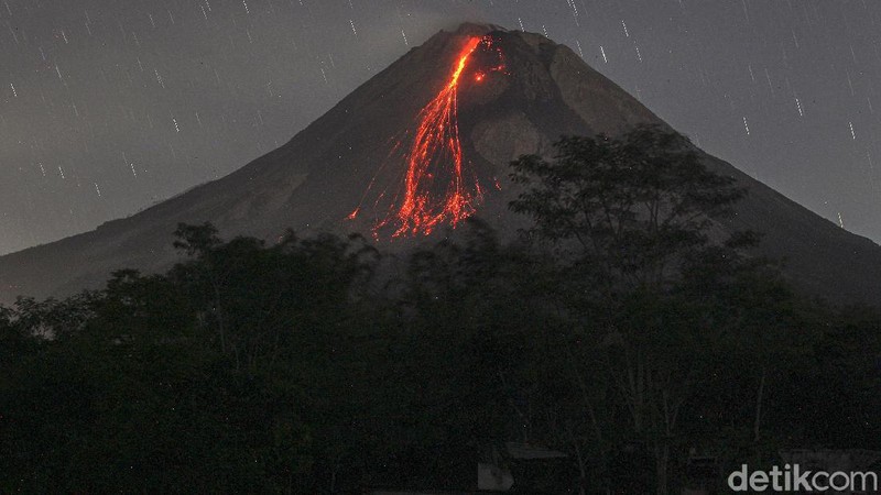
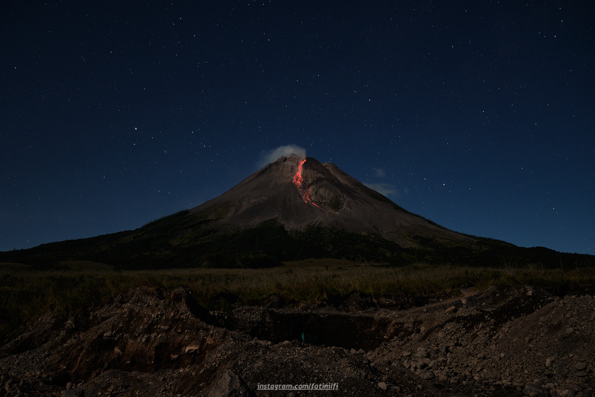
Indonesia , Merapi :
Report on the activity of Mount Merapi from December 23, 2022 to December 29, 2022, Published on December 30, 2022
RESULTS OF OBSERVATIONS
Visual
The weather around Mount Merapi is usually sunny in the morning and afternoon, while the evening is foggy. White smoke, thin to medium thickness, low pressure and 50 m high was observed from the observation post of Mount Merapi in Badaban on December 24, 2022 at 05:30 WIB.
This week, there were 2 lava avalanches towards the South-West (Kali Bebeng) with a slip distance of 1,500 m. The noise of the descent was heard 2 times from Babadan Post with low to medium intensity.
– There is no significant morphological change in the South-West dome and the central dome. The volume of the South-West dome is calculated fixed, i.e. 1,616,500 m3, while for the middle dome it is 2,772,000 m3.
Seismicity
This week, the seismicity of Mount Merapi showed:
13 deep volcanic earthquakes (VTB)
534 deep volcanic earthquakes (VTA),
185 avalanche earthquakes (RF),
1 emission earthquakes (DG),
5 tectonic earthquakes (TT).
76 multi-phase (MP) earthquakes
The intensity of this week’s seismicity is still quite high.
Deformation
The Mount Merapi deformation that was monitored using EDM and GPS this week showed a shortening rate of 0.6 cm/day.
Rain and lahars:
This week, there was rain at Kaliurang observation post with a rain intensity of 31 mm/h for 260 minutes on December 26, 2022. It is reported that there was an increase in flow in the Boyong River on December 29.
Conclusion
Based on the results of visual and instrumental observations, it is concluded that:
-The volcanic activity of Mount Merapi is still quite high in the form of effusive eruption activity. The state of the activity is defined at the « SIAGA » level.
-The current potential dangers are lava avalanches and hot clouds in the South-South-West sector including the Boyong River up to 5 km, the Bedog, Krasak, Bebeng Rivers up to 7 km. In the South-East sector, they cover the Woro River with a maximum of 3 km and the Gendol River for 5 km. While the ejection of volcanic materials during an explosive eruption can reach a radius of 3 km around the summit.
Source : BPPTKG.
Photo : detik .com , merapi_uncover .
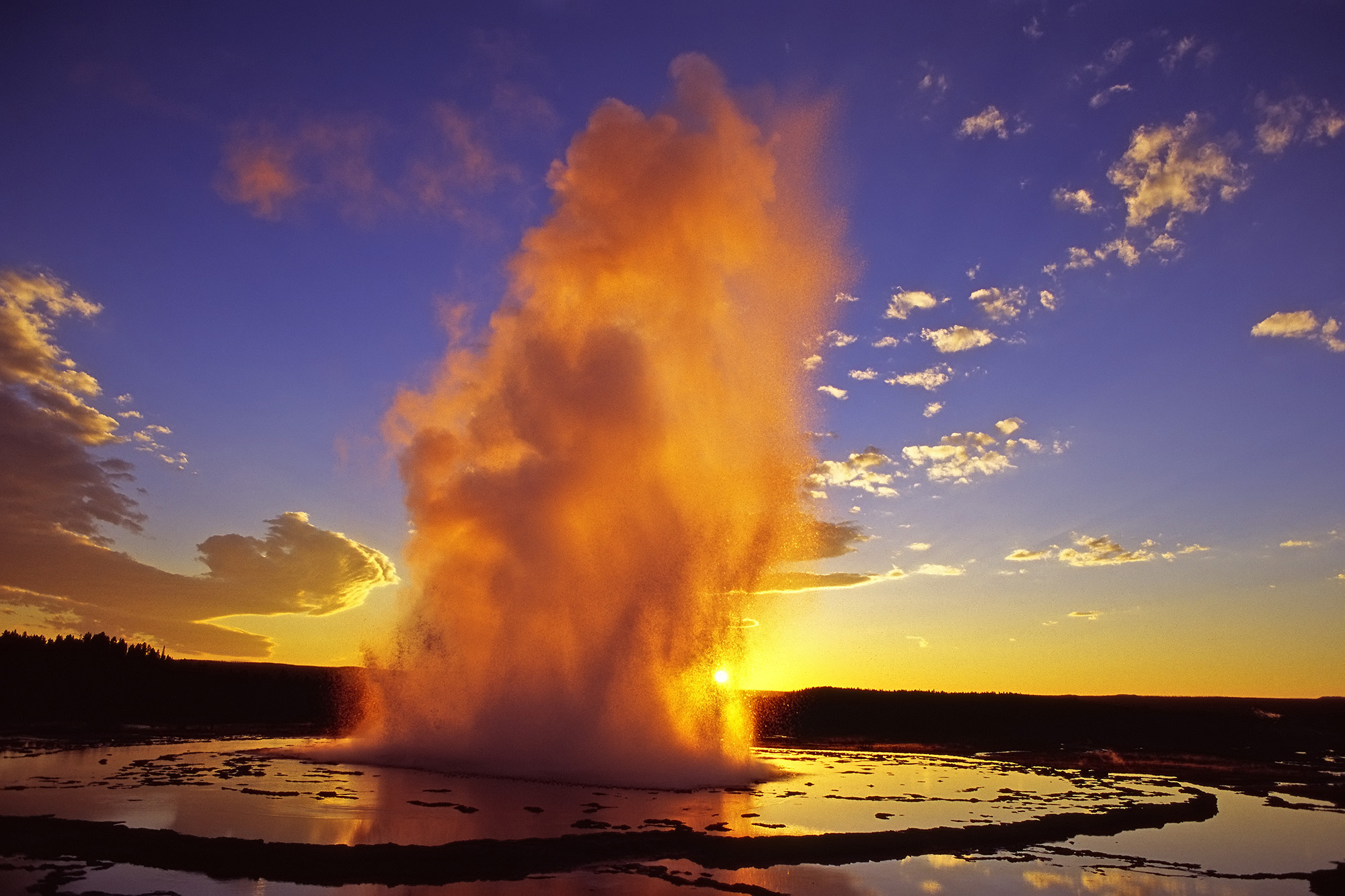
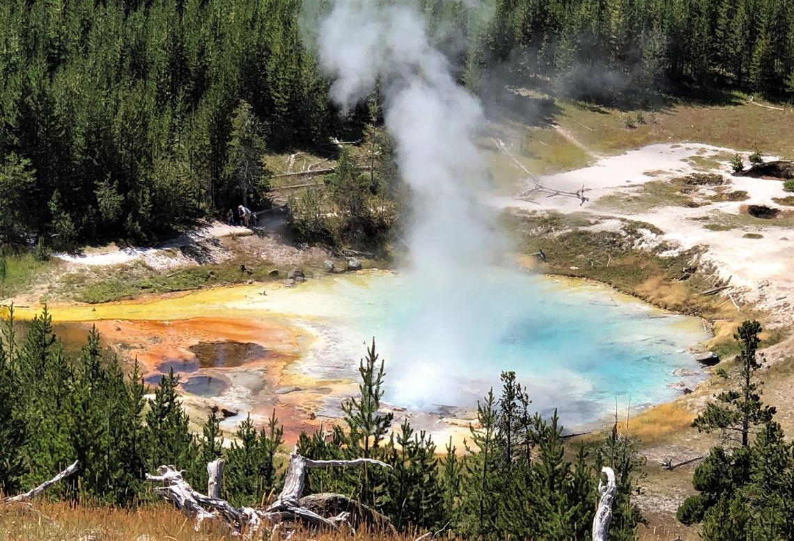
United-States , Yellowstone :
44°25’48 » N 110°40’12 » W,
Summit Elevation 9203 ft (2805 m)
Current Volcano Alert Level: NORMAL
Current Aviation Color Code: GREEN
Recent Work and News
Steamboat Geyser had one major water eruption during the past month, on December 6, bringing the total number of eruptions in 2022 to 11. This is significantly less than the numbers of eruptions in 2021 (20), 2020 (48), 2019 (48), and 2018 (32), suggesting that the geyser’s episode of frequent eruptions may be approaching an end. But minor activity at the geyser picked up on December 18, so we might see another major water eruption in early 2023.
Overall, 2022 was an average year in terms of seismicity in the Yellowstone region, with slightly less than 2500 located earthquakes, the largest being an M4.2 event on May 11. Just over 1000 of these earthquakes occurred as part of a swarm near Grizzly Lake, between Norris Geyser Basin and Mammoth Hot Springs, that began in the summer and waxed and waned throughout the year, peaking in September. No significant changes in deformation occurred during the year, with typical caldera subsidence of a few centimeters (about an inch) interrupted during the summer months by a pause or slight uplift due to groundwater recharge. This pattern of subsidence with a summer interruption has been ongoing since 2015–2016.
Seismicity
During December 2022, the University of Utah Seismograph Stations, responsible for the operation and analysis of the Yellowstone Seismic Network, located about 70 earthquakes in the Yellowstone National Park region. The largest event of the month was a minor earthquake of magnitude 2.5 located about 14 miles south-southwest of Mammoth Hot Springs in Yellowstone National Park on December 1 at 5:41 PM MST. This event was part of ongoing seismicity that began in the area on July 29. In December, approximately 28 earthquakes were added to the sequence, and seismicity continued through the end of the month. Earthquake sequences like these are common and account for roughly 50% of the total seismicity in the Yellowstone region.
Yellowstone earthquake activity is currently at background levels.
Ground Deformation
Continuous GPS stations in Yellowstone Caldera recorded gradual subsidence at a rate of 2–3 centimeters (1 inch) per year, which has been ongoing since 2015. This subsidence was interrupted during the summer months as groundwater recharge from snowmelt caused the ground to swell slightly, but the subsidence resumed in late October. A similar pattern of ground deformation was measured in the area of Norris Geyser Basin. In early-mid December, snow and ice accumulation on GPS antennas due to a winter storm that impacted the region caused apparent subsidence of 1-2 cm (less than an inch). This signal reversed itself within a few days as the storm passed and snow/ice cover on the antennas diminished.
Source : YVO.
Photos : USGS , Pat Shanks.
Hawaii , Kilauea :
19°25’16 » N 155°17’13 » W,
Summit Elevation 4091 ft (1247 m)
Current Volcano Alert Level: ADVISORY
Current Aviation Color Code: YELLOW
KĪLAUEA INFORMATION STATEMENT
A swarm of small earthquakes beneath Kīlauea caldera began at about 6 p.m. on Friday, December 30th, 2022. The USGS Hawaiian Volcano Observatory recorded approximately 25 earthquakes less than magnitude 2 between 6 and 9 p.m. HST. The swarm seems to be diminishing at this time, but activity may pick up again.
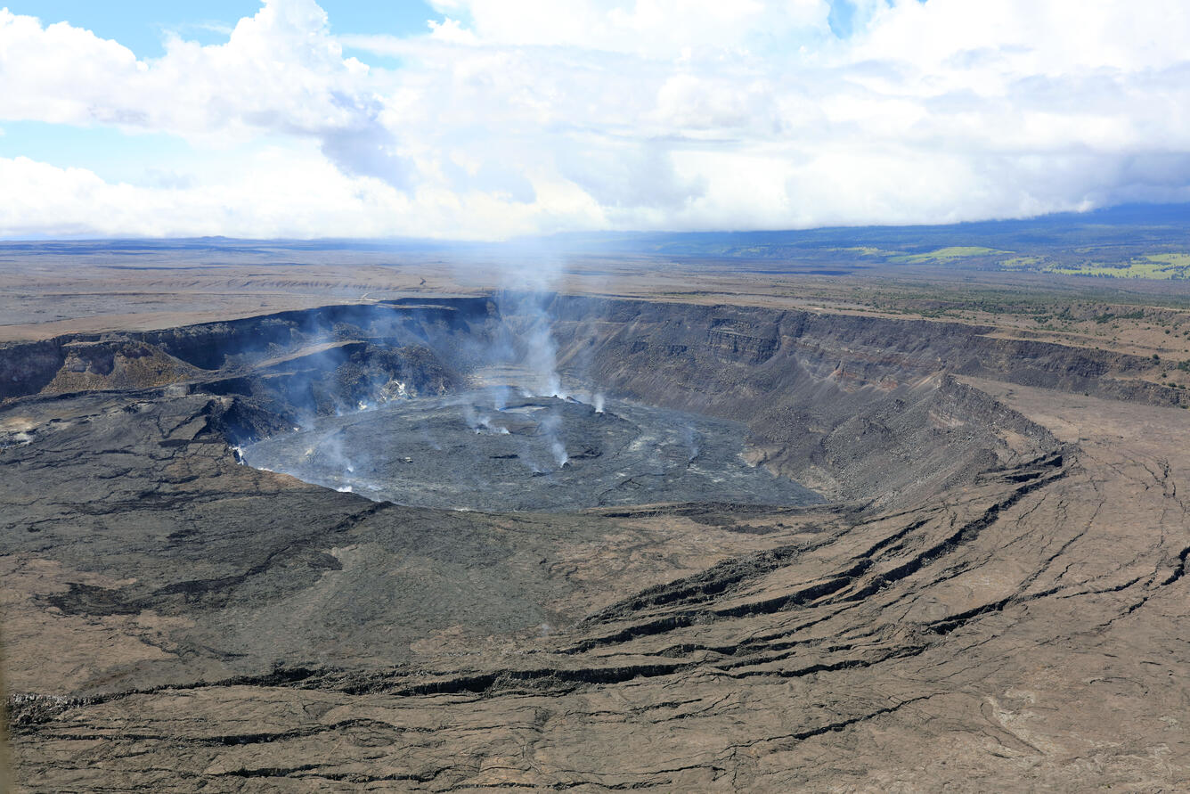
These earthquakes are typical as the summit of Kīlauea repressurizes after the end of the last eruption. The earthquakes are generally dispersed beneath and around the south side of Halemaʻumaʻu. Overall, the summit of Kīlauea has been gradually inflating since the 28th of November. There is no indication that resumption of eruptive activity is imminent and there are no signs of significant activity in either of Kīlaueaʻs rift zones or on Mauna Loa.
Source : HVO.
Photo : USGS/ K. Mulliken.