November 13 , 2020.
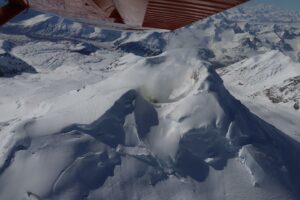
Kamchatka , Karymsky :
54.05 N, 159.44 E;
Elevation 4874 ft (1486 m)
Aviation Colour Code is ORANGE
A moderate eruptive activity of the volcano continues. Ash explosions up to 19,700-23,000 ft (6-7 km) a.s.l. could occur at any time. Ongoing activity could affect low-flying aircrafts.

A moderate eruptive activity of the volcano continues. According to satellite data by KVERT, explosions sent ash up to 8 km a.s.l. on 08 November; ash plumes and clouds drifted for 230 km to the northeast of the volcano. A thermal anomaly over the volcano was noted on 07-09 and 12 November.
Source : Kvert .
Photo : Belkamtour
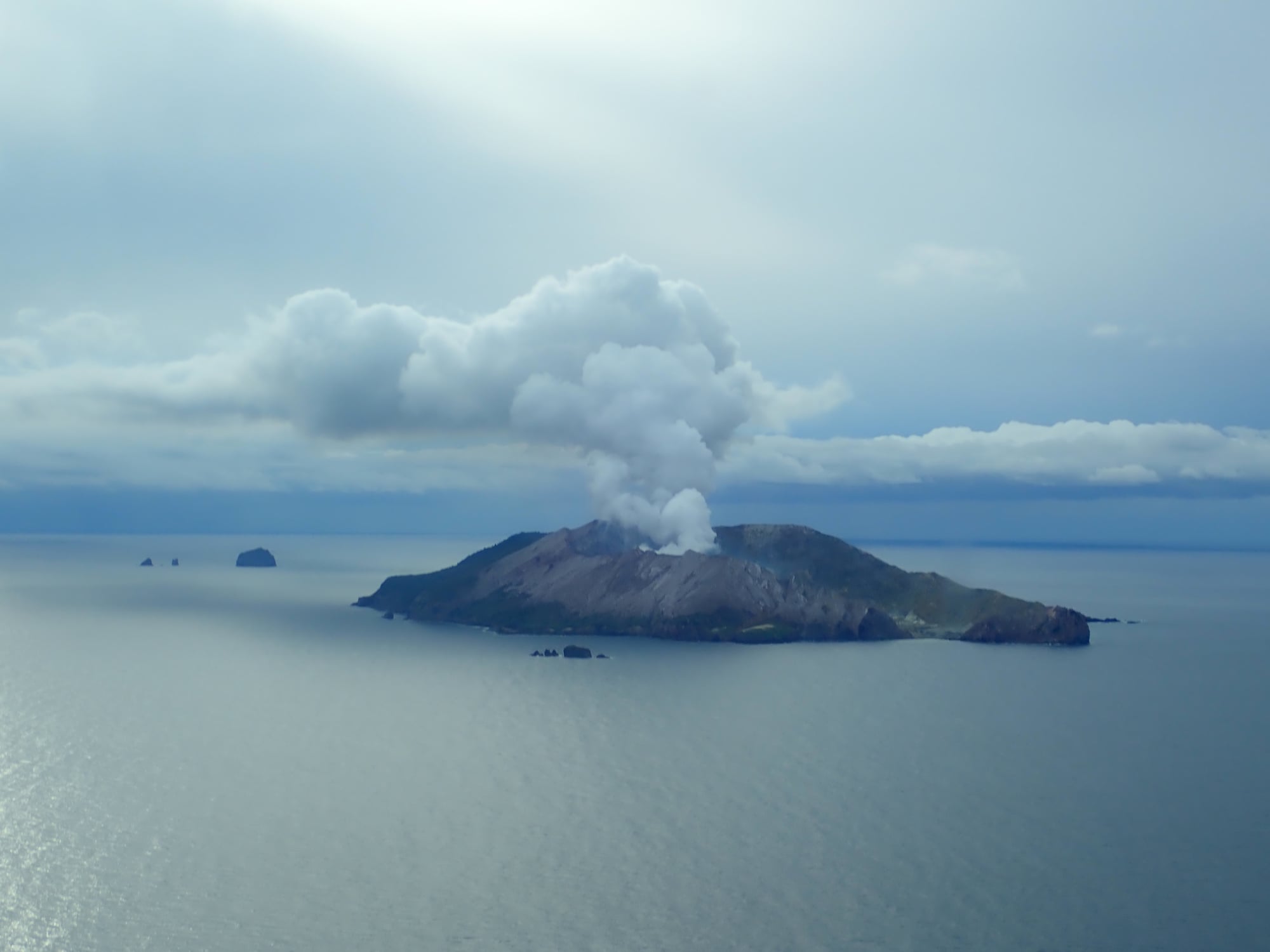
New Zealand , White Island :
Minor ash emission at Whakaari/White Island. Volcanic Alert Level raised to Level 2.
Published: Fri Nov 13 2020 4:35 PM
Volcanic Alert Level is raised to 2
Aviation Colour Code is raised to Yellow
New observations show small amounts of volcanic ash being carried in the steam and gas plume at Whakaari/White Island and deposited on the island’s webcams. The Volcanic Alert Level is now raised to Level 2.
Following a period of severe wet weather, scientists completed a gas monitoring and observation flight over Whakaari/White Island on Thursday 12 November 2020. Some occasional deposits had been observed on some of the islands’ webcams, and a darker than usual plume was also reported at times from the mainland.
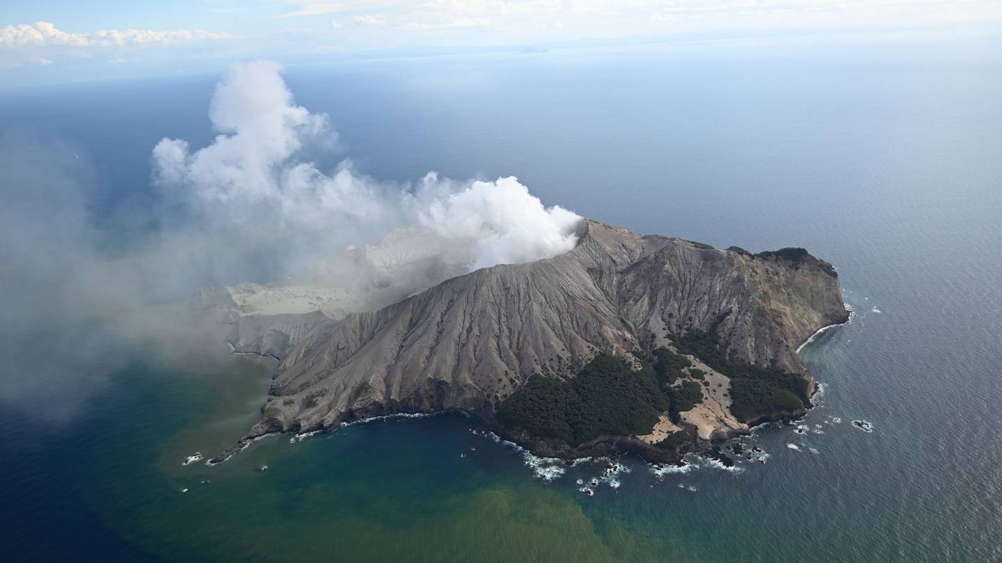
Observations during the flight confirmed the presence of some fine material (ash) in the plume. The fine particles originate from the main steam vent at the back of the crater lake. Initial analyses of the ash particles suggest that it is loose material from around the vent or underlying conduit being carried by the steam and gas emission.
While the gas output observed on Thursday is higher than recent observations, other monitoring parameters do not show significant changes. The Volcanic Alert Level is now raised to Level 2 in response to these observations of vent activity and monitoring data.
Observations from the flight show there is no substantial change in the location and size of active vents. The rainfall has formed a pool of water on the floor of the 1978/90 Crater, re-forming a shallow lakelet. During the past week, a small sequence of earthquakes has been located close to the volcano and we had several episodes of slightly increased volcanic tremor. None of these observations are unusual for Whakaari/White Island and it remains unclear whether these are just coincidental with the incorporation of material in the plume.
During fine weather conditions, moderate to large gas-steam plumes will be seen rising above the island and trailing off downwind. Some of the particles may be carried a few kilometres downwind but are unlikely to reach the mainland. Should any explosive activity produce a significant ash cloud, the likelihood of ash affecting the mainland remains very low. The gas and steam plume may be noticed on the mainland as weak acid rain.
The changes at the vent resulting in the minor ash emissions have not been observed at Whakaari/White Island in 2020 and indicate a greater level of unrest at the surface. There are no indications currently of a substantial change in the overall behaviour of the volcano. The main plausible triggers for a sudden eruption with little or no warning remain the collapse of unstable material in an active vent and the possible ingress of water underground onto the shallow magma body.
Overall, recent observations are consistent with moderate-heightened volcanic unrest and, therefore, the Volcanic Alert Level is raised to Level 2 and the Aviation Colour Code to Yellow.
The Volcanic Alert Level reflects the current level of volcanic unrest or activity and is not a forecast of future activity.
GNS Science and our National Geohazards Monitoring Centre continue to closely monitor Whakaari/White Island continuously for changes in activity. Further updates will be provided as needed.
Source : Geonet / Yannik Behr (Duty Volcanologist)
Photos : Rotorua Daily Post , Geonet .
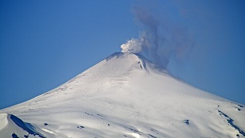
Chile , Villarica :
Special Report on Volcanic Activity (REAV), La Araucanía region, Villarrica volcano, November 10, 2020, 4:30 p.m. local time (Continental Chile).
The National Service of Geology and Mines of Chile (Sernageomin), on the basis of information obtained through the monitoring equipment of the National Volcanic Surveillance Network (RNVV), processed and analyzed at the Volcanological Observatory of the Andes of the South ( Ovdas), and in relation to the activity of the Villarrica volcano, reports the following:
On Tuesday, November 10, at 3:14 p.m. local time (6:14 p.m. UTC), the IP cameras installed near the volcano recorded a pulsatile gas emission with emission of particulate matter associated with continuous tremor-type seismicity.
The data obtained are as follows:
MAXIMUM HEIGHT OF THE COLUMN: 320 m with particle emission.
DISPERSAL DIRECTION: South-South-West (SSO).
REDUCED DISPLACEMENT VALUE OF THE CONTINUOUS TREMOR: 3.9 cm2.
It is important to emphasize that during this day, explosions were recorded, with magnitudes of lower amplitude than that described.
The volcanic alert remains at the Yellow level.
Source : Sernageomin .
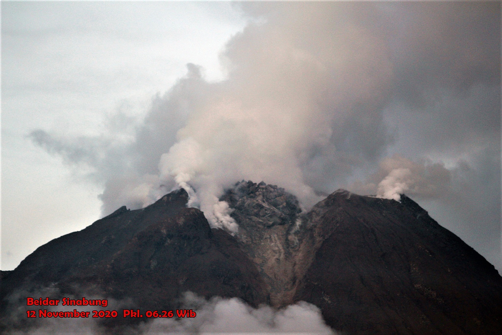
Indonesia , Sinabung :
The activity level has been at level III (SIAGA) since May 20, 2019 at 10:00 a.m. WIB. The Sinabung volcano (2460 m altitude) has been erupting since 2013.
The volcano was clear until it was covered in fog. The main crater emits white smoke with a moderate height, thick, about 50 to 500 m above the peak. The weather is cloudy to rainy, with light to moderate winds to the east, south-east, south-west and north-west. The air temperature is around 17-26 ° C. Hot avalanche clouds were observed with a sliding distance of 1500 m to the east and south-east. Lava avalanches were observed with a sliding distance of 200 to 500 m from the summit to the east and south-east.
According to the seismographs of November 12, 2020, it was recorded:
1 hot cloud avalanche earthquake
32 avalanche earthquakes
4 emissions earthquakes
21 low frequency earthquakes
3 hybrid / multiphase earthquakes
3 local tectonic earthquakes
1 remote tectonic earthquake.
Recommendation:
The public and visitors / tourists should not carry out activities in the villages that have been relocated, as well as within a radial radius of 3 km around the summit of G. Sinabung, and a sector radius of 5 km for the southern sector. -East and 4 km for the East-North sector.
Source : PVMBG.
Vidéo et photo : Beidar sinabung .