November 08 , 2020.
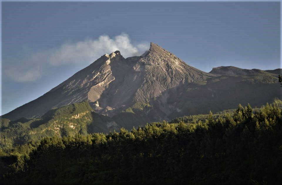
Indonesia : Merapi ,
Mount Merapi Activity Report, October 30 to November 5, 2020.
OBSERVATION RESULTS
Visual
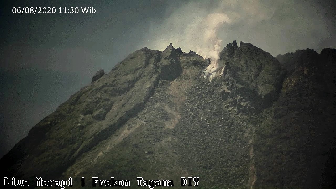
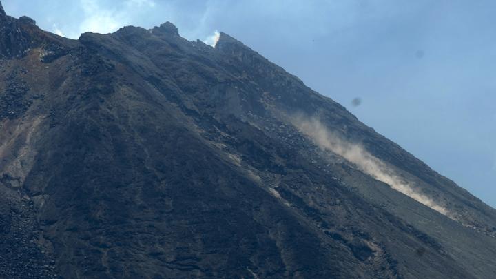
The weather around Mount Merapi is generally clear in the morning and at night, while the afternoon until evening is foggy. The smoke from the crater is white, thin to thick with low pressure. A maximum smoke height of 600 m is observed from the Mount Merapi observation post in Selo on October 31, 2020 at 5:35 a.m. A number of avalanches were heard with glide distance not observed as the prevailing images were hazy.
Morphological analysis of the crater area based on photos of the South-East sector from November 3 to October 30, 2020 did not show any change in the morphology of the dome. The calculation of the volume of the lava dome from measurements using aerial photos with drones on November 3, 2020, is 200,000 m3. Based on the analysis of the drone photos, no new magmatic material was observed.
Seismicity
This week, the seismicity of Mount Merapi recorded:
193 shallow volcanic earthquakes (VTB),
1663 multiphase earthquakes (MP),
9 low frequency earthquakes (LF),
391 avalanche earthquakes (RF),
330 earthquakes of emissions (DG
9 tectonic earthquakes (TT).
The seismic intensity this week is higher than last week.
Deformation
The deformation of Mount Merapi which was monitored using EDM this week showed a shortening rate of 9cm / day.
Rain and lahars
This week there was rain at the Mount Merapi Observation Post with the highest rainfall intensity of 74mm / hour for 80 minutes at Babadan Post on October 31, 2020. There were no reports of lahars or additional flow in the rivers that descend from Mount Merapi.
Conclusion
Based on the results of visual and instrumental observations, it is concluded that:
1. There is an increase in volcanic activity at Mount Merapi, so the activity status is defined as the activity level « SIAGA ».
2. Current potential hazards are in the form of lava avalanches, eruption of volcanic material in an explosive eruption, and hot clouds up to 5 km away.
TEMPO.CO, Yogyakarta – Mount Merapi National Park (TNGM) has confirmed that so far it is still shutting down most tourist activities in its management area following a potential eruption of Mount Merapi and the Covid-19 pandemic.
The state of the volcano has been on alert since May 2018 and has increased recently. Indonesia has also been hit by an ongoing disaster, the Covid-19 pandemic, since March 2020.
« We are still closing the mountain top trekking activities since May 21, 2018, until now, and most tourist attractions have not been opened since March 2020, » TNGM official Pujiati said, at a conference on pandemic mitigation and contingency planning on Wednesday, November 4, 2020.
Puji said the central government had indeed announced that TNGM was one of 29 national parks allowed to open during the pandemic. Indonesia has a total of 58 national parks. However, due to the increase in volcanic activity, only tourist sites near the volcano are reopened.
Puji pointed out that on his side, he was closely monitoring areas of Mount Merapi to make sure there was no activity from people within a three kilometer radius of the summit.
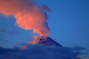
El Salvador , Santa Ana ( Llamatepec) :
Location: shared by the departments of Santa Ana and Sonsonate
Altitude: 2381 meters above sea level
Type of volcano: Stratovolcano
Type of activity: Vulcanian – Strombolian
Last eruption: October 1, 2005.
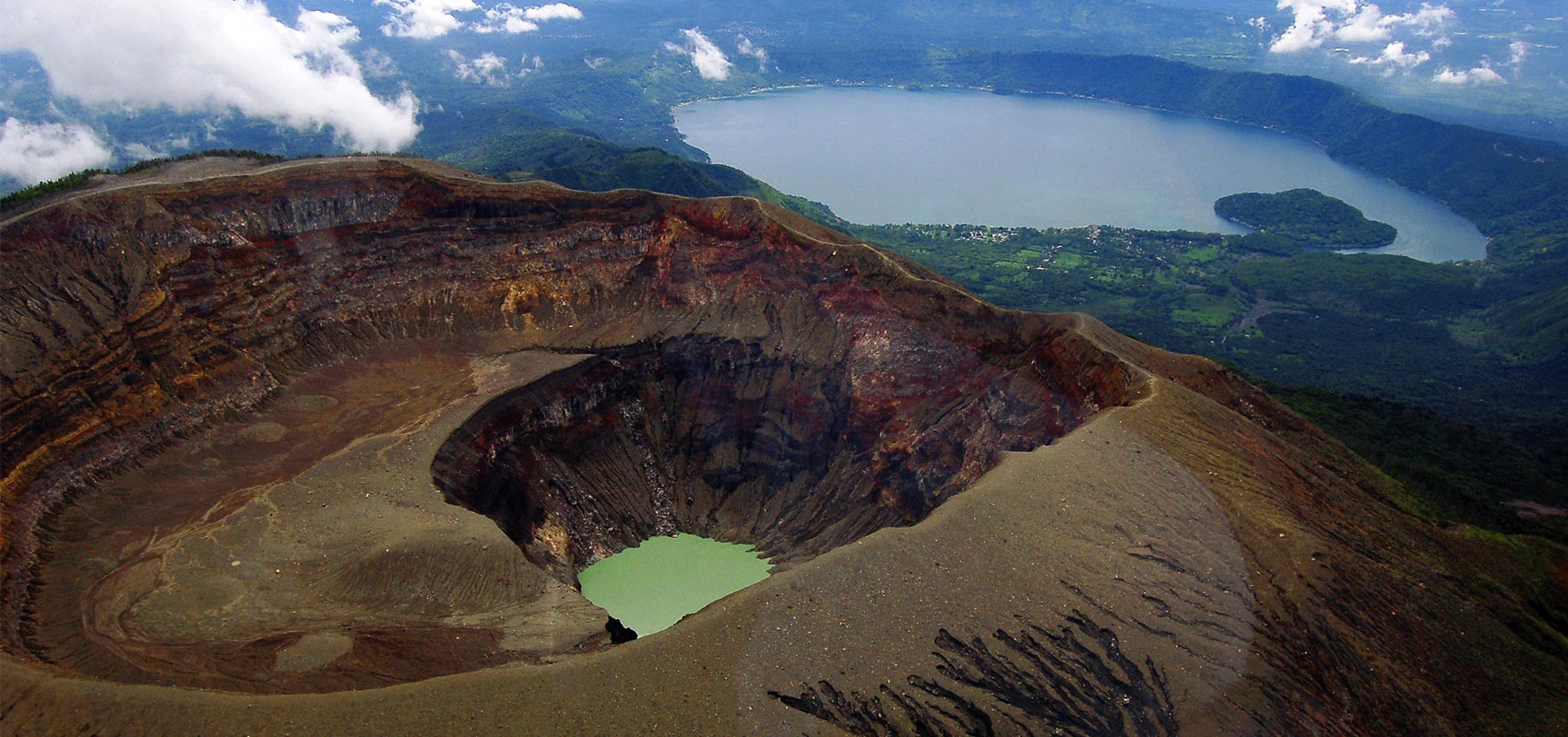
The seismic vibration of the Santa Ana volcano remained between 18 and 22 RSAM units, on average per day, in other words, in a normal range. During the month of October, a total of 55 earthquakes related to the movement of fluids inside the volcanic system were recorded. Regarding earthquakes associated with distal fault fracturing, eight were recorded, one of which exhibited sufficient energy to be located, with a depth of 6 kilometers and a magnitude of 1.7, reported as felt by the inhabitants of Juayúa, about 15 km from the volcano. Concerning Sulfur Dioxide (SO2) emissions, measured with DOAS equipment, they fluctuated between 142 and 277 tonnes per day, with an average of 204 tonnes / d, the threshold being 300 tonnes / d. The guards who are in the area of the volcano and the surveillance inspections carried out, report the increase in the water level of the lagoon.
According to the analysis of monitoring data, the volcano remains with latent activity.
Source : Marn .
Photo : kaytetours.com
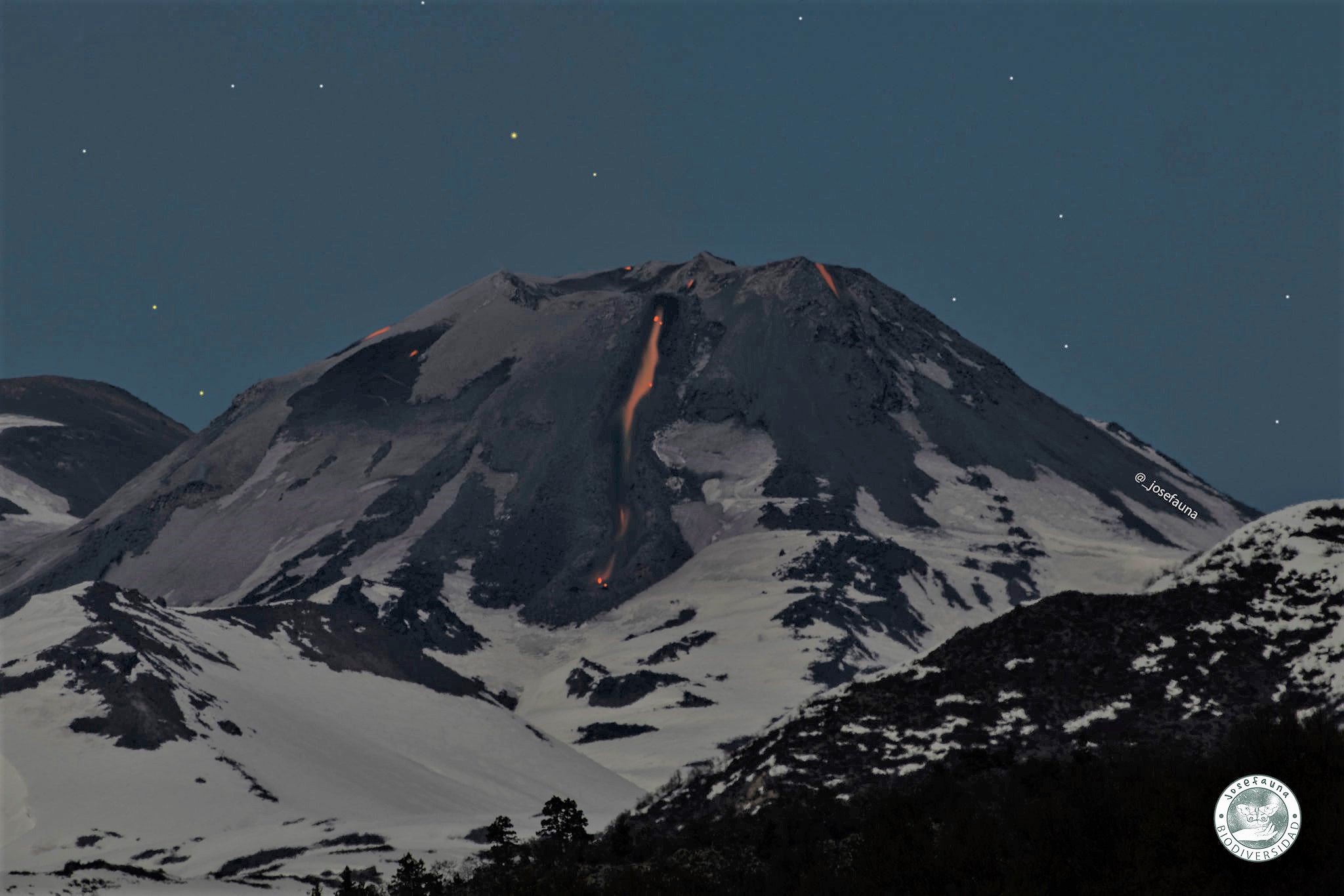
Chile , Nevados of Chillan :
During the period, 34 seismic events classified as volcano-tectonic (VT) type were recorded, associated with fragile rupture processes in volcanic systems; the most energetic event had a local magnitude (ML) value of 2.0 and was located 4.6 km east (E) of the crater with a depth of 4.1 km.
Likewise, 1516 long-period (LP) seismic events have been classified, associated with the dynamics of fluids present in a volcanic system; the most energetic event had a reduced displacement value (RD) equal to 510 cm2. Likewise, 632 seismic events have been classified as being of the tremor type, associated with the sustained dynamics of the fluids present in a volcanic system; the most energetic event had a DR value equal to 151 cm2
– 607 events were identified as discrete explosive activity. The highest energy explosion had a seismic signal associated with a DR of 510 cm2.
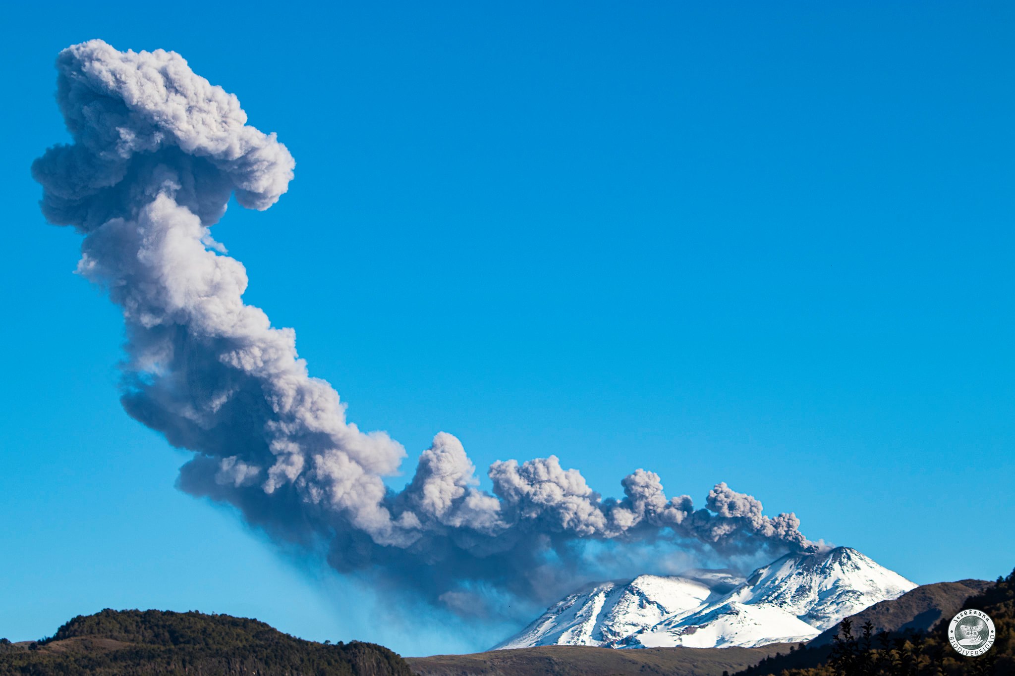
The images provided with the fixed cameras installed around the complex allowed us to observe effusive and explosive activity during this fortnight. This activity was characterized by low column height explosions (only 7 of them had column heights between 1000 m and 1500 m), moderate pyroclast content and higher volcanic gas content. Some isolated episodes showed a high content of reddish pyroclasts. When weather conditions allowed, a nocturnal incandescence focused on the eastern edge of the active crater (Nicanor crater) was observed. An intensification of the incandescence was recognized, reflected in the greater range of coverage of the incandescent fragments ejected during specific events.
– By processing the available thermal images, maximum temperatures of 354 ° C and 210 ° C were observed during the occurrence of explosions and for the L5 lava flow currently located on the North slope, respectively.
– On the other hand, the development of a sub-crater is recorded on the inner eastern edge (E) of the Nicanor crater, whose morphology has been accentuated, at least, since October 29, according to the photo-interpretation of the images Planet Scope OrthoTile and Sentinel L2 A satellites. Its diameter is of the order of 25 m and it was associated with explosive activity in the last days of the period evaluated.
Regarding the effusive activity and according to the photo-interpretation of the Pléiades and Sentinel L2 A satellite images, the L5 lava front, located on the northern slope of the volcano, has maintained an advance
continuous during the period evaluated, reaching an extension of 683 m from the edge of the crater, and a maximum speed of 0.82 m / h during the month of October. Regarding the dome nestled in the Nicanor crater, a basal area of 115m by 107m is measured, greater than that measured during the month of September, recognizing the impact and texture morphologies that suggest greater erosion, associated with emissions greater explosiveness of its distribution center.
11 thermal alerts were recorded in the area associated with the volcanic complex during the period, with a maximum volcanic radiative power (VRP) of 3 MW on October 16, a value deemed low according to data processed by the Medium infrared Observation of MIROVA volcanic activity, and by near real-time thermal monitoring of global hot spots (MODVOLC).
Likewise, in satellite images from Sentinel 2-L2A, radiation anomalies were detected during days 17, 20, 22, 25 and 30 October.
Source : Sernageomin .
Photos : Josefauna.
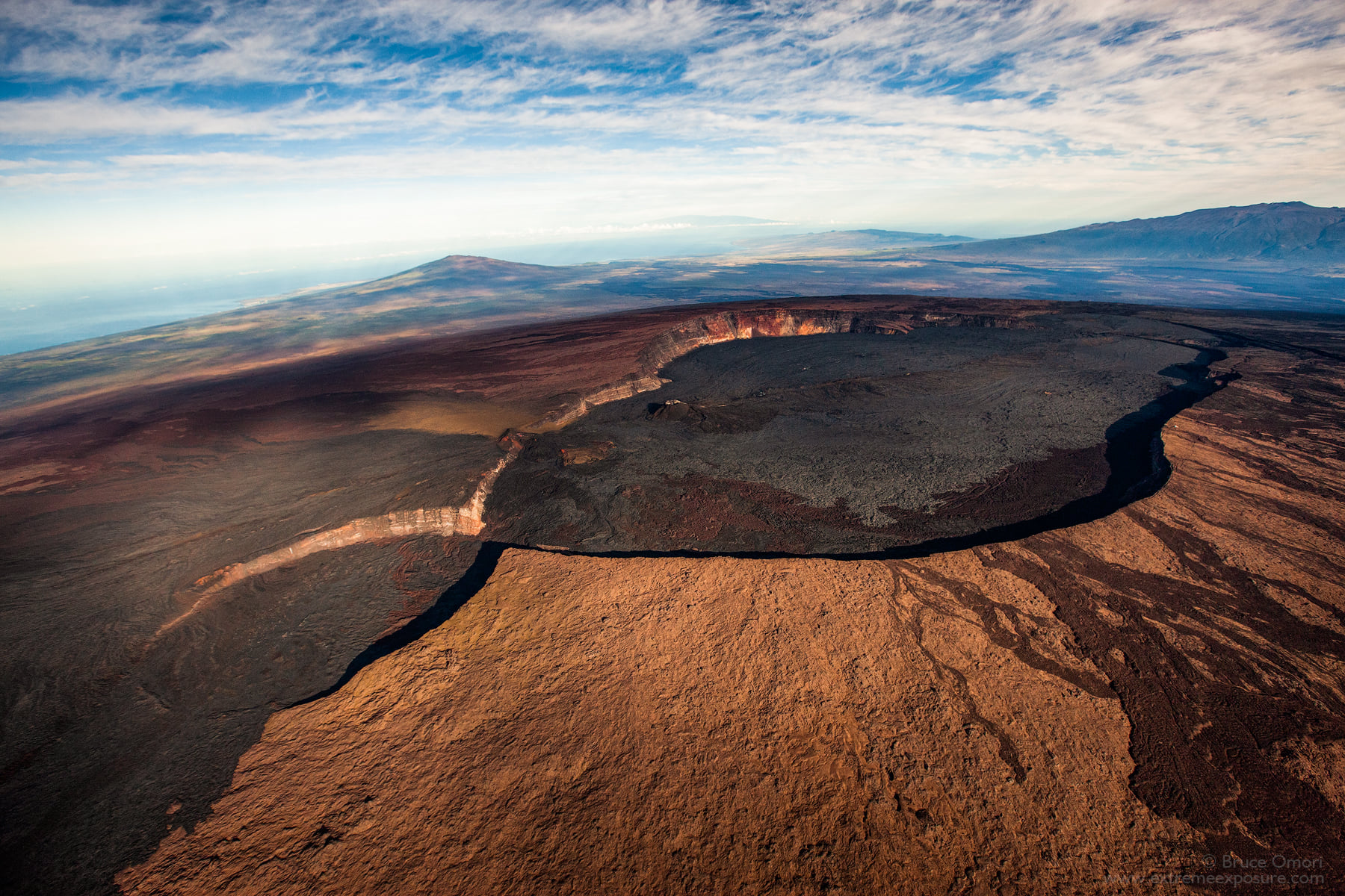
Hawaii , Mauna Loa :
19°28’30 » N 155°36’29 » W,
Summit Elevation : 13681 ft (4170 m)
Current Volcano Alert Level: ADVISORY
Current Aviation Color Code: YELLOW
Activity Summary:
Mauna Loa Volcano is not erupting. Rates of deformation and seismicity have not changed significantly over the past week and remain above long-term background levels.
Observations:
During the past week, HVO seismometers recorded 42 small-magnitude earthquakes on the volcano’s summit and upper-elevation flanks. Most of these earthquakes occurred at shallow depths of less than 8 kilometers (~5 miles) below ground level.
Global Positioning System (GPS) measurements show continued slow summit inflation, consistent with magma supply to the volcano’s shallow storage system.
Gas concentrations and fumarole temperatures at both the summit and Sulphur Cone on the Southwest Rift Zone remain stable.
Webcam views have revealed no changes to the landscape over the past week.
Source : HVO.
Photo : Bruce Omori .