August 10 , 2018.
Post to read until the end. Important.
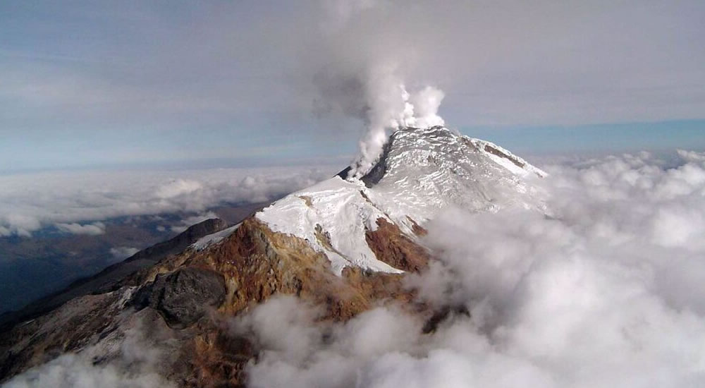
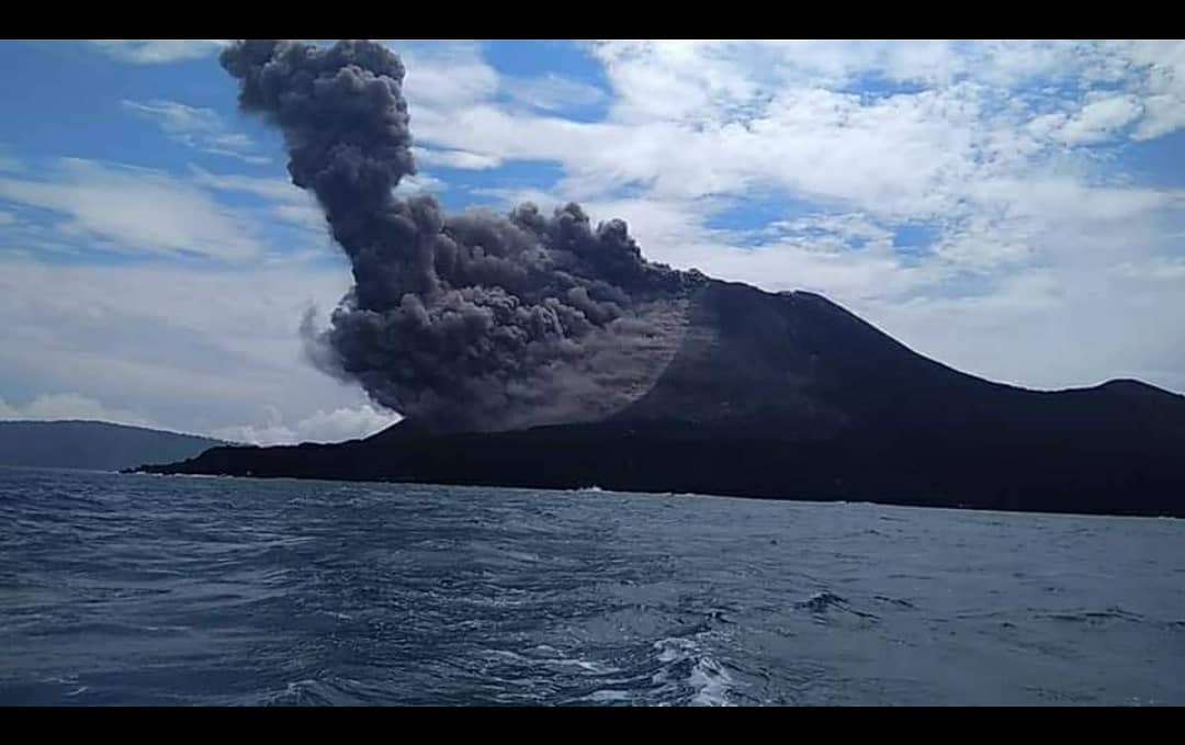
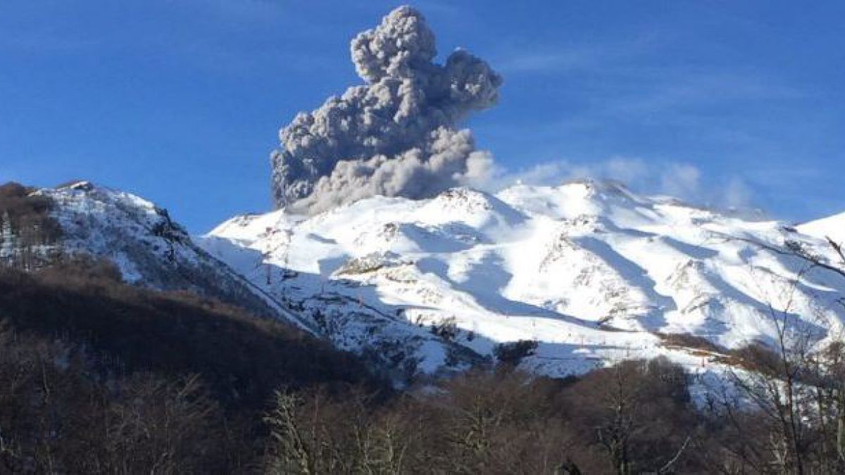
Chile , Nevados de Chillan :
Special Report on Volcanic Activity (REAV)
Region of Biobio, C.V. Nevados de Chillân, August 8, 2018.12: 40 local time (mainland Chile).
The National Geological and Mining Service of Chile (Sernageomin) publishes the following PRELIMINARY information, obtained from monitoring equipment of the National Volcanic Monitoring Network (RNVV), processed and analyzed at the Volcanological Observatory of the Andes. South (OVDAS):
On August 08, 2018, at 12:12 local time (16:12 GMT), the monitoring stations installed in the vicinity of the Nevados volcanic complex of Chillan recorded an earthquake associated with an explosion related to the dynamics of the fluids inside the volcanic system. .
The characteristics of the recorded seismic event are as follows:
TIME OF ORIGIN: 12h12 local time (16h12 GMT).
LATITUDE: 36,867 ° S
LONGITUDE: 71.377 ° W
DEPTH: 0.2 km
REDUCED DISPLACEMENT: 700 cm2
ACOUSTIC SIGNAL: 0.2 Pa reduced.
Observations:
Since the camera installed in the vicinity of the Nevados volcanic complex of Chillan, it has been recorded a column of emission of approximately 1500 meters of altitude, as well as an important particulate material of greyish color. On the thermal camera, hot ballistic material was recorded, deposited on the surroundings of the center of emission.
The occurrence of this explosion, which implies a high energy in its development, suggests that the volcanic system could increase its level of activity in accordance with the scenarios developed in daily volcanic activity reports.
Even if Nevados de Chillan is maintained at the ORANGE volcanic alert level, the possibility of energy explosions similar to or greater than those reported above can not be ruled out, which could lead to an increase in its level of energy. ‘activity.
For now, the volcanic alert level is maintained at the ORANGE volcanic alert level.
Sernageomin continues online monitoring and will inform in a timely manner about possible changes of activity.
Source : Sernageomin.
Photo : La Nacion , Archives El Comercio.
Colombia , Galeras :
Subject: Weekly Activity Bulletin of Galeras Volcano
The level of activity of the volcano continues at the level:
YELLOW LEVEL ■ (III): CHANGES IN THE BEHAVIOR OF VOLCANIC ACTIVITY.
Following the activity of VOLCAN GALERAS, SERVICIO GEOLÓGICO COLOMBIANO informs that:
Between July 31 and August 6, 2018, seismicity showed similar behavior to that of the previous week. There was a predominance of earthquakes associated with rock fracturing (Volcano-Tectonic type), most of them located in the area where the earthquake sequence of June 12, 2018 took place, in the direction Northeast, at a distance of 8 km from the active crater of the Galeras volcano. Other scattered events also occurred at distances up to 14 km. The maximum local magnitude of earthquakes of this type was M 1.3 with depths of up to 7 km in the Northeast source and 13 km for scattered earthquakes, depths relative to the average height of the Galeras volcano summit. (4200 m).
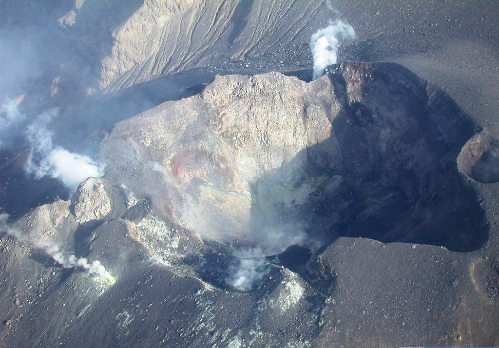
During the week evaluated when weather conditions permitted, it was possible to observe gas emissions from the main fumarole fields on the top of the active cone showing a white color with a low exit pressure, reaching a low altitude, direction of dispersal variable according to the prevailing direction of the winds. The temperature measured in the fumaroles Deformes field was 83.8 degrees centigrade.
The other geophysical and geochemical monitoring parameters of the recorded Galeras volcano show no variation that reveals a change in the activity level of the volcano.
The SERVICIO GEOLÓGICO COLOMBIANO continues to monitor the evolution of the volcanic phenomenon and will continue to report in a timely manner on any changes observed.
Source : Ingeominas.
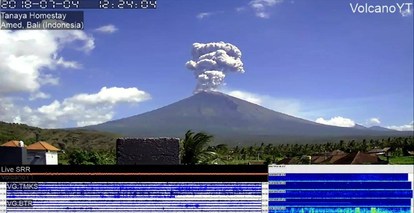
La Réunion , Piton de la Fournaise :
Bulletin of Tuesday, August 7, 2018 at 8:30 am (local time) – earthquake felt.
On Tuesday, August 7, 2018, 07:50 (local time – that is 03H: 50 UTC), an earthquake was felt by the inhabitants of the island, mainly in the North.
This earthquake was recorded by the seismometers of the Volcanological Observatory of Piton de la Fournaise. The first analyzes of this earthquake made it possible to locate it, 12 km below sea level in the North of Réunion, 5 km southeast of Sainte-Clotilde. Its magnitude was measured at 2.5 on the Richter scale. OVPF staff are working on refining the location calculations for this event. Also location and intensity information could change marginally.
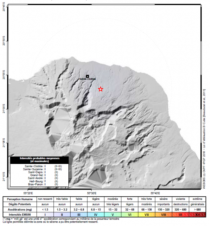
(© IPGP/OVPF)
Location map of the earthquake felt in Reunion on August 7, 2018 at 07:50 (local time). (© OVPF / IPGP)
This type of event, felt by the population is recorded several times a year. This event is isolated and is of tectonic origin.
Call for evidence on earthquakes felt: real intensities (effects of an earthquake in a given place) can only be properly determined by collecting testimonies. If you have felt this earthquake, even weakly, you are invited to report it to the BCSF (Bureau Central Seismologique Français) on the website http://www.franceseisme.fr/
Source : OVPF.
Photo : G Vitton / Le Chaudron de Vulcain.
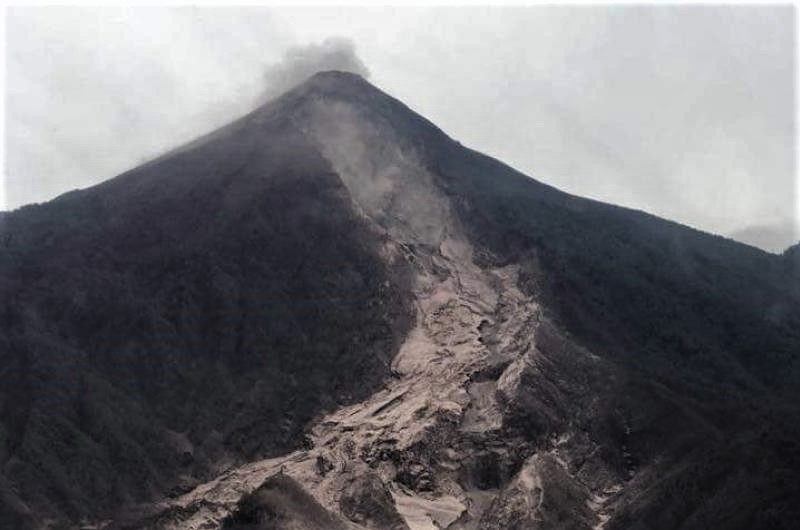
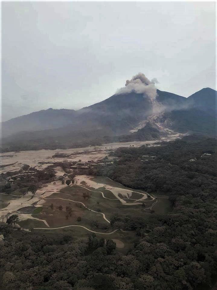
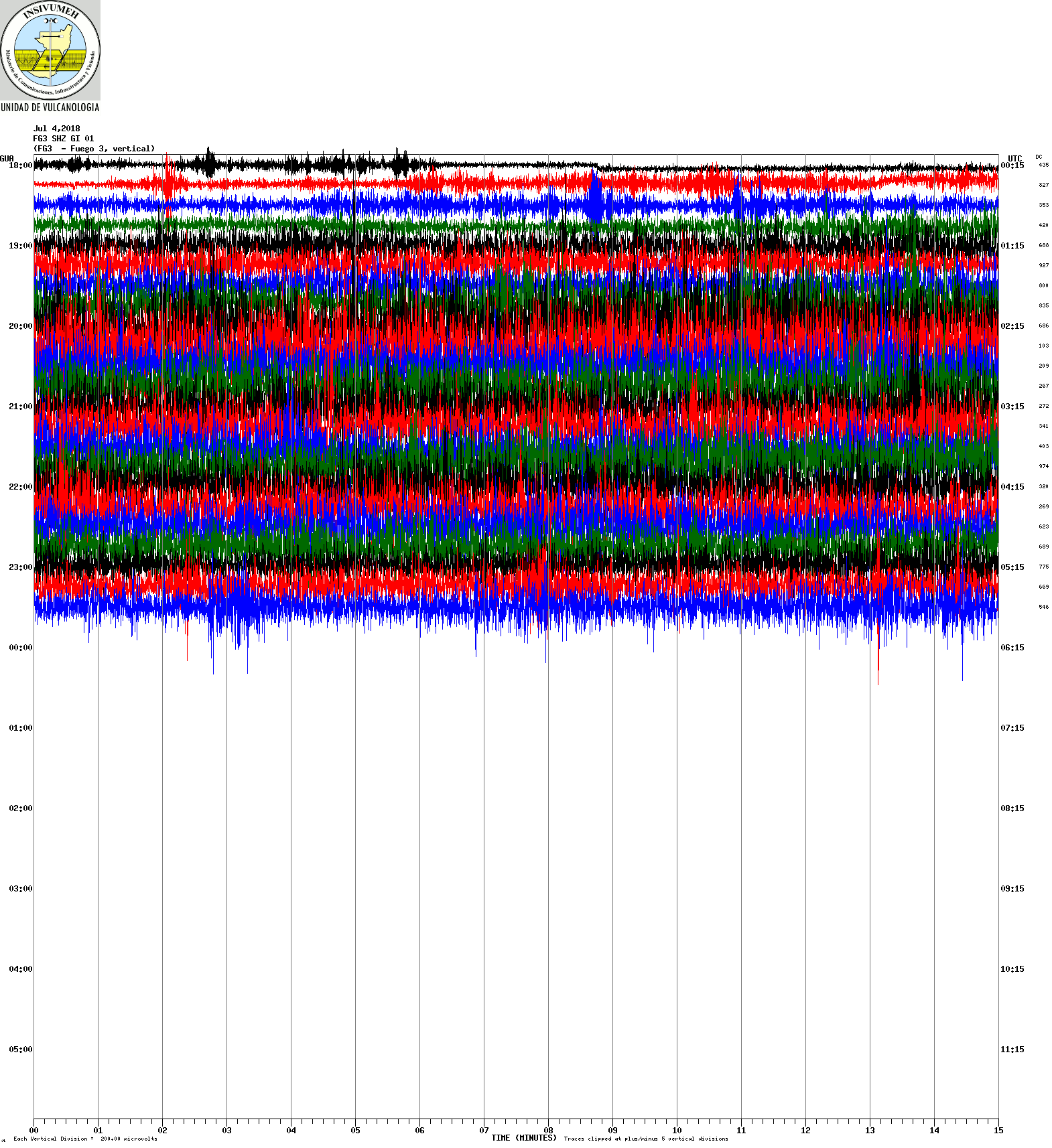
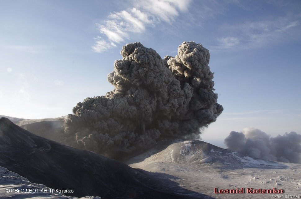
Guatemala , Fuego :
SPECIAL BEFGO VULCANOLOGICAL BULLETIN # 106-2018
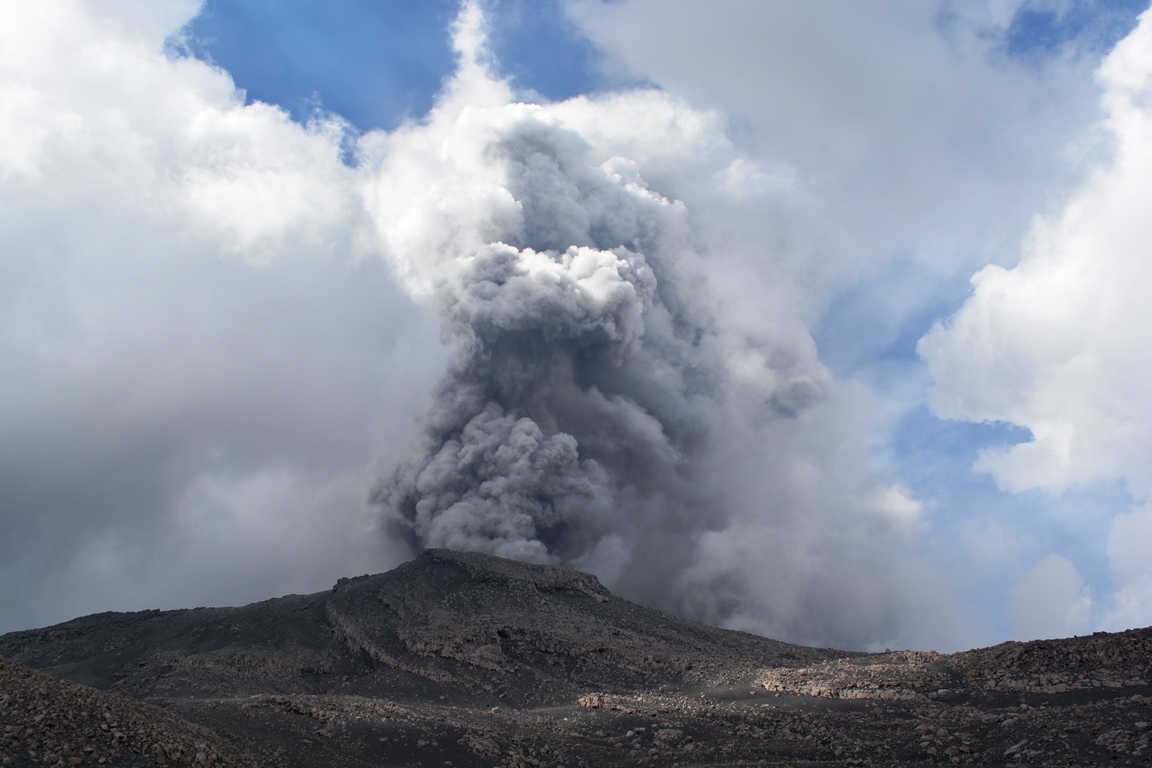
MODERATE EXPLOSION WITH SHOCK WAVES. Guatemala August 8, 2018, 9:40 pm (local time).
Type of activity: Vulcanian
Morphology: Composite stratovolcano
Location: 14 ° 28’54˝ Latitude N; 90 ° 52’54˝ Longitude W.
Height: 3,763msnm.
The eruptive behavior changes of the Fuego volcano recorded a strong explosion, accompanied by avalanches all around the crater, rumblings and shock waves, this 08 August at 21:20 local time. The abundant incandescent rocks ejection at 4,800 m (feet) expelled a column of ash that travels 12 km to the west, with the possible fall of ash particles on San Pedro Yepocapa and villages in that direction.
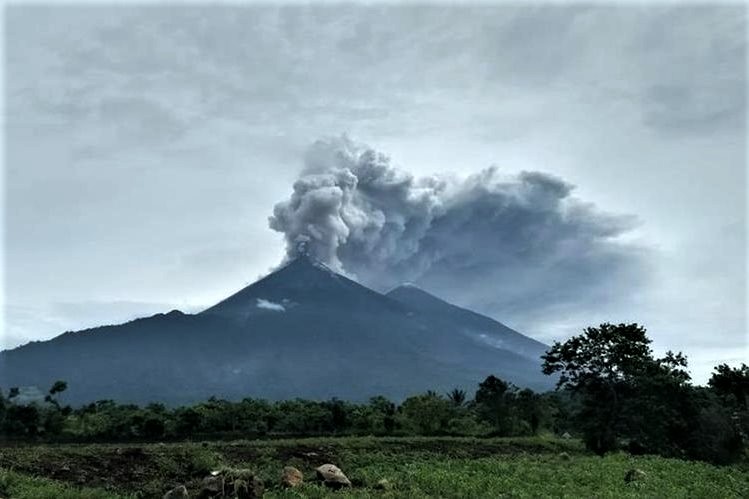
This explosion is the first strong recorded in the last 6 weeks and may be the beginning of another stage of the activity, so that constant vigilance is maintained in the visual and instrumental form of the activity.
Source : Insivumeh.
This post was written with the music of my friends of QUEEN REAL TRIBUTE in the ears. These guys are GREAT and just want to play . They come from Serbia. In some countries, they make a misfortune, but not at home, in France, country stricken for MUSIC. Share, write to them, like their Facebook page, their site, move for them and come see them, explodes guaranteed. China will welcome them, but not us, Europe, France, Italy, Spain, Portugal, Germany, and the country of origin of the myth: Great Britain … ..
These guys are:
Ivan Ristanović:
He is inhabited by the good cause. Superb voice, he has the intelligence to stay himself and not to try to imitate Freddy Mercury.
Nenad Bojković:
Fine guitarist, he plays with a coin, like Brian May.
Ivan Đerfi:
Bass player who sends molten lava. Huge .
Radoš Ćapin:
Splendid drummer. The wig does not hurt him …