September 07 , 2020.
Indonesia , Raung :
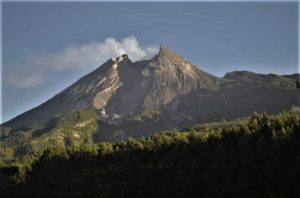
Since July 16, 2020, the number of emission earthquakes recorded on Mount Raung has increased, followed by the appearance of other types of volcanic earthquakes (tremors and eruptions), accompanied by changes in the height of the column of emission / ash and the color of this column. Thus, since July 17, 2020, the activity level of G. Raung has been raised to level II (Waspada). The last eruption occurred on August 11, 2020 with an unobserved eruption column height.
The volcano is clearly visible until it is covered in fog. The crater emits white smoke of moderate intensity, rising about 50 meters above the summit. The weather is sunny to cloudy, the wind is weak towards the North and the South.
According to the seismographs of September 6, 2020, it was recorded:
– 65 emissions earthquakes
– 18 non-harmonic earthquakes
– 1 local tectonic earthquake
– 9 distant tectonic earthquakes
Recommendation:
Communities / visitors / tourists should not carry out activities within a radius of 2 km around the summit crater.
VONA:
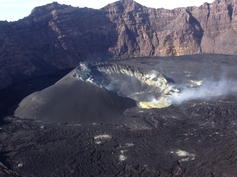
The last VONA message was sent with the color code ORANGE, published on July 16, 2020 at 15:49:00. Volcanic ash was observed at an altitude of 3,532 m above sea level or about 200 m above the summit.
Source : PVMBG.
Photo : Unknown author .
Ecuador , Reventador :
DAILY REPORT OF THE STATE OF THE REVENTADOR VOLCANO, Sunday 06 September 2020.
Information Geophysical Institute – EPN.
Surface activity level: Moderate, Surface trend: Increasing.
Internal activity level: High, Internal trend: No change.
Seismicity: From September 05, 2020, 11: 00h to September 06, 2020, 11: 00h:
Explosions (EXP): 50 events
Rains / lahars: Not recorded.
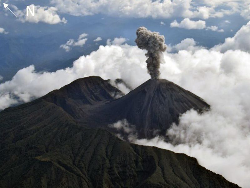
Emission / ash column: Yesterday afternoon, the volcano was clear for most of the time, several ash emissions could be observed at a height greater than 1000 meters above the level of the crater with a West and North direction. Where is. The Washington VAAC reported 3 alerts of emissions observed by the satellites, the direction of these was maintained in the Northwest, with a maximum height of 1338 meters above the level of the crater.
Other monitoring parameters: no change.
Observations: During the last 24 hours, the volcano was cleared and pyroclastic flows were observed on the western flank. Incandescence was observed in the summit area. A small lava flow (~ 350m) is maintained in the northeast, still in the upper part. The seismic statistics were carried out at the CASC station located in Dorado de Cascales, about 42 km from the Reventador volcano (read the press release: http://ow.ly/IB0C30r51gd).
Alert level: Orange.
Source : IGEPN.
Photo : f-naranjo , GVP.
Guatemala , Santiaguito :
Type of activity: Pelean
Morphology: Complex of dacitic domes
Geographical location: 14 ° 44 ’33 ˝ Latitude N; 91 ° 34’13˝ Longitude W.
Height: 2500 m.
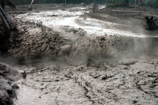
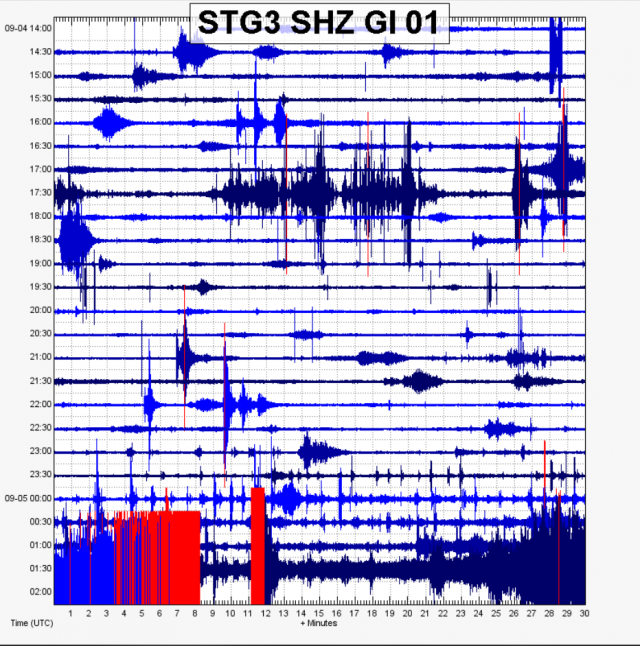
LOW TO MODERATE LAHAR IN THE CABELLO DE ÁNGEL RIVER, INFLUENCE OF THE NIMA I RIVER.
At 20:05 (local time), the descent of weak and moderate lahars was recorded in the Cabello de Ángel river. The seismic network of INSIVUMEH located on the Santiaguito volcano, records a high frequency seismic tremor as observed in the seismogram of the STG3 station, generated by a volcanic material that descends through the Cabello de Ángel river, tributary of the Nimá I river , because of the rain that is currently occurring near the volcanic building.
Heavy rains in the upper part of the domes of the volcanic complex generate the descent of weak and moderate lahars, these can carry pasty material in their path, tree branches and volcanic material such as ash and boulders. 1 to 2 meters in diameter which make the ground vibrate. If the rain persists, the generation of more lahars in this channel or in others of the volcanic complex is not excluded.
Source : Insivumeh
Photo : Géologues-Prospecteurs .fr
United – States , Cascade Range Volcanoes :
Current Volcano Alert Level: NORMAL
Current Aviation Color Code: GREEN
Activity Update:
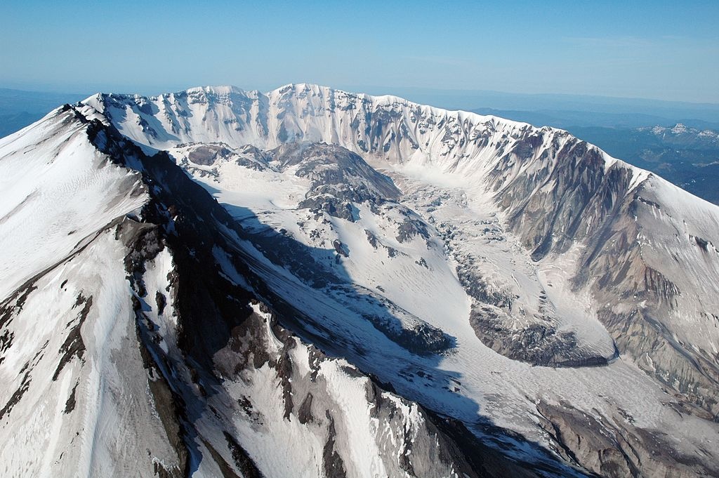
All volcanoes in the Cascade Range of Oregon and Washington are at normal background levels of activity. These include Mount Baker, Glacier Peak, Mount Rainier, Mount St. Helens, and Mount Adams in Washington State; and Mount Hood, Mount Jefferson, Three Sisters, Newberry, and Crater Lake in Oregon.
Recent Observations:
Earthquakes were located at Mount Rainier and Mount St. Helens over the last week, consistent with normal background seismicity. This week field crews finished a two-week geologic mapping campaign at Glacier Peak. Field crews were also at Mount Rainier to install a new lahar monitoring station and at Mount St. Helens to do maintenance on monitoring stations and perform an annual photogrammetry survey.
The U.S. Geological Survey and Pacific Northwest Seismic Network (PNSN) continue to monitor these volcanoes closely and will issue additional updates and changes in alert level as warranted.
Source : CVO.
Photo :St Helens , Unknown author .
Mexico , Popocatepetl :
September 06, 11:00 a.m. (September 06, 4:00 p.m. GMT)
During the past 24 hours, the Popocatepetl volcano monitoring system has identified 261 exhalations accompanied by volcanic gases and sometimes small amounts of ash; that due to the weather conditions in the area, you could only see at certain times. In addition, 126 minutes of low amplitude tremor were recorded.
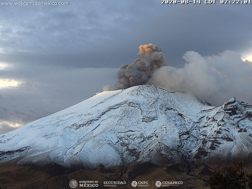
Since the early hours of the morning and at the time of this report there is no visibility towards the crater, however, the winds are heading West.
CENAPRED urges NOT TO APPROACH the volcano and especially the crater, because of the danger posed by the fall of ballistic fragments and, in the event of heavy rains, to stay away from the bottom of the ravines because of the danger of lava flows. mud and debris.
The Popocatépetl volcanic alert semaphore is in YELLOW PHASE 2.
Source : Cenapred .
Photo : Archive webcamdemexico.