
June 10 , 2020.
Italy / Sicily , Etna :
Weekly bulletin from June 01, 2020 to June 07, 2020 (issue date 06/09/2020)
SUMMARY OF THE STATUS OF THE ACTIVITY
In light of the monitoring data, it is underlined:
1) VOLCANOLOGICAL OBSERVATIONS: Moderate strombolian intra-crater activity and occasional ash emissions from the New South-East Crater.
2) SEISMOLOGY: Seismicity linked to weak fracturing events, with high levels of tremors.
3) INFRASONS: Considerable activity, decreasing towards the end of the week.
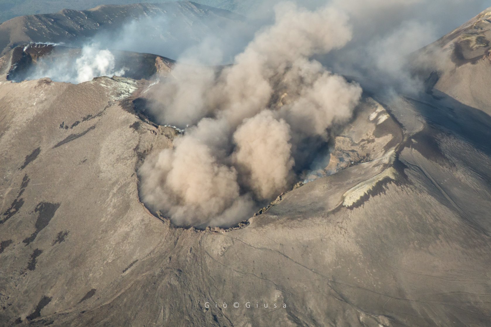
Close-up of the Central Crater area of Mount Etna. (Voragine / Bocca Nuova)
4) DEFORMATIONS: Etna’s soil deformation monitoring networks did not show any significant changes last week
5) GEOCHEMISTRY: The flow of SO2 is at a medium-low level. Soil CO2 flow values are kept at average levels. The partial pressure of dissolved CO2 does not show significant variations. No update is available concerning the C / S value measured at the Voragine crater. The last figure (May 28) corresponded to average values. There is no new data available on the value of the helium isotope ratio. The last figure (May 22) concerned medium-high values.
6) SATELLITE OBSERVATIONS: The thermal activity in the summit area is low.
VOLCANOLOGICAL OBSERVATIONS.
During the week, the volcanic activity of the summit craters of Etna was monitored by analyzing the images from the INGV surveillance cameras, Etneo Observatory (INGV-OE). Observations over a few days were limited due to adverse weather conditions.
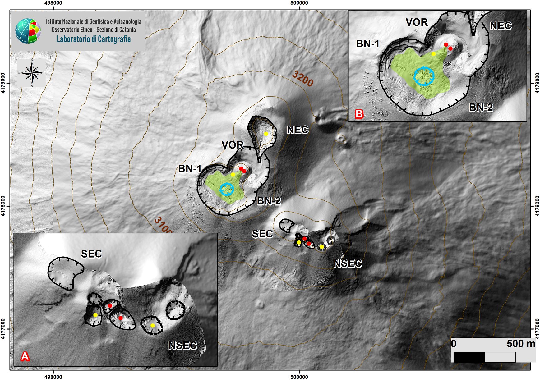
Summit area of Etna with zoom of the sectors linked to the SEC-NSEC system (A) and craters BN and VOR (B) produced by aerial photogrammetry, which show the intra-crater morphology of the two sectors.
During the period studied, the activity of Etna was characterized by an eruptive activity in the New Southeast Crater (NSEC) and by the degassing of a variable character from the other summit craters. In particular, the modest intra-crater strombolian activity at the saddle cone reported in the previous bulletin continued at the New Southeast Crater (NSEC) (Bulletin Etna Rep. N ° 23/2020), without temporal discontinuity . On the surface, this activity produced an intense pulsed degassing, which at night resulted in lightning flashes of variable intensity, discontinuous and weak ash emissions which quickly dispersed in the atmosphere and an occasional expulsion of shreds above the crater edge of the cone.
Seismicity: during the week of June 1 to 7, 2020, the seismic activity linked to fracturing events was low, no event of magnitude 2 or more was recorded.
Volcanic Tremor: The amplitude of tremor during the week of June 1 to 7 is stationary at high levels. The sources are located in the area of the NSEC crater at shallow depths.
Source : INGV .
Read the whole article: file:///C:/Users/Utilisateur/AppData/Local/Packages/Microsoft.MicrosoftEdge_8wekyb3d8bbwe/TempState/Downloads/BollettinoEtna20200609%20(1).pdf
Photos : Gio Giusa , INGV ,
Peru , Ubinas :
Analysis period: June 1 to 7, 2020. Arequipa, June 8, 2020.
Alert level: ORANGE Suggested alert level: GREEN
The Geophysical Institute of Peru (IGP) reports that the dynamic behavior of the Ubinas volcano remains at low levels. Consequently, in the short term, no eruptive activity is planned for the said volcano, so that the population can exercise its activities normally according to the directives of the government and the state of health emergency.
Between June 1 and June 7, the IGP recorded and analyzed a total of 16 seismic events associated with the dynamic behavior of the Ubinas volcano, with the predominance of seismic signals of the Volcano-Tectonic (VT) type, related to the fracturing of rocks inside the volcano. An average of 2 earthquakes per day was recorded with magnitudes less than M1.2. Surveillance cameras recorded slight and sporadic emissions of water vapor with heights less than 500 m above the summit of the volcano. The monitoring of the deformation of the volcanic structure does not record any significant anomalies. MIROVA satellite monitoring did not record any thermal anomalies.
RECOMMENDATIONS
• It is recommended to lower the volcanic alert level from Orange to Green.
• Do not approach within a radius of less than 3 km around the crater of the volcano.
Source : IGP.
Photo : Archive , Auteur inconnu.
Kamchatka , Klyuchevskoy :
VOLCANO OBSERVATORY NOTICE FOR AVIATION (VONA).
Issued: June 09 , 2020
Volcano: Klyuchevskoy (CAVW #300260)
Current aviation colour code: ORANGE
Previous aviation colour code: orange
Source: KVERT
Notice Number: 2020-115
Volcano Location: N 56 deg 3 min E 160 deg 38 min
Area: Kamchatka, Russia
Summit Elevation: 15580 ft (4750 m)

Volcanic Activity Summary:
A moderate explosive-effusive eruption of the volcano continues. According to video and satellite data, an ash plume is extending for 34 km to the southwest of the volcano.
This eruption continues. Ash explosions up to 16,400-23,000 ft (5-7 km) a.s.l. could occur at any time. Ongoing activity could affect low-flying aircraft.
Volcanic cloud height:
18040-19680 ft (5500-6000 m) AMSL Time and method of ash plume/cloud height determination: 20200609/2345Z – Video data
Other volcanic cloud information:
Distance of ash plume/cloud of the volcano: 21 mi (34 km)
Direction of drift of ash plume/cloud of the volcano: WSW / azimuth 240 deg
Time and method of ash plume/cloud determination: 20200609/2302Z – NOAA 18 (4m5)
Source : Kvert .
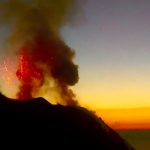
Photo : Yuri Demyanchuk.
Colombia , Nevado del Huila :
Nevado del Huila volcano weekly activity bulletin
The level of activity of the volcano continues at:
Yellow activity level or (III): changes in the behavior of volcanic activity.
According to the analysis and evaluation of information obtained through the monitoring network of the Nevado del Huila volcano during the week of June 2 to 8, 2020, the COLOMBIAN GEOLOGICAL SERVICE – Vulcanological and Seismological Observatory of Popayán reports that:
During the period evaluated, 216 seismic events were recorded, 96 of which were related to the fracturing processes of rocks (VT type) and 120 to the dynamics of fluids in volcanic conduits. Of these, 107 were cataloged as long period type events (LP type), three (3) as hybrid events (HB type) and 10 as low energy tremor pulses (TR type).
The images obtained during the week by the web cameras of Caloto, Tafxnú, Maravillas and La Palma showed a weak degassing of the volcanic system.
Sensors monitoring soil deformation, magnetic fields and infrasound waves did not record the variations associated with changes in volcanic activity.
Therefore, it is concluded that during the evaluated period, the volcano continued to show stable behavior.
Source : SGC.
Photo : Parque Nacional .
Guatemala , Santiaguito :
Geographical location: 14 ° 44 ’33 ˝ Latitude N; 91 ° 34’13˝ longitude W.
Height: 2500 m above sea level.
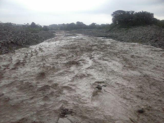
LAHAR MODERATE TO STRONG IN THE CABELLO RIVER OF ANGEL, A tributary of the NIMA RIVER I.
The INSIVUMEH seismic network located on the Santiaguito volcano, records high-frequency seismic tremors, generated by volcanic materials that descend through the gorges of the tributary of the Cabello de Ángel River to the Nima I River in due to the rain that is currently occurring near the volcanic building. During the last 24 hours, 3.6 mm of precipitation were recorded.

Figure 1: Seismic signal from the STG3 station. The high frequency seismic tremor begins at 3:25 p.m. local time.
Heavy rains in the upper part of the domes of the volcanic complex generate the descent of weak to moderate lahars, these can carry pasty materials on their way, tree branches and volcanic materials such as ash and blocks of 1 to 2 meters in diameter which vibrate the ground. If the rain persists, the generation of more lahars in this or other ravines of the volcanic complex is not excluded.
Source : Insivumeh .
Photos : Insivumeh.


No comment yet, add your voice below!