
June 22 , 2019.
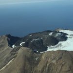
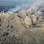
Alaska , Great Sitkin :
52°4’35 » N 176°6’39 » W,
Summit Elevation 5709 ft (1740 m)
Current Volcano Alert Level: ADVISORY
Current Aviation Color Code: YELLOW
The level of seismic activity has been slightly elevated and just above background during the past week. Steam emissions from the volcano’s summit have been observed by field crews working on Adak during clear weather. No unusual activity has been observed in satellite views over the past Week.
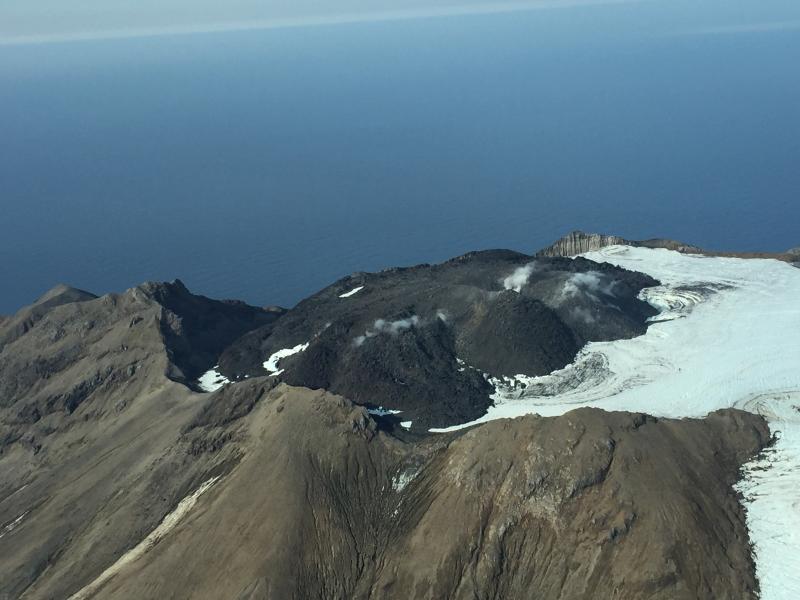
A gas flight was conducted at Great Sitkin on Tuesday, June 18. Elevated concentrations of carbon dioxide were detected above the dome, but sulfur dioxide was not detected. These observations are consistent with magma degassing and the presence of a shallow aquifer beneath the volcano, as well as with recent observations of small phreatic (steam) explosions.
Great Sitkin Volcano is monitored with a local real-time seismic network, which will typically allow AVO to detect changes in unrest that may lead to an explosive eruption. Rapid detection of an ash-producing eruption would be accomplished using a combination of seismic, infrasound, lightning, and satellite data.
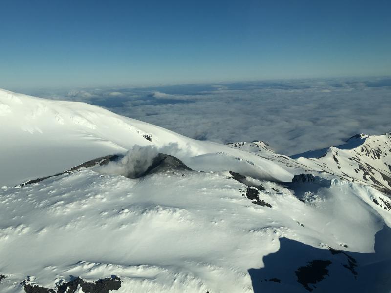
Great Sitkin Volcano is a basaltic andesite volcano that occupies most of the northern half of Great Sitkin Island, a member of the Andreanof Islands group in the central Aleutian Islands. It is located 43 km (26 miles) east of the community of Adak. The volcano is a composite structure consisting of an older decapitated volcano and a younger parasitic cone with a 2-3 km diameter summit crater. A steep-sided lava dome, emplaced during an eruption in 1974, occupies the center of the crater. Great Sitkin erupted at least three times in the 20th century, most recently in 1974. That eruption produced a lava dome and at least one ash cloud that likely exceeded an altitude of 25,000 ft above sea level. A poorly documented eruption occurred in 1945, also producing a lava dome that was partially destroyed in the 1974 eruption. Within the past 280 years a large explosive eruption produced pyroclastic flows that partially filled the Glacier Creek valley on the southwest flank.
Source : AVO.
Photos : Dave Clum ( 09/2018 , 06/2018).
Russia / Kurile Islands , Raikoke :
Raikoke volcano (Kurile Islands, Russia): major explosive eruption, ash to approx. 43,000 ft altitude
Friday Jun 21, 2019 23:37 PM .
A very significant explosive eruption occurred – without any warning – at Raikoke volcano on the evening of 21 June 2019, at or shortly before around 18:10 UTC (or 06:10 local time on 22 June).
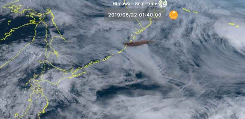
A dense dark-brown ash plume rising to estimated 43,000 ft (13 km) altitude was spotted clearly on Japan’s Himawari 8 satellite, high above the dense lower cloud decks. As of the time of this post, about 6 hours after the start of the (presumably still ongoing) eruption, the ash plume has reached a length of approx. 500 km and drifting eastwards. .
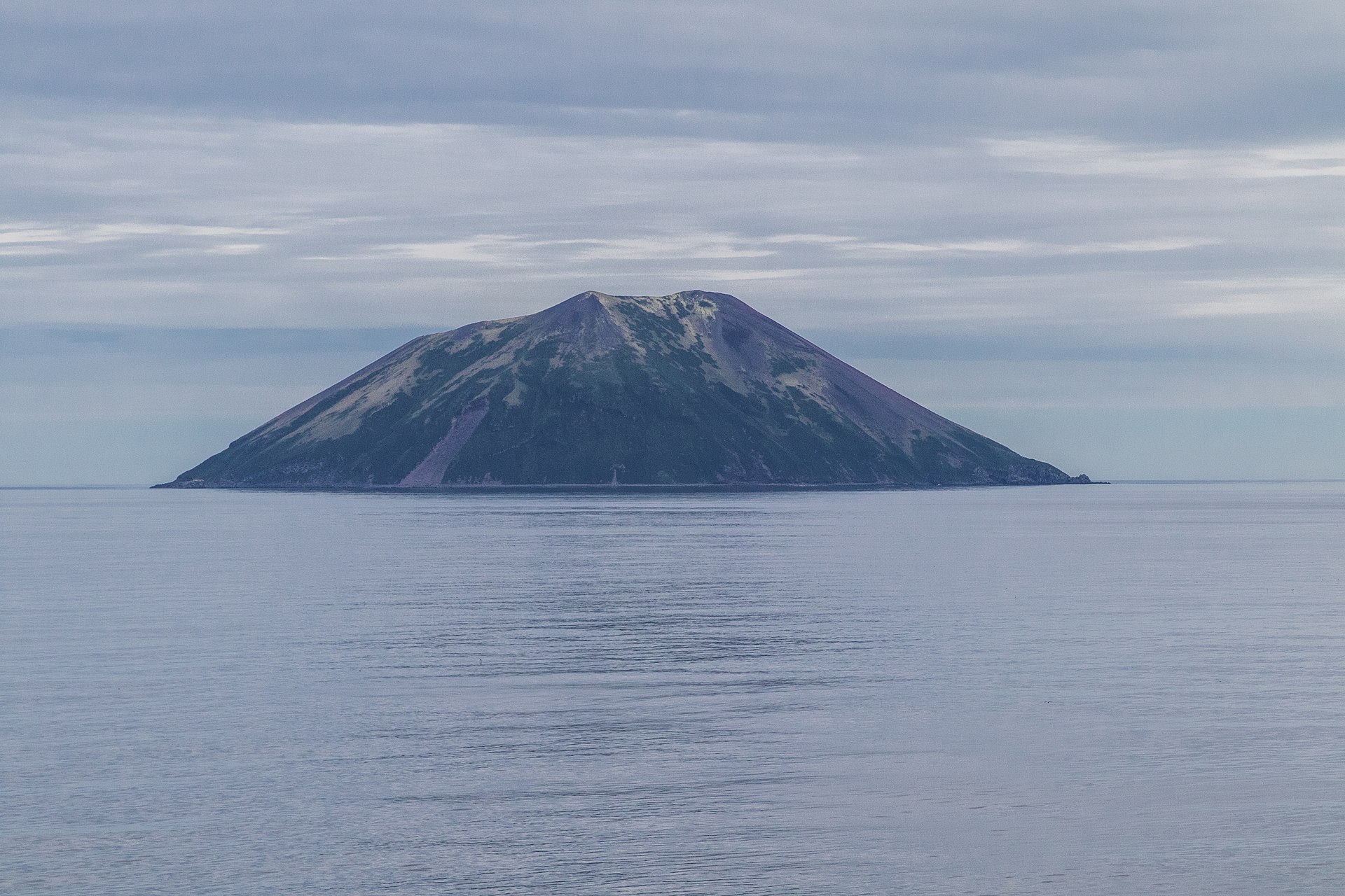
A low truncated volcano forms the small barren Raikoke Island, which lies 16 km across the Golovnin Strait from Matua Island in the central Kuriles. The oval-shaped basaltic island is only 2 x 2.5 km wide and rises above a submarine terrace. The steep-walled crater, highest on the SE side, is 700 m wide and 200 m deep. Lava flows mantle the eastern side of the island. A catastrophic eruption in 1778, during which the upper third of the island was said to have been destroyed, prompted the first volcanological investigation in the Kuril Islands two years later. Reports of eruptions in 1777 and 1780 are erroneous (Gorshkov, 1970). Another powerful eruption in 1924 greatly deepened the crater and changed the outline of the island.
Read the article : https://www.volcanodiscovery.com/raikoki/news/81988/Raikoki-volcano-Kurile-Islands-Russia-major-explosive-eruption-ash-to-approx-43000-ft-altitude.html
Source : VOLCANODISCOVERY , GVP.
Photos : Iwamari , Wikipédia .
Mexico , Colima :
Weekly technical bulletin of the activity of the Colima volcano, Date: 21 June 2019 Bulletin n ° 126.
Seismic activity:
Last week, 39 high frequency events (HF), 10 landslides, 5 low intensity explosions, 31 min of low amplitude tremor and a small lahar in the Montegrande ravine were recorded automatically. A low intensity explosion was recorded on June 15 at 11:44 (16:44 UTC) at the INCA station located 1.9 km from the crater of the volcano.
Visual observations:
During the reporting period, small explosions and intermittent releases of steam and gas mainly from the northeast side of the crater continue to be recorded. The visibility dropped significantly this week, which allowed to observe the volcano over very short spaces of time.
When cloudiness permitted, the fixed thermal imaging camera located south of the volcano recorded thermal anomalies associated with fumarolic activity and very low intensity explosions.

Geochemistry:
No SO2 flow measurements were performed during the last week.
Remote perception:
No thermal anomalies detected by the MIROVA satellite system were observed during the last week.
Diagnostic :
The volcano maintains an explosive activity of low intensity. The occurrence of these events indicates that the gas associated with the moving magma has reached superficial levels; this activity can continue and increase in intensity in the following days or weeks. The staff in charge of monitoring the volcano is attentive to possible changes and changes in activity.
Source : Ucol Mexique
Photo : afmedios.com.
Guatemala , Fuego :
SPECIAL VOLCANOLOGICAL BULLETIN, BEFGO # 39-2019, Guatemala June 21, 2019 at 18:40 (local time)
LOW TO MODERATE LAHARES IN CANYON CENIZA.
Heavy rainfall over the volcanic area during this afternoon in the Fuego Volcano region has resulted in the descent of lahars with weak to moderate features from Ceniza Canyon, a tributary of the Achiguate River.
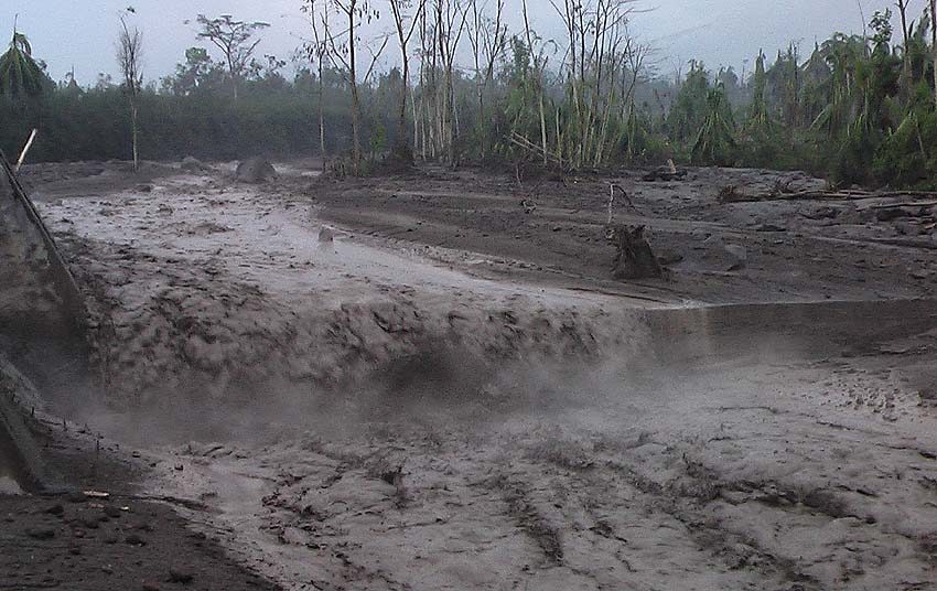
This lahar carries pasty materials, blocks of 2 to 3 meters in diameter, branches and tree trunks. The material carried by the lahar can lift steam columns.
Due to the rains, it is likely that other lahars descend into the main ravines of the Fuego volcano. It is therefore recommended not to stay in the ravines or nearby.
Activity:
Presence of a weak, white, outgassing at an approximate height of 4 200 m (13 779 ft) scattered in a westerly and southwesterly direction. 14 to 17 ash emissions are reported, of low to moderate characteristics, emitting ash column at a height of approximately 4,600 to 4,700 meters (14,764 to 15,420 feet), traveling 20 to 25 km to the east. West and Southwest. Low to moderate rumblings, low to moderate shock waves that cause vibrations in the roofs and windows of houses near the volcano, and low degassing sounds with 5-minute intervals are noted.
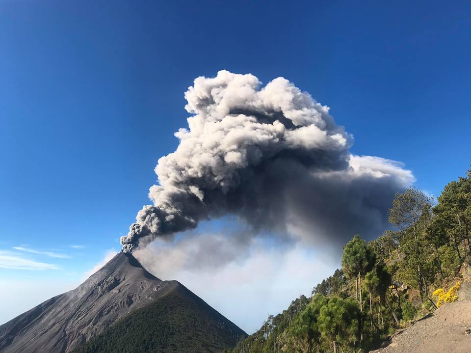
At night and early in the morning, incandescence was observed in the crater at an approximate height of 350 meters above the crater, causing weak to moderate avalanches in the crater contour, some reaching long distances towards the vegetation in the direction of the crater. ravines: Seca, Taniluya, Ceniza, Trinidad, El Jute, Las Lajas and Honda. Ashes fall in Morelia, Santa Sofia, El Porvenir, the Palo Verde area, San Pedro Yepocapa, Panimache I and II, among others.
Source : Insivumeh .
Photos : Caroline Sarrazin / Rés-EAUx . Jessica Chicco .


No comment yet, add your voice below!