October 07 , 2018.
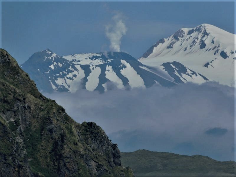
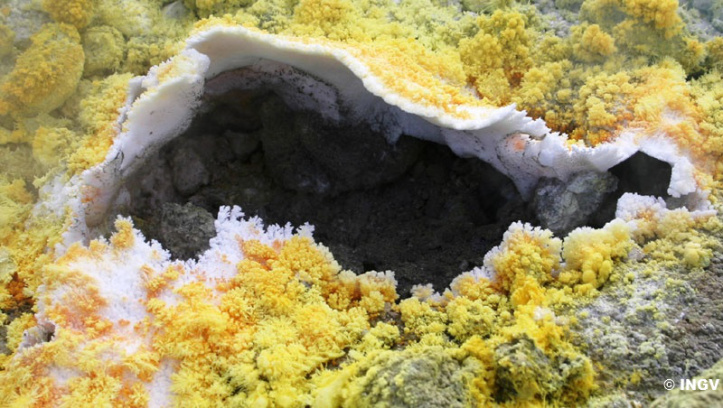
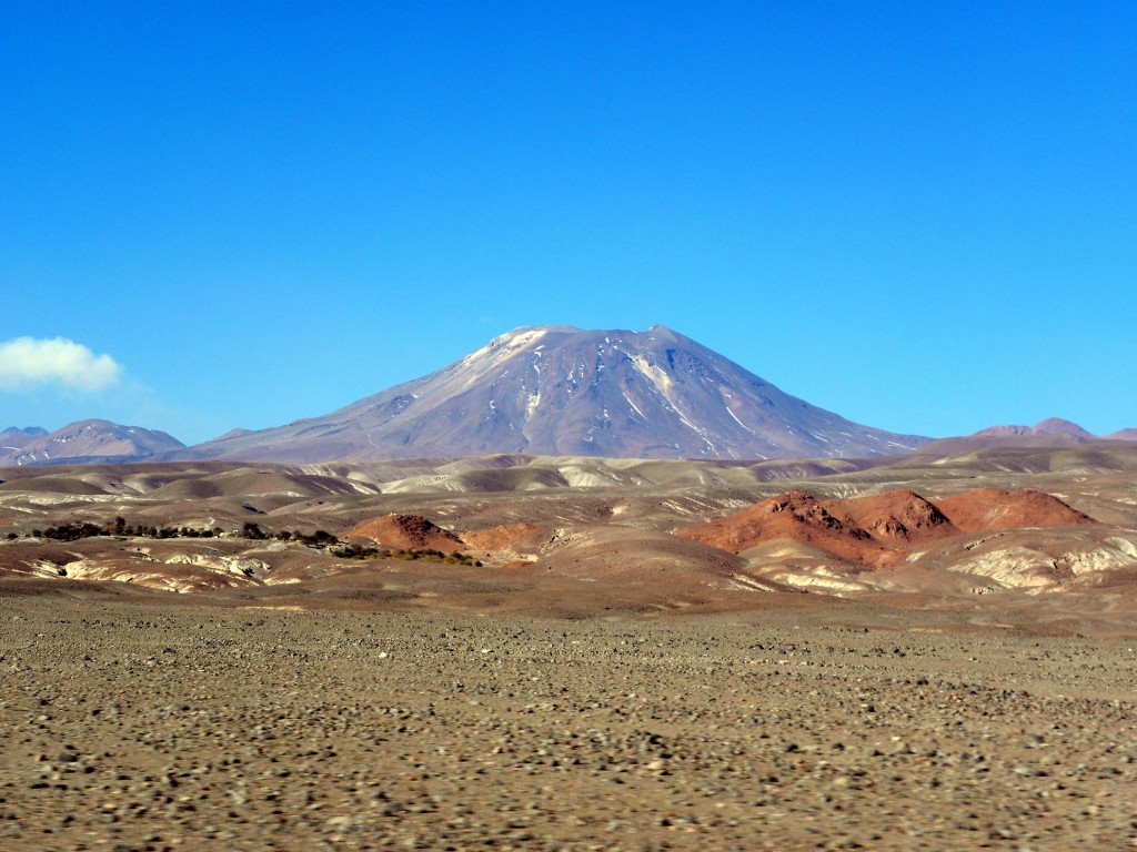
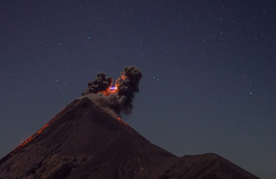
Chile , Lascar :
During the evaluated period, a total of 152 seismic events were recorded, of which 9 were classified as volcano-tectonic earthquakes (VT) in relation to rock fracturing processes within the volcanic edifice. with local magnitudes less than M0.4. The event of greatest energy was located in the active crater, at a depth of 1 km.
There were also 143 long-period (LP) earthquakes recorded in relation to fluid dynamics within the volcano with reduced displacement values (DRc) of less than 4.5 cm2.
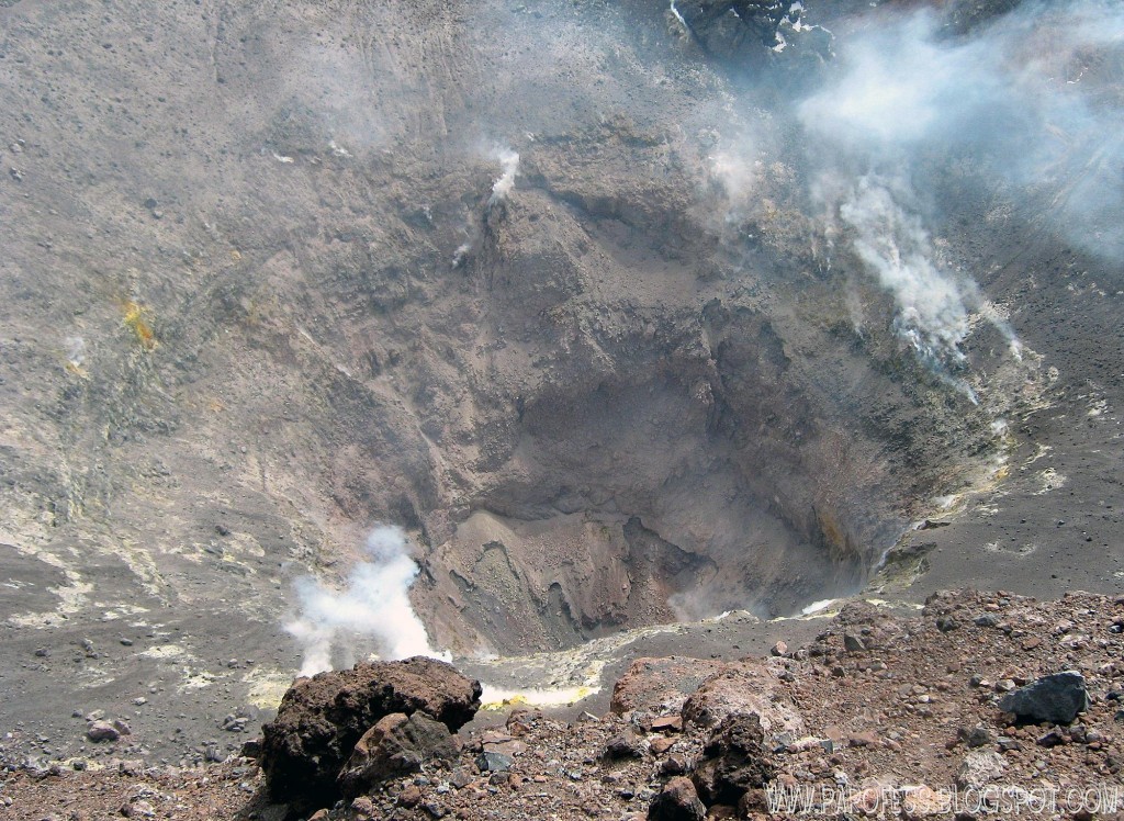
The images provided by the IP cameras installed around the volcano show a recurrent degassing from the main crater, reaching a maximum of 300 m above the active crater.
According to the data provided by two GNSS stations, there is a shortening of approximately 0.75cm in the line of surveillance that crosses the crater. The shortening of the surveillance line is due to a large extent to the displacement of the station located south of the crater.
The sulfur dioxide (SO 2) emissions recorded by the Differential Absorption Spectrometry Equipment (DOAS) show a value for the evaluated period of 675 +/- 106 T / day and a maximum value of 1962 t / d recorded on September 13th. SO2 emissions are at moderate levels for this volcano, returning to levels observed in previous periods.
6 thermal warnings were reported in the area associated with the volcanic complex during the period, with a maximum MVRP of 0.8 MW, values considered low, according to the data processed by infrared observation. Volcanic Activity (MIROVA) (http://www.mirovaweb.it/) and Temporal Thermal Monitoring of Global Hot Spots (MODVOLC) (http://modis.higp.hawaii.edu/).
The level of activity presented during the period considered is considered to be in the basic level
Because of the above, the volcanic warning is kept at the level:
GREEN LEVEL: Active volcano with stable behavior – Probable time for eruption: MONTH / YEARS.
Observation:
A zone of danger is considered as an area of 500 m around the crater.
Source : Sernageomin
Photo : Desertexploring .cl.
La Réunion , Piton de la Fournaise :
Activity Bulletin from Saturday, October 6, 2018 at 3:00 pm (local time).
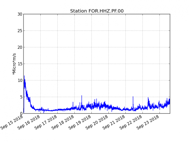
The eruption started on September 15th at 4:25 am local time continues. The intensity of the volcanic tremor (indicator of the eruptive intensity at the surface), after having increased markedly since October 3 at 10 pm local time (18h UTC), has decreased slightly since that day but remains high (Figure 1).
This high intensity would be related to the gradual closure of the entire feeding system, ranging from the dike (« supply duct » of the eruption) to the eruptive cone, favoring a phenomenon of « resonance » more important.
Piston gases (« gas flushes » or « tremor puffs ») at the eruptive site are always recorded by the OVPF seismometers. These « piston gases » mark a change of regime in the degassing of the eruption, and are generally observed when the quantity of available gas is exhausted, and often synonymous with a decrease of activity on the surface.
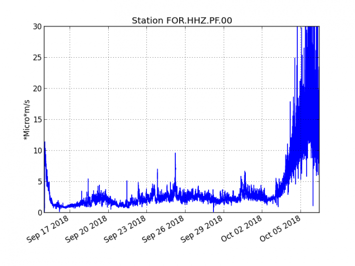
Figure 1: Evolution of the RSAM (indicator of the volcanic tremor and the intensity of the eruption) between 04:00 (00h UTC) on September 15th and 14h50 (10h50 UTC) on October 6th on the FOR seismic station, located near the crater Chateau Fort (2000 m altitude on the southeast flank of the terminal cone). (© OVPF / IPGP)
– No volcano-tectonic earthquake was recorded during the day of 5 October or during the current day.
– An inflation (swelling) of the volcano, witnessing the influence of a source of pressure at the foot of the volcano, is still perceptible. This inflation is now accompanied by an increase in CO2 concentrations in the soil in the Volcano Cottage area.
– The surface flow rates could not be estimated today because of lava flows that are too weak at the surface.
– The OVPF NOVAC network stations located around the Enclos still record SO2 flows. Even though their concentrations are 5 times lower than at the beginning of eruption, these flows confirm that there is still magma present at low pressure.
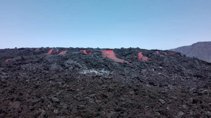
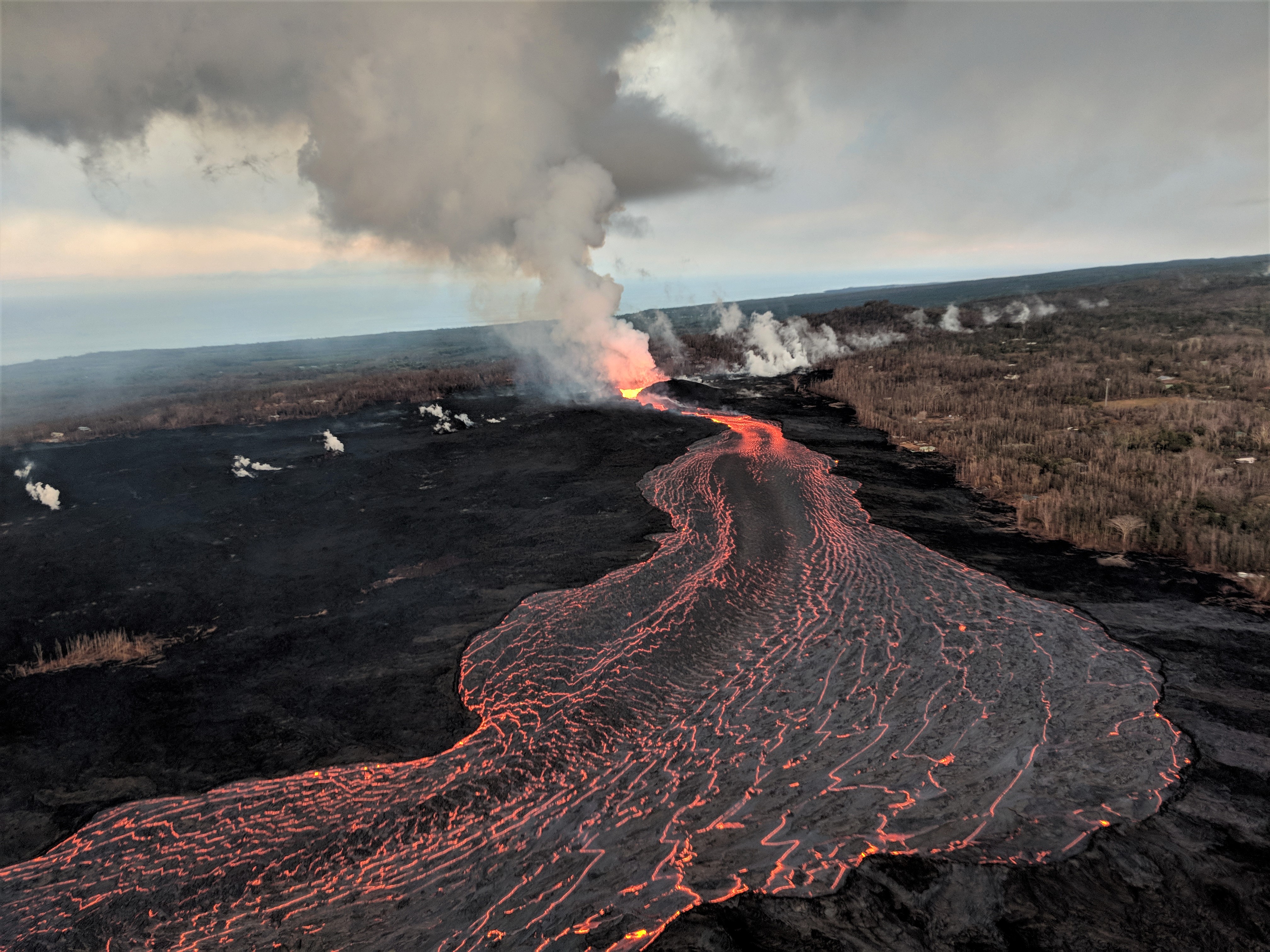
– The surface activity is still very limited with very few lava projections inside the cone and no major resurgence visible from the main tunnel. Nevertheless, the activity continues in lava tunnels, with degassing particularly visible along their path from the eruptive vent (Figure 2) to the flow front. No recognition of the lava front has been achieved in recent days but according to shots from the eruptive site and from Piton Bert, the flow front would have progressed east a few hundred meters.
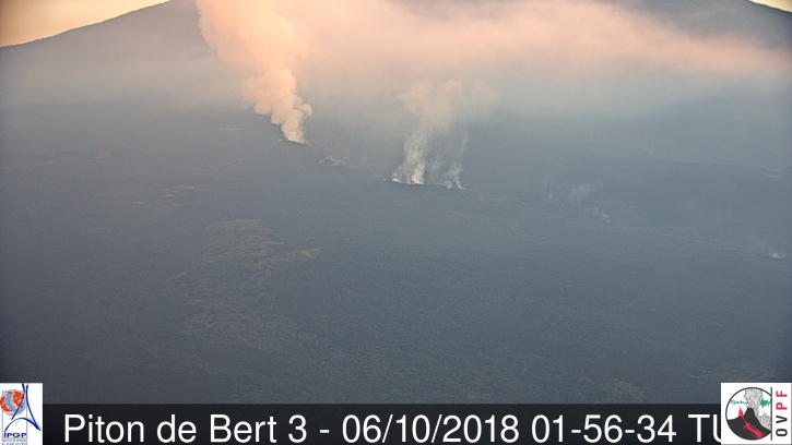
Figure 2: Shooting of the eruptive site on October 6, 2018 at 05h56 local time – 01h56 UTC time. (© OVPF / IPGP-IRT)
Balance sheet:
For 4 days, the OVPF has been recording signals of two trends that occur at different levels:
1) at the level of the eruptive vent: recordings of « piston gas » and an increase in the tremor, witnessing a progressive closure of the dike (« supply conduit » connecting the superficial reservoir to the eruptive site) and the cone ;
2) at the level of the superficial reservoir: pressurization of a localized source under the summit craters at a depth of 1-1.5 km (detected by the inflation of the building) witnessing a refilling of the superficial reservoir by deeper magma (increased CO2 concentration in the soil outside the Enclos).
Given these two observables, no assumption is excluded as to the continuation of this eruption in the coming days (shutdown, re-intensification of activity on the same site, opening of new cracks, especially further downstream).
Alert level: Alert 2-2 – Eruption in the Enclos .
Source : OVPF , www.ipgp.fr/fr/ovpf/bulletin .
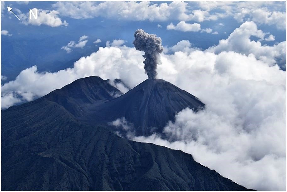
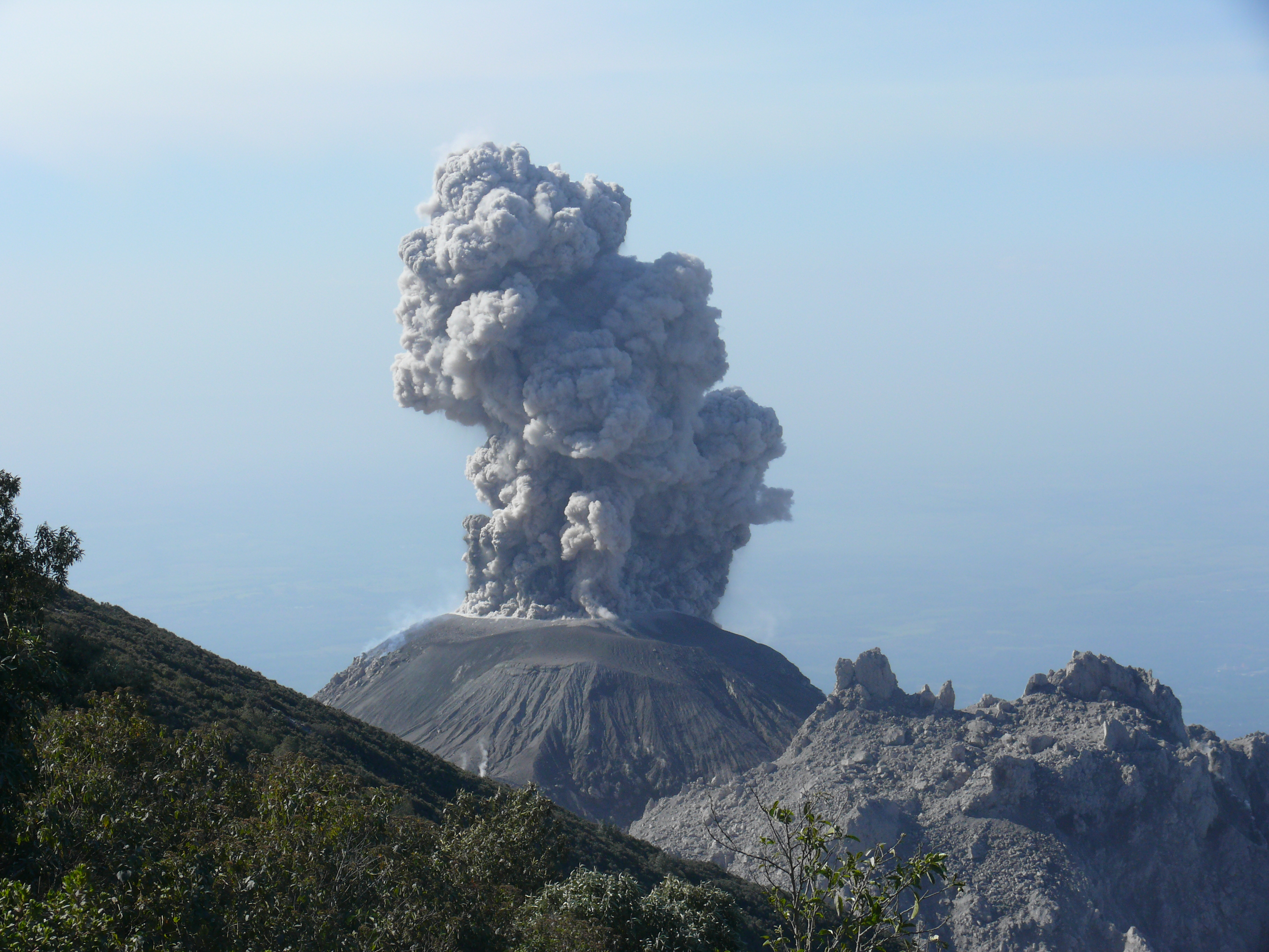
Guatemala , Fuego :
Type of activity: Vulcanian
Morphology: Composite Stratovolcano
Geographical location: 14 ° 28’54˝ N Latitude; 90 ° 52’54˝ Longitude O.
Height: 3,763msnm
Weather conditions: cloudy
Wind: Northeast
Precipitation: 6.0 mm
Activity:
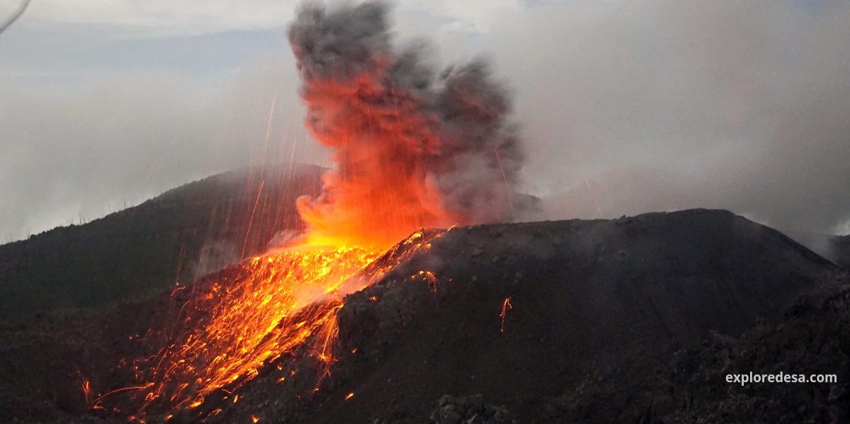
Presence of low white degassing fumaroles reaching an approximate height of 4300 msnm (14107 feet), dispersing in the west and southwest direction. Six to eight low-to-moderate explosions per hour were observed, ejecting columns of gray ash at an approximate height of 4400 to 4500 m / l (14435 and 14763 feet) dispersing to the west and southwest over a approximate distance of 10 km. Some of them generate weak rumblings and degassing sounds similar to those of a train locomotive with a greater recurrence. Incandescent pulses at an approximate height of 100 meters above the crater, generate weak avalanches on the crater contour and towards the canyons of Ceniza, Las Lajas and Seca. Ash falls are reported in the communities of Sangre de Cristo, Palo Verde, Panimache I and II and others located in this direction.
Source : Insivumeh
Photo : Inconnu.
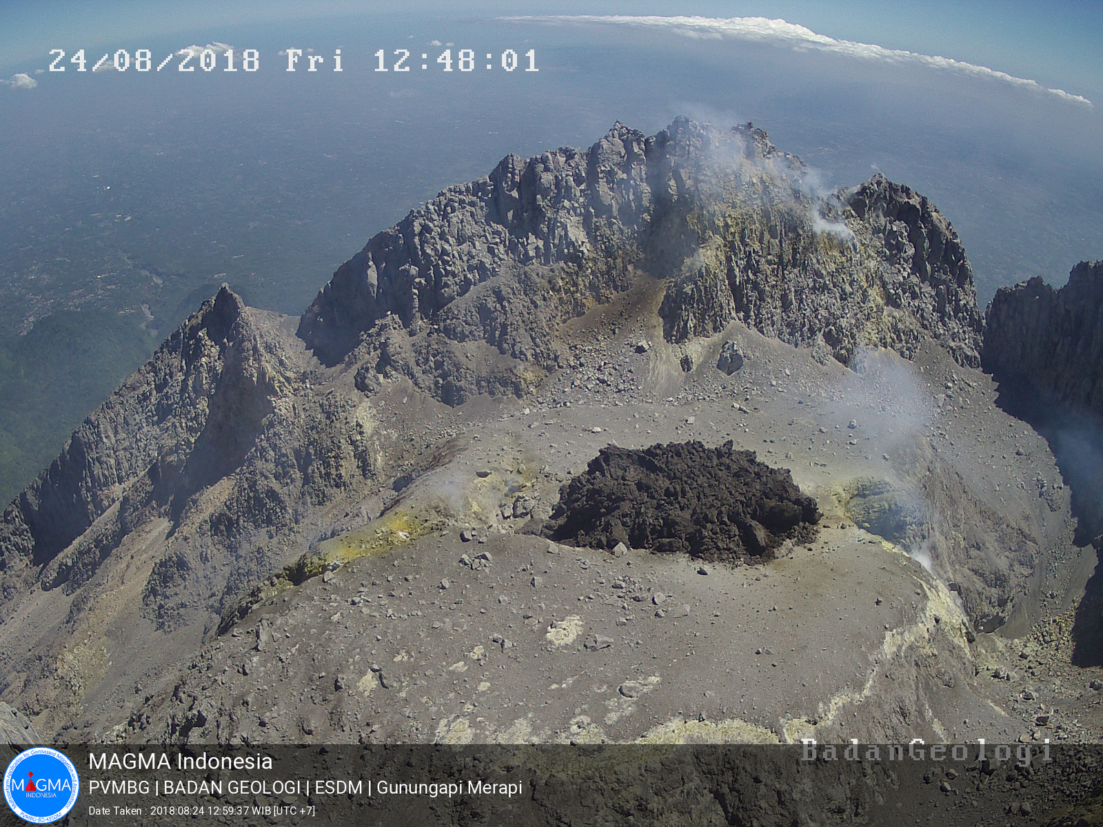
Indonesia , Anak Krakatau :
Mount Anak Krakatau Seismically Erupts 407 Times
TEMPO.CO, Bandarlampung – Mount Anak Krakatau located in the Sunda Strait, South Lampung District, Lampung Province, has seismically erupted 407 times and spewed lava since Saturday until Sunday morning.
The volcano`s relatively loud bang was heard and trembling was felt at the Mount Krakatau observation post, according to Jumono, the post`s officer, as quoted by the Meteorology, Climatology and Geophysics Agency (BMKG) in a statement on Sunday.
The authorities have declared the volcano is in an alert status and closed to the public within a radius of two kilometers from the mountain`s crater.
The observation post recorded a total of 407 seismic eruptions with amplitude of 30-50 mm, duration of 37-300 seconds; 14 harmonic tremors with amplitude of 10-41 mm, duration of 34-123 seconds; and incessant tremors with amplitude of 2-40 mm, and dominant of 20 mm.
Level of activity at Level II (WASPADA). G. Krakatau (338 m altitude) has experienced an increase in volcanic activity since June 18, 2018.
Since yesterday and until this morning, the volcano was visually covered with mist. The weak winds were oriented to the east and south-east. The smoke from the crater is not observed.
The seismographs of October 5, 2018 recorded:
348 earthquakes of eruption
26 harmonic earthquakes
2 volcanic earthquakes
A continuous tremor with a maximum amplitude of 2 to 25 mm (dominant value 15 mm)
Recommendation: People / tourists are not allowed to approach within a radius of 2 km around the crater.
VONA: The latest VONA code was given the ORANGE color code, published on September 22, 2018 at 6:56 am, for an eruption with ash column height of approximately 538 m above sea level or approximately 200 m above the summit. The column of ashes was moving south.
Source : Tempo , PVMBG.
Video : Yohannes Tyas Galih Jati
Ecuador , Reventador :
The volcano maintains a high eruptive activity. In the morning hours and today, we have been able to observe gas and ash emissions at a height of 800 meters above the crater level in a northwesterly direction. Incandescence has also been observed at the crater level. At the moment the area of the volcano is partly cloudy.
Ash Emission / Column: Several emissions of gas and ash have been observed, with heights greater than 1,000 meters and directions from north-east to north-west. Image 20181006 07h20 (TL).
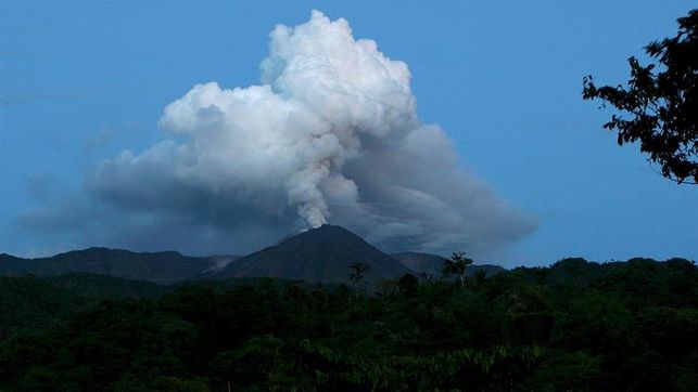
Seismic activity:
Long period (LP) events: 44
Explosions (EXP): 30
Transmission Tremor (TE): 5
Harmonic tremor (TA): 3
The Institute of Geophysics of the National Polytechnic School is attentive to the activity on the volcano and informs about its changes.
Source : IGEPN