July 23 , 2018.
Guatemala , Santiaguito :
Activity type: Peléenne
Morphology: Complex of dacitic domes
Geographical location: 14 ° 44 ’33 ˝ Latitude N; 91 ° 34’13˝ Longitude W.
Height: 2,500msnm
Weather conditions: Clear
Wind: West 6 km / h
Precipitation: 5.8 mm
Activity:
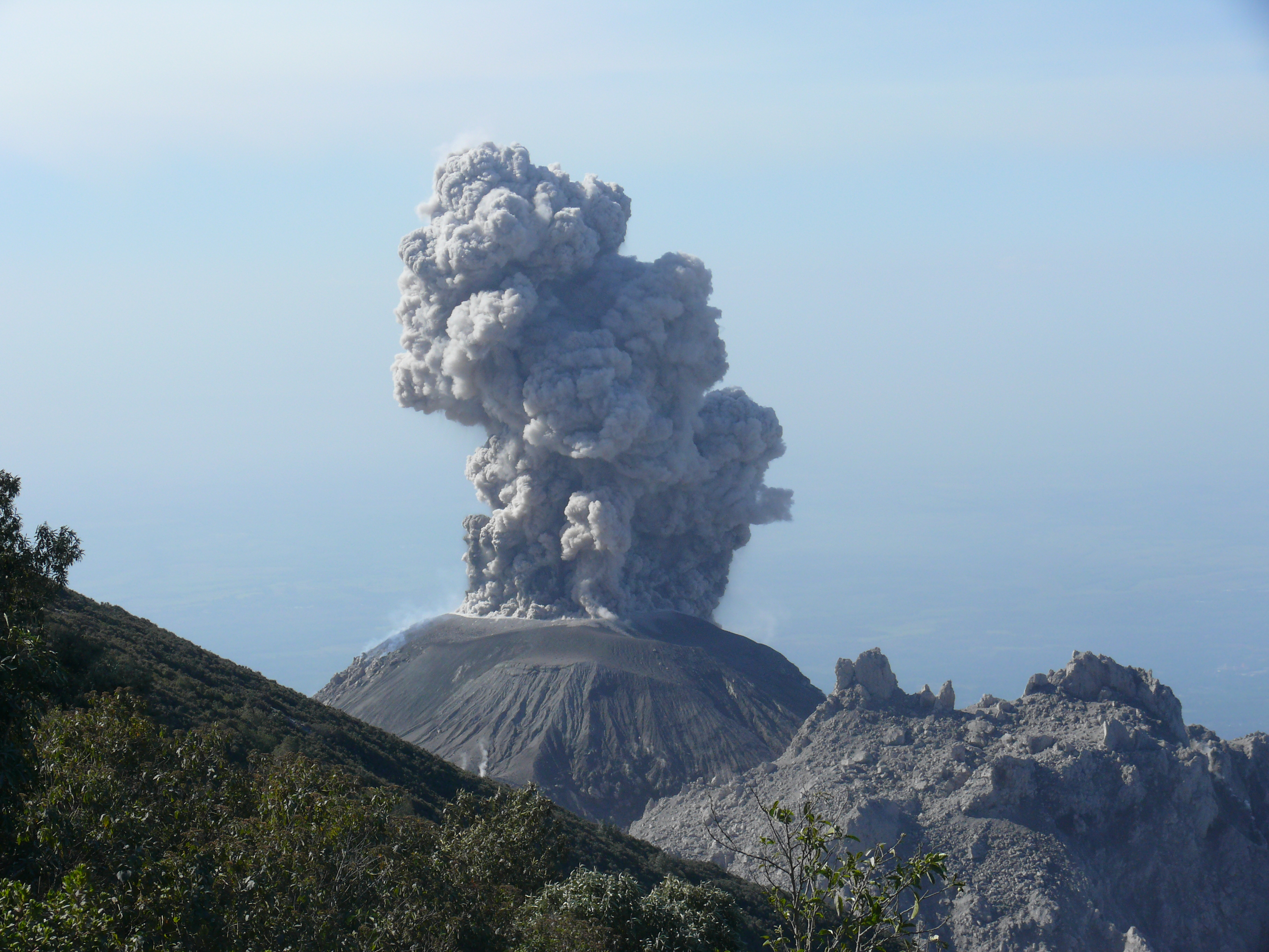
Occasionally, white degassing is observed at an approximate elevation of 2900 m (9514 ft) dispersing in a southeasterly direction. Low to moderate explosions are observed, generating a white column approximately 3200 m (10498 feet) in height, moving south-east, with ashes falling back into the volcanic perimeter. Slight to moderate avalanches are noted on the southeast flank. Degassing is sound. Low to moderate avalanches are also recorded towards the Southeast Dome.
Source : Insivumeh
Hawaï , Kilauea :
Sunday, July 22, 2018, 9:55 AM HST (Sunday, July 22, 2018, 19:55 UTC)
19°25’16 » N 155°17’13 » W,
Summit Elevation 4091 ft (1247 m)
Current Volcano Alert Level: WARNING
Current Aviation Color Code: ORANGE
Kīlauea Volcano Lower East Rift Zone
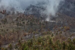
Fissure 8 continues to erupt lava into the channel leading northeastward from the vent. Overnight UAV flights made six flights over the active channel measuring surface velocities. No new significant overflows were reported. The most vigorous ocean entry is located a few hundred meters northeast of the southern flow margin with a few tiny pahoehoe toes were entering the ocean from the Kapoho Bay lobe to the north. The southern margin of the flow remains about 500 m (0.3 mi) from the boat ramp at Isaac Hale Park.
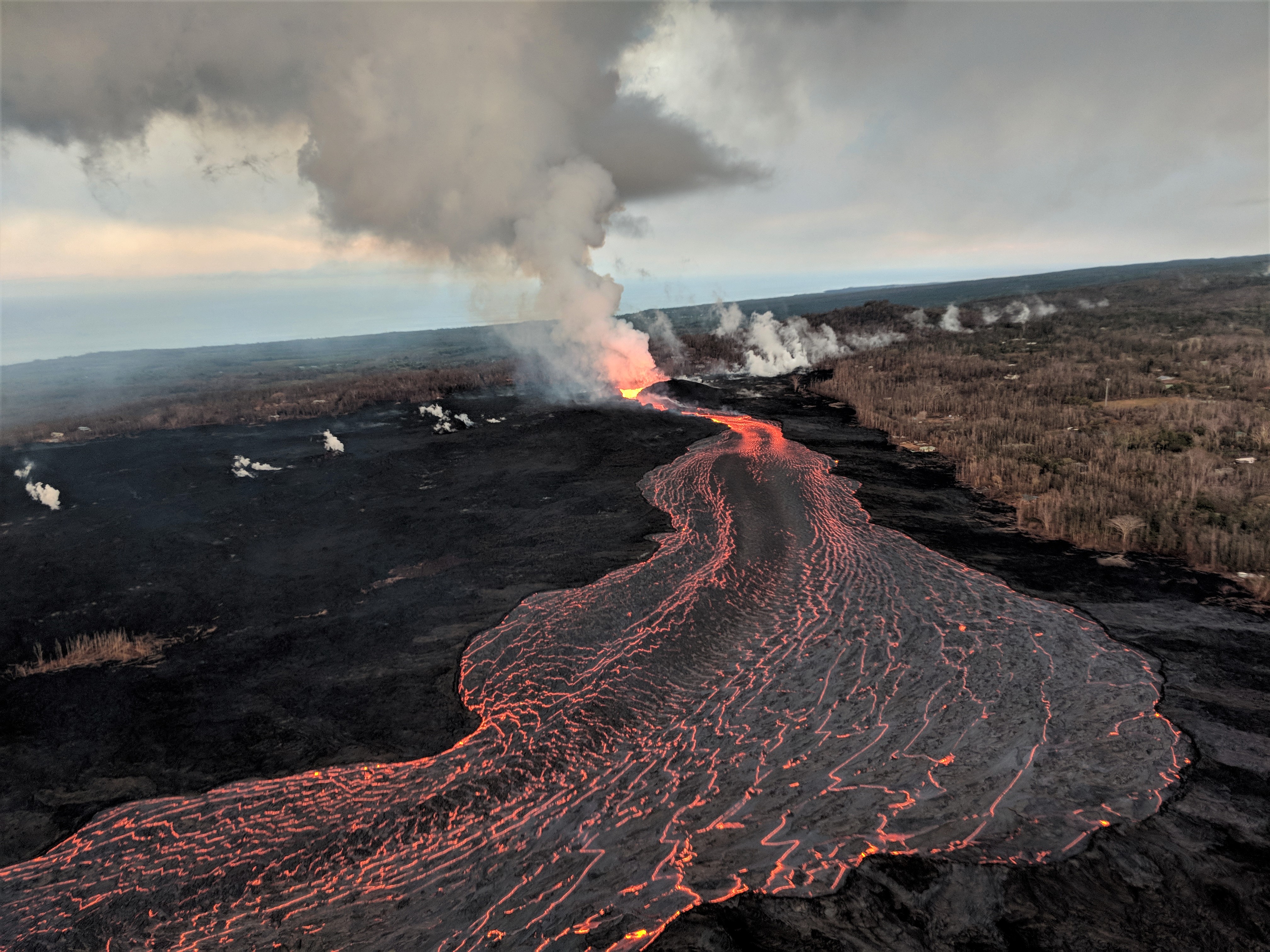
Fissure 8 on Kīlauea’s lower East Rift Zone continues to erupt, feeding a channel that carries lava to the coast. This aerial image captured during HVO’s early morning overflight, shows the erupting vent (center) and near-vent part of the channel.
No other fissures are active this morning.
Kīlauea Volcano Summit
The last collapse event occurred at 9:46 AM HST Saturday, July 21. Seismicity dropped following the event and has increased to 20-40 earthquakes per hour. The next collapse event is expected tonight. Inward slumping of the rim and walls of Halemaʻumaʻu continues.
Source : HVO.
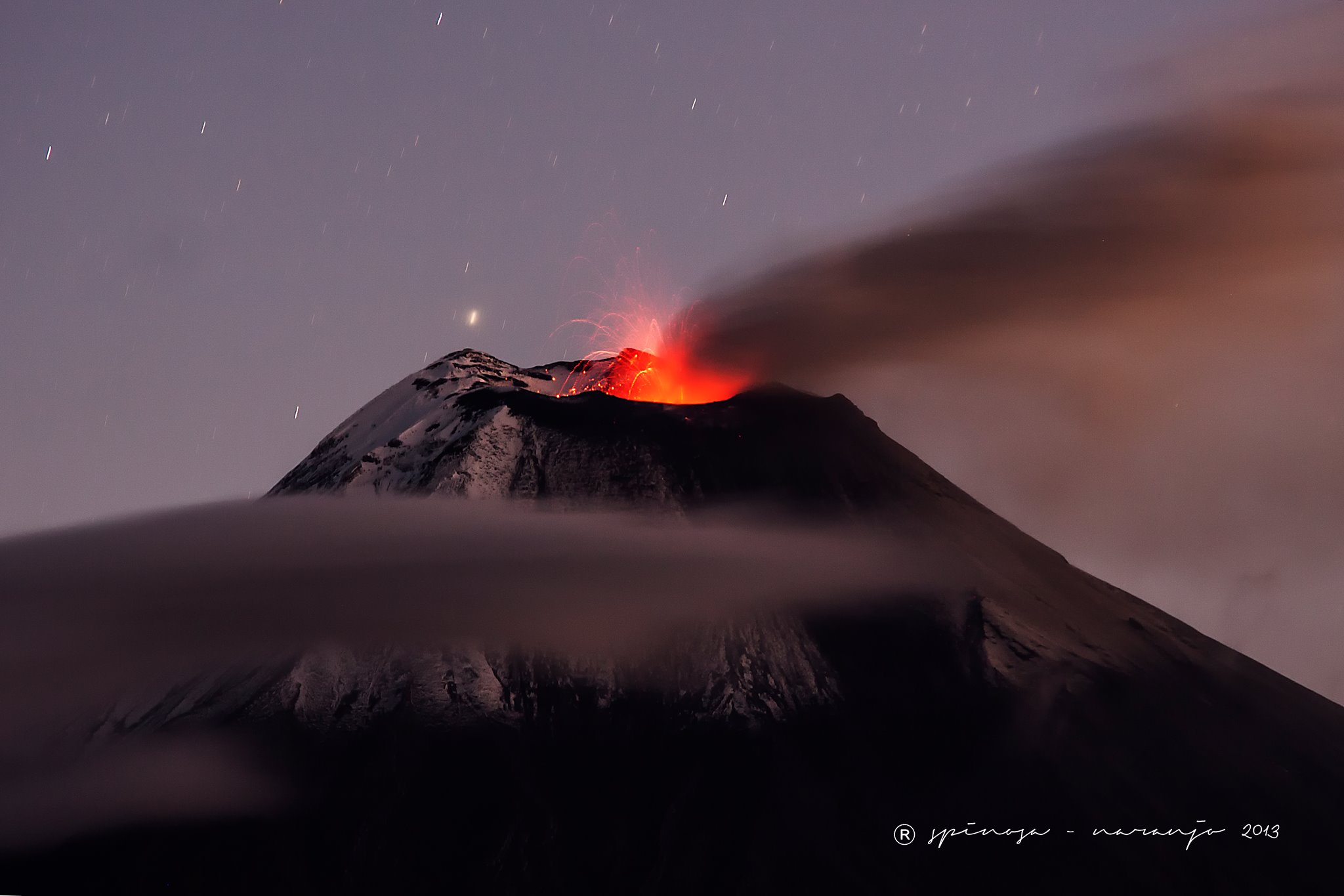
Reventador , Ecuador :
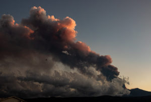
The Reventador volcano maintains a strong eruptive activity. July 22, 2018 – 09:57
At the end of yesterday afternoon, gas and ash emissions were observed on the west-facing Reventador, which reached up to 700 meters above the summit.
Quito, July 22 (Andes) .- The Reventador volcano maintains a « high » eruptive activity, according to the Institute of Geophysics of the National Polytechnic School (IGEPN).
In his report, he reports that late yesterday afternoon, emissions of gas and ash were observed to the west, reaching up to 700 meters above the summit.
During the night, incandescent blocks were visible up to 700 meters below the crater on the southeast flank, and moderate rains were also reported during the night.
The IGEPN has ratified that it remains attentive to the activity in the volcano and will inform about the changes that can be recorded.
The level of alert for the Reventador remains orange, according to the National Secretariat of the Risks.
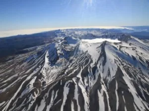
This volcano is located at 3562 meters above sea level and is 17 kilometers in diameter.
On its website, the IGEPN indicates that the historic activity of this volcano is little known because of its remoteness, its inaccessibility and persistent bad weather conditions that prevent direct visual observations.
It is estimated that the volcano had at least 16 eruptions between 1541 and the present and its eruptive periods confirmed before that which began in 2002 occurred in: 1898-1912, 1926-1929, 1944, 1959-1960, 1972-1974 and 1976.
These eruptions have been characterized by small pyroclastic flows, lava flows, block emissions, mudslides, and ashfall.
Source : Andes info . ec
Photo :J.L. Espinosa Naranjo.
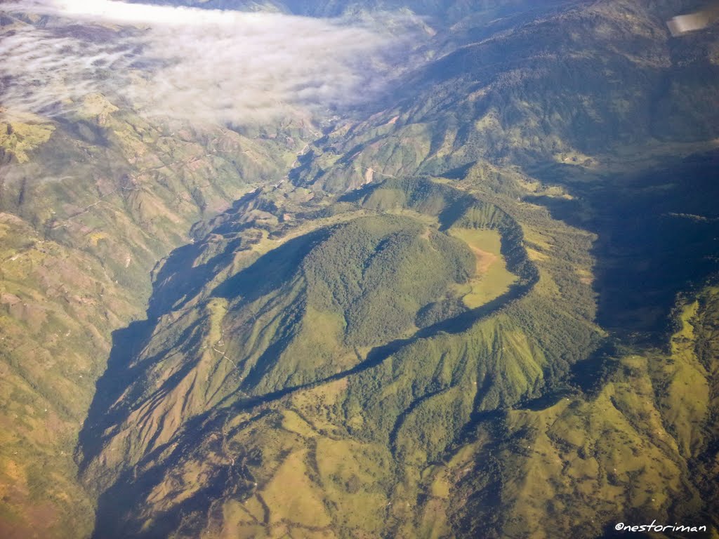
Colombia , Cerro Machin :
Subject: Cerro Machín Volcano Activity Bulletin.
The level of activity continues at Level: Level of activity yellow or (III): changes in the behavior of volcanic activity.
With regard to monitoring the activity of the Cerro Machín volcano, the COLOMBIAN GEOLOGICAL SERVICE informs that:
During the last week, the Cerro Machín volcano recorded a seismic activity associated with the fracturing of the rocks that make up the volcano. This seismic activity was characterized by presenting a number of earthquakes with low energy levels, similar to those of the previous week. The earthquakes were located southwest and north of the main dome at depths between 2.5 and 3.0 km.
The maximum magnitude recorded during the week was 0.3 ML (local magnitude) corresponding to earthquakes recorded on July 10 at 08:54 (local time) and 11 July 09:42 (local time). These earthquakes were located 0.7 km southwest and north of the main dome at a depth of 2.5 and 3.0 km respectively. The other monitored parameters did not show any significant changes.
The COLOMBIAN GEOLOGICAL SERVICE is attentive to the evolution of the volcanic phenomenon and will continue to inform in a timely manner of the changes that may occur.
Source : SGC
Photo : Nestoriman