April 2 ,2024.
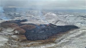
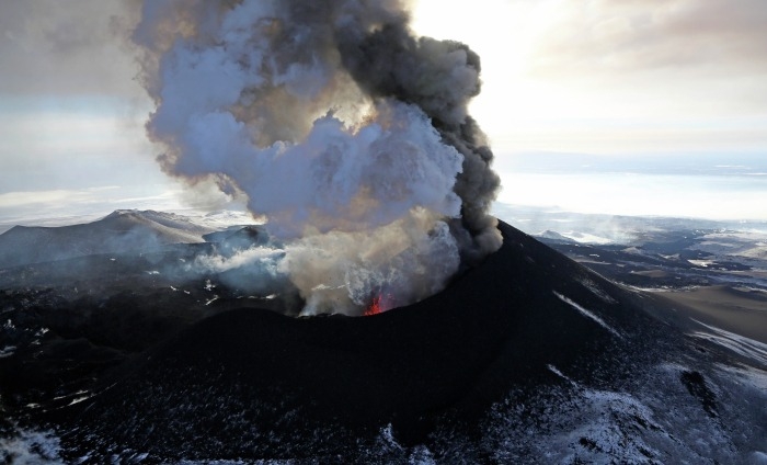
Aleutian Islands , Atka :
Unrest at the Atka volcanic complex continues. Low-frequency earthquakes and periods of seismic tremor occurred over the past day. Clouds obscured satellite and webcam views and nothing noteworthy was observed.
AVO has detected no unusual surface activity since a small explosion at the summit of Korovin volcano on the evening of March 27.
Korovin is one of the volcanoes that makes up the Atka volcanic complex.
The Atka volcanic complex is monitored by local seismic and infrasound sensors and webcam, satellite data, and regional lightning detection instruments.
Name Origin
« Atka Island » comes from an Unangam Tunuu name reported by early Russian traders; published as « Atchu Island » by Rev. Coxe (1780), « Atghka » by Captain Cook (1785), « Atkha Ile » by Captain Lutke (1836), and « O[strov] Atka on Captain Tebenkov’s 1852 map (Orth, 1971).
Source : AVO
Photo : Schaefer, Janet ( courtesy of the AVO/ADGGS. )
Russia / Kuril Islands , Ebeko :
VOLCANO OBSERVATORY NOTICE FOR AVIATION (VONA)
Issued: April 01 , 2024
Volcano: Ebeko (CAVW #290380)
Current aviation colour code: ORANGE
Previous aviation colour code: orange
Source: KVERT
Notice Number: 2024-17
Volcano Location: N 50 deg 41 min E 156 deg 0 min
Area: Northern Kuriles, Russia
Summit Elevation: 1156 m (3791.68 ft)
Volcanic Activity Summary:
A moderate explosive eruption of the volcano continues. According to visual data from Severo-Kurilsk, explosion sent ash up to 4.5 km a.s.l., and ash cloud drifted to the south of the volcano.
A moderate explosive eruption of the volcano continues. Ash explosions up to 6 km (19,700 ft) a.s.l. could occur at any time. Ongoing activity could affect low-flying aircraft and airport of Severo-Kurilsk.
Volcanic cloud height:
4000-4500 m (13120-14760 ft) AMSL Time and method of ash plume/cloud height determination: 20240401/2300Z – Visual data
Other volcanic cloud information:
Distance of ash plume/cloud of the volcano: 5 km (3 mi)
Direction of drift of ash plume/cloud of the volcano: S
Time and method of ash plume/cloud determination: 20240401/2300Z – Visual data
Source : Kvert
Photo : Yuri Demyanchuk ( archive).
Indonesia , Marapi :
Mount Marapi erupted on Tuesday, April 2, 2024 at 02:08 WIB. The height of the eruptive column was not observed. The eruption was recorded on a seismograph with a maximum amplitude of 30.2 mm and a duration of 45 seconds.
Observation of seismicity
1 emissions earthquake with an amplitude of 1.2 mm and duration of the earthquake of 16 seconds.
1 Deep volcanic earthquake with an amplitude of 1 mm, and an earthquake duration of 7 seconds.
1 Distant tectonic earthquake with an amplitude of 1 mm, duration of the earthquake of 38 seconds.
1 Continuous tremor with an amplitude of 0.5 to 1 mm, dominant value of 0.5 mm.
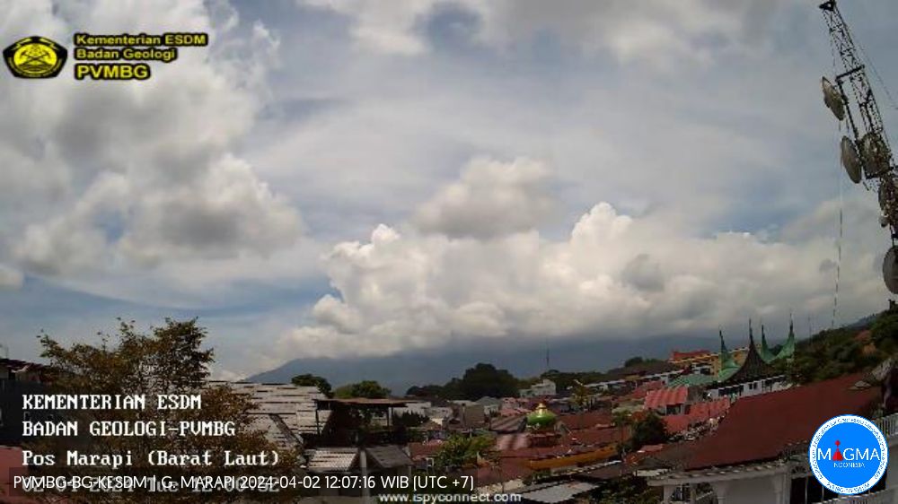
Recommendation
1. Communities around Mount Marapi and climbers/visitors/tourists should not enter and conduct activities within a 4.5 km radius of the eruption center (Verbeek crater) of Mount Marapi.
2. Communities living around the valleys/streams/river banks that originate at the top of Mount Marapi should always be aware of the potential threat of lahars that may occur, especially during the rainy season.
Source et photo : Magma Indonésie
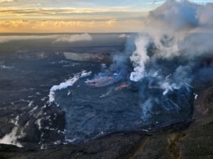
Chile , Puyehue – Cordon Caulle :
Special Report on Volcanic Activity (REAV), Los Lagos region, Puyehue-Cordon Caulle volcanic complex, April 1, 2024, 06:05 local time (mainland Chile).
The National Service of Geology and Mines of Chile (Sernageomin) publishes the following PRELIMINARY information, obtained using the monitoring equipment of the National Volcanic Monitoring Network (RNVV), processed and analyzed at the Southern Andean Volcanological Observatory ( Ovdas):
On Monday, April 1, at 5:46 a.m. local time (8:46 a.m. UTC), monitoring stations installed near the Puyehue-Cordon Caulle volcanic complex recorded an earthquake associated with the fracturing of rocks (volcano-tectonic type).
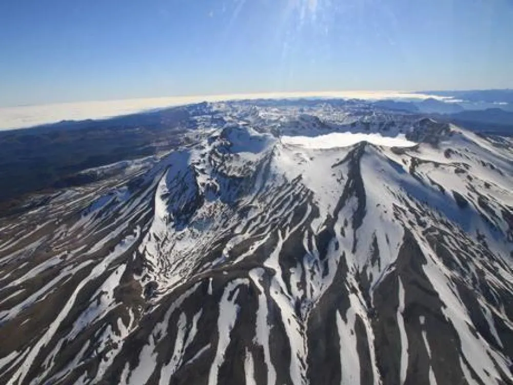
The characteristics of earthquakes after their analysis are as follows:
ORIGINAL TIME: 05:46 local time (08:46 UTC)
LATITUDE: 40.556° S
LONGITUDE: 72.157°E
DEPTH: 4.8 km
LOCAL MAGNITUDE: 3.2 (ML)
OBSERVATIONS:
The event has a similar epicenter to the previous report
The technical volcanic alert remains at level Green.
Source et photo : Sernageomin
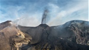
Peru , Sabancaya :
Analysis period: from March 25, 2024 to March 31, 2024, Arequipa, April 1, 2024
Alert level: ORANGE
The Geophysical Institute of Peru (IGP) reports that the eruptive activity of the Sabancaya volcano remains at moderate levels, that is, with the recording of an average of 12 daily explosions, with columns of ash and of gas up to 1500 m altitude above the summit of the volcano. Consequently, the volcanic alert level remains at the ORANGE level
The IGP recorded and analyzed the occurrence of 164 earthquakes of volcanic origin, associated with the circulation of magmatic fluids inside the Sabancaya volcano, as well as earthquakes linked to the fracturing of rocks. An average of 12 explosions were recorded daily.
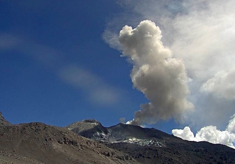
Columns of ash and gas have been observed at an altitude of up to 1500 m above the summit of the volcano. The predominant direction of these emissions was towards the South, South-East and East sectors of the volcano over a distance of less than 10 KM.
We continue to record a slight inflation process in the northern sector (around the Hualca Hualca volcano).
Satellite recordings identified the presence of 18 thermal anomalies, with a maximum value of 8 MW, associated with the presence of a lava body on the surface of the volcano crater.
Moderate emissions (504 tonnes/day) of sulfur dioxide (SO2) were observed.
RECOMMENDATIONS
• Keep the volcano alert level in orange.
• Do not approach within a radius of less than 12 km from the crater.
Source : Cenvul
Photo : Ingemmet