
June 27 , 2023 .
Indonesia , Semeru :
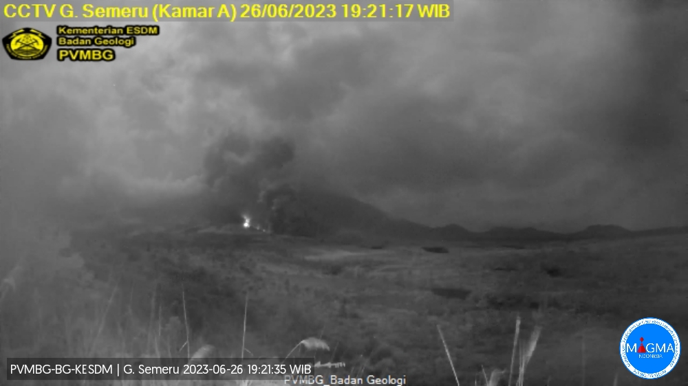
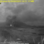
Mount Semeru erupted on Monday, June 26, 2023 at 7:10 p.m. WIB with the height of the ash column observed at ± 1500 m above the summit (± 5176 m above sea level). The ash column was observed to be gray to brown with a thick intensity, oriented northeast and east. This eruption was recorded on a seismograph with a maximum amplitude of 23 mm and a duration of 633 seconds.
VOLCANO OBSERVATORY NOTICE FOR AVIATION – VONA
Issued : June 26 , 2023
Volcano : Semeru (263300)
Current Aviation Colour Code : ORANGE
Previous Aviation Colour Code : orange
Source : Semeru Volcano Observatory
Notice Number : 2023SMR223
Volcano Location : S 08 deg 06 min 29 sec E 112 deg 55 min 12 sec
Area : East java, Indonesia
Summit Elevation : 11763 FT (3676 M)
Volcanic Activity Summary :
Eruption with volcanic ash cloud at 12h10 UTC (19h10 local).
Volcanic Cloud Height :
Best estimate of ash-cloud top is around 16563 FT (5176 M) above sea level or 4800 FT (1500 M) above summit. May be higher than what can be observed clearly. Source of height data: ground observer.
Other Volcanic Cloud Information :
Ash cloud moving from northeast to east. Volcanic ash is observed to be gray to brown. The intensity of volcanic ash is observed to be thick.
Remarks :
Eruption recorded on seismogram with maximum amplitude 23 mm and maximum duration 633 second.
Source : Magma Indonésie.
Philippines , Mayon :
MAYON VOLCANO ADVISORY , 26 June 2023 , 04:00 PM .
This is a notice of increased seismic activity and ground deformation in Mayon Volcano.
Since Alert Level 3 was raised over Mayon Volcano in Albay Province on 8 June 2023, eruptive activity has been dominated by weak aseismic effusion of degassed lava from the summit crater. However, an increasing number of weak and shallow volcanic earthquakes began on 24 June 2023 and steadily increased to 102 volcanic earthquakes during a 24-hour between 25 and 26 June 2023. Between 5:00 AM and 3:00 PM today, an additional 100 volcanic earthquakes were recorded. Some of the analyzed earthquakes that could be located emanated from the summit lava dome, indicating origins from lava extrusion processes at the crater. The increased seismicity was accompanied by a noticeable sharp jump in ground tilt on the southwest sector of the edifice that began on 25 June 2023. As of present, steady-rate lava effusion from the summit crater and sporadic generation of rockfall and pyroclastic density currents or PDCs still persist.
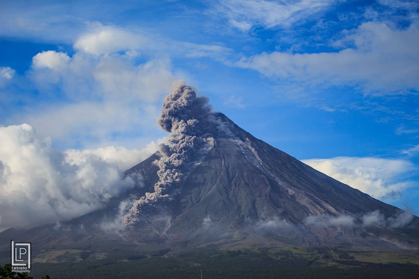
DOST-PHIVOLCS reiterates that Alert Level 3 (increased tendency towards a hazardous eruption) still currently prevails over Mayon Volcano, but that a sudden change in monitoring parameters has been detected and is being closely monitored. It is strongly recommended that the areas inside the 6 kilometer-radius Permanent Danger Zone must remain evacuated, and that communities within the 7- and 8-kilometer radius must always be prepared. Civil aviation authorities must also advise pilots to avoid flying close to the volcano’s summit as ash from eruptions can be hazardous to aircraft.
DOST-PHIVOLCS maintains close monitoring of Mayon Volcano and any new development will be communicated to all concerned stakeholders.
Source : Phivolcs.
Photo : LP Letrato photography.
Japan , Kuchinoerabujima :
Meteorological authorities raised the eruption alert level for Kuchinoerabujima island in Kagoshima Prefecture on June 26 after a surge in volcanic earthquakes.
The Japan Meteorological Agency’s Fukuoka Regional Headquarters raised the alert from Level 1, which asks visitors to take note there is potential for increased activity, to Level 2, which calls for no entry around the crater.
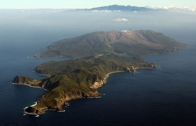
Volcanic activity has been increasing on the island, with 100 volcanic earthquakes centered on Mount Shindake over the 10 days from June 17.
The agency has issued a warning for the public to be on the lookout for scattered cinders within approximately 1 kilometer of Mount Shindake’s crater.
It also calls for vigilance against pyroclastic flows about 2 km west of the crater.
An explosive eruption occurred on Kuchinoerabujima in 2015, forcing all islanders to temporarily evacuate the island.
Source et photo : Asahi Shimbun
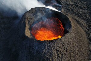
Peru , Ubinas :
Analysis period: June 23-23, 2023 Arequipa, June 26, 2023.
Alert level: YELLOW
The Geophysical Institute of Peru (IGP) reports that the geophysical processes which allow to know the dynamic behavior of the Ubinas volcano (Moquegua region) continues to record an increase in its seismic activity and the recording of ash emissions which could be the beginning of a new eruptive process. For this, it is suggested to the authorities to maintain the volcanic alert level at the Yellow level.
During the analysis period, the occurrence of 402 volcano-tectonic (VT) earthquakes was detected, associated with rock rupture processes that occur inside the volcano. These earthquakes had a maximum magnitude of M1.9. In addition, 865 seismic signals of the long period (LP) and tremor type were recorded, associated with the movements of volcanic fluids (gas and magma). Which continue to generate ash emissions.
Monitoring of the deformation of the volcanic structure does not show any significant changes at this time. Satellite monitoring does not show thermal anomalies in Ubinas Crater. The surveillance cameras made it possible to identify columns of gas and ash which reached heights up to 1.5 km above the summit of the volcano, which were dispersed mainly towards the eastern, northern and northern sectors. East of the Ubinas volcano.

PERSPECTIVE:
The recent activity observed on the Ubinas volcano poses two possible scenarios for the next few weeks:
-1/ That activity continues at its current level.
-2/ That seismic events increase in number and energy and that a greater ascent of magma towards the surface is recorded, which could give rise to volcanic explosions with ash emissions, with heights greater than 2 km . These can affect the populations of the Ubinas Valley, such as the district of San Juan de Tarucani, in the Arequipa region.
RECOMMENDATIONS
• Maintain the volcanic alert level at the Yellow level.
Source : IGP.
Photo : Ingemmet .
Kamchatka , Sheveluch :
VOLCANO OBSERVATORY NOTICE FOR AVIATION (VONA)
Issued: June 26 , 2023
Volcano: Sheveluch (CAVW #300270)
Current aviation colour code: ORANGE
Previous aviation colour code: orange
Source: KVERT
Notice Number: 2023-79
Volcano Location: N 56 deg 38 min E 161 deg 18 min
Area: Kamchatka, Russia
Summit Elevation: 3283 m (10768.24 ft), the dome elevation ~2500 m (8200 ft)
Volcanic Activity Summary:
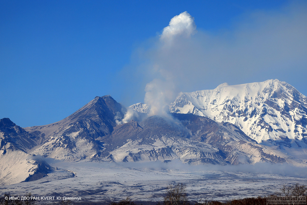
Video and satellite data by KVERT shows a strong wind lifts ash from the southeastern slopes of Sheveluch volcano, and a plume of resuspended ash extends 92 km to the southeast of the volcano.
An extrusive-effusive eruption of the volcano continues. A danger of ash explosions up to 10 km (32,800 ft) a.s.l. is remains. Ongoing activity could affect international and low-flying aircraft.
Volcanic cloud height:
2500-3000 m (8200-9840 ft) AMSL Time and method of ash plume/cloud height determination: 20230626/2335Z – Video data
Other volcanic cloud information:
Distance of ash plume/cloud of the volcano: 92 km (57 mi)
Direction of drift of ash plume/cloud of the volcano: ESE / azimuth 105 deg
Time and method of ash plume/cloud determination: 20230626/2300Z – Himawari-9 14m15
Remarks: resuspended ash plume
Source : Kvert
Photo : Yu. Demyanchuk, IVS FEB RAS, KVERT


No comment yet, add your voice below!