May 11 , 2023 .
Guatemala , Fuego :
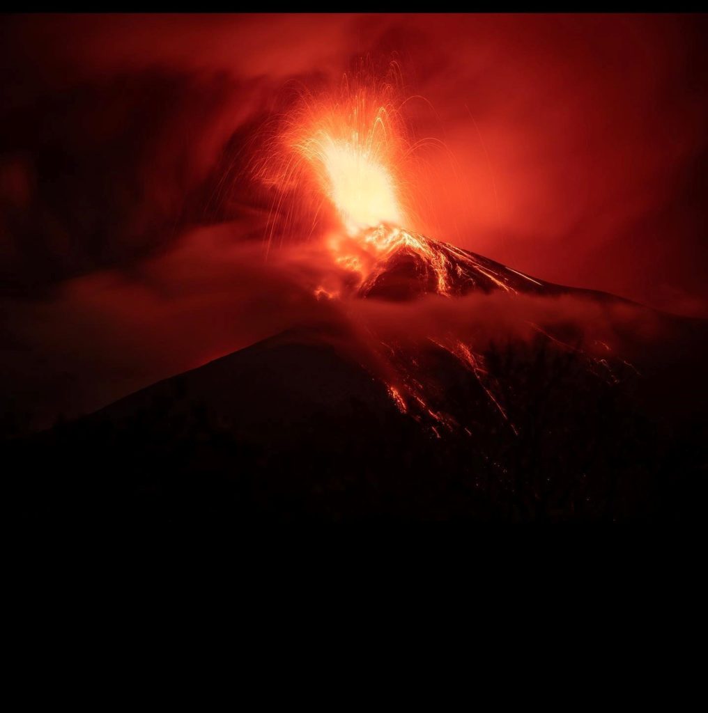
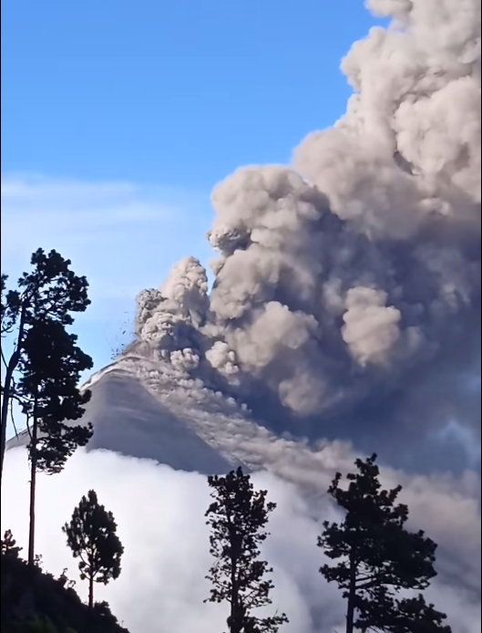
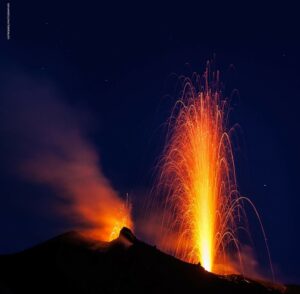
INSIVUMEH reported that activity at Fuego during 2-9 May included intense explosions, dense ash emissions, lava effusion, pyroclastic flows, and lahars. During 1-3 May there were 5-8 weak explosions per hour generating dense ash plumes that rose more than 1 km above the summit and drifted to 10-15 km W, SW, and S. Explosions were accompanied by rumbling sounds and shockwaves that vibrated nearby houses. During the morning and night incandescent material was visible 100-200 m above the crater. Avalanches descended the Ceniza (SSW) and Las Lajas (SE) drainages, sometimes reaching vegetated areas. Ashfall was reported in areas downwind including Panimache I and II (8 km SW), Morelia (9 km SW), Santa Sofía (12 km SW), El Porvenir (8 km ENE), Finca Palo Verde, Sangre de Cristo (8 km WSW), and Yepocapa (8 km N). In the early afternoon (around 1500) on 2 May lahars descended the Las Lajas and El Jute (ESE) drainages, carrying branches, tree trunks, and blocks 30 cm to 1.5 m in diameter; about 30 minutes later similar lahars descended the Ceniza drainage. At 16h18 a weak-to-moderate pyroclastic flow traveled down the Ceniza and an associated ash plume drifted W and SW. Within 30 minutes after the pyroclastic flow a lahar descended the Seca (W), carrying tree trunks and branches, and blocks up to 1.5 m in diameter.
Activity intensified at around 02h00 on 4 May with a new effusive phase; by 05h10 a lava flow was traveling down the Ceniza drainage, incandescent material rose above the summit, avalanches were continuous, and ash-and-gas plumes drifted SW. At around 07h00 weak-to-moderate pyroclastic flows descended the Ceniza and within 1.5 hours pyroclastic flows also descended the Las Lajas. Ashfall was reported on W-flank farms and communities including Finca La Asunción, La Rochela, Panimaché I and II, Morelia, Santa Sofía, as well as others at a greater distance such as San Rafael Sumatán (19 km WSW) and San Pedro Yepocapa. By 10h00 moderate-to-strong pyroclastic flows were descending the W-flank Seca and Santa Teresa ravines. Loud rumbling sounds and shock waves were reported by local residents. Ashfall continued in communities near the Ceniza and Las Lajas ravines. Ash plumes rose 2.2 km above summit and drifted more than 50 km W and SW.
Activity continued at a high level and as of a special report posted at 12h35 ash plumes were still rising more than 2.2 m above the summit. Pyroclastic flows were continuing and had traveled 5-7 km down the Ceniza, Las Lajas, Seca and Santa Teresa (W) drainages; the most intense pyroclastic flow had descended the Ceniza drainage minutes earlier. The ash plumes were identified in satellite images drifting more than 100 km W and SW. Significant ashfall continued in communities downwind and minor ashfall was reported in several municipalities of the department of Suchitepéquez.
The last pyroclastic flow descended the Ceniza at 15h30. Avalanches continued to be seen and heard descending multiple flanks. Ash deposits up to 2 mm thick were noted on crops, houses, and streets. Activity began to wane at about 18h00, though explosions continued to produce ash plumes that rose 1.2 km above the summit. The leading edge of the ash plume was 200 km W and SW of the volcano. According to CONRED, about 1,200 residents were preemptively evacuated from their homes in San Pedro Yepocapa, Chimaltenango (21 km NNE), Panimaché I and II, El Porvenir, and Morelia. According to news articles, a section of the RN-14 highway was closed from kilometer 84 of San Juan Alotenango, Sacatepequez (9 km ENE) to kilometer 95 in Escuintla due to the pyroclastic flows. An estimated 130,000 people lived within areas exposed to ashfall.
Activity during the morning of 5 May was characterized by some weak-to-moderate explosions, ash plumes that rose 850 m above the summit, crater incandescence, and ash in the air in communities around the Ceniza, Seca, and Las Lajas drainages. Ashfall continued to impact agriculture and infrastructure in Panimaché I, Morelia, Santa Sofía, La Rochela, Los Yucales, El Porvenir, Ceylon, Finca Asunción (12 km SW), Yepocapa, Santa Lucía Cotzumalguapa (22 km SW), Siquinalá (21 km SSW), and other nearby communities. By 12h30 data from seismic and infrasound monitoring networks, webcam images, satellite data, and reports from observers in the field all indicated that activity had returned to normal levels. Weak explosions at a rate of 5-6 per hour produced minor ash plumes that rose as high as 850 m and drifted 30 km W. On 6 May weak explosion generated ash plumes that rose 750 m and drifted 10 km W and SW. The lava flow was no longer incandescent. According to a news report, residents returned to their communities that same day. During 7-9 May weak explosions continued to produce ash plumes that rose as high as 750 m above the summit and drifted W and SW. Minor avalanches descended the Ceniza and crater incandescence was occasionally observed.
Sources : GVP , INsivumeh.
Photos : Diego Rizzo , Guias Leonel Acatenango.
Indonesia , Raung :
Decreased G. Raung’s Alert Level from WASPADA Alert (Level II) to Normal (Level I)
Observation result
Visual
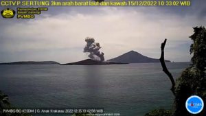
The Raung volcano in the period from April 1 to April 30, 2023 is clearly visible until it is covered with fog. Smoke from the main crater was observed to be white with moderate intensity, about 50-200 meters above the summit.
Seismicity:
The types of earthquakes recorded during the period from April 1 to April 30, 2023 are emission earthquakes, tremors, local tectonics and distant tectonics, with details:
510 emission earthquakes,
2 local tectonic earthquakes,
164 distant tectonic earthquakes,
continuous tremor with an amplitude of 0.5 to 2 mm (dominant value 0.5 mm).
Deformation
GPS modeling confirms that there was inflation at a point more than 10 km from the summit on the surface of the G. Raung crater for the period from January 1 to April 30, 2023, which makes it possible to conclude that the inflation is local, not influenced by volcanic activity of G. Raung
Assessment
Visually, the color of the smoke that appears is usually a fine white, indicating that the smoke is not carrying ash.
The current potential threats are in the form of sudden phreatic eruptions without being preceded by a significant increase in seismicity, the ejection of incandescent rock materials, but its distribution is still limited in the crater, while materials of Ash size can spread further depending on wind direction and speed.
Based on the results of visual and instrumental monitoring, as of May 2, 2023 at 12:00 WIB, Mount Raung’s activity level has been lowered from Level II (waspada) to Level I (normal). Intensive monitoring continues to be carried out to assess the activity of G. Raung and is coordinated with the local regional government and the Regional Disaster Management Agency. G. Raung’s activity status will be raised if there is an increase in activity.
Source : Magma Indonésie.
Photo : Istimewa
Chile , Laguna del Maule :
Seismology
The seismological activity of the period was characterized by the recording of:
12,308 VT-type seismic events, associated with rock fracturing (Volcano-Tectonics). The most energetic earthquake presented a value of local magnitude (ML) equal to 3.1, located 4.4 km west-southwest of the center of the lagoon, at a depth of 6.9 km in reference to the average height of the lagoon.
1 LP-type seismic event, associated with fluid dynamics within the volcanic system (Long Period). The size of the largest earthquake assessed from the Reduced Displacement (DR) parameter was equal to 0.6 cm2.
1 TR type seismic event, associated with the dynamics maintained over time of the fluids within the volcanic system (TRemor). The size of the largest earthquake assessed from the Reduced Displacement (DR) parameter was equal to 1.4 cm2.
Geodesy
The geodetic activity of the period was characterized by:
– Stability of the GNSS tracking line over time, with a slight evolution (decrease in the elongation rate) and its deformation rate reaches a maximum of 0.65 cm/month.
– The vertical components remain within the usual historical parameters observed, with a change in the BWIN season that reaches 2.2 cm/month, becoming the highest rate of
moving above MAU2 which maintains a rate of 1.84 cm/month.
– Historical data using the radar analysis technique (InSAR), show the deformation located in the South-West of the lagoon coinciding with what was observed in GNSS, where its maximum deformation is located at the location of the MAU2 station .
After the significant increase in VT type activity recorded at the beginning of the month, occurrence levels gradually decreased from a maximum of 3700 earthquakes/day, mainly of low energy, to around 200-250 earthquakes/ day. Despite this decline, occurrence values are still above historically recorded baseline thresholds. The occurrence of VT seismicity in swarms and with an ML magnitude equal to or greater than 3 during the second half of April, which justified the issuance of the REAV, stands out.
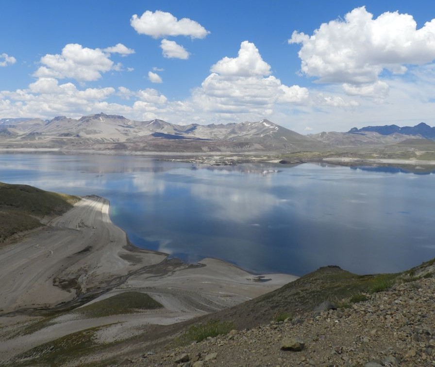
Regarding the deformation, the historical inflationary process continues, highlighting an uplift in the location of the Nieblas and Maule2 stations. As far as surface activity is concerned, there is no record of anomalies. Mainly due to the recording of seismic activity, the technical alert and its possible assignment zone with a radius of 2 km from the point of maximum abnormal CO2 emission are maintained:
YELLOW TECHNICAL ALERT: Changes in volcanic activity behavior
Source : Sernageomin
Photo : Cegemar.
Japan , Sakurajima :
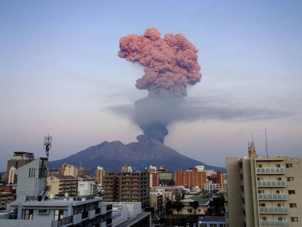
JMA reported that Minamidake Crater and Showa Crater (Aira Caldera’s Sakurajima volcano) remained active during 1-8 May. Crater incandescence was observed nightly at Minamidake Crater. Three explosions at Minamidake during 2-3 May produced small shock waves and ash plumes. The explosion at 04h22 on 2 May generated an ash plume that rose 1.8 km above the crater rim and drifted SW, and ejected blocks 500-700 m from the vent. The explosion at 02h41 on 3 May produced an ash plume that rose 800 m and ejected blocks to 500-700 m from the vent. Later that morning, at 10h25, an explosion produced an ash plume that rose 500 m and drifted W. An ash plume from an eruptive event at 23h37 on 7 May rose 1 km.
At Showa Crater very small eruptive events were recorded during 1-5 May, and three eruptive events on 8 May produced ash plumes that rose as high as 1.2 km above the crater rim and drifted S and SW. The Alert Level remained at 3 (on a 5-level scale), and residents were warned to stay 2 km away from both craters.
Sources : Agence météorologique japonaise (JMA) , GVP.
Photo : Deniss García Mendoza
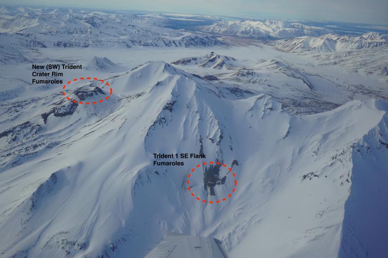
Alaska , Trident :
58°14’3″ N 155°6’9″ W,
Summit Elevation 3599 ft (1097 m)
Current Volcano Alert Level: ADVISORY
Current Aviation Color Code: YELLOW
Over the past two days, there has been a slight increase in the number of shallow earthquakes near Trident. Variation in the rate of earthquake activity is common during periods of unrest, and we will continue to watch for additional signs of change in the monitoring data streams. No other activity was observed in mostly cloudy satellite and webcam data.
The current period of seismic unrest began on August 24, 2022. Increases in seismic activity have been detected previously at Trident Volcano and other similar volcanoes, with no subsequent eruptions. We expect additional shallow seismicity and other signs of unrest, such as gas emissions, elevated surface temperatures, and surface deformation, to precede any future eruption if one were to occur.
AVO monitors Trident Volcano with a local network of seismometers, a webcam, remote sensing data, and regional infrasound and lightning networks.
Source : AVO.
Photo : Lopez, Taryn


