January 30 , 2023 .
Ecuador , Reventador :
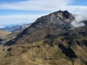
DAILY REPORT OF THE STATE OF THE REVENTADOR VOLCANO, Sunday January 29, 2023.
Information Geophysical Institute – EPN.
Surface Activity Level: Moderate, Surface Trend: No change
Internal activity level: Moderate, Internal trend: No change.
Seismicity: From January 28, 2023, 11:00 a.m. to January 29, 2023, 11:00 a.m.:
Explosion (EXP): 19
Long Periods (LP): 35
Emission Tremors (TREMI): 6.
Rains / Lahars:
There was no rain in the volcano area.
Emission / Ash Column:
This morning an emission of steam and ash was observed at a height of 500 meters in a northwesterly direction. The Washington VAAC reported 5 ash emissions over the past 24 hours. Elevations fluctuated between 1,000 and 1,400 m above crater level, direction remained southwest and north.
Other Monitoring Parameters:
In the last 24 hours, 4 thermal alerts have been generated, including one classified as moderate by the MIROVA-VIRS system.
Observation:
This morning a pyroclastic flow was recorded following a collapse of hot material on the northern flank. For the moment, the volcano remains cloudy.
Alert level: Orange.
Sources : IGEPN.
Photo : EDIIMA
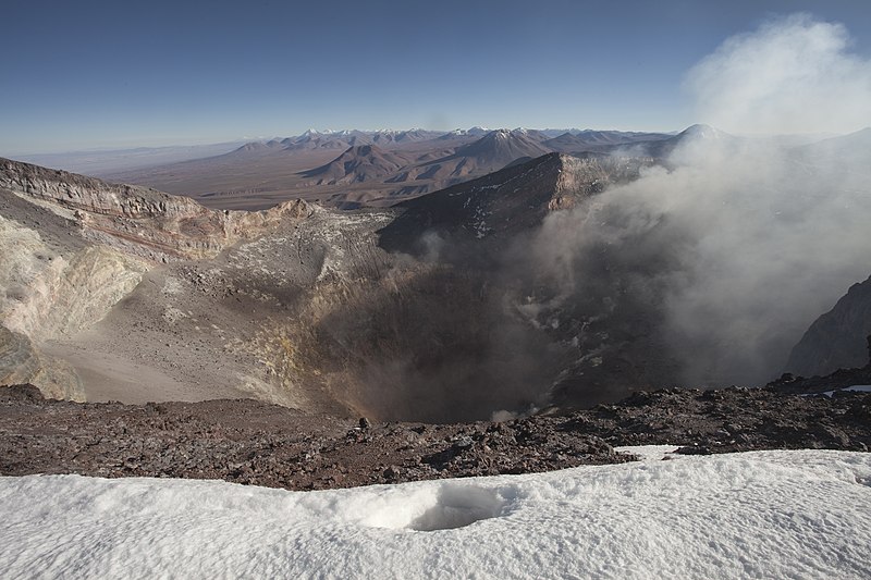
Chile , Lascar :
Volcanic Activity Report (RAV), Volcanological Observatory of the Southern Andes – Ovdas.
Seismic activity:
During the past 24 hours, the instrumental monitoring network of the Láscar volcano has continued to record mainly long-period (LP) seismicity and, to a lesser extent, Tremor (TR) and volcano-tectonic type seismicity ( VT). An important characteristic of LP events is related to their energy, being abnormal for this volcano.
Observations:
The highest energy VT earthquake was located 1.7 km south-southeast (SSE) of the active crater at a depth of 5.5 km.
A low height whitish gray degassing has been identified, possibly with some episodes with low pyroclastic content.
Occasionally, low intensity incandescence was observed in the crater area.
Other Observations
The network of GNSS stations installed on the Láscar volcano does not indicate any deformation within the system.
A thermal anomaly of 2 MW was reported (Source MIROVA group.
According to the DOAS team, the SO2 flux was 62 t/d and 78 t/d on January 27 and 28 respectively.
No SO2 satellite anomaly detected.
Source : Sernageomin.
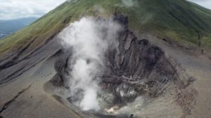
Hawaii , Mauna Loa :
Thursday, January 26, 2023, 9:38 AM HST (Thursday, January 26, 2023, 19:38 UTC)
19°28’30 » N 155°36’29 » W,
Summit Elevation 13681 ft (4170 m)
Current Volcano Alert Level: ADVISORY
Current Aviation Color Code: YELLOW
Activity Summary:
Mauna Loa Volcano is not erupting.
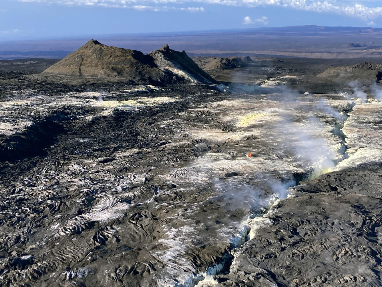
Observations:
Webcams show no signs of activity on Mauna Loa’s Northeast Rift Zone, site of the recent eruption in November–December 2022.
There is no active lava within Moku’āweoweo caldera nor along either rift zone. Satellite imagery shows that the entire 2022 flow field is cooling and no longer active.
Seismicity remains low and there is no detectable tremor (a signal associated with subsurface fluid movement). Deformation rates show inflation somewhat above background levels, but this is not uncommon following eruptions. The Hawaiian Volcano Observatory continues to closely monitor the earthquake and deformation rates at Mauna Loa. We expect additional shallow seismicity and other signs of unrest to precede any future eruption, if one were to occur.
Sulfur dioxide (SO2) emission rates are at background levels. Concentrations of sulfur dioxide (SO2), hydrogen sulfide (H2S), and carbon dioxide (CO2), as well as fumarole temperatures, remain low and stable at Sulphur Cone on the upper Southwest Rift Zone.
Source : HVO.
Photo : USGS/ T. Elias
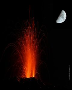
Guatemala , Santiaguito :
Activity:
Constant degassing 400 meters above the Caliente dome, moving west and southwest. Similarly, the incandescence observed at night and in the early morning in the cupola of the dome remains constant. Seismic stations continue to record low explosions, and reports from field observers indicate that some are generating low to moderate rumblings. Weak and moderate avalanches are generated from the cupola of the dome.
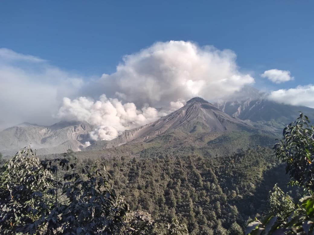
The lava flow continues to be active on the southwest and west flanks, causing degassing and weak avalanches along its path. This can cause fine ash particles to fall and a hazy atmosphere near the volcano. Strong avalanches and audible sounds are possible several kilometers from the volcanic edifice. The appearance of block and ash flows of moderate to strong characteristics is not excluded, as well as possible pyroclastic flows over long distances in different directions.
Source : Insivumeh
Photo : Noticias la Red GT San José del Golfo
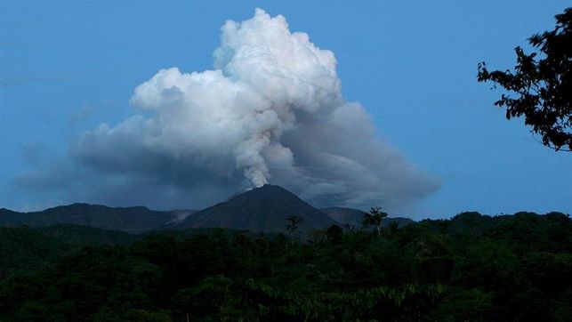
Costa Rica , Turrialba / Poas :
Daily report on the state of volcanoes. OVSICORI-A, Date: January 29, 2023. Updated at: 11:22:00.
Turrialba Volcano
Latitude: 10.025
Longitude:-83.767
Altitude: 3,325 meters above sea level

Observed activity:
No sighting of the crater due to cloudy conditions. Seismicity continues to show frequent low frequency volcanic events with low to moderate amplitudes. The gas ratios remain stable with CO2/SO2 ~10 and H2S/SO2 ~0.2. The deformation shows the contraction of the building.
Activity Level: Warning (2)
Poas Volcano
Latitude: 10.2
Longitude:-84.233
Altitude: 2687 meters above sea level
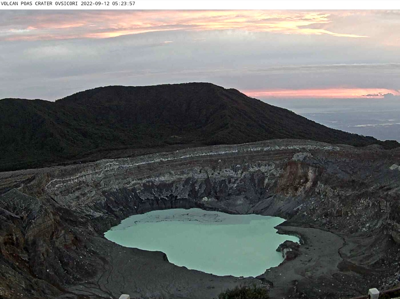
Observed activity:
No sighting of the crater due to cloudy conditions. A low amplitude continuous background tremor is observed. The gas ratios remain stable with CO2/SO2 between 1 and 5 and H2S/SO2 < 0.1. The SO2 concentration at the belvedere remains low (<0.7ppm). The deformation shows the contraction of the building.
Activity Level: Warning (2)
Source : Ovsicori .
Photos : RSN , Ovsicori