August 24 , 2023.
Indonesia , Dempo / Lokon :
An eruption of G. Dempo occurred on Monday, August 21, 2023, at 09:05 WIB. The height of the eruptive column was not observed. The eruption was recorded on a seismograph with a maximum amplitude of 35 mm and a duration of 182 seconds.
VOLCANO OBSERVATORY NOTICE FOR AVIATION – VONA
Issued :August 21 , 2023
Volcano : Dempo (261230)
Current Aviation Colour Code : ORANGE
Previous Aviation Colour Code : yellow
Source : Dempo Volcano Observatory
Notice Number : 2023DEM004
Volcano Location : S 04 deg 01 min 48 sec E 103 deg 07 min 48 sec
Area : South Sumatra, Indonesia
Summit Elevation : 10154 FT (3173 M)
Volcanic Activity Summary :
Eruption at 14h05 UTC (21h05 local).
Volcanic Cloud Height :
Ash-cloud is not observed.
Other Volcanic Cloud Information :
Ash-cloud is not observed.
Remarks :
Eruption recorded on seismogram with maximum amplitude 35 mm and maximum duration 72 second.
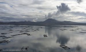
Report on the decrease in activity level of G. Lokon from Level III (SIAGA) to Level II (WASPADA).
visual observation
Visual conditions for the period August 1-20, 2023 are mostly sunny to rainy, rainfall was measured at 6 mm for 17 days, and winds are light to strong from the North, West and Northwest. The volcano is sometimes covered in fog. When clear, smoke from the main crater is white with low to thick intensity, about 25-200 meters high above the summit.
Instrumental observation
Seismicity recorded from August 1 to 20, 2023;
25 emission earthquakes,
8 harmonic tremors,
35 shallow volcanic earthquakes,
5 deep volcanic earthquakes,
3 local tectonic earthquakes
69 distant tectonic earthquakes
2 continuous tremor signals with an amplitude of 0.5 to 5 mm, dominant value of 0 0.5 mm.
Deformation data based on vertical displacement analysis detected land subsidence (deflation) at 6 test points, all test points showed the same pattern in the G. Lokon crater area.
Assessment
The seismicity of G. Lokon was dominated by shallow volcanic earthquakes (VB) and emissions, a significant increase in activity was observed by the continuous tremor recorded with a maximum amplitude of 17 mm, so that the G. Lokon’s activity level was raised from level II. (waspada) to level III (siaga), but since July 21, 2023 the seismicity has shown a decrease where volcanic earthquakes have started to decrease in number and amplitude even since July 22, 2023 the tremors that had showed a significant decrease, as have shallow volcanic earthquakes since July 22, 2023, so it is clear that G. Lokon activity has decreased. The deformation of G. Lokon resulting from the analysis of the vertical displacement shows a deflation from January to August 2023.
Source : Magma Indonésie / PVMBG .
Photo : lumbalumba resort , Manado
Italy , Campi Flegrei :
Weekly bulletin, from August 14, 2023 to August 20, 2023, (Issue date August 22, 2023)
ACTIVITY STATUS SUMMARY
In the light of the monitoring data, it emerges:
SEISMOLOGY: In the week of August 14 to 20, 2023, 203 earthquakes of magnitude Md≥0.0 (Mdmax=3.6±0.3) were located in the Campi Flegrei area.
2) DEFORMATIONS: From January 2023, the average value of lifting speed in the maximum deformation zone is about 15±3mm/month. The uplift recorded at the RITE GNSS station is about 23 cm since January 2022.
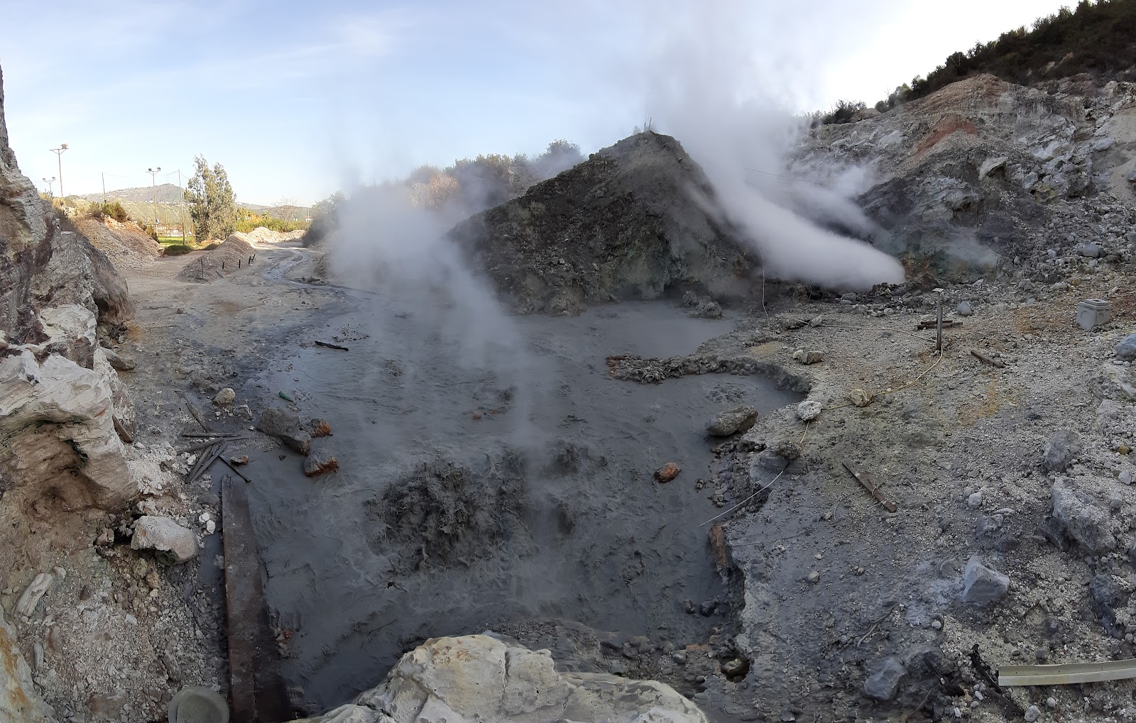
3) GEOCHEMISTRY: There are no significant changes in the geochemical parameters monitored during the reference period. The temperature sensor installed in a fumarole emission 5 meters from the main Pisciarelli fumarole showed an average value of ~95°C, the condensation temperature of the fumarole fluid. There is always an absence of liquid in the Pisciarelli basin.
SEISMOLOGY
In the week of August 14 to 20, 2023, 203 earthquakes of magnitude Md≥0.0 (Mdmax=3.6±0.3) were located in the Campi Flegrei area.
135 earthquakes were recorded during 3 seismic swarms:
● the first on 08/15 at 22:17 UTC, composed of 9 earthquakes with Md≥0.0 (Mdmax=1.5±0.3), occurring in the Pozzuoli area;
● the second at 08:14 UTC on 08/16, consisting of 11 earthquakes with Md≥0.0 (Mdmax=1.8±0.3), occurring in the Pozzuoli area;
● the third at 23:57 UTC on 08/17, consisting of 115 earthquakes with Md≥0.0 (Mdmax=3.6±0.3), occurring in the area of Solfatara, Pisciarelli, Accademia.
GEOCHEMISTRY
During the reference period, the monitored data from the geochemical network did not show any significant variations in the acquired parameters.
In the Pisciarelli area (north-eastern outer slope of Solfatara), which has shown the greatest variations in the degassing process in recent years, the values of the soil CO2 flux recorded continuously by the FLXOV8 station show the persistence of already the long-term trends previously identified. During the past week, CO2 fluxes measured from the ground did not show any significant changes compared to previous periods.
During the last week, there have been no significant variations in temperature, the average value of which is ~95°C, the condensation temperature of the fumarolic fluid.
Source : INGV
Photo : Pisciarelli , Tullio Ricci, dicembre 2019
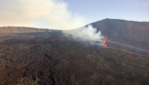
Hawaii , Kilauea :
Wednesday, August 23, 2023, 12:05 PM HST (Wednesday, August 23, 2023, 22:05 UTC)
19°25’16 » N 155°17’13 » W,
Summit elevation: 4091 feet (1247 m)
Current Volcanic Alert Level: NOTICE
Current Aviation Color Code: YELLOW
Summary of activity:
The Kīlauea volcano is not erupting. The summit of Kīlauea is currently showing signs of increased unrest. No unusual activity was noted along the East Rift Zone or Southwest Rift Zone of Kilauea.
Summit Observations:
This morning, between approximately 4:30 a.m. and 8:30 a.m., a swarm of about 50 earthquakes occurred at a depth of 2 to 3 km below the surface, south of Halema’uma’u crater. This is the fourth seismic swarm in this area in the past week, and is likely caused by the movement of magma in the South Kīlauea Caldera region. The recent general trend of inflationary tilt in summit tiltmeters has continued over the past day. Earthquake swarms and tiltmeter data indicate Kīlauea’s summit is still showing signs of elevated unrest. Sulfur dioxide (SO2) emissions from the summit remain low; the most recent SO2 emission rate of about 86 tonnes per day was measured on August 15.
Halemaʻumaʻu Crater Lava Lake Observations:
No active lava has been observed since June 19.
East Rift Zone Observations:
No unusual activity was noted along the East Rift Zone or the Southwest Rift Zone; steady rates of ground deformation and seismicity continue along both. Measurements from continuous gas monitoring stations downwind of Pu’u ‘ō’ō in the Southeast Rift Zone remain below detection limits for SO2, indicating that SO2 emissions from Pu ‘u’ō’ō are negligible.
Source : HVO
Photo : USGS / N. Deligne.
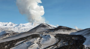
Peru , Ubinas :
Analysis period: August 14, 2023 – August 21, 2023. Arequipa, August 22, 2023.
Alert level: ORANGE
The Geophysical Institute of Peru (IGP) reports that the eruptive processes of the Ubinas volcano (Moquegua region) maintain moderate levels. During this period, 2 volcanic explosions as well as emissions of ballistic blocks, ash and gas which reached up to 3500 m above the summit of the volcano were recorded. For this, it is suggested to the authorities to maintain the volcanic alert level at the Orange level.
During the analysis period, the occurrence of 104 volcano-tectonic (VT) earthquakes was detected, associated with rock rupture processes that occur inside the volcano. In addition, 71 long-period (LP) type seismic signals were recorded, associated with the movements of volcanic fluids (gas and magma), with a maximum energy of 3.1 Megajoules. Finally, it has been identified a duration of 8 hours / day of seismic recordings in relation to ash emissions with a maximum of 14 hours, recorded on August 17. During this period, 2 volcanic explosions were recorded (August 21 at 01:41 a.m. and 09:18 a.m. local time)
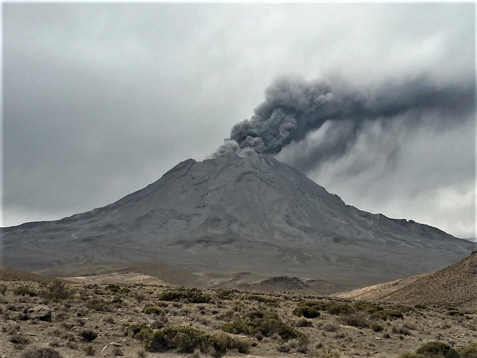
Surveillance cameras identified volcanic explosions with emissions of ballistic blocks, columns of gas and ash that reached heights of 3500 m above the summit of the volcano, which were dispersed mainly to the northern sectors , North-West, West and North-East of the Ubinas volcano with a radius of 50 km. On the other hand, the monitoring of the deformation of the volcanic structure, show variations of less than 7 mm of displacement (slight tendency to inflation). Satellite monitoring has not shown any thermal anomalies in the Ubinas crater.
RECOMMENDATIONS
• Maintain Volcanic Alert Level at ORANGE.
Source : Cenvul
Photo : archive ingemmet.
Chile , Puyehue-Cordon Caulle :
Special Report on Volcanic Activity (REAV), Los Lagos region, Puyehue-Cordon Caulle volcanic complex, August 19, 2023, 1:40 p.m. local time (mainland Chile).
The National Service of Geology and Mines of Chile (Sernageomin) publishes the following PRELIMINARY information, obtained through the monitoring equipment of the National Volcanic Monitoring Network (RNVV), processed and analyzed at the Volcanological Observatory of the Southern Andes ( Ovdas):
On Saturday August 19, 2023, at 1:17 p.m. local time (5:17 p.m. UTC), the monitoring stations installed near the Puyehue-Cordon Caulle volcanic complex recorded an earthquake associated with the fracturing of rocks (volcano-tectonic type) in the volcanic system, located 4.7 km south-southwest of the eruptive center of 2011.
The characteristics of earthquakes after their analysis are as follows:
ORIGINAL TIME: 1:17 p.m. local time (5:17 p.m. UTC)
LATITUDE: 40.558°S
LONGITUDE: 72.175°E
DEPTH: 4.7 km
LOCAL MAGNITUDE: 3.0 (ML)
COMMENTS:
Following the occurrence of the event, no changes in volcanic activity were observed.
The volcanic technical alert remains at the Green level.
Sources : Sernageomin.
Photo : wikiloc.