November 11 , 2018.
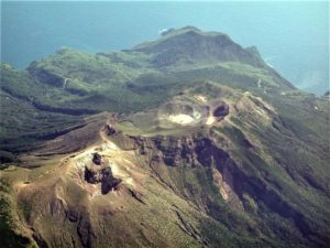
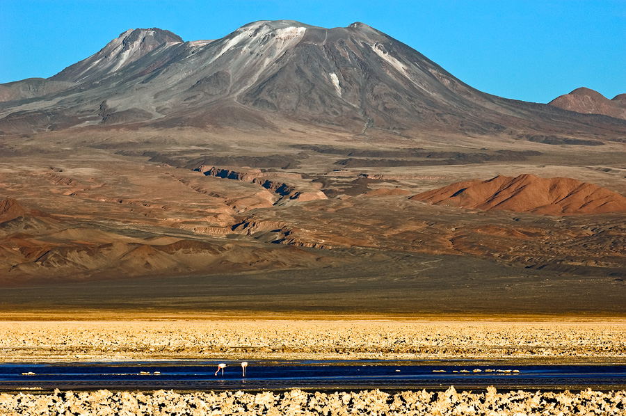
Chile , Lascar :
During the evaluated period, a total of 151 seismic events were recorded, of which 11 were classified as volcano-tectonic earthquakes (VT) in relation to rock fracturing processes inside the volcanic structure. with local magnitudes lower than M 1.8. The larger event was located 1.8 km south-southwest of the active crater at a depth of 7.6 km.
140 long-period (LP) type earthquakes were also recorded in relation to fluid dynamics within the volcano with reduced displacement values (DRc) of less than 1.2 cm2.
The images provided by the IP cameras installed around the volcano show a recurrent degassing from the main crater, reaching a maximum of 650 m above the active crater. Through some images, there are periods of incandescence of low intensity.
According to data provided by two GNSS stations, there is a shortening of approximately 0.7 cm, recorded during the month of September, of the surveillance line that crosses the crater, without increase in magnitude, which could indicate a slight deflation punctual and non-persistent in time, which had started during the period previously evaluated.
Sulfur dioxide (SO2) emissions, recorded by Differential Absorption Spectrometry Equipment (DOAS), have a value for the evaluated period of 471 +/- 76 T / day and a maximum value of 1137 t / d recorded on October 13th. SO2 emissions are at moderate levels for this volcano.
8 thermal warnings were reported in the area associated with the volcanic complex during the period, with a maximum MVRP of 1.3 MW, values considered low, according to the data processed by infrared observation. Volcanic Activity (MIROVA) (http://www.mirovaweb.it/) and Temporal Thermal Monitoring of Global Hot Spots (MODVOLC) (http://modis.higp.hawaii.edu/).
The level of activity presented during the period considered is considered to be in the basic level
Because of the above, the volcanic warning is kept at the level:
GREEN LEVEL: Active volcano with stable behavior – Probable time for eruption: MONTH / YEARS.
Observation:
A zone of danger is considered as an area of 500 m around the crater.
Source : Sernageomin
Photo : Sernageomin , Gerard Prins ( Wikipédia).
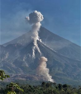
Mexico , Popocatepetl :
November 10, 11:00 am (November 10, 17:00 GMT)
In the last 24 hours, through the surveillance systems of the Popocatepetl volcano, 166 exhalations have been identified, accompanied by water vapor, gas and light amounts of ash. The most important took place yesterday at 18:40 and today at 17:45, 19:38 and 20:23.
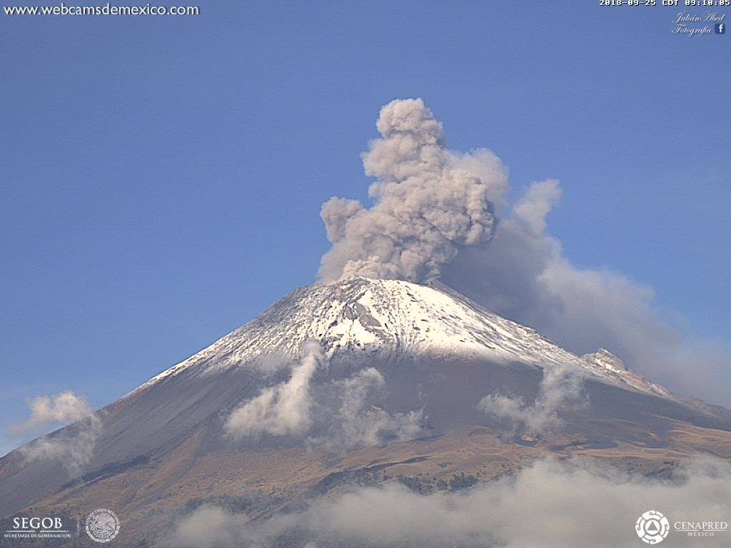
At the time of writing, there was little visibility due to clouds. However, in the last few hours, there was steam and gas emission in the Southeast direction.
CENAPRED urges NOT to APPROACH the volcano and in particular the crater, because of the risk of falling ballistic fragments and in case of heavy rains, to move away from the bottom of the ravines because of the risk of landslides and mudslides.
The traffic light of the Popocatepetl volcano is located at Amarillo Phase 2.
Source : Cenapred .
Photo : Archive Webcamdemexico.
Alaska , Semisopochnoi :
51°55’44 » N 179°35’52 » E,
Summit Elevation 2625 ft (800 m)
Current Volcano Alert Level: WATCH
Current Aviation Color Code: ORANGE
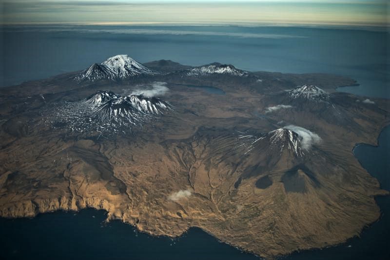
Unrest continues at Semisopochnoi volcano. Three possible small explosions were detected in infrasound data yesterday evening between 4:51 and 5:04 UTC (19:51-20:04 AKST). No associated ash clouds were observed in partly cloudy satellite views. Additional explosions are possible and will likely occur without warning. The satellite link that transmits seismic data from Semisopochnoi failed on November 1, but an infrasound array on Adak Island should still detect significant explosive emissions from Semisopochnoi (with a 13-minute delay) if atmospheric conditions permit.
Semisopochnoi is monitored with an on-island seismic network, though this is currently off-line, and remotely by satellite and lightning sensors. As noted above, an infrasound array on Adak Island may detect explosive emissions from Semisopochnoi with a 13 minute delay if atmospheric conditions permit.
Source : AVO
Photo : AVO
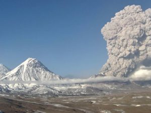
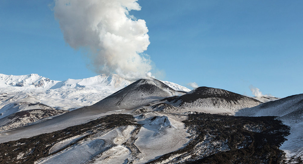
Russia / Kuriles Islands , Ebeko :
VOLCANO OBSERVATORY NOTICE FOR AVIATION (VONA).
Issued: November 10 , 2018.
Volcano:Ebeko (CAVW #290380)
Current aviation colour code:ORANGE
Previous aviation colour code:orange
Source:KVERT
Notice Number:2018-110
Volcano Location:N 50 deg 41 min E 156 deg 0 min
Area:Northern Kuriles, Russia
Summit Elevation:3791.68 ft (1156 m)
Volcanic Activity Summary:
A moderate explosive activity of the volcano continues. Visual data from Severo-Kurilsk showed an explosion sent ash up to 4.5 km a.s.l., an ash plume is extending to the south-east from the volcano.
A moderate eruptive activity of the volcano continues. Ash explosions up to 19,700 ft (6 km) a.s.l. could occur at any time. Ongoing activity could affect low-flying aircraft and airport of Severo-Kurilsk.
Volcanic cloud height:
13120-14760 ft (4000-4500 m) AMSL Time and method of ash plume/cloud height determination: 20181110/0012Z – Visual data
Other volcanic cloud information:
Distance of ash plume/cloud of the volcano: 6 mi (10 km)
Direction of drift of ash plume/cloud of the volcano: SE
Time and method of ash plume/cloud determination: 20181110/0012Z – Visual data
Source : Kvert.
Photo : Sputnik . Alexandre Peraguis.
Japan /Ryukyu Islands , Kuchinoerabujima :
30.443°N, 130.217°E
Elevation 657 m
JMA reported that during 31 October-5 November there were very small events recorded at Kuchinoerabujima’s Shindake Crater. Plumes rose 500-1,200 m above the crater rim. The Alert Level remained at 3 (on a scale of 1-5).
https://www.facebook.com/yakushima.umikawa/videos/2245447659070176/
A group of young stratovolcanoes forms the eastern end of the irregularly shaped island of Kuchinoerabujima in the northern Ryukyu Islands, 15 km west of Yakushima. The Furudake, Shindake, and Noikeyama cones were erupted from south to north, respectively, forming a composite cone with multiple craters. The youngest cone, centrally-located Shintake, formed after the NW side of Furutake was breached by an explosion. All historical eruptions have occurred from Shintake, although a lava flow from the S flank of Furutake that reached the coast has a very fresh morphology. Frequent explosive eruptions have taken place from Shintake since 1840; the largest of these was in December 1933. Several villages on the 4 x 12 km island are located within a few kilometers of the active crater and have suffered damage from eruptions.
Source: Agence météorologique japonaise (JMA), GVP.
Video : 民宿 宇美河(うみかわ via Sherine France.