January 20 , 2023 .
Alaska , Pavlof :
AVO/USGS Volcanic Activity Notice
Current Volcano Alert Level: NORMAL
Previous Volcano Alert Level: ADVISORY
Current Aviation Color Code: GREEN
Previous Aviation Color Code: YELLOW
Issued: Thursday, January 19, 2023, 11:51 AM AKST
Source: Alaska Volcano Observatory
Notice Number: 2023/A84
Location: N 55 deg 25 min W 161 deg 53 min
Elevation: 8261 ft (2518 m)
Area: Alaska Peninsula
Volcanic Activity Summary:
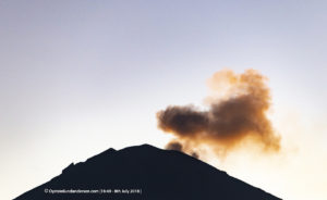
Eruptive activity at Pavlof Volcano has stopped. Seismicity has decreased to background levels, and no explosions have been detected since December 11, 2022. Weakly elevated surface temperatures and minor steaming from the recently active vent continue to be observed intermittently in satellite and web camera imagery, consistent with cooling of previously erupted lava. Due to the decrease in activity to background levels, we are lowering the Aviation Color Code to Green and the Volcano Alert Level to Normal.
Previous eruptions of Pavlof indicate that the level of unrest can change quickly and eruptive activity could resume with little or no warning. Pavlof is monitored by local seismic and infrasound sensors, satellite data, web cameras, and regional infrasound and lightning networks.
Remarks:
Pavlof Volcano is a snow- and ice-covered stratovolcano located on the southwestern end of the Alaska Peninsula about 953 km (592 mi) southwest of Anchorage. The volcano is about 7 km (4.4 mi) in diameter and has active vents on the north and east sides close to the summit. With over 40 historic eruptions, it is one of the most consistently active volcanoes in the Aleutian arc. Eruptive activity is generally characterized by sporadic Strombolian lava fountaining continuing for a several-month period. Ash plumes as high as 49,000 ft ASL have been generated by past eruptions of Pavlof, and during the March 2016 eruption, ash plumes as high as 40,000 feet above sea level were generated and the ash was tracked in satellite data as distant as eastern Canada. The nearest community, Cold Bay, is located 60 km (37 miles) to the southwest of Pavlof.
Source : AVO.
Photos : Fee, David , Volcano Observatory / University of Alaska Fairbanks, Geophysical Institute , Ben David Jacob.
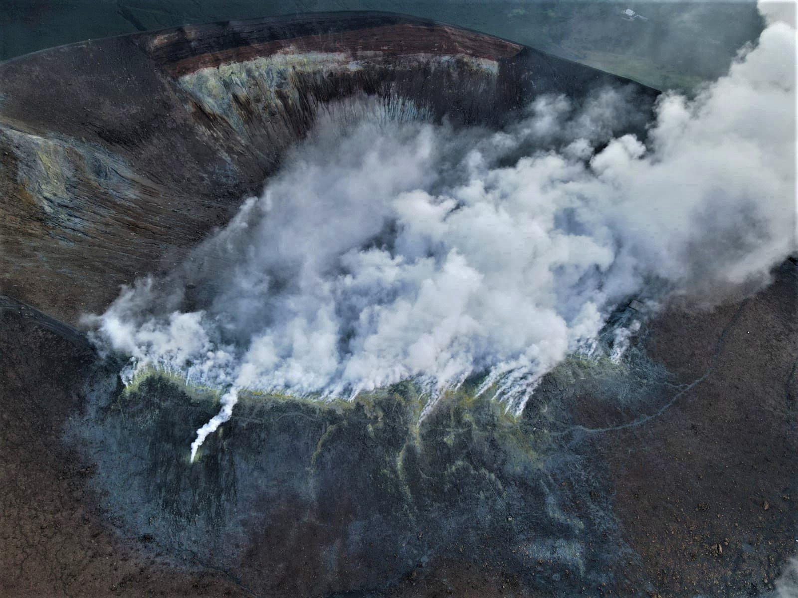
Italy , Vulcano :
WEEKLY BULLETIN, from January 09, 2023 to January 15, 2023. (issue date January 17, 2023)
ACTIVITY STATUS SUMMARY
In the light of the monitoring data, it is highlighted:
1) Temperature of the crater fumaroles: The temperatures recorded on the edge of the crater are stable at high values.
2) CO2 flux in the crater area: The CO2 flux in the crater area remains at high values.
3) SO2 flux in the crater area: At a moderately medium-high level
4) Geochemistry of fumarolic gases: There are no updates.
5) CO2 fluxes at the base of the La Fossa cone and in the Vulcano Porto area: In the C. Sicilia and Rimessa sites, the CO2 fluxes present values higher than background levels and slightly increasing; in the P4max site, the values show a slight decrease in flow, while in the Faraglione site, the values recorded are constant and always close to the background level.
6) Geochemistry of thermal aquifers: In the Camping Sicilia well, values with a slight increase in temperature are recorded; in the Bambara well, no significant variation in the monitored parameters is observed.
7) Local seismicity: Very low occurrence rate both for local events characterized by a high frequency and for those characterized by a low frequency (VLP).
8) Regional seismicity: No regional seismic event.
9) Deformations – GNSS: The network of permanent GNSS stations has not recorded any significant variations
10) Deformations – Inclinometry: The inclinometric network did not record any significant variations,
11) Gravimetry: No significant change was recorded.
CRATER FUMEROLES TEMPERATURE:
The fumarolic field presented homogeneous emission temperatures along the summit fracture line, confirming a thermal anomaly maintained by a stable vapor flow. Along the summit edge, the emission temperature exhibited an hourly maximum of 368C (T1). The thermal signal from sensor FT3 (fumarole F5) remains interposed between the temperatures recorded in FT1 and FT2 (these 2 probes are located in fumarole F5AT). The hourly temperature amplitude recorded on board is between 184 and 368°C, a rainy event had transient effects (after 4 days the temperature recovered).
Source : INGV.
Photo : INGV-Roma1
Indonesia , Semeru :
Mount Semeru erupted on Friday, January 20, 2023 at 6:49 a.m., with an ash column height observed at ± 500 m above the summit (± 4176 m above sea level). The ash column was observed to be white to gray with a thick intensity, oriented to the southeast and south. This eruption was recorded on a seismograph with a maximum amplitude of 20 mm and a duration of 100 seconds.
VOLCANO OBSERVATORY NOTICE FOR AVIATION – VONA
Issued : January 19 , 2023 .
Volcano : Semeru (263300)
Current Aviation Colour Code : ORANGE
Previous Aviation Colour Code : orange
Source : Semeru Volcano Observatory
Notice Number : 2023SMR029
Volcano Location : S 08 deg 06 min 29 sec E 112 deg 55 min 12 sec
Area : East java, Indonesia
Summit Elevation : 11763 FT (3676 M)
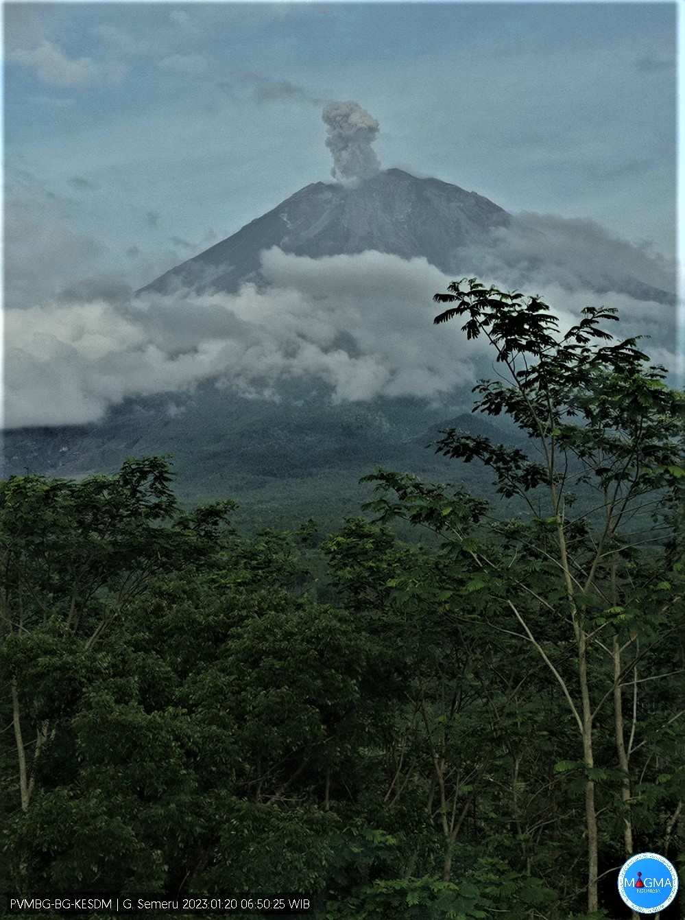
Volcanic Activity Summary :
Eruption with volcanic ash cloud at 23h49 UTC (06h49 local).
Volcanic Cloud Height :
Best estimate of ash-cloud top is around 13363 FT (4176 M) above sea level or 1600 FT (500 M) above summit. May be higher than what can be observed clearly. Source of height data: ground observer.
Other Volcanic Cloud Information :
Ash cloud moving from southeast to south. Volcanic ash is observed to be white to gray. The intensity of volcanic ash is observed to be thick.
Remarks :
Eruption recorded on seismogram with maximum amplitude 20 mm and maximum duration 100 second.
Source et photo : Magma Indonésia.
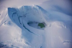
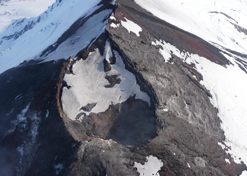
Chile , Lascar :
Seismology
The seismological activity of the period was characterized by the recording of:
22 VT-type seismic events, associated with rock fracturing (Volcano-Tectonics). The most energetic earthquake presented a value of local magnitude (ML) equal to 0.5, located 0.7 km east-south-east of the volcanic edifice, at a depth of 3.4 km from the crater.
23 LP-type seismic events, associated with fluid dynamics within the volcanic system (Long Period). The size of the largest earthquake assessed from the Reduced Displacement (DR) parameter was equal to 4 cm2. No event presented the minimum energy to be located
Fluid Geochemistry
The sulfur dioxide (SO2) emission data obtained by the Differential Absorption Optical Spectroscopy (DOAS) equipment, corresponding to the Emú station, located 6 km in an East-South-East (ESE) direction from the active crater, presented an average value of 483 ± 74 t / d, with a maximum daily value of 881 t / d on January 13. The average SO2 reported for this period is lower than that reported for the previous period and is within the values considered normal for this volcano.
![]()
Satellite thermal anomalies
10 thermal alerts were recorded in the area associated with the volcanic edifice during the period, with a maximum volcanic radiative power (VRP) of 3 MW on January 1 and 13, a value considered low according to data processed by MIROVA . Meanwhile, according to the analytical processing of satellite images (Sentinel 2-L2A in combination of false color bands), 3 luminance anomalies were observed on January 3, 8 and 13, with an estimated maximum luminance area of 2,700 m2. This value is within the values considered normal for this volcano.
Geodesy
The geodetic activity of the period was characterized by:
The GNSS survey line shows a low magnitude of displacement, with a maximum shortening rate of -0.18 cm/month, which is considered low for this volcano.
Stability in both the horizontal and vertical components of the GNSS monitoring stations, with rates that do not exceed 0.3 cm / month, considered low magnitude for this volcano.
Surveillance cameras
A passive whitish degassing is observed up to 1,400 m above the level of the crater (maximum recorded on January 11), without emission of pyroclasts. Low-intensity incandescence is occasionally observed in nighttime records (January 7).

Satellite geomorphological analysis
From the observation of Planet Scope and Sentinel 2-L2A satellite images, the permanence of three heat cores inside the active crater is identified, which have thermal radiation and correspond to passive degassing emission centers .
During the evaluated period, seismic activity is maintained with low seismic productivity and very low energy events. On the surface, there are diffuse gaseous emissions, of low output power and of an intermittent nature. The above suggests that after the explosive event that occurred in December, the volcanic system gradually returned to the thresholds previously observed and considered to be at its base activity.
However, as has been observed since the start of its monitoring, sudden eruptive pulses of short duration and impact limited to the area surrounding the crater may occur, which could present little or even no instrumental premonitory.
Therefore, it is suggested that the volcanic system is in a stable phase, its probable area of use is reduced and its volcanic technical alert is changed to:
GREEN TECHNICAL ALERT: Active volcano with stable behavior – There is no immediate risk of a major eruptive event.
Observation: It is considered as a zone of probable assignment by volcanic products corresponding to a radius of 700 m around the center of the crater.
Source : Sernageomin .
Photos : Sernageomin / Gabriel Orozco , RudiR/ commons.wikimedia.org .
Hawaii , Kilauea :
Thursday, January 19, 2023, 8:55 AM HST (Thursday, January 19, 2023, 18:55 UTC)
19°25’16 » N 155°17’13 » W,
Summit Elevation 4091 ft (1247 m)
Current Volcano Alert Level: WATCH
Current Aviation Color Code: ORANGE
Activity Summary:
The summit eruption of Kīlauea Volcano, within Halemaʻumaʻu crater, continued over the past 24 hours. All recent eruptive activity has been confined to the crater. No significant changes have been observed at the summit or in either rift zone.

Lava lake activity continues in Halema‘uma‘u crater, at the summit of Kīlauea volcano. This photo from the January 17 overflight looks west and shows that the eastern lake, in the foreground, remains stable. This eastern lake is supplied by a single fountain marked by the bright spot of incandescence. The smaller western lake is also active, and can be seen through the thick fume that rises from the crater.
Halemaʻumaʻu Lava Lake Observations:
Eruption of lava in the eastern portion of Halemaʻumaʻu crater floor continued over the past 24 hours. Activity is concentrated in a large lava lake in the eastern half of the crater, as well as a smaller lake to the west, in the basin of the 2021–2022 lava lake. The eastern lava lake has one dominant fountain, measured at 6-7 yards (meters) high and an area of approximately 25 acres as of January 17. The surface area of the lake did not change much over the past 24 hours, though sporadic overflows onto the crater floor occurred throughout the day. Also a small ooze-out occurred just after 2am on the crater’s western edge.
Summit Observations:
Summit tiltmeters showed no significant change in tilt throughout the past 24 hours. Volcanic tremor remains above background levels. A sulfur dioxide (SO2) emission rate of approximately 3,500 tonnes per day (t/d) was measured on January 9, 2023.
Source : HVO.
Photo : USGS / C. Parcheta.