January 17 , 2023.
New Zeland , Ruapehu :
VOLCANIC ACTIVITY BULLETIN , Tue Jan 17 2023 2:00 PM;
Volcanic Alert Level remains at 1
Aviation Colour Code remains at Green
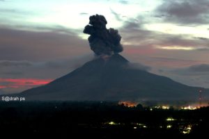
Ruapehu Crater lake temperature has increased to over 30 °C and the level of volcanic unrest activity remains low. A minor heating episode has occurred in the last 2 months with monitoring indicators remaining within normal range for this type of activity. The Volcanic Alert Level remains at Level 1 and the Aviation Colour Code remains Green.
Since early in December 2022 the temperature of the summit Crater Lake (Te Wai ā-moe) has increased. The temperature peaked at 35.5 °C on 27 December. Currently the lake temperature is 32 °C, remaining hot. This temperature is consistent with heat flow into the lake of about 150-200 MW. As the temperature rose in December the heat input increased to around 400 WM to support the heating phase.
The level of volcanic tremor was slightly elevated mid-late December 2022, however, has remained weak since then. Gas scanning equipment and a gas flight have confirmed an increase in gas output during the lake heating phase. The Crater Lake has also been overflowing during this time.

Analyses of water samples from the lake collected on 21 December 2022 show no changes in the lake chemistry. This indicates that there is no evidence of chemical interaction between magma (molten rock) and the hydrothermal system beneath the lake.
The current low levels of volcanic tremor, the Crater Lake chemistry data, and a peaking of the Crater Lake temperature are consistent with a low level of volcanic unrest at Mt Ruapehu. As a result, the Volcanic Alert Level remains at Level 1. The Aviation Colour Code remains Green.
Mt Ruapehu is an active volcano and has the potential to erupt with little or no warning when in a state of minor volcanic unrest.
The Volcanic Alert Level reflects the current level of volcanic unrest. The Volcanic Alert Level should not be used to forecast future activity.
Volcanic Alert Level 1 indicates the primary hazards are those expected during volcanic unrest: steam discharge, volcanic gas, earthquakes, landslides, and hydrothermal activity. While Volcanic Alert Level 1 is mostly associated with environmental hazards, potential for eruption hazards also exists and eruptions can still occur with little or no warning. Volcanic Alert Levels 3, 4 and 5 are reserved for eruptions with varying impact distances.
Source : Geonet / Brad Scott .
Photo : Bradd Scott
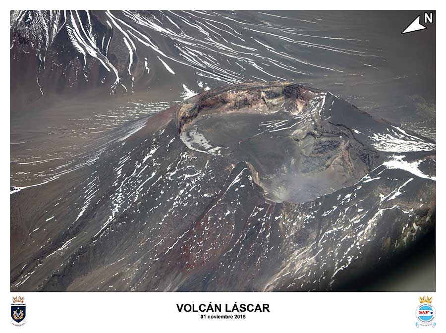
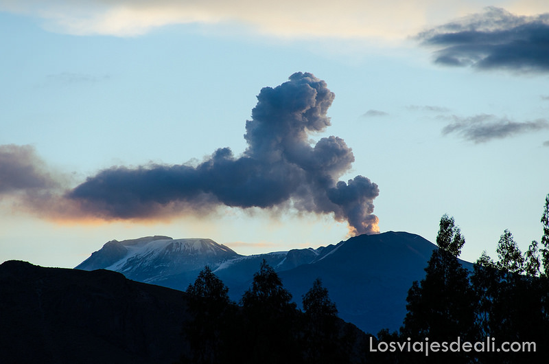
Chile , Lascar :
Seismology
The seismological activity of the period was characterized by the recording of:
17 VT-type seismic events, associated with rock fracturing (Volcano-Tectonics). The most energetic earthquake presented a value of local magnitude (ML) equal to 2.2, located 0.9 km east-southeast of the volcanic edifice, at a depth of 3.4 km from the crater.
30 LP-type seismic events, associated with fluid dynamics within the volcanic system (Long Period). The most energetic earthquake exhibited a reduced displacement value (DR) of 3.7 cm2. No event presented the minimum energy to be located.
Fluid Geochemistry
The sulfur dioxide (SO2) emission data obtained by the Differential Absorption Optical Spectroscopy (DOAS) equipment, corresponding to the Emú station, located 6 km in an East-South-East (ESE) direction from the active crater, presented an average value of 612 ± 67 t / d, with a maximum daily value of 1333 t / d on December 26. The average SO2 reported for this period is higher than that reported for the previous period and is within the values considered normal for this volcano.
1 anomaly was reported in the emissions of sulfur dioxide (SO2) into the atmosphere in the area close to the volcano, according to data published by the Tropospheric Monitoring Instrument (TROPOMI).
Satellite thermal anomalies
Eight thermal alerts were recorded in the area associated with the volcanic edifice during the period, with a maximum Volcanic Radiative Power (VRP) of 3 MW on December 16, a value considered low according to the data processed by the Observation Mid-Infrared Volcanic Activity. (MIROVA).
Geodesy
On the data provided by the geodetic monitoring network (GNSS), the most important aspects related to volcanic deformation during the last period have been characterized by:
– After slight changes in the deformation, shortening of the line between GNSS by 2 cm (August-October) and elongation of the same magnitude (October-December), a process that has been observed in previous years, but of lesser magnitude, the components behave stably.
– The maximum levels correspond to those recorded by the QUEB station, reaching 0.25 cm/month in the vertical component and 0.60 cm/month in the East, they are considered to be of medium magnitude.
Geodetic data indicate that minor variations are recorded which would not indicate deformation on the volcano, for the period evaluated.
Surveillance cameras
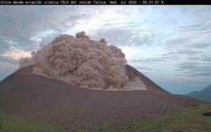
A passive whitish degassing is observed up to 980 m above the level of the crater on December 18, without emission of pyroclasts. Low-intensity incandescence is occasionally observed (December 25, 26, and 27) in nighttime records.
Satellite geomorphological analysis
From the observation of Planet Scope, Sentinel 2-L2A and Skysat Collect satellite images, since December 24, three heat cores (with thermal radiance) have been identified inside the active crater, equidistant at 100 m, where the highest intensity is in the northeast part of the crater. Skysat Collect images from December 18 and 28 make it possible to link these heat sources to degassing.
During the second fortnight, the volcanic system gradually decreased its internal and external activity, recording seismic activity with levels of occurrence and energy similar to those observed before the eruptive pulse of December 10. In addition, surface activity is characterized by low power and height outgassing, and low intensity incandescence. Although the monitoring parameters show a decreasing trend, this behavior should be observed over time.
Therefore, the Volcanic Technical Alert is maintained at:
YELLOW TECHNICAL ALERT: Changes in volcanic activity behavior
Note: A potential impact zone is considered within a radius of 1 km around the active crater.
Source : Sernageomin
Photo : 80 jours voyages / Sylvain Chermette, SAF.
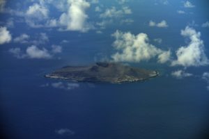
Peru , Sabancaya :
Analysis period: from January 09, 2023 to January 15, 2023, Arequipa, January 17, 2023.
Alert level: ORANGE
The Geophysical Institute of Peru (IGP) reports that the eruptive activity of the Sabancaya volcano remains at moderate levels, that is to say with the recording of an average of 50 daily explosions, with columns of ash and of gas up to 2.9 km altitude above the summit of the volcano and their subsequent dispersion. Therefore, for the following days, no significant change is expected in eruptive activity.
The IGP recorded and analyzed the occurrence of 462 earthquakes of volcanic origin, associated with the circulation of magmatic fluids inside the Sabancaya volcano. An average of 50 explosions was recorded daily, in addition to recording Volcano-Tectonic (VT) type events associated with rock fracturing inside the Sabancaya volcano.
Monitoring the deformation of the volcanic structure using GNSS techniques (processed with fast orbits) does not show any significant anomalies. However, in general, an inflation process was observed in the northern sector (surroundings of the Hualca Hualca volcano). Visual surveillance identified columns of gas and ash up to 2.9 km above the summit of the volcano, which were scattered towards the southwest, west and northwest sectors of Sabancaya . Satellite recordings have identified the presence of 10 thermal anomalies, with a maximum value of 16 MW, associated with the presence of a lava body on the surface of the volcano’s crater.
RECOMMENDATIONS
• Keep the volcanic alert level orange.
• Do not approach within a radius of less than 12 km from the crater.
Source : Cenvul
Photo : Losviajesdeali
Indonesia , Semeru :
Mount Semeru exhibited an eruption on Tuesday January 17, 2023 at 05:36 WIB with the height of the ash column observed at ± 1000 m above the summit (± 4676 m above sea level). The ash column was observed to be gray to brown with moderate to thick intensity, oriented to the west. This eruption was recorded on a seismograph with a maximum amplitude of 22 mm and a duration of 163 seconds.
VOLCANO OBSERVATORY NOTICE FOR AVIATION – VONA
Issued : January 16 , 2023
Volcano : Semeru (263300)
Current Aviation Colour Code : ORANGE
Previous Aviation Colour Code : orange
Source : Semeru Volcano Observatory
Notice Number : 2023SMR024
Volcano Location : S 08 deg 06 min 29 sec E 112 deg 55 min 12 sec
Area : East java, Indonesia
Summit Elevation : 11763 FT (3676 M)

Volcanic Activity Summary :
Eruption with volcanic ash cloud at 22h36 UTC (05h36 local).
Volcanic Cloud Height :
Best estimate of ash-cloud top is around 14963 FT (4676 M) above sea level or 3200 FT (1000 M) above summit. May be higher than what can be observed clearly. Source of height data: ground observer.
Other Volcanic Cloud Information :
Ash cloud moving to west. Volcanic ash is observed to be gray to brown. The intensity of volcanic ash is observed from medium to thick.
Remarks :
Eruption recorded on seismogram with maximum amplitude 22 mm and maximum duration 163 second.
Source et photo : Magma Indonésie
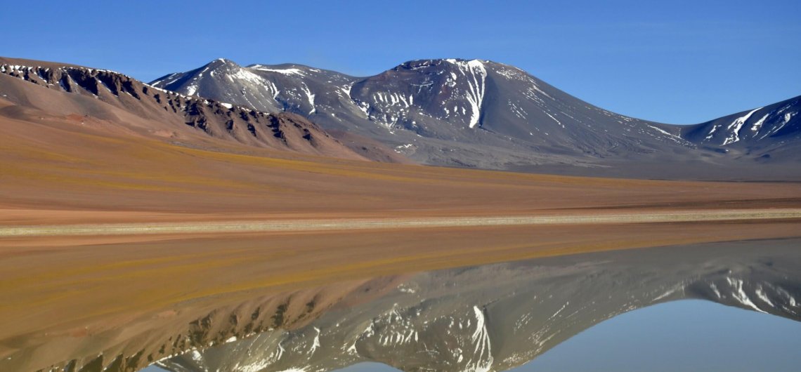
Chile , Villarica :
Special Report on Volcanic Activity (REAV), La Araucanía and Los Ríos regions, Villarrica volcano, January 17, 2023, 03:40 local time (mainland Chile)
The National Geology and Mining Service of Chile (Sernageomin) announces the following PRELIMINARY information, obtained through the monitoring equipment of the National Volcanic Monitoring Network (RNVV), processed and analyzed at the Observatory of Volcanoes of the Southern Andes (Ovdas):
On Monday, January 17, 2023, at 03:22 local time (06:22 UTC), monitoring stations installed near the Villarrica volcano recorded Strombolian activity associated with fluid dynamics within the volcanic system. (type LP).

The characteristics of the earthquake, after its analysis, are as follows:
ORIGINAL TIME: 03:22 local time (06:22 UTC)
REDUCED DISPLACEMENT: 17.7 (cm*cm)
ACOUSTIC SIGNAL: 1.7 Pascals (Pa) reduced to 1 km
The characteristics of this activity are as follows:
MAXIMUM HEIGHT OF THE COLUMN: 120 meters above the point of emission
COMMENTS:
During the morning, Strombolian explosions were recorded at a height of around 100 m above the crater. The observed explosions are characterized by the emission of incandescent materials on the surroundings of the crater. In relation to seismic activity, the parameters recorded on previous days continue.
The volcanic technical alert is maintained at the Yellow level.
Source : Sernageomin .
Photos : Sernageomin ,