July 23 , 2022.
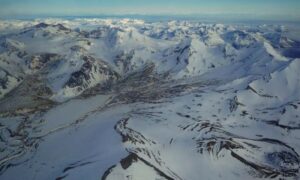
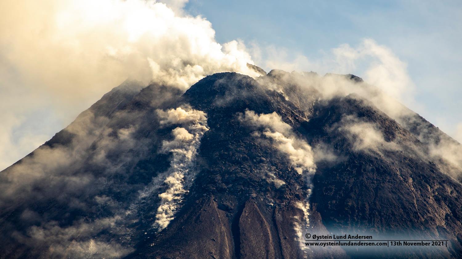
Indonesia , Merapi :
Merapi activity report from July 15 to 21, 2022:
This week, 22 lava avalanches were observed in a dominant South-West direction towards the Bebeng River with a maximum slip distance of 1800 m. For the Southwest dome, there is no change in the height of the dome. For the central dome, no significant morphological change was observed. According to photo analysis, the volume of the Southwest lava dome is 1,645,000 m3 and that of the central dome is 2,582,000 m3.
Seismicity:
This week, the seismicity of Mount Merapi recorded:
2 shallow volcanic earthquake (VTB),
54 multi-phase earthquakes (MP),
508 avalanche earthquakes (RF),
19 emission earthquakes (DG),
10 tectonic earthquakes (TT).
The intensity of seismicity this week is still quite high.
Mount Merapi’s deformation, which was monitored using EDM this week, showed no significant changes. Rainfall intensity was 22 mm/hour for 30 minutes at Kaliurang Post on July 16, 2022. There were no reports of lahars or additional flow in the rivers that originate at Mount Merapi.
Conclusion:
1. Merapi volcanic activity is still quite high in the form of effusive eruption activity. The state of the activity is defined at the « SIAGA » level.
2. The current potential danger is lava avalanches and hot clouds in the South-South-West sector covering the Boyong River for a maximum of 5 km, the Bedog River, Krasak, Bebeng for a maximum of 7 km. The Southeast sector covers the Woro River for a maximum of 3 km and the Gendol River for a maximum of 5 km. Meanwhile, the ejection of volcanic material in the event of an explosive eruption can reach a radius of 3 km around the summit.
The public should not carry out any activity in potentially dangerous areas, anticipate disturbances due to volcanic ash from the Merapi eruption and be aware of the dangers of lahars, especially when it rains around Merapi.
Source : BPPTKG
Photo : Oystein Lund Andersen.
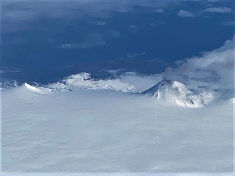
Alaska , Pavlof :
55 25’2″ N 161 53’37 » W,
Summit Elevation 8261 ft (2518 m)
Current Volcano Alert Level: WATCH
Current Aviation Color Code: ORANGE
Pavlof Volcano continues to erupt from the active vent on its east flank, just below the summit. Seismic tremor and elevated surface temperatures in satellite data were observed throughout the week, and minor explosions were detected daily in seismic and infrasound data. Weak ash emissions associated with this activity were observed occasionally in web camera images when not obscured by clouds. A pilot report from today at 11:50 local time observed a low-level ash cloud to about 8,600 ft above sea level which correlates with slightly larger explosion signals detected in infrasound data. No ash emissions were observed in satellite data.
A plume rises from Pavlof volcano, as seen on Alaska Airlines flight 187 ADK to ANC 04/06/2022
Periods of lava spatter and fountaining from the vent on the volcano’s upper east flank have been occurring since mid-November 2021. This activity has built a small cone and sent flows down the flank that melt the snow and ice and produce variable amounts of meltwater. The meltwater typically incorporates loose debris on the flank of the volcano and forms thin (less than 2 m thick) lahars. The lahar deposits extend down the east-southeast flank for several kilometers, not quite to the base of the volcano. Previous eruptions of Pavlof indicate that the level of unrest can change quickly and the progression to more significant eruptive activity can occur with little or no warning.
Pavlof is monitored by local seismic and infrasound sensors, satellite data, web cameras, and remote infrasound and lightning networks.
Source : AVO.
Photo : Ferguson-Gould, Tara / Alaska Volcano Observatory / University of Alaska Fairbanks, Geophysical Institute.
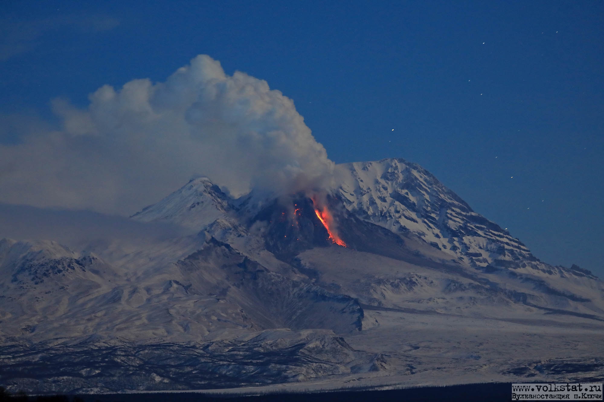
Kamchatka , Sheveluch :
VOLCANO OBSERVATORY NOTICE FOR AVIATION (VONA)
Issued: July 22 , 2022
Volcano: Sheveluch (CAVW #300270)
Current aviation colour code: ORANGE
Previous aviation colour code: orange
Source: KVERT
Notice Number: 2022-80
Volcano Location: N 56 deg 38 min E 161 deg 18 min
Area: Kamchatka, Russia
Summit Elevation: 3283 m (10768.24 ft), the dome elevation ~2500 m (8200 ft)
Volcanic Activity Summary:
A growth of the lava dome continues, a strong fumarolic activity, and an incandescence of the lava dome, explosions, and hot avalanches accompanies this process. Video and satellite data by KVERT showed an ash plume up to 4 km a.s.l. extending to the south-south-west from the volcano.
The extrusive eruption of the volcano continues. Ash explosions up to 10-15 km (32,800-49,200 ft) a.s.l. could occur at any time. Ongoing activity could affect international and low-flying aircraft.
Volcanic cloud height:
3500-4000 m (11480-13120 ft) AMSL Time and method of ash plume/cloud height determination: 20220722/2215Z – NOAA 19 (4m5)
Other volcanic cloud information:
Distance of ash plume/cloud of the volcano: 25 km (16 mi)
Direction of drift of ash plume/cloud of the volcano: SSW / azimuth 200 deg
Time and method of ash plume/cloud determination: 20220722/2215Z – NOAA 19 (4m5)
Source : Kvert.
Photo : Y. Demyanchuk . (Archive Volkstat ru .)
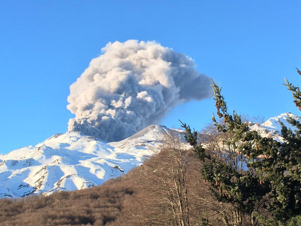
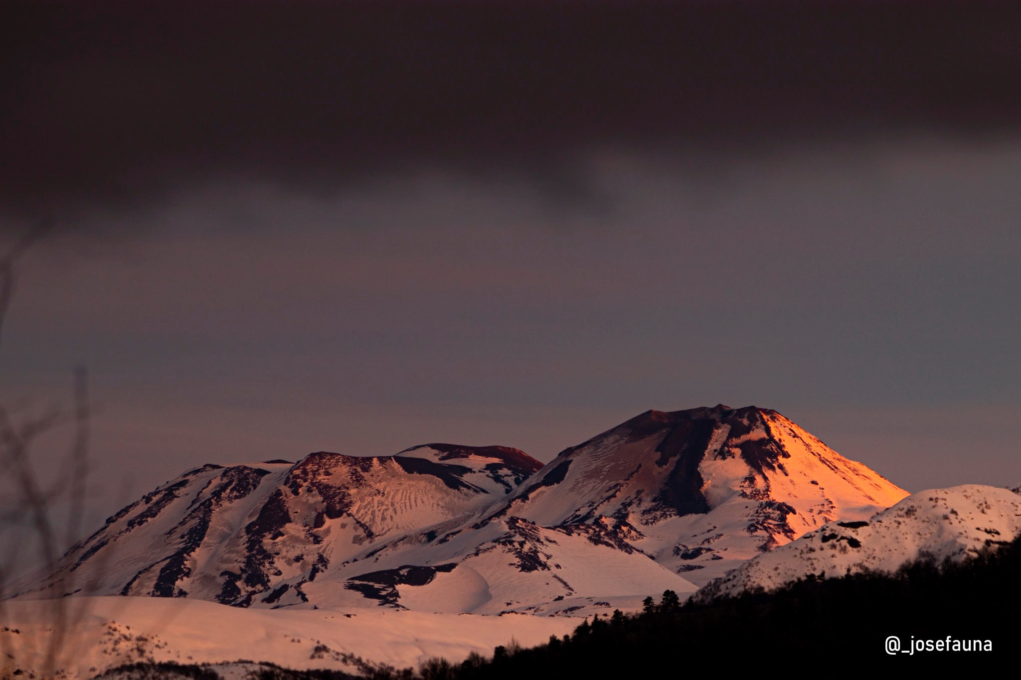
Chile , Nevados de Chillan :
Seismology
The seismological activity of the period was characterized by the recording of:
31 volcano-tectonic earthquakes (VT) associated with brittle rupture processes; the most energetic earthquake had a local magnitude (ML) equal to 2.2, whose location was estimated at a depth of 3.8 km and at an epicentral distance of 5.4 km north-northeast of the crater asset.
Long period (LP), explosion (EX) and tremor (TR) seismicity continued to be recorded, associated with fluid dynamics within the volcanic system. 586 LP-type earthquakes were classified, of which 70 were related to surface-level explosions, due to the presence of acoustic waves and/or gaseous emissions, however, recording the two mentioned characteristics is difficult due to unfavorable weather conditions, which may induce a decrease in the total count of this type of event. The size of the largest LP earthquake estimated from the Reduced Displacement (DR) parameter reached a value equal to 765 cm2. This event being associated with an explosion is the event with the highest seismic energy recorded during the year 2022, despite its size. No significant change in the current eruptive dynamics has been observed. Regarding TR type seismicity, 181 episodes were identified, the most important of which reached a DR of 222 cm2. The current eruptive phase is characterized by relatively low seismic energies linked to the movement of fluids, but with a greater presence of TR-type events, contrasting with the periods of greater volcanic activity, which were characterized by the generation of a greater amount of LP seismicity associated with more energetic explosions.
Satellite thermal anomalies
1 thermal alert was recorded in the area associated with the volcanic complex during the period, with a Volcanic Radiative Power (VRP) of less than 1 MW on July 11, a value considered low according to data processed by the Middle Infrared of Observation of Volcanoes (MIROVA, http://www.mirovaweb.it/).
At the same time, according to the analytical processing of satellite images (Sentinel 2-L2A in combination of false color bands), luminance anomalies were observed on July 2, 4, 7 and 14.
Surveillance cameras
An explosive surface activity was recorded from the active crater, with the generation of mainly whitish eruptive columns associated with degassing and low height,
less than 740 m. Due to climatic conditions, much of the visual recordings were obstructed by cloudiness or snow, so the occurrence of explosions containing pyroclasts associated with explosions recorded with other techniques cannot be ruled out. A mixed avalanche-type deposit is identified on the northeast slope of the Nuevo volcano, which is associated with the explosion that occurred on July 13, reaching 470 m in length, as well as proximal deposits (< 200 m in range) on the eastern side.
Satellite geomorphological analysis
From analysis with Planet Scope OrthoTile and Sentinel 2 L2A satellite images, the permanence of a dome-like effusive body nestled within the active crater (Dome 4) was observed, highlighting the fact that it was covered with snow. No significant morphological variation is identified, however, its visualization is affected by snow cover and winter weather fronts.
According to Sentinel 2 L2A false-color images, an area of anomalous thermal radiation is indicated, coinciding with Dome 4, with no major variations in its spatial distribution from what has been observed previously. Point decreases are identified in the thermal radiation anomaly area, with no continuous trend. Due to weather conditions, only three of these satellite images were available, with adequate visibility for interpretation.
The Nevados de Chillán volcanic complex remains in the context of a moderately explosive eruption, prolonged in time and whose impact is limited to the upper part of the volcanic edifice.
During this fortnight, there was an explosive event considered the most energetically recorded during the year, which produced a mixed avalanche on the surface which did not exceed 500 m from the edge of the crater in a direction North-North-East. After its occurrence, the seismic activity did not experience major changes in the released energy and seismic productivity, likewise, the surface processes continued with pulsating column dynamics, without presence or with low content. in particulate matter. Due to the above, its technical alert remains yellow and its possible impact zone of the products emitted remains at 2 km.
Source : Sernageomin.
Read the full article : https://rnvv.sernageomin.cl/rnvv/TI_Santiago_prod/reportes_LB/2022/RAV_20220722_%C3%91uble_v13.pdf
Photos : Noticias De Los Volcanes De Chile , Josefauna.
Guatemala , Pacaya :
Weather conditions: partly cloudy
Wind: North-East.
Precipitation: 0.0 mm.
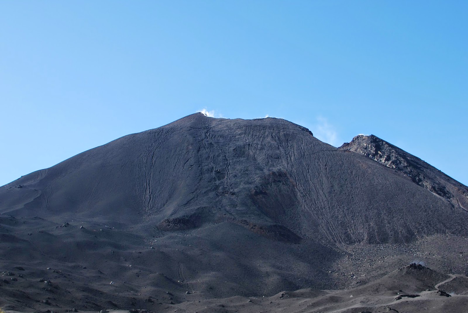
Activity:
The Pacaya Volcano Observatory reports weak to moderate white outgassing at an approximate height of 100 meters above the crater moving in a South-South-West direction with an approximate length of 400 meters. No explosion, sound, rumble or glow is reported. During the night and early in the morning, there was no emission of ash, nor expulsion of incandescent material. Seismic stations located around the volcano confirm that low frequency and short duration events persist, indicating movement of magma and gas within the volcanic edifice. The generation of lava flows or degassing columns with abundant ash emissions is not excluded.
Source et photo : Insivumeh