November 06 , 2023.
Alaska , Katmai :
ALASKA VOLCANO OBSERVATORY INFORMATION STATEMENT . U.S. Geological Survey .
Sunday, November 5, 2023, 7:10 AM AKST (Sunday, November 5, 2023, 16:10 UTC)
58°16’44 » N 154°57’12 » W,
Summit Elevation 6716 ft (2047 m)
Current Volcano Alert Level: NORMAL
Current Aviation Color Code: GREEN
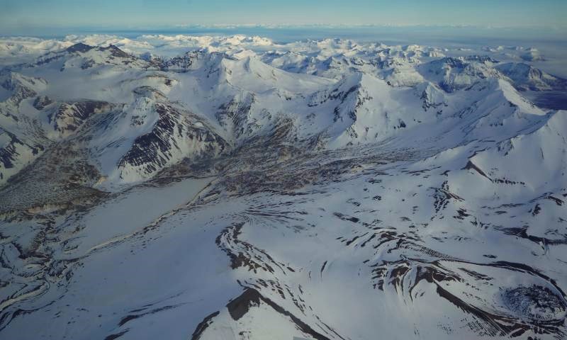
Aerial view of Katmai caldera (top left – sliver of lake visible), Trident (top right) and Novarupta (bottom right).
Strong northwesterly winds in the vicinity of Katmai and the Valley of Ten Thousand Smokes have picked up loose volcanic ash erupted during the 1912 Novarupta-Katmai eruption and are carrying it to the southeast this morning. The National Weather Service has issued a SIGMET for this low-level event and suggests that the maximum cloud height is 5,000 ft (1.5 km) above sea level.
This phenomenon is not the result of recent volcanic activity and occurs during times of high winds and dry snow-free conditions in the Katmai area and other young volcanic areas of Alaska. No eruption is in progress. Trident Volcano remains at color code YELLOW due to elevated earthquake activity, while other volcanoes of the Katmai area (Snowy, Griggs, Katmai, Novarupta, Mageik, Martin) remain at color code GREEN. Resuspended volcanic ash should be considered hazardous and could be damaging to aircraft and health.
Source : AVO
Photo : Lopez, Taryn
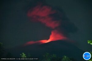
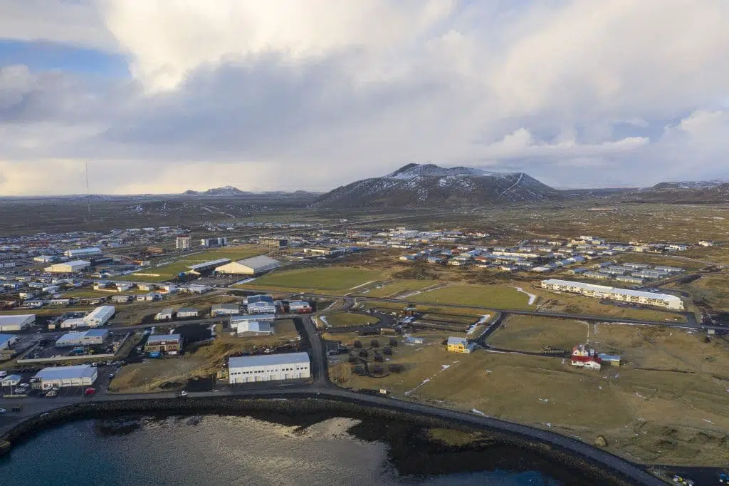
Iceland , Reykjanes Peninsula :
“I’m scared that we’re coming close to an eruption,” says Þorvaldur Þórðarson, a professor of volcanology and rock science, when asked for his opinion on the morning’s earthquake on the Reykjanes peninsula.
He says that people should think in hours rather than days, both with regard to volcanic eruptions and evacuation plans.
Magma intrusion and land keeps rising
Several large earthquakes have occurred since midnight. Just before 5 am, a magnitude 4.2 earthquake hit, and just after eight o’clock, a magnitude 4.3 earthquake hit. There are also more than ten earthquakes of more than three magnitudes.
The magma is at a smaller depth
“It seems to me that the magma has reached a smaller depth. It spreads from 4-5 kilometers to almost the surface,” Þórðarson says.
“It could be either hours or days. I think we’re pretty close to this. The land continues to rise as everyone can see,” Þórðarson says.
According to Þórðarson, the earthquakes that have occurred today are spreading over a known volcanic fissure. “The earthquakes seem to follow these fissures north-south, or just east or the northern fissures,” he says.
Þórðarson said he was very worried that a volcanic eruption would start with a bang at this location because of the nature of the magma.
“The magma will definitely be a little rougher. It’s magma that has accumulated at a shallower depth. To reach up to that level, it needs to be more lighter in weight. So it’s expected to be less rich in magnesium. If it becomes as rough as we call it, it means it will have more magma gases,” he explains.
He says it is possible that then a fairly powerful magma eruption could form. “If there’s an eruption in these places, it’s a rather difficult situation and we can expect a relatively high productivity at the beginning of an eruption. Then maybe a so-called felsic lava field would form,” Þorvaldsson says.
“It can flood very quickly. You’re most worried about the beginning of the eruption.”
Strong seismic activity resumed in Eldvörp this morning in the Reykjanes peninsula. The swarm started from 5 am. this morning and during its first half hour, six earthquakes were of magnitude greater than three, including one of magnitude 4.2.
At the end of this sequence, activity had already moved towards Eldvörp.
Land rise in Þorbjörn continues and the mountain itself has risen by 7 cm in just over two weeks.
Source : MBL.is, IMO
Photos : IMO , Golli (Grindavík and Þorbjörn mountain)
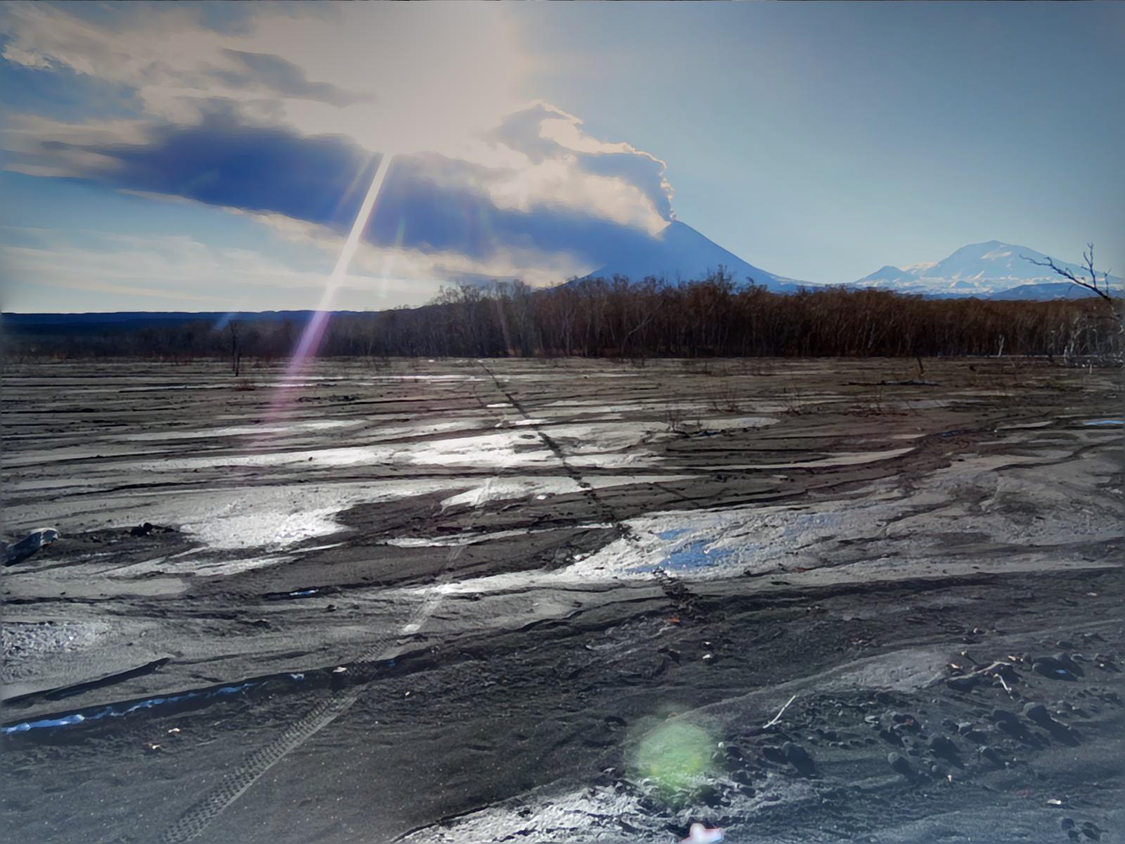
Kamchatka , Klyuchevskoy :
VOLCANO OBSERVATORY NOTICE FOR AVIATION (VONA)
Issued: 20231106/0234Z
Volcano: Klyuchevskoy (CAVW #300260)
Current aviation colour code: YELLOW
Previous aviation colour code: orange
Source: KVERT
Notice Number: 2023-154
Volcano Location: N 56 deg 3 min E 160 deg 38 min
Area: Kamchatka, Russia
Summit Elevation: 4750 m (15580 ft)
Volcanic Activity Summary:
The eruption of the Klyuchevskoy volcano has ended, only fumarole activity of the summit crater is observed. However, a large hot lava flow lying in the Apakhonchichsky chute, continues to provoke the collapses of old pyroclastic material from the sides of the chute. Such old ashes can form plumes that rise to 5-7 km a.s.l., and stretching for several hundred kilometers from the volcano.
The eruption of the Klyuchevskoy volcano has ended, only fumarole activity of the summit crater is observed. A danger of ash rising up to 7 km (23,000 ft) a.s.l. remains. Ongoing activity could affect low-flying aircraft.
Volcanic cloud height: NO ASH CLOUD PRODUSED
Other volcanic cloud information: NO ASH CLOUD PRODUSED
Source : Kvert
Photo : Andrew Matseevsky ( 29 octobre).
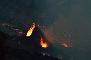
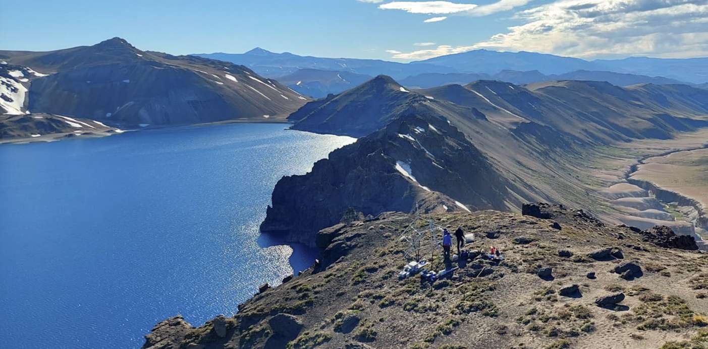
Chile , Laguna del Maule :
Special Report on Volcanic Activity (REAV), Maule region, Laguna del Maule volcanic complex, November 5, 2023, 8:15 p.m. local time (mainland Chile)
The National Geology and Mining Service of Chile (Sernageomin) announces the following PRELIMINARY information, obtained through the monitoring equipment of the National Volcanic Monitoring Network (RNVV), processed and analyzed at the Andes del Sud Volcanological Observatory ( Ovdas):
On Sunday, November 5, 2023 at 6:50 p.m. local time (9:50 p.m. UTC), monitoring stations installed near the Laguna del Maule volcanic complex recorded a swarm earthquake, associated with fracturing of rocks inside the volcanic system (type volcano-tectonic). At the time of issuing this report, approximately 140 events have been recorded. The recorded events are concentrated 4.6 km south-southeast of the center of the lagoon.
The characteristics of the largest magnitude earthquake recorded so far after its analysis are as follows:
ORIGINAL TIME: 6:50 p.m. local time (9:50 p.m. UTC)
LATITUDE: 36.092° S
LONGIT: 70.479°E
DEPTH: 3.4 km
LOCAL MAGNITUDE: 2.1 (ML)
On Sunday, November 5, 2023 at 6:48 p.m. local time (9:48 p.m. UTC), monitoring stations installed near the Laguna del Maule volcanic complex recorded an earthquake, associated with fracturing of rocks inside the volcanic system (volcano type -tectonic).
The characteristics of the largest magnitude earthquake recorded so far after its analysis are as follows:
ORIGINAL TIME: 6:48 p.m. local time (9:48 p.m. UTC)
LATITUDE: 36.095° S
LONGITUDE: 70.480°E
DEPTH: 4.1 km
LOCAL MAGNITUDE: 3.9 (ML)
Comments:
Following the main event, 3 lower energy events were recorded.
The technical volcanic alert remains at the Yellow level.
Source : Sernageomin.
Photo : neuqueninforma.gob.ar
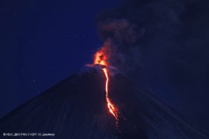
Guatemala , Santiaguito :
Type of activity: Peléenne
Morphology: Dacitic dome complex
Geographical location: 14°44′ 33˝ N latitude; 91°34’13˝ West longitude.
Altitude: 0.2500 meters above sea level.
Weather conditions: Partly cloudy.
Wind: North-East.
Precipitation: 0.0 mm.

The network of instruments and webcams at the Santa María-Santiaguito volcanic complex records activity in the Caliente dome, with low to moderate outgassing of water vapor and other magmatic gases rising 400 meters above above the Caliente dome. During the night and early morning, incandescence was observed in the dome and on the sides of the dome following the explosions. Small and moderate explosions occur at a rate of 1 to 2 per hour, raising columns of water vapor and ash to heights of 700 meters above the dome and causing mainly block and ash flows to descend towards the South-West, South and South-East flanks of the Caliente dome, leaving its channels marked with gray ashes, some of which almost reach the base of the dome. The descent of these flows produces faint noises perceptible in areas close to the domes. Detachment of boulders from the dome and occasional lava flows continue. The west and southwest wind can cause ash falls on San Marcos Palajunoj and Loma Linda. Activity remains at a high level, so it is possible that with explosions or under the effect of gravity, part of the accumulated materials collapse and that pyroclastic flows over long distances are generated towards the South. West, South and South-East. In the afternoon, rains may bring down lahars through the Cabello de Ángel and Nimá I channels, as well as at El Tambor.
Source : Insivumeh
Photo : Armando Pineda