July 31 , 2023.
New Zealand , Ruapehu :
Te Wai ā-moe (Crater Lake) has stopped cooling at Mt Ruapehu. Volcanic activity remains low and the Volcanic Alert Level remains at Level 1. Mon Jul 31 2023 4:00 PM
Te Wai ā-moe (Ruapehu Crater Lake) has now stopped cooling and started to reheat, rising 4 °C over the last 2 weeks. The lake temperature is now reaching 15 °C. Other monitoring indicators remain within normal ranges and the overall level of volcanic activity remains low. The Volcanic Alert Level remains at Level 1 and the Aviation Colour Code at Green.
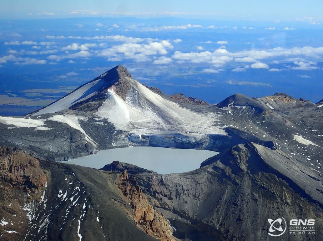
Since late December 2022 the temperature of Te Wai ā-moe (Crater Lake) had shown a declining trend, falling from 32 °C to 11 °C (Figure 1) by mid-July. Since then, the lake temperature has risen 4 °C and is now 15 °C. During the cooling phase the heat flow into the lake declined from around 400 MW to less than 50 MW. Now that heating has started it has increased to around 100 MW.
The lake can experience temporary drops in temperature due to short-lived input of snow melt and heavy rainfall into the lake. But these short-term variations did not affect the long-term heating or cooling trends.
The level of volcanic tremor recorded by our seismic equipment has remained weak since May and very few earthquakes have been located beneath the volcano. Our scanDOAS gas scanning equipment has measured low-to-moderate levels of gas output most days during the past three months. Indicating volcanic gases are flowing through the volcano.
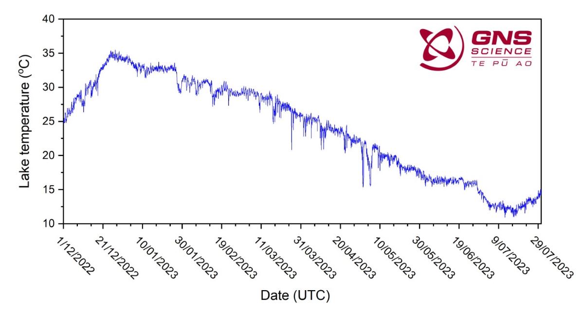
The temperature of Te Wai ā-moe (Crater Lake) from December 2022 to end of July 2023.
Water samples were collected from the lake most recently on June 15th, 2023. Analyses of fluids and gases in these samples show no significant changes compared to other recent chemistry samples. Key chemical indicators suggest the temperature of the gas input into the lake was still decreasing at the time of sampling, which is consistent with the still decreasing lake temperature at that time. The water and gas composition data are consistent with chemical interactions between the fluids and gases, and volcanic rocks in the hydrothermal system beneath the lake at low levels of volcanic activity.
Both the current low levels of volcanic tremor, the very small changes in lake chemistry, and the overall lake temperature are consistent with a low level of volcanic activity at Mt Ruapehu. As a result, the Volcanic Alert Level remains at Level 1. The Aviation Colour Code remains Green.
Source : Agnès Mazot / Volcanologue de service , Geonet.
Photo : GNS Science
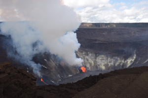
Alaska , Shishaldin :
54°45’19 » N 163°58’16 » W,
Summit Elevation 9373 ft (2857 m)
Current Volcano Alert Level: WATCH
Current Aviation Color Code: ORANGE
Low-level eruptive activity is likely occurring within the summit region of Shishaldin Volcano. Seismicity contunues to be low following the eruptive activity on the morning of July 26. Earthquakes and volcanic tremor are being detected but at much reduced levels. Strongly elevated surface temperatures continue to be observed in satellite data over the past day. Clear web camera views show steaming, occassionaly in the form or puffs, from the summit crater of the volcano .

Shishaldin has had five periods of elevated eruptive activity resulting in significant ash emission during the current eruption which started on July 12. It is unknown how long this eruption will last, but previous eruptions of Shishaldin Volcano have lasted weeks to months with repeated cycles of activity similar to those seen in the last two weeks.
Shishaldin Volcano is monitored by local seismic and infrasound sensors, web cameras, and a telemetered geodetic network. In addition to the local monitoring network, AVO uses nearby geophysical networks, regional infrasound and lighting data, and satellite images to detect eruptions.
Source : AVO
Photo : Nick Enloe
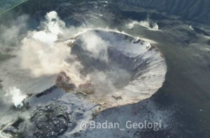
La Réunion , Piton de la Fournaise :
Press release from the Institut de physique du globe de Paris, Volcanological Observatory of Piton de la Fournaise, July 30, 2023 – 12:00 – 08:00 UTC
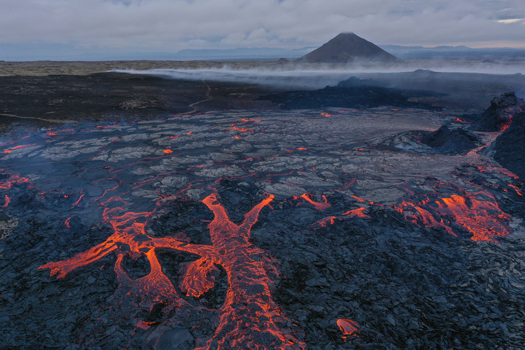
Ongoing eruption
The eruption started on July 02, 2023, around 08:30 local time continues. The amplitude of the volcanic tremor (indicator of an emission of lava and gas on the surface) still remains very low compared to the start of the eruption.
During the last 24 hours, the cloud mass present regularly on the eruptive site as well as the presence of lava tunnels did not allow the estimation of flows by satellite method by the HOTVOLC platform (OPGC – Clermont Auvergne University).
Since yesterday (29/07/2023) the weather conditions in the area of the eruptive site and the flows have only allowed very rare direct visual observations.
With the low surface activity, the morphology of the active volcanic cone – located southeast of the Enclos Fouqué at 1720 m altitude – hardly changes . Lava projections are rare and the flow of the lava takes place mainly in lava tunnels. The resurgence points – and therefore the visible flows – are currently located at lower altitudes at distances between 1200 and 2500 m from the eruptive cone, i.e. up to a minimum altitude of 900 m.
The flow front has not changed since July 5 and is now frozen. It is 1.8 km from the road.
A weak inflation of the summit zone is always recorded since mid-July, indicating a re-pressurization of the feeding system of the volcano centered under the summit zone with possibly the transfer of deep magma towards the latter, then coming to feed the eruption. .
The seismic activity recorded under the summit zone remains weak. Thus over the last 24 hours, four superficial volcano-tectonic earthquakes have been recorded. This low seismic activity leads to a reduction in the risk of the appearance of a new crack and/or collapse in the crater, but does not mean that it can be excluded, as shown by the continuation of the summit inflation and the fluctuations in the amplitude of the tremor which are regularly observed.
Alert level: Alert 2-1 (eruption in the Enclos without any particular threat to the safety of people, property or the environment).
Source : OVPF.
Photo : Facebook / Alain Bertil/Zinfos974.
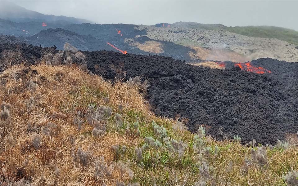
Iceland , Litli Hrútur :
Wildfires near the eruption are still burning in many places, with firefighting efforts lasting until midnight last night. Work to extinguish the fires went well yesterday, but tankers will continue to be used today and firefighting will start again at ten o’clock.
Yesterday was the biggest day of firefighting at the volcanoes to date. Many thousands of litres of water were ferried in tankers – they each take eight to ten thousand litres.
The Coast Guard’s helicopter, which has helped the fire brigade to ferry water, takes just one to two thousand litres per trip.
However, the tankers faced their own issues as they repeatedly got stuck on the way to the fire.
Yesterday, a hiker injured his leg, and a tired tourist required assistance. The official closure went well yesterday, with most people seemingly understanding that access to the eruption area is subject to restrictions.
The Litli Hrútur eruption releases around 5,000 to 12,000 tonnes of sulfur dioxide (SO2) per day and between 7,000 and 15,000 tonnes of carbon dioxide (CO2) according to Þorvald Þórðarson, professor of volcanology at the University of ‘Iceland. He then says that the release is most likely much higher, because some of it then turns into sulfuric acid particles when the substance reacts with water molecules in the atmosphere.
« It’s happening very quickly and the show is actually this haze that we’re now seeing rolling over the Reykjanes peninsula. » Þorvaldur says the greenhouse gas emission is slightly higher during the Litli Hrútur eruption, but on par with what it was during similar eruptions in 2021 and 2022. « There is a bit more of rising magma than during the 2022 eruption. When it was most active, there were about two to four thousand tons per day of SO2, but much more CO2 resulted.
Sources : RUV , MBL.is
Photo : Martin Rietze .
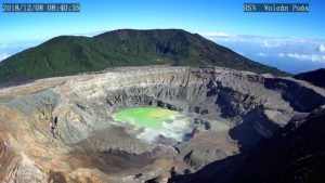
Ecuador , Sangay :
DAILY REPORT OF THE STATE OF SANGAY VOLCANO, Sunday July 30, 2023.
Information Geophysical Institute – EPN.
Surface Activity Level: High, Surface Trend: Unchanged
Internal activity level: High, Internal trend: No change
Seismicity: From July 29, 2023, 11:00 a.m. to July 30, 2023, 11:00 a.m.:
The number of seismic events recorded at the reference station over the past 24 hours is shown below. The level of seismic activity of the volcano remains high.
Explosion Event (EXP): 302.
Rains / Lahars:
Rains were recorded in the volcano area without generating mudslides and debris. Due to the rain, an increase in the flow of the Upano River is observed. **In the event of heavy rains, these could remobilize the accumulated materials, generating mudslides and debris that would descend the flanks of the volcano and flow into the adjacent rivers.**
Emission / Ash Column:
During yesterday night, an emission of gas and ash was recorded with a height equal to 866 meters above the level of the crater in a westerly direction. In the early hours of today, an emission of gas and ash was recorded at a height of less than 1000 meters above the level of the crater in a westerly direction. In the morning today, the Washington VAAC reported a new emission from a height of 860 meters above the level of the crater in a westerly direction.
Observation:
Since yesterday afternoon until today morning, the volcano remained cloudy.
Alert level: Orange.
Source : IGEPN.
Photo : volcan sangay