September 01 , 2020.
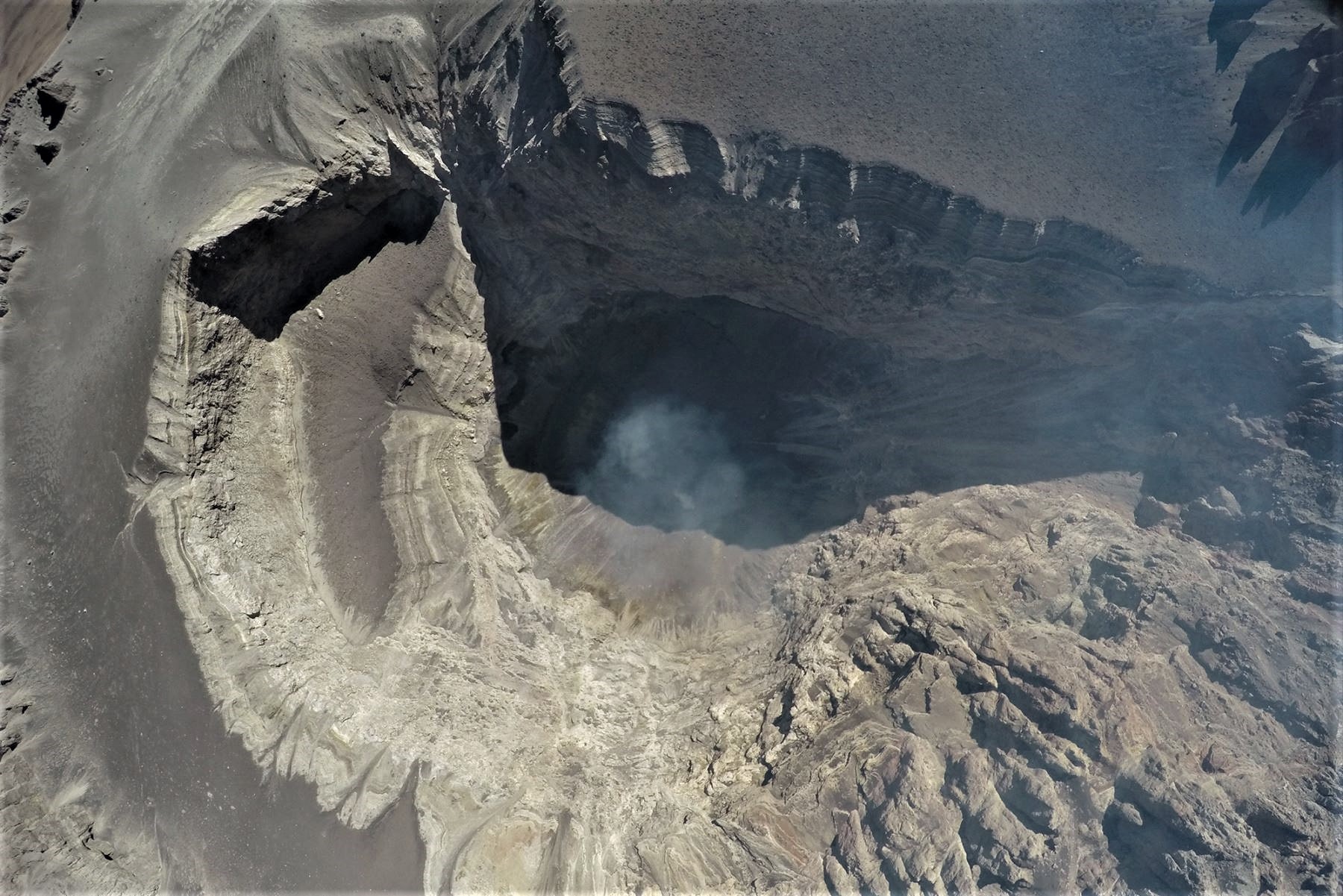
Peru , Sabancaya :
Analysis period: August 24 to 30, 2020, Arequipa, August 31, 2020
Alert level: ORANGE
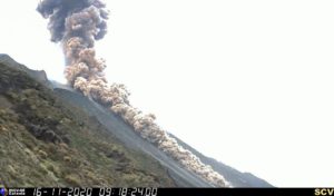
The Geophysical Institute of Peru (IGP) reports that the eruptive activity of the Sabancaya volcano remains at moderate levels; that is, with the continuous recording of explosions which generated columns of gas and ash during this period. These rose up to 3.5 km above the summit of the volcano and were scattered to the south, south-east and east of Sabancaya. For the following days, no significant change is expected concerning the eruptive activity.
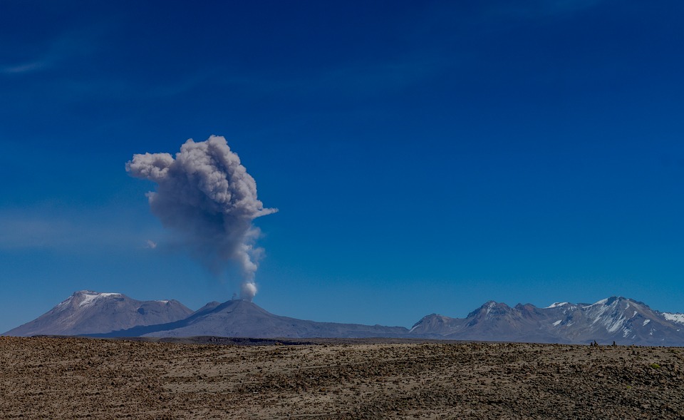
The IGP recorded and analyzed the occurrence of 2,063 earthquakes of volcanic origin associated with the circulation of magmatic fluids on the Sabancaya. In addition, an average of 29 explosions of low to medium intensity was recorded daily. During this period, Volcano-Tectonic (VT) type earthquakes, with a magnitude between M2.2 and M3.7, were located mainly in the North-West area of Sabancaya. The main earthquake (magnitude M3.7) was recorded on August 25 at 8:37 p.m., 14 km north of Sabancaya and at a depth of 15 km. Seismic activity saw a slight increase last week, recording up to 41 explosions on August 30, 2020; however, this activity is within the parameters observed in the current eruptive process of Sabancaya.
Monitoring the deformation of the volcanic structure, using GNSS equipment and data (processed with fast orbits), recorded a slight inflation of the northern sector of Hualca Hualca and the southeast flank of the Sabancaya volcano. Visual surveillance identified columns of gas and ash up to 3.5 km high above the summit of the volcano, which were scattered towards the southern, southeast and eastern sectors of Sabancaya. Satellite monitoring has identified the presence of 4 thermal anomalies with values between 6 MW and 98 MW, associated with the presence of a lava body on the surface of the volcano crater.
RECOMMENDATIONS
• Keep the volcanic alert level in orange.
• Do not approach within a radius of less than 12 km around the crater.
Source : IGP.
Photo : Pixabay
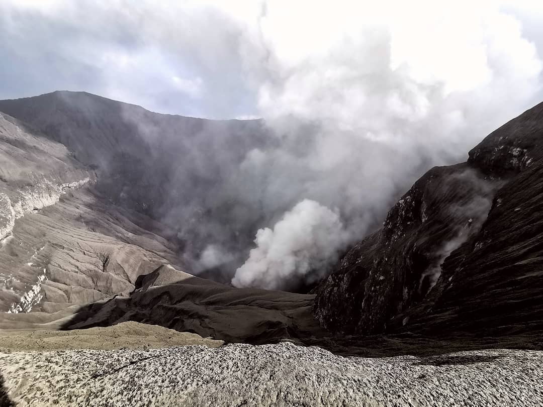
Peru , Ubinas :
Analysis period: August 24 to 30, 2020, Arequipa, August 31, 2020
Alert level: ORANGE
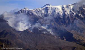
The Geophysical Institute of Peru (IGP) reports that the Ubinas volcano (region of Moquegua) continues to record a slight increase in seismic activity during the analysis period; therefore, it is suggested that the authorities and the public are aware of the bulletins published by the IGP.
During the analysis period, the occurrence of 31 earthquakes of volcanic origin of magnitude less than M1.4 were identified, events associated with rock breaking processes that occur inside the volcano. On average, 4 earthquakes were recorded per day. Likewise, 10 seismic signals were recorded, linked to the movement of volcanic fluids (water vapor and gas).
Surveillance cameras recorded columns of gas (mainly water vapor) reaching heights of up to 600 m above the summit of the volcano, which were then dispersed towards the south-eastern sector of the volcano.
Monitoring the deformation of the volcanic structure, using GNSS equipment and data (processed with fast orbits), shows a slight inflation of the volcano’s surface since early August. Satellite monitoring, carried out through the SENTINEL, OMI-NASA (SO2 gas) and MIROVA (thermal anomalies) systems, did not record any anomalies during the period.
RECOMMENDATIONS
• Stay informed at all times of the activity of the Ubinas volcano thanks to the bulletins issued by the IGP:
• Do not approach within a radius of less than 4 km around the crater.
Source et photo : IGP
Guatemala , Pacaya :
Type of activity: Strombolian.
Morphology: composite stratovolcano
Geographical location: 14 ° 22’50˝ Latitude N; 90 ° 36’00˝ Longitude W.
Height: 2,552 msnm.
Atmospheric conditions: clear
Wind: south-east
Precipitation: 0.60 mm.
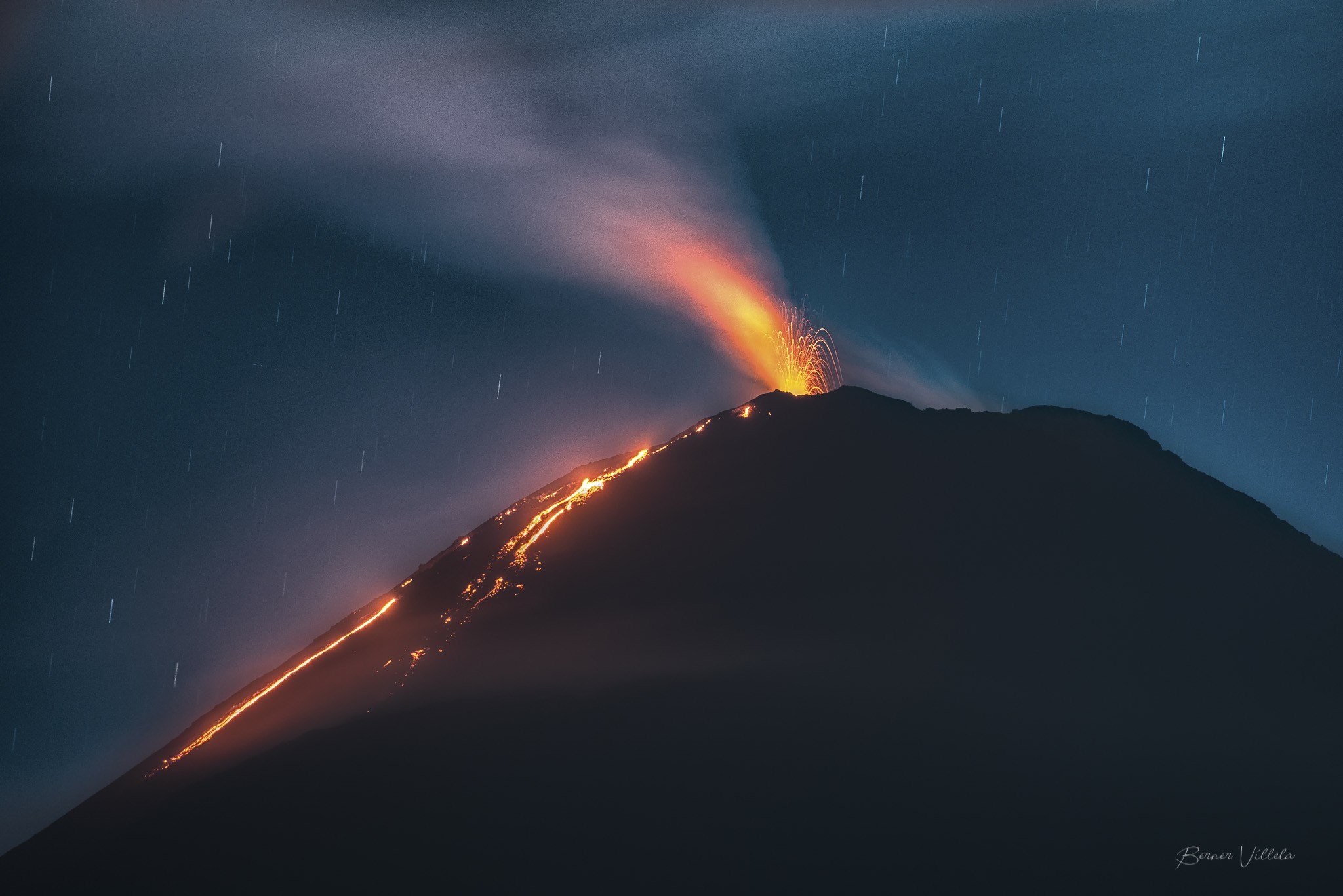
Activity:
The Mackenney crater is observed with a white fumarole which disperses towards the West and the North-West. Weak to moderate Strombolian type explosions are recorded which expel incandescent materials from 25 to 100 meters above the crater. A constant incandescence is observed in the crater accompanied by prolonged degassing, which generates thick and tall columns for long periods. Lava flows are observed on the northern flank, also moving in the same direction. The length of the lava flow is between 300 and 450 meters. The previous lava flow in a northeast direction did not exhibit any incandescence or outgassing along its path, which is why it is considered inactive. The INSIVUMEH seismic stations constantly record tremors, associated with the rise of magma, as well as the permanent degassing observed in the crater. The recommendations described in special bulletin no. 62-2020 remain in force.
Source : Insivumeh.
Photo : B. Villela .
Indonesia , Dukono :
VOLCANO OBSERVATORY NOTICE FOR AVIATION – VONA.
Issued : August 31 2020
Volcano : Dukono (268010)
Current Aviation Colour Code : ORANGE
Previous Aviation Colour Code : orange
Source : Dukono Volcano Observatory
Notice Number : 2020DUK76
Volcano Location : N 01 deg 41 min 35 sec E 127 deg 53 min 38 sec
Area : North Maluku, Indonesia
Summit Elevation : 3933 FT (1229 M)
Volcanic Activity Summary :
Eruption with volcanic ash cloud at 02h45 UTC (11h45 local).
Volcanic Cloud Height :
Best estimate of ash-cloud top is around 5213 FT (1629 M) above sea level, may be higher than what can be observed clearly. Source of height data: ground observer.
Other Volcanic Cloud Information : Ash-cloud moving to west
Remarks : Eruption and ash emission is continuing.
Level of activity at level II (WASPADA). The Dukono volcano (1229 m altitude) is in continuous eruption. The last eruption occurred on August 24, 2020, resulting in a column height of 900 meters above the summit. The color of the ash column ranges from white to thick gray.
The volcano was clearly visible until it was covered in fog. The smoke from the crater was observed to be white and gray with a shallow thickness, rising about 100 to 400 meters from the summit. The weather is sunny to cloudy, the wind is weak in the West.
According to the seismographs of August 31, 2020, it was recorded:
Continuous tremor with an amplitude of 0.5 to 4 mm, dominant value of 2 mm
1 Distant Tectonic earthquake.
Source : Magma Indonésie , PVMBG.
Photo : Rainwater Media via Sherine France.