October 08 , 2023.
Kamchatka , Sheveluch :
56.64 N, 161.32 E;
Elevation 3283 m (10768 ft),
the dome elevation ~2500 m (8200 ft)
Aviation Colour Code is ORANGE
The extrusive-effusive eruption of the volcano continues. A danger of ash explosions up to 10 km (32,800 ft) a.s.l. remains. Ongoing activity could affect international and low-flying aircraft.
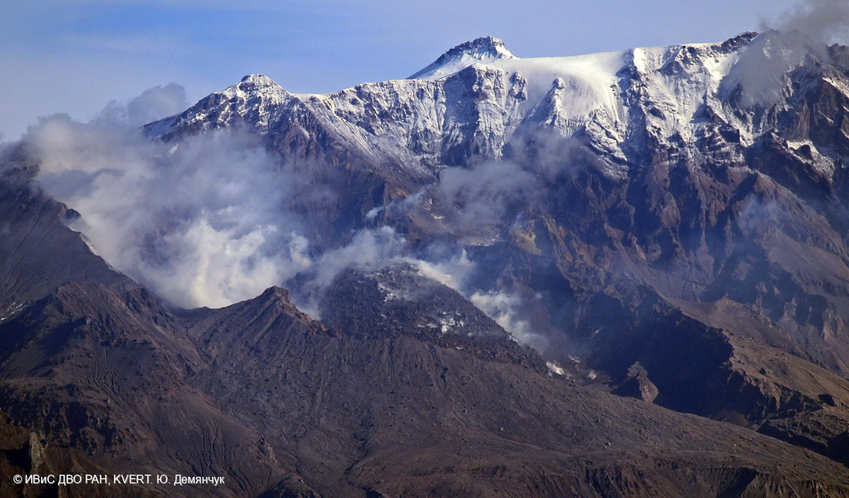
The extrusive-effusive eruption of the volcano continues: a lava is extruded out in the explosive crater of the Young Sheveluch, it is accompanied by powerful gas-steam activity, and sometimes an incandescence of the lava dome. A powerful gas-steam activity is also observed at the area of the Karan dome. Satellite data by KVERT showed a thermal anomaly over the volcano on 28-29 September, and 01-02 and 05 October; the volcano was obscured by clouds during other days of the week.
Source : Kvert
Photo : Yu. Demyanchuk. IVS FEB RAS, KVERT
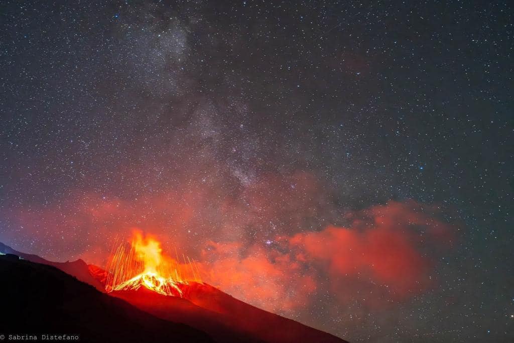
Italy , Stromboli :
Communiqué on the activity of Stromboli, October 7, 2023 3:01 p.m. (1:01 p.m. UTC)
The National Institute of Geophysics and Volcanology, Osservatorio Etneo, communicates that from around 06:20 UTC, there was a progressive decrease in the intensity of the projections which fueled the lava overflow reported in the previous press release of 04:27 UTC. Analysis of images from surveillance cameras shows that the lava overflow is currently no longer fed and is cooling. In the northern area of the crater, in addition to the splashes, Strombolian activity persists. Strombolian activity is also observed in the Central-South crater area.
From a seismic point of view, in recent hours, the tremor amplitude has returned to average values. There are no significant variations in the frequency of occurrence and amplitude of explosion earthquakes.
The deformation data from the inclinometer and GNSS networks do not show significant variations.
Further updates will be communicated shortly.
Source : INGV.
Photo : Sabrina Distefano
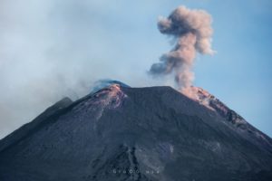
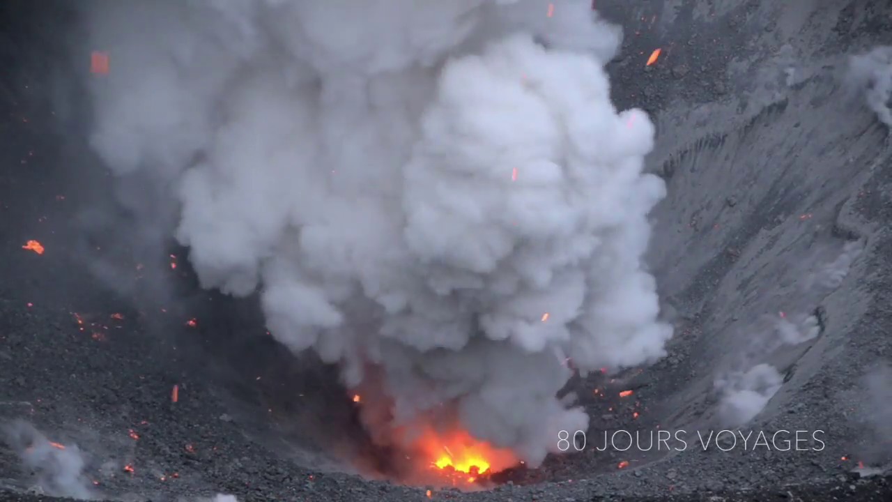
Indonesia , Dukono :
An eruption of Mount Dukono occurred on Sunday, October 8, 2023, at 2:27 p.m. WIT. The height of the eruptive column was observed to be ± 600 m above the peak (± 1,829 m above sea level). The ash column was observed to be white, gray to black with thick intensity, oriented towards the East. At the time of writing, the eruption was still ongoing.
VOLCANO OBSERVATORY NOTICE FOR AVIATION – VONA
Issued : October 06 , 2023
Volcano : Dukono (268010)
Current Aviation Colour Code : ORANGE
Previous Aviation Colour Code : orange
Source : Dukono Volcano Observatory
Notice Number : 2023DUK005
Volcano Location : N 01 deg 41 min 35 sec E 127 deg 53 min 38 sec
Area : North Maluku, Indonesia
Summit Elevation : 3933 FT (1229 M)
Volcanic Activity Summary :
Eruption with volcanic ash cloud at 21h25 UTC (06h25 local).
Volcanic Cloud Height :
Best estimate of ash-cloud top is around 5693 FT (1779 M) above sea level or 1760 FT (550 M) above summit. May be higher than what can be observed clearly. Source of height data: ground observer.
Other Volcanic Cloud Information :
Ash cloud moving to east. Volcanic ash is observed to be white to dark. The intensity of volcanic ash is observed to be thick.
Remarks :
Eruption recorded on seismogram with maximum amplitude 7 mm and maximum duration 54.45 second.
Source : Magma Indonésie
Photo : S Chermette / 80 Jours voyages.
Chile , Villarica :
Sernageomin lowers the alert level of the Villarrica volcano to yellow technical alert
The measure was decreed because the abnormal process that began in the last days of September gradually lost its power, thus reducing the possibility of evolving towards more energetic phases.
– The technical body considered an area of probable impact by volcanic processes within a radius of 2 km around the center of the active crater.
This morning, the National Service of Geology and Mines (Sernageomin) decided to lower the Villarrica volcano to technical yellow alert, which since Sunday September 24 had been on orange alert. The decision was announced during a technical table held at the central level of Senapred in online coordination with the Cogrids of La Araucanía and Los Ríos.

The decision is justified because in recent days the instrumental parameters of the Villarrica volcano have shown a gradual return to moderate activity levels. Volcanic seismicity shows a domain of discrete LP-type signals and some tremor pulses, with energy values that have stabilized at RSAM values (mean measurement of the seismic amplitude of the continuous signal) close to 1 um/sec.
At the same time, surface phenomena have lost power and recurrence, observing gaseous emissions from low altitudes and, on some occasions, with low pyroclastic content. However, some Strombolian explosions have been recorded which eject material in the area near the crater and generate nocturnal incandescent phenomena.
The volcano is monitored with 9 seismological stations, 4 GPS, 2 tiltmeters, 4 IP cameras, 1 IR camera, 1 infrasound microphone, 2 DOAS and a Multigas camera, so that specialists have adequate technology for monitoring the volcano. volcanic activity.
Finally, the authority highlighted the coordination of all the institutions that participated in these 12 days of orange alert.
Source : Sernageomin
Photo : minutoneuquen.com
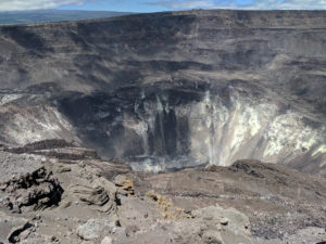
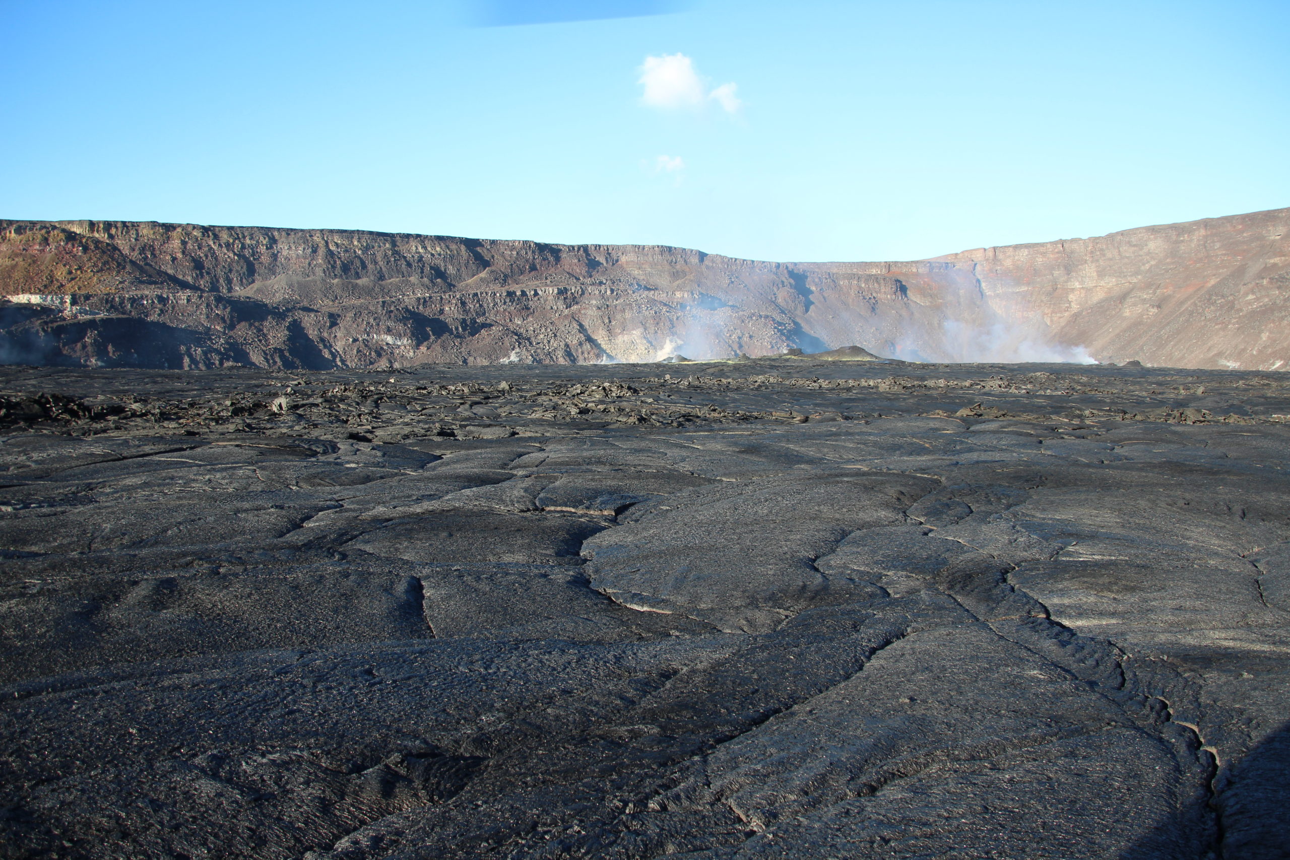
Hawaii , Kilauea :
Saturday, October 7, 2023, 8:58 AM HST (Saturday, October 7, 2023, 18:58 UTC)
19°25’16 » N 155°17’13 » W,
Summit Elevation 4091 ft (1247 m)
Current Volcano Alert Level: ADVISORY
Current Aviation Color Code: YELLOW
Activity Summary:
Kīlauea volcano is not erupting. The area just south of Kīlauea’s summit is showing signs of unrest. No unusual activity has been noted along Kīlauea’s East Rift Zone or Southwest Rift Zone.
Summit Observations:
Ground deformation in the area just south of the summit caldera leveled off around 2:00 a.m. with no appreciable changes in the tilt since then. Inflation at the summit of Kīlauea remains close to its highest level in over 5 years and has nearly returned to the level seen just before the last eruption on September 10th. Seismicity beneath Kīlauea summit region, which began October 4, decreased around 2:00 a.m. and remains low at this time. Over the past 24 hours approximately 170 earthquakes were recorded in Kīlauea summit region compared to about 320 earthquakes occuring over the previous day. Most of the earthquakes from the seismic swarm south of the caldera are at depths of around 2.5–3.5 km (1.5–2 mi) below the surface. The trend of the seismic activity parallels, but is slightly south of the December 1974 eruption vents. Sulfur dioxide (SO2) emission rates remain low and were measured at a rate of about 100 tonnes per day on October 6.
Source : HVO
Photo : USGS / N. Deligne.