June 24 , 2020.
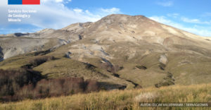
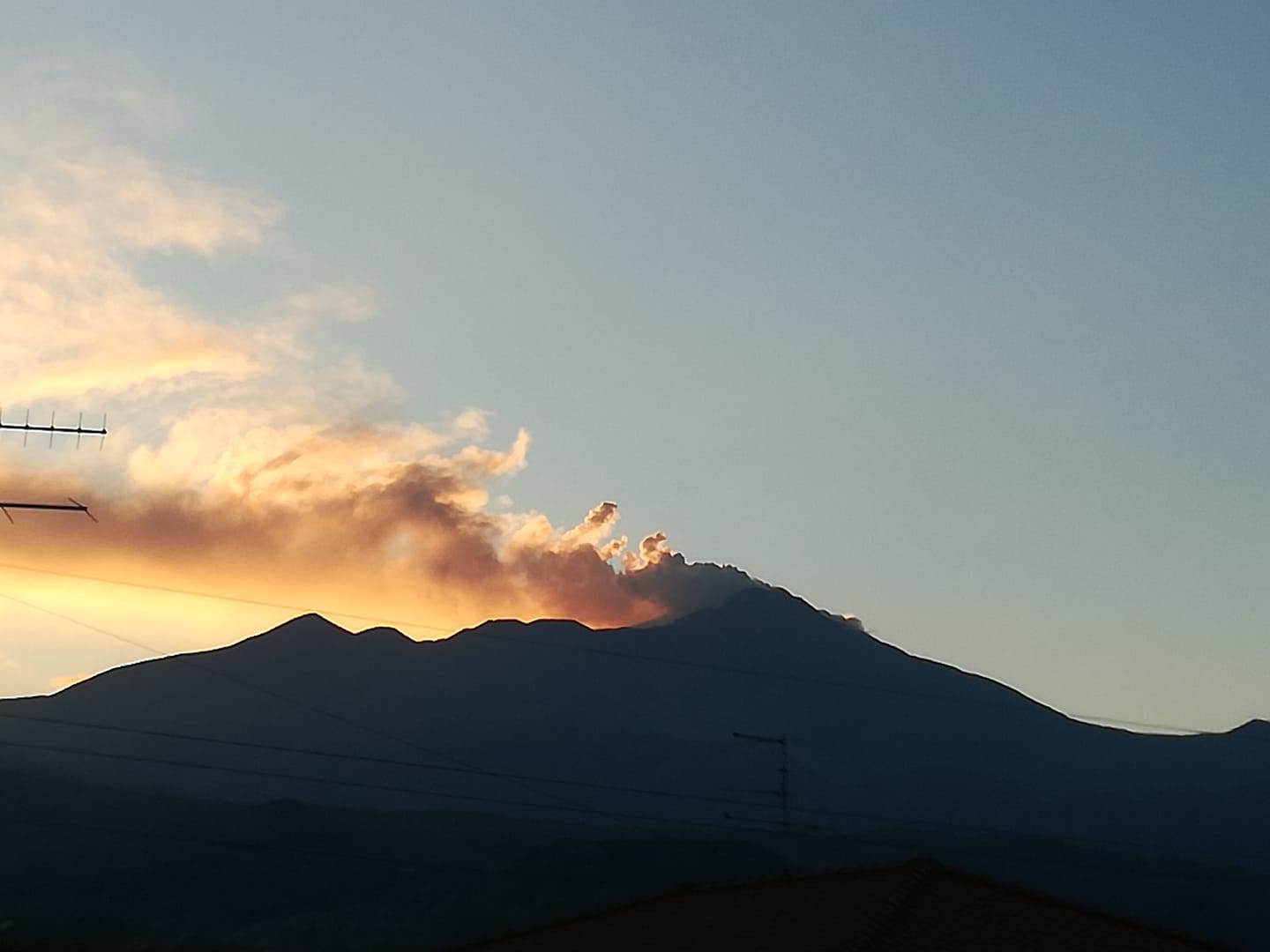
Italy / Sicily : Etna ,
Weekly bulletin from June 15, 2020 to June 21, 2020 (issue date June 23, 2020)
SUMMARY OF THE STATUS OF THE ACTIVITY
In light of the monitoring data, it is underlined:
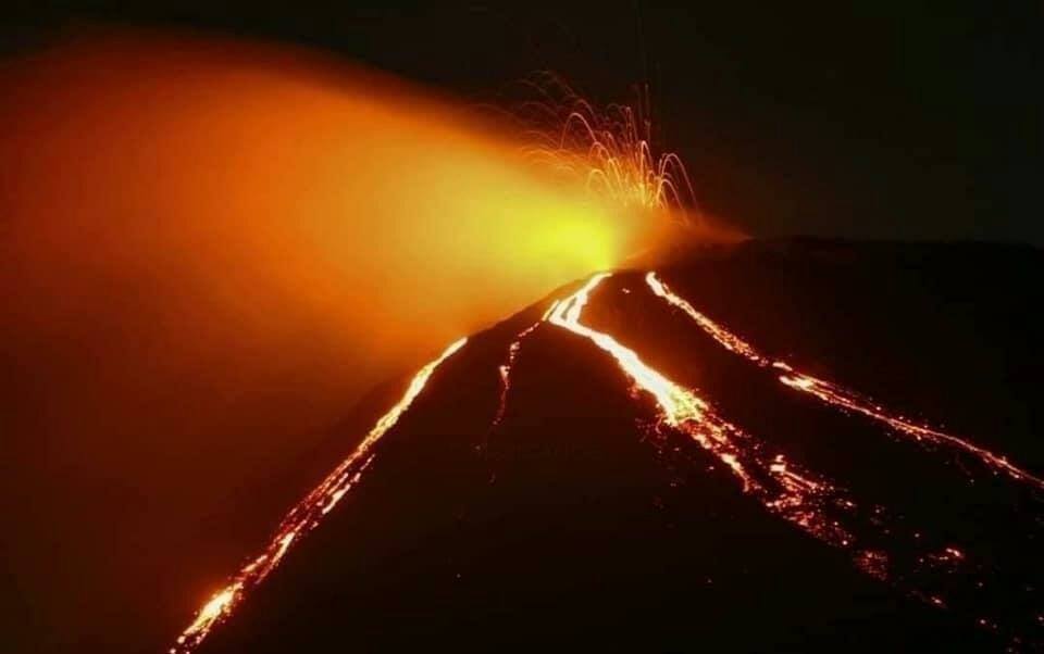
1) VOLCANOLOGICAL OBSERVATIONS: Moderate intra-crater strombolian activity in the New Southeast Crater; sporadic Strombolian explosions with small ash emissions in the Voragine crater.
2) SEISMOLOGY: Moderate seismicity linked to fracturing events; the amplitude of the volcanic tremor remained at high levels with a slight tendency to increase further.
3) INFRASOUND: Moderate infrasonic activity in the region of the Southeast Crater – New Southeast Crater.
4) DEFORMATIONS: The Etna soil deformation monitoring networks did not show any significant changes last week.
5) GEOCHEMISTRY: The flow of SO2 is at a medium-low level.
The average flow of CO2 from soils remains at average values.
The partial pressure of dissolved CO2 does not show significant variations.
C / s values are average values (19/06/2020)
The He isotopic values confirm the downward trend.
6) SATELLITE OBSERVATIONS: The thermal activity in the summit area is low.
VOLCANOLOGICAL OBSERVATIONS
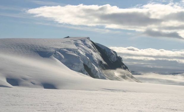
The volcanic activity in the upper craters of Etna was monitored during the week from June 15 to 21, 2020, by analyzing images from the network of surveillance cameras from the INGV Catania section, Etneo Observatory ( INGV-OE) and by remote observations made by INGV staff in the field. Visibility conditions are generally satisfactory, despite certain periodic limitations due to cloud cover.
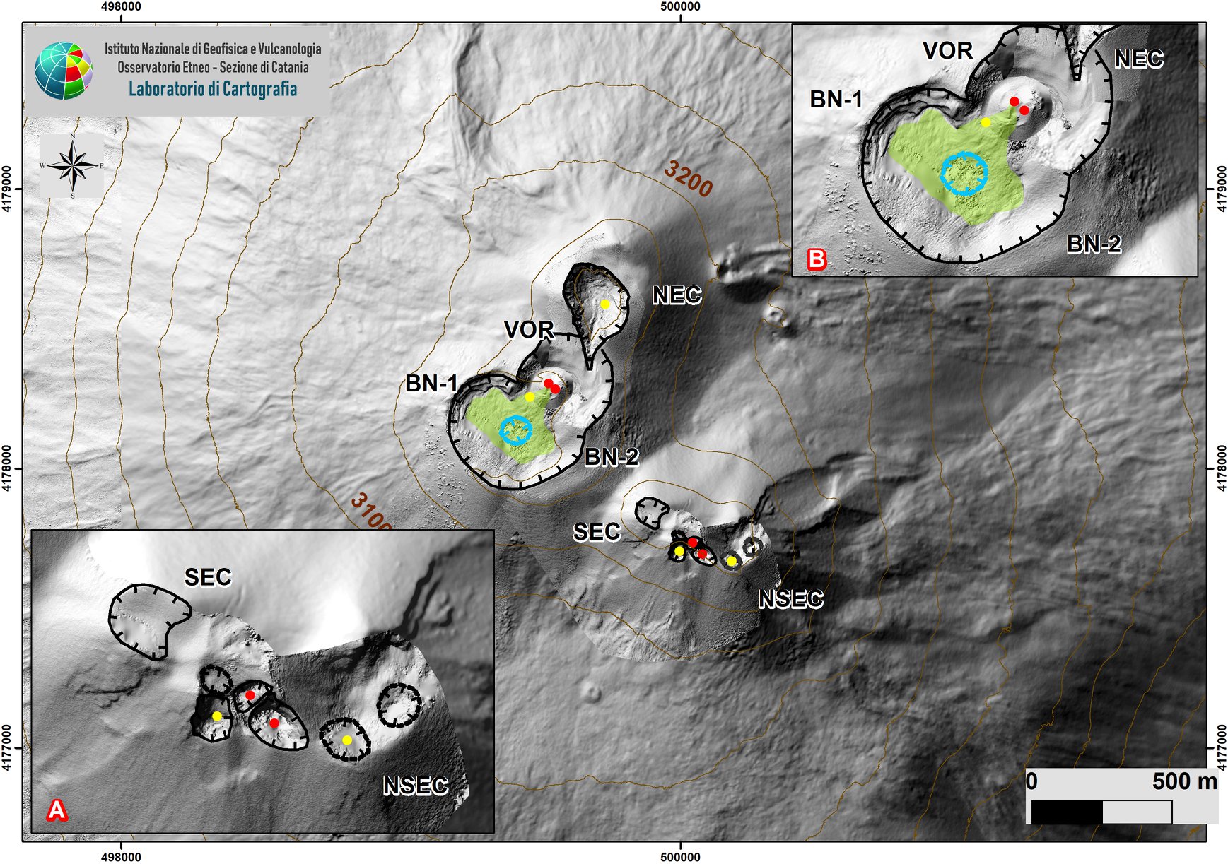
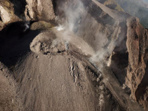
Summit area of Etna with zoom of the sectors linked to the SEC-NSEC system (A) and craters BN and VOR (B) produced by aerial photogrammetry, which show the intra-crater morphology of the two sectors.
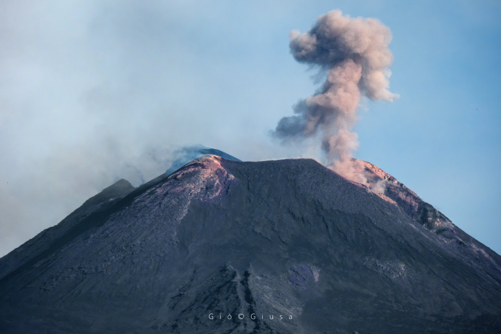
During the period considered, the activity in the upper craters of Etna was mainly characterized by an intense degassing of the open mouths of the Northeast Crater (NEC), the Voragine crater (VOR) and the system of Southeast crater / New Southeast crater (SEC / NSEC), as well as the large fumarolic zones on the edges of the summit craters.
In particular, the modest intra-crater strombolian activity in the « saddle cone » area, described in the bulletins of the previous weeks, continued in the New Southeast Crater. On the surface, this activity continues to produce an intense pulsatile degassing, which translates at night into flashes of variable intensity, sometimes visible even at a considerable distance.
Finally, unique explosions were observed in the crater of Voragine accompanied by modest emissions of ash quickly dispersed in the atmosphere.
Emission from the mouth present on the eastern side of the New Southeast Crater (nsec), May 31, 2020.
Volcanic tremors:
During the week in question, the average amplitude of the volcanic tremor remained at high levels with a slight tendency to increase further. The location of the tremor source is located in the New Southeast Crater area at an altitude of approximately 2.9 to 3.0 km above sea level.
Source : INGV.
Photo : Salvatore Fulvio Persico , Gio Giusa .
Italy , Stromboli :
Weekly bulletin from June 15, 2020 to June 21, 2020 (issue date June 23, 2020)
SUMMARY OF THE STATUS OF THE ACTIVITY
In light of the monitoring data, it is underlined:
1) VOLCANOLOGICAL OBSERVATIONS: During this period, normal explosive activity of Strombolian type was observed accompanied by degassing and splashing activities. The hourly frequency of explosions fluctuated between average values (12-14 events / h) with the sole exception of June 20 with 17 events / h (medium-high value). The intensity of the explosions varied from low to high, both in the area of the North crater and in the area of the Center-South crater.
2) SEISMOLOGY: The seismological parameters do not show significant variations.
4) DEFORMATIONS: The island’s soil deformation monitoring networks did not show any significant variation to report for the period considered.
5) GEOCHEMISTRY: the flow of SO2 is at an average level
The CO2 / SO2 value since the last available updates is at low values (06/21/2020).
The isotopic values of the He of the last update (9/06/2020) are at the mean values.
6) SATELLITE OBSERVATIONS: The thermal activity in the summit area is at a medium-low level.
VOLCANOLOGICAL OBSERVATIONS
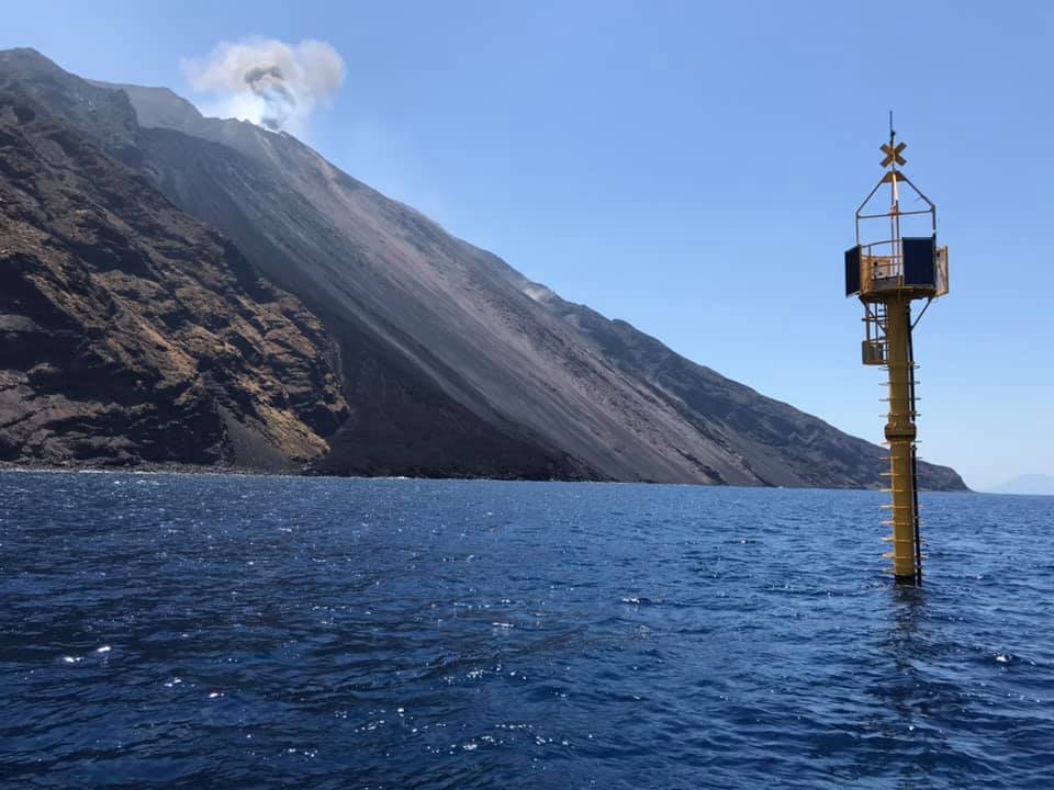
During the observation period, the eruptive activity of Stromboli was characterized by the analysis of the images recorded by the INGV-OE surveillance cameras (altitude 190, Punta Corvi, altitude 400 and Pizzo) and the data collected during of an inspection carried out on day 18 June.
During the inspection carried out on the afternoon of June 18, it was found that the morpho-structural structure of the crater terrace did not present any specific variations compared to what is reported in the bulletin Rep. N ° 25/2020. During the period of absence in the summit area, explosive activity was observed with low frequency values and widespread ash emissions in the Center-South area; rather, the northern zone showed impulsive activity with the production of coarse pyroclastic materials.
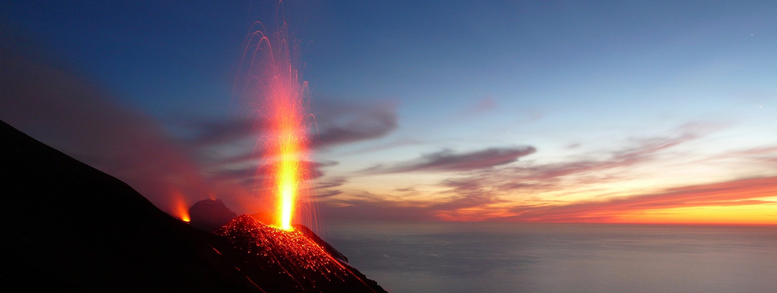
The crater N1 located in the North zone produced mainly explosions of medium and high intensity (the products of many explosions exceeded 150 m in height), which emitted reddish matters (lapilli and bombs) which fell abundantly with a radial distribution. The N2 vent showed an explosive activity of low intensity (less than 80 m in height), with the emission of fine materials (ashes) sometimes mixed with coarse materials. The average frequency of explosions was between 5 and 11 events / h.
In the Center-South zone, the mouth S1 located on the cone facing the Sciara produced low intensity explosions with the emission of fine materials, while the mouth located in the crater S2 produced low intensity explosions to high of mainly fine materials. The two vents located in the Center zone produced an intense activity of splashes continuously interrupted by explosions of coarse materials of low intensity. The frequency of the explosions was between 3 and 7 events / h.
Source : INGV .
Photos : LGS , stromboli adventures.
Guatemala , Pacaya :
SPECIAL VOLCANOLOGICAL BULLETIN
Type of activity: Strombolian.
Morphology: composite stratovolcano
Location: 14 ° 22’50˝ Latitude N; 90 ° 36’00˝ Longitude W.
Height: 2,552 meters above sea level.
INCREASE IN STROMBOLIAN ACTIVITY
The INSIVUMEH seismic network located on the Pacaya volcano has recorded an increase in seismic activity since June 20. This increase in seismicity is linked to two lava flows which extend in a southwest direction over a distance of 650 meters and another in a northwest direction for about 200 meters, simultaneously from eruptive foci at 100 meters from Mackenney crater. At the same time, Strombolian type explosions are recorded which launch incandescent materials at a height of up to 200 meters which form a column of ash 100 meters high, these explosions are heard at a distance of up to 5 kilometers.
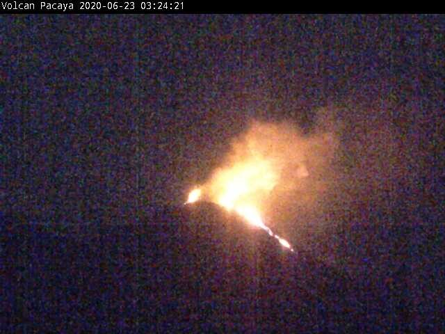
Figure 1 (a) Photograph of the Pacaya volcano, taken by the INSIVUMEH webcam.
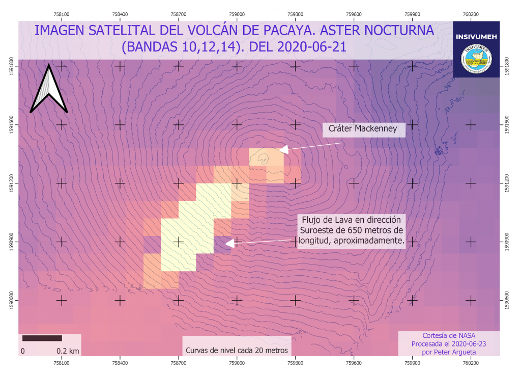
(b) ASTER satellite image at night of the Pacaya volcano on the day 2020-06-21.
In fig. 1, in (a) today’s photograph (June 23) where the effusive activity (lava flow and degassing) of the Pacaya volcano can be observed, in (b) the lava flow in a southwest direction which can be observed It reaches 650 meters on June 21. Lava flows are a common volcanic product in the Pacaya volcano, but they can cause an increase in seismicity when magma rises and fractures parts of the volcanic building that were not previously open and which now expel incandescent materials.
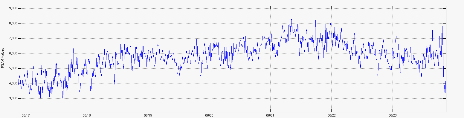
Fig. 2 RSAM (seismic amplitude) graph of the PCG station.
In figure. 2 we can see how the amplitude of the tremor gradually increased due to the extrusion of the material in the eruptive foci, this increase is marked since June 20 due to the lava flows which are constantly supplied with magmatic material.
Source : Insivumeh / Fredy Arnoldo Esquit Chiquitá.
Photos : Abc news. Insivumeh.
Iceland , Seismicity / Reykjanes Peninsula :
An earthquake swarm NE of Siglufjörður is still ongoing. Slight decrease in activity last night but more than 700 earthquakes were detected there since midnight,mainly smaller than M3.0. Since then two earthquakes M3.2 and M3.4 were measured at 10:00 and 10:15 this morning. Yesterday more than 1100 earthquakes were detected, the largest of which measured M4.0 at 12:18 about 30 km NNE of Siglufjördur.
The earthquake swarm began on 19th of June. More than 4500 earthquakes have been detected, three of which measured greater than magnitude 5. The largest was on Sunday at 19:07 of M5.8 around 30 km NNE of Siglufjörður. Other earthquakes above M5.0 were M5.6 and M5.4 and were located around 20 km NE of Siglufjörður.
Seismic activity if still ongoing and there are chances of more earthquakes of this magnitude occurring in the area.
Around 4200 earthquakes were automaticly located by the IMO¿s SIL seismic network in week 25, and at currently around 1000 of them have been manually located. This increased activity to seismic swarm which started north of Iceland on the 19. of June. The swarm counts more than 3300 events, three of which are greater in magnitude than 5.0. The largest earhquake occured on Sunday evening 21. june at 19:07, and measured M5.8 about 30km NNE of the town of Siglufjörður. The other two were detected on Saturday 20. june, first one M5.4 at 15:06 and the latter M5.6 at 19:26. Both events on Saturday were closer to the coastline or 20km NE of Siglufjörður. IMO received numerous reports on all three earthquakes being felt, both far and near the source. Still incresed activity at Reykjanes this week with 540 earthquakes being detected, largest of which was 2.9 in magnitude, that was the largest earthquake outside the swarm in the north.
Source : Vedur is .
Photo : Grímsvötn . ICE-SAR