
May 09 , 2020.
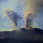
Italy / Sicily , Etna :
PRESS RELEASE ON THE VOLCANIC ACTIVITY OF 08 May 2020, 16:58:58 UTC (18:58:58 LOCAL HOURS) – ETNA
The National Institute of Geophysics and Volcanology, Etnéo Observatory, announces that from 17.00 hours (local hours), there was a slight increase in the emission of ash from the New Crater of the South East, this button activity formed a plume of diluted ash towards the South-South-East. The INGV staff present near the New Southeast Crater observed a strong degassing, with deep rumors and ashes. Regarding the amplitude of the volcanic tremor, it oscillates on average to high values; the location of the source of the tremor is located near the New Southeast Crater, at a depth of about 2800-3000 meters above mean sea level.
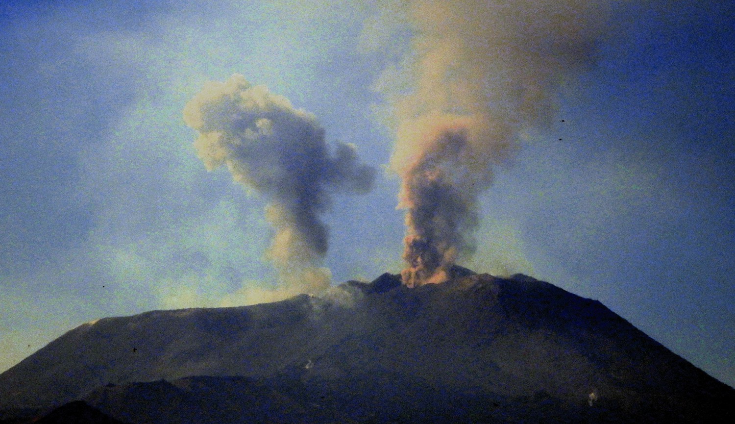
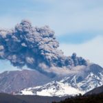
One of the sporadic, but sometimes very strong explosions of the crater of the Voragine of Etna, on the evening of May 8, 2020. Note the two bombs flying to the left, almost exceeding the edge of the Bocca Nuova. Many bombs are falling these days on the south and west side of the Bocca Nuova, but also in the Northeast Crater region.
The photo shows the ash emission from the New Southeast Crater on the right and an explosion from the Voragine crater on the left. Photo taken by Tremestieri Etnéo, on the south side of the volcano, in the late afternoon of May 8, 2020.
UNIFI-LGS press release on ETNA volcanic activity, 08 May 2020, 10:50 UTC
It is reported that as of 09:15 h UTC today, Etna’s automatic infrasonic alert system, from the LGS Experimental Geophysics Laboratory of the Department of Earth Sciences at the University of Florence, is passed in EW1 signaling a strong increase of the explosive activity, above the average, in the craters of the Southeast / New Crater of the Southeast.
This activity is still in progress and is associated with a continuous degassing of the craters of the Southeast / New Crater of the Southeast.
Source : INGV , LGS.
Photos et vidéo : Boris Behncke .
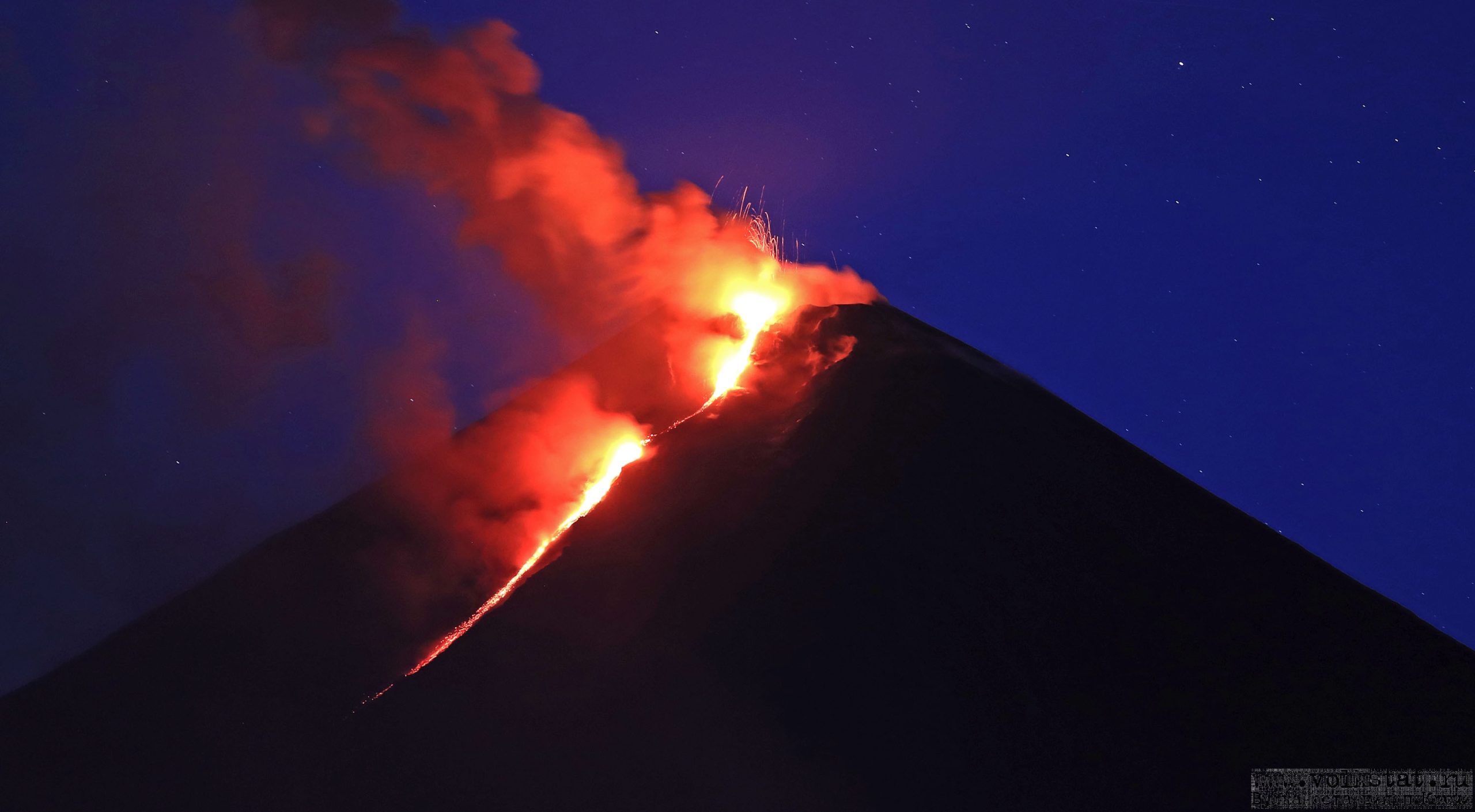
Kamchatka , Klyuchevskoy :
VOLCANO OBSERVATORY NOTICE FOR AVIATION (VONA).
Issued: May 8 , 2020.
Volcano: Klyuchevskoy (CAVW #300260)
Current aviation colour code: ORANGE
Previous aviation colour code: orange
Source: KVERT
Notice Number: 2020-75
Volcano Location: N 56 deg 3 min E 160 deg 38 min
Area: Kamchatka, Russia
Summit Elevation: 15580 ft (4750 m)
Volcanic Activity Summary:
A moderate explosive-effusive eruption of the volcano continues. The Strombolian and sometimes Vulcanian types of volcanic activity is observing. The lava flow continues to move on the southeastern flank of the volcano (the Apakhonchich chute), phreatic bursts and collapse of loose slag material accompany this process. According to satellite data, a gas-steam plume containing some amount of ash is extending about 35 km to the east of the volcano.
This eruption continues. Ash explosions up to 16,400-23,000 ft (5-7 km) a.s.l. could occur at any time. Ongoing activity could affect low-flying aircraft.
Volcanic cloud height:
19680 ft (6000 m) AMSL Time and method of ash plume/cloud height determination: 20200508/0310Z – Himawari-8
Other volcanic cloud information:
Distance of ash plume/cloud of the volcano: 22 mi (35 km)
Direction of drift of ash plume/cloud of the volcano: E / azimuth 84 deg
Source : Kvert .
Photo : Volkstat ru.
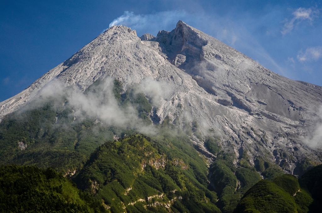
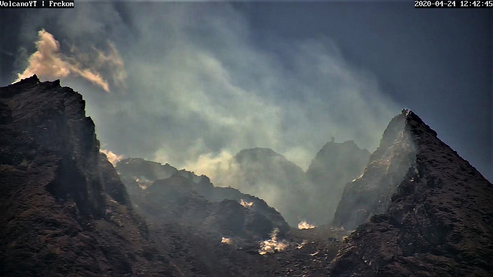
Indonesia , Merapi :
Activity report of the Merapi volcano from May 1 to 7, 2020.
RESULTS OF OBSERVATIONS:
Visuals.
The weather around Mount Merapi is generally sunny in the morning and at night, while the day until the afternoon is foggy. There is a white smoke, of weak to strong thickness with a low pressure. A maximum smoke height of 400 m was observed from the Mount Merapi observation post in Kaliurang on May 6, 2020 at 6:15 a.m. EST.
Morphological analysis of the crater area based on photos of the Southeast sector showed no change in the morphology of the dome. The volume of the lava dome based on measurements using aerial photos with drones on February 19, 2020 was 291,000 m3.
Seismicity:
During this week, the seismicity of Mount Merapi recorded:
34 emission earthquakes (DG),
76 multi-phase earthquakes (MP),
50 avalanche earthquakes (RF),
14 tectonic earthquakes (TT).
The intensity of the seismicity this week is higher than last week.
Deformation:
The deformation of G. Merapi who was monitored by EDM this week did not show any significant change.
Rain and lahars:
This week, there was rain at the Mount Merapi observation post with the highest rain intensity of 26 mm / hour for 30 minutes at the Kaliurang post on May 1, 2020. There was neither lahars nor additional flow in the rivers that descend from Mount Merapi.
Conclusion:
Based on the results of the visual and instrumental observations, it was concluded that:
1. The lava dome is currently in a stable state.
2. The volcanic activity of Mount Merapi is still quite high and is determined by the level of activity « WASPADA ».
3. The current potential danger is in the form of hot clouds from the collapse of the lava dome and emissions of volcanic material from explosive eruptions.
Source : BPPTKG.
Photos : Azimuth Adventure Travel. Frekom.
Guatemala , Fuego :
Special bulletin of volcanology, May 8, 2020, 11:08 p.m. local time.
SPECIAL VOLCANOLOGICAL BULLETIN BEFGO # 12-2020, LAHARS in the SANTA TERESA AND MINERAL ravines.
The descent of moderate to strong lahars is reported at 10:30 p.m. (local time) in the ravines of Santa Teresa and Mineral, located on the western flank of the volcano, which in turn are tributaries of the Rio Pantaleón.
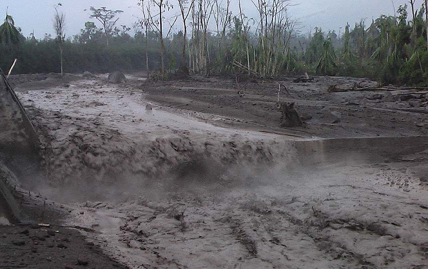
The INSIVUMEH seismic network located on the Fuego Volcano, records high frequency seismic tremors, generated by volcanic materials which descended at 9:00 p.m. (local time) in the form of a lahar in the upper part of the Las ravine. Lajas due to the rain that occurs in the area of the volcanic building. Currently, 37.4 mm of precipitation is recorded at station FG12.
Heavy rains in the upper part of the ravines of the volcanic complex generate the descent of weak to moderate lahars, these can transport branches of trees and volcanic materials such as ash and blocks of 1 to 2 meters in diameter which make the ground vibrate. If the rain persists, the generation of other lahars in these or other ravines of the volcanic complex is not excluded.
Source : Insivumeh / Jose Jose Leonardo Quexel Hernandez .
Photo : Caroline Sarrazin , Rés-EAUx .


No comment yet, add your voice below!