August 13 , 2021.
Alaska , Semisopochnoi :
1°55’44 » N 179°35’52 » E,
Summit Elevation 2625 ft (800 m)
Current Volcano Alert Level: WATCH
Current Aviation Color Code: ORANGE
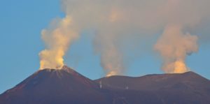
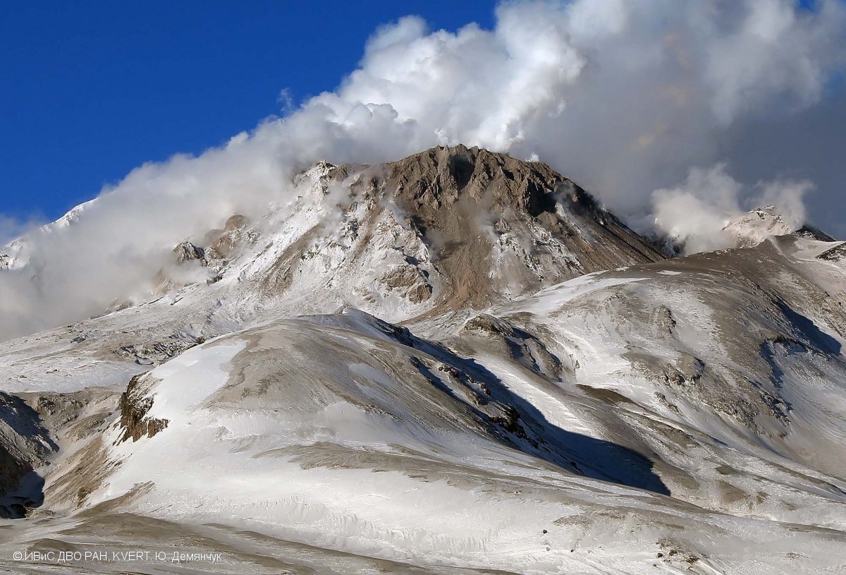
Over 20 small explosions were detected from North Cerberus crater at Semisopochnoi over the past day. None of these were noted in satellite images, and a steady, low-level steam plume, possibly containing ash, was observed in clear web camera images this morning. Ash emissions from these explosions are likily similar to recent days, but not always detected due to low altitudes and cloud cover.
Degassing of the Cerberus cone on the Semisopochnoi.
Small eruptions producing minor ash deposits within the vicinity of the active north crater of Mount Cerberus and ash clouds under 10,000 feet above sea level have characterized the recent activity and show no signs of abating. Small explosions may continue and could be difficult to detect especially during poor weather conditions.
Semisopochnoi is monitored by local seismic and infrasound sensors, satellite data, web cameras, and remote infrasound and lightning networks.
Source : AVO
Photo : Read, Cyrus / Alaska Volcano Observatory / U.S. Geological Survey.
Kamchatka , Sheveluch :
VOLCANO OBSERVATORY NOTICE FOR AVIATION (VONA)
Issued: August 13 , 2021
Volcano: Sheveluch (CAVW #300270)
Current aviation colour code: ORANGE
Previous aviation colour code: orange
Source: KVERT
Notice Number: 2021-86
Volcano Location: N 56 deg 38 min E 161 deg 18 min
Area: Kamchatka, Russia
Summit Elevation: 3283 m (10768.24 ft), the dome elevation ~2500 m (8200 ft)
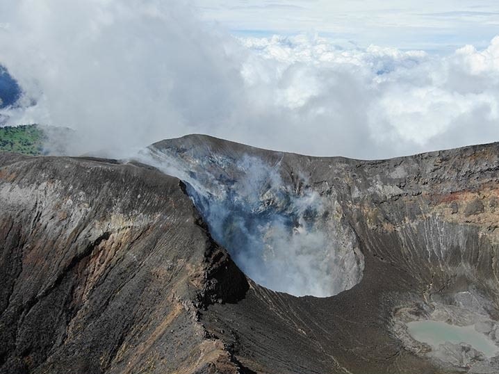
The fumarole activity of the lava dome of Molodoy Sheveluch volcano on 24 January, 2020.
Volcanic Activity Summary:
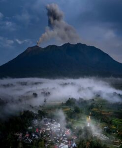
Activity of the volcano continues. Satellite data showed a gas-steam plume containing some amount of ash is extending for 110 km to the southwest of the volcano.
The extrusive eruption of the volcano continues. Ash explosions up to 10-15 km (32,800-49,200 ft) a.s.l. could occur at any time. Ongoing activity could affect international and low-flying aircraft.
Volcanic cloud height:
1500 m (4920 ft) AMSL Time and method of ash plume/cloud height determination: 20210813/0120Z – Himawari-8
Other volcanic cloud information:
Distance of ash plume/cloud of the volcano: 110 km (68 mi)
Direction of drift of ash plume/cloud of the volcano: SW / azimuth 224 deg
Time and method of ash plume/cloud determination: 20210813/0120Z – Himawari-8
Source : Kvert
Photo : Yu. Demyanchuk, IVS FEB RAS, KVERT.
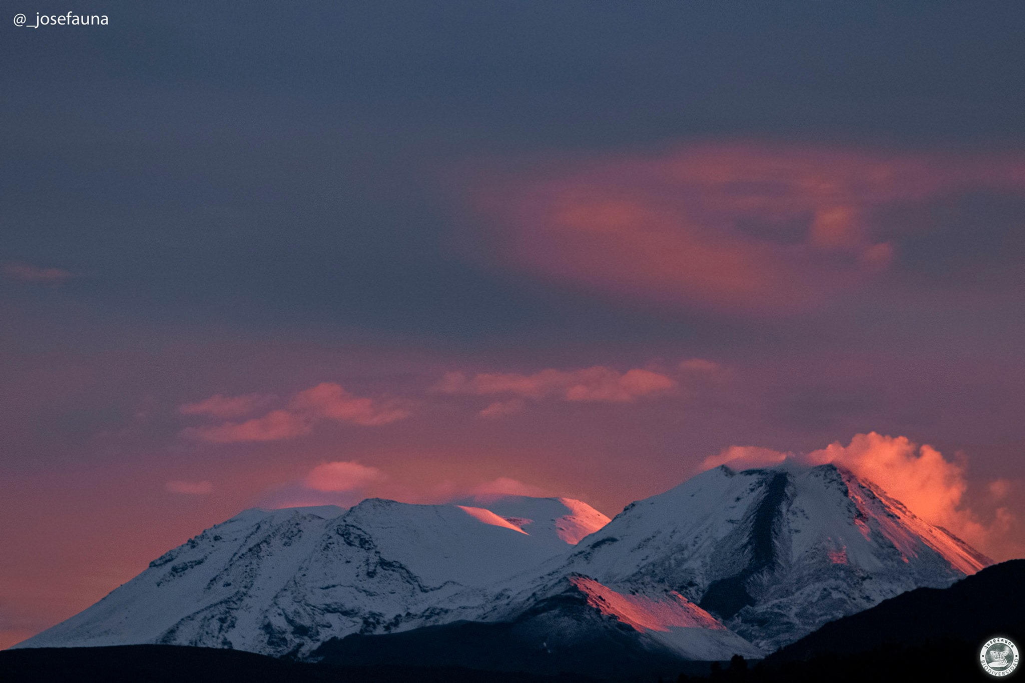
Chile , Nevados de Chillan :
Special Report on Volcanic Activity (REAV), Region of Ñuble, Nevados de Chillán Volcanic Complex, August 13, 2021, 01:30 local time (Continental Chile).
The National Service of Geology and Mines of Chile (Sernageomin) publishes the following PRELIMINARY information, obtained through the monitoring equipment of the National Volcanic Monitoring Network (RNVV), processed and analyzed at the Volcanic Observatory of the Southern Andes ( Ovdas):
Today, Friday August 13 at 00:46 and 01:04 local time (04:46 and 05:04 UTC), the monitoring stations installed near the volcanic complex of Nevados de Chillán recorded two earthquakes associated with fluid dynamics in the volcanic system (type Long period).
The characteristics of earthquakes after their analysis are as follows:
ORIGINAL TIME: 00:46 local time (04:46 UTC)
LATITUDE: 36,870 ° S
LONGITUDE: 71.373 ° W
DEPTH: 0.8 km
REDUCED DISPLACEMENT: 550 (cm * cm)
ACOUSTIC SIGNAL: 20.3 Pascals (Pa) reduced to 1 km.
ORIGINAL TIME: 01:04 local time (05:04 UTC)
LATITUDE: 36.868 ° S
LONGITUDE: 71.375 ° W
DEPTH: 1, km
REDUCED DISPLACEMENT: 534 (cm * cm)
ACOUSTIC SIGNAL: 4.06 Pascals (Pa) reduced to 1 km.
The characteristics of the associated major surface activity are as follows:
MAXIMUM HEIGHT OF THE INCANDESCENCE: 160 meters above the point of emission
DIRECTION OF DISPERSION: Not observable.
The volcanic technical alert level remains at: Yellow Level.
Source : Sernageomin
Photo : josefauna.
Hawaii , Kilauea :
19°25’16 » N 155°17’13 » W,
Summit Elevation 4091 ft (1247 m)
Current Volcano Alert Level: ADVISORY
Current Aviation Color Code: YELLOW
Activity Summary:
Kīlauea volcano is not currently erupting. No surface activity has been observed by field crews or in webcam images since May 23, 2021. Low rates of ground deformation and modest rates of seismicity continue across the volcano. Sulfur dioxide (SO2) emission rates are close to the low levels associated with the non-eruptive period from late 2018 to late 2020. It is possible that the Halema‘uma‘u vent could resume eruption or that Kīlauea is entering a longer period of quiescence prior to the next eruption.
Summit Observations:
The latest field visit to Halema‘uma‘u and Kīlauea caldera in the past weeks confirmed continued fumarole degassing and no changes to the crater floor. SO2 emission rates continue to be low, consistent with a return to non-eruptive period from late 2018 to late 2020 (30-35 t/d) and are well below emission rates from mid-February to mid-April (~800 t/d). Summit tiltmeters continued to record gradual inflation over the past week until last night when a change to deflationary tilt occurred. Summit GPS instruments continue to show inflation. Seismicity rates remain unchanged in the past week.
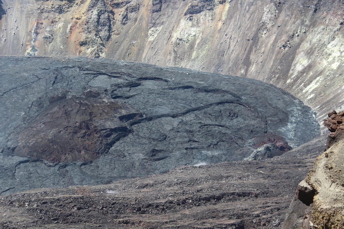
On Tuesday, August 10, HVO scientists traversed the west and south rims of Halema‘uma‘u, at the summit of Kīlauea, to collect photos of the inactive lava lake from many different angles. Such a collection of photos will enable the construction of a three-dimensional model of the crusted lake surface using structure-from-motion software. Here, the western end of the lava lake is seen from a vantage to the north-northwest. The scientists did not observe any significant changes to recent eruptive features during their visit.
Halemaʻumaʻu Lava Lake Observations:
The lake’s surface is completely covered by solidified lava crust and no surface activity has been observed over the past week.
East Rift Zone Observations:
Seismicity persisted along the upper East Rift Zone this past week. Together with the geodetic monitoring, the observations suggest that the summit and upper East Rift Zone continue to be replenished with magma. By contrast, the Lower East Rift Zone was mostly quiet.
Source : HVO.
Photo : USGS / M. Zoeller.
Costa Rica , Turrialba / Poas / Rincon de la Vieja / Irazu :
Volcanic Watch Program Weekly Bulletin August 9, 2021
Turrialba volcano:
Lat: 10.025 ° N;
Longitude: 83.767 ° W;
Height: 3340 m.s.n.m.
Current activity level: 2 (active volcano)
Potentially associated hazards: gas, ash emission, proximal ballistic projections, acid rain.
The last eruption took place on July 26. Seismic activity remains stable, similar to the previous week. Short tremors and LPs type events were recorded, almost no harmonic tremors or VT type events detected. Tracking of « tone codes » remains stable. Geodetic tracking by GPS shows a stable trend towards less marked contraction than in the first half of this year. The SO2 flow has a weekly average of 191 +/- 126 t / d, similar to the previous week.
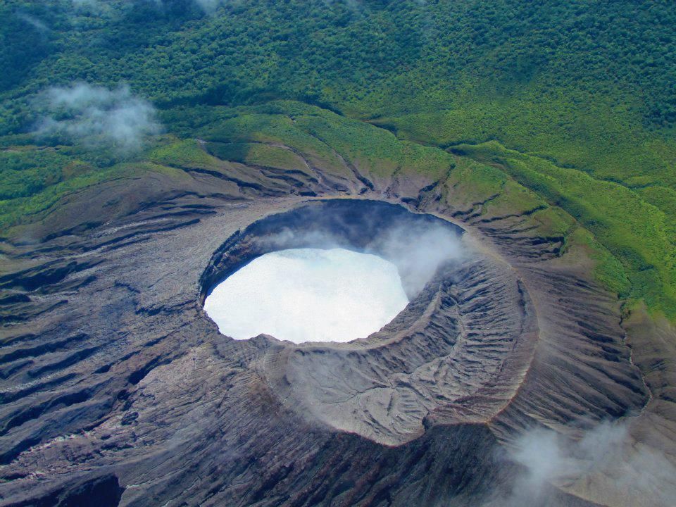
Poas volcano:
Lat: 10.2 ° N;
Longitude: 84.233 ° W;
Height: 2780 m.s.n.m.
Current activity level: 2 (active volcano)
Potentially associated hazards: gas, phreatic eruptions, proximal ballistic projections, lahars, acid rain.
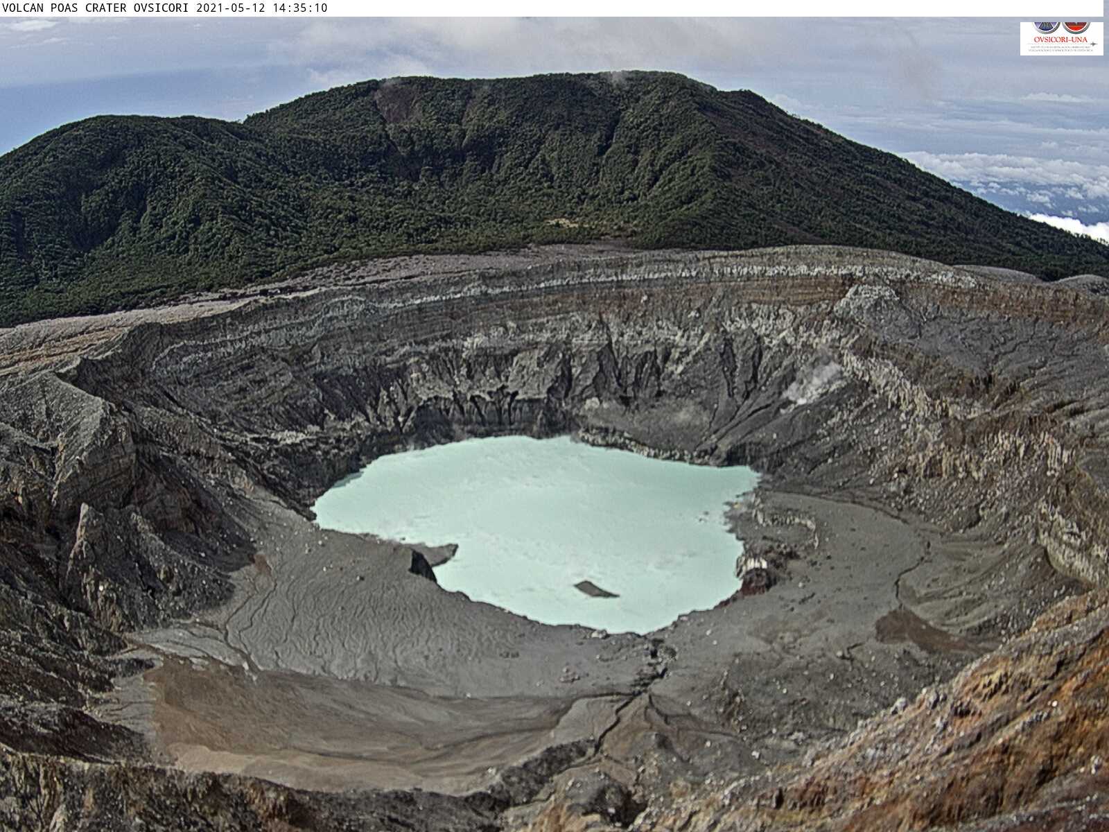
No eruption was observed. Regular short tremors continue to be recorded (every 10-11 min), but the amplitude has decreased and are not always detected depending on the background noise level. Very distal VT-type events and a swarm of superficial proximal VT-type events were recorded under the crater on July 27. Sometimes a synchronization is observed between the activity of certain convection cells in the lake and the shaking. Monochromatic tremors are recorded with large slips at high frequencies. The GPS geodetic monitoring shows an inflation spanning a period of 7 months and a small extension over a period of 3 months. The H2S / SO2 and SO2 / CO2 gas ratios have remained low and stable since the start of the year. The SO2 flow shows a weekly average of 84 +/- 25 t / d, very similar to that of the previous week. The level of the hyperacid lake has risen by about ~ 10cm over the past week.
Rincón de la Vieja volcano:
Lat: 10.83 ° N;
Longitude: 85.324 ° W;
Height: 1895 m.s.n.m.
Current activity level: 2 (active volcano)
Potentially associated hazards: lahars, gas, phreatic eruptions, proximal ballistic projections, ash falls, acid rain.
The last phreatic eruption occurred on July 31, 2021, after heavy rains. After the eruption, the continuous tremor ceased to be recorded. Since the end of June, a decrease in RSAM has been observed, which fell after the last eruption. “Tornillos type events” are maintained at a frequency close to 8 Hz, and their amplitude is low. GPS geodetic tracking shows a bit of extension over a 3 month period and top contraction in recent weeks.
On August 12, 2021 at 10:52 a.m. local time, an eruption was recorded on the Rincón de la Vieja volcano, the height reached by the column is unknown due to the visibility conditions of the site.
Duration of the activity: 4 minutes.
Ash fall reported in: No ash fall reported
Sulfur odor reported in: No sulfur odor reported
Comments: There was a small eruption on the Rincón de la Vieja volcano. Right now the site is cloudy.
Irazu volcano
Lat: 9.979 ° N;
Longitude: 83.852 ° W;
Altitude: 3432 m.s.n.m.
Current activity level: 1 (active volcano)
Potentially associated risks: landslides, lahars, proximal ballistic projections, acid rain, ash falls, debris avalanches.
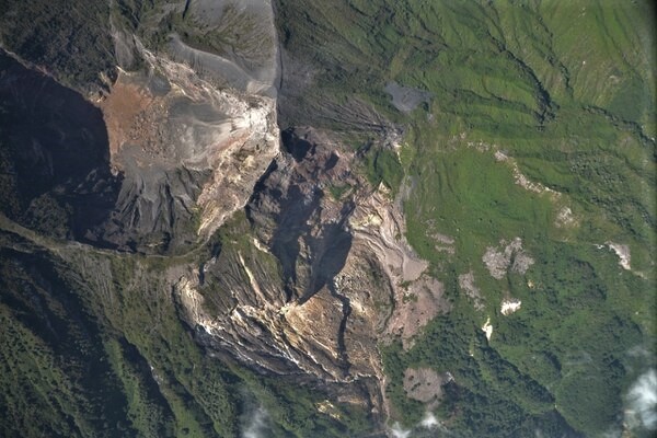
The main landslide in the area of the communication towers at the top of the Irazú remains stable, no significant change has been observed in the speeds of the permanent GNSS station in this area.
Source : Ovsicori .
Photos : G. Avard / Ovsicori , Ovsicori , Raul Mora / RSN / UCR , Federico Chavarría Kopper .