November 15 , 2020.
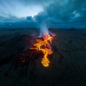
Indonesia , Dukono :
VOLCANO OBSERVATORY NOTICE FOR AVIATION – VONA.
Issued : November 13 ,2020
Volcano : Dukono (268010)
Current Aviation Colour Code : ORANGE
Previous Aviation Colour Code : orange
Source : Dukono Volcano Observatory
Notice Number : 2020DUK99
Volcano Location : N 01 deg 41 min 35 sec E 127 deg 53 min 38 sec
Area : North Maluku, Indonesia
Summit Elevation : 3933 FT (1229 M)
Volcanic Activity Summary :
Eruption with volcanic ash cloud at 23h03 UTC (08h03 local).
Volcanic Cloud Height :
Best estimate of ash-cloud top is around 5213 FT (1629 M) above sea level, may be higher than what can be observed clearly. Source of height data: ground observer.
Other Volcanic Cloud Information :
Ash-cloud moving to south.
Remarks :
Eruption and ash emission is continuing.
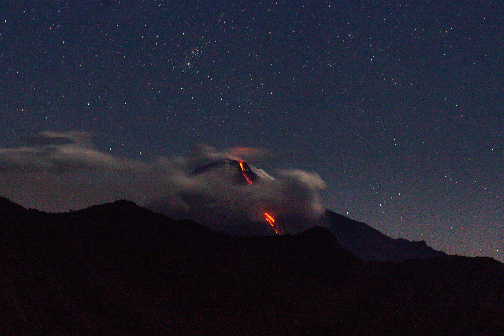
Level of activity level II (WASPADA). The Dukono (1229 m above sea level) is continuously erupting. The last eruption occurred on November 4, 2020, resulting in a column height of 400 m. The color of the ash column ranged from white to gray.
The volcano was clearly visible until it was covered in fog. The smoke from the crater was observed to be white and gray with high intensity about 100-700 meters above the peak. The weather is sunny, cloudy to rainy, the wind is weak in the south. The air temperature is around 26-31 ° C.
According to the seismographs of November 14, 2020, it was recorded:
2 distant tectonic earthquakes
Continuous tremor, amplitude 0.5-6 mm (dominant value 2 mm)
Source : Magma Indonésie , PVMBG.
Photo : PGA.
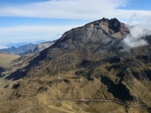
Ecuador , Sangay :
DAILY REPORT ON THE STATE OF SANGAY VOLCANO, Saturday November 14, 2020.
Surface activity level: High, Surface trend: Increasing.
Internal activity level: High, Internal trend: Increasing.
Seismicity: From November 13, 2020, 11:00 a.m. to November 14, 2020, 11:00 a.m.
Long period type events (LP): 40
Emission tremor (TE): 1
Explosions (EXP): 111.
Rains / lahars:
Moderate rains were recorded yesterday afternoon and in the evening.
** In case of heavy rains, lahars can be generated in the Volcán, Upano rivers and other tributaries **
Emission / ash column: Gas and ash emissions were observed between 1000 and 2000 meters above the level of the crater in a northwest, north and northeast direction. The Washington VAAC reported gas and ash emissions between 1,170 and 2,070 meters above the summit, dispersing in a northwest and west direction.
Other monitoring parameters: FIRMS recorded 2 thermal alerts, MIROVA reported 1 low thermal alert and 1 moderate thermal alert in the last 24 hours.
Observations: The volcano sector was partially cleared in the late afternoon yesterday and early in the morning today, the rest of the time it remained cloudy.
Alert level: yellow.
Source : IGEPN.
Photo : TopMotor Storee ( Sept 2020).
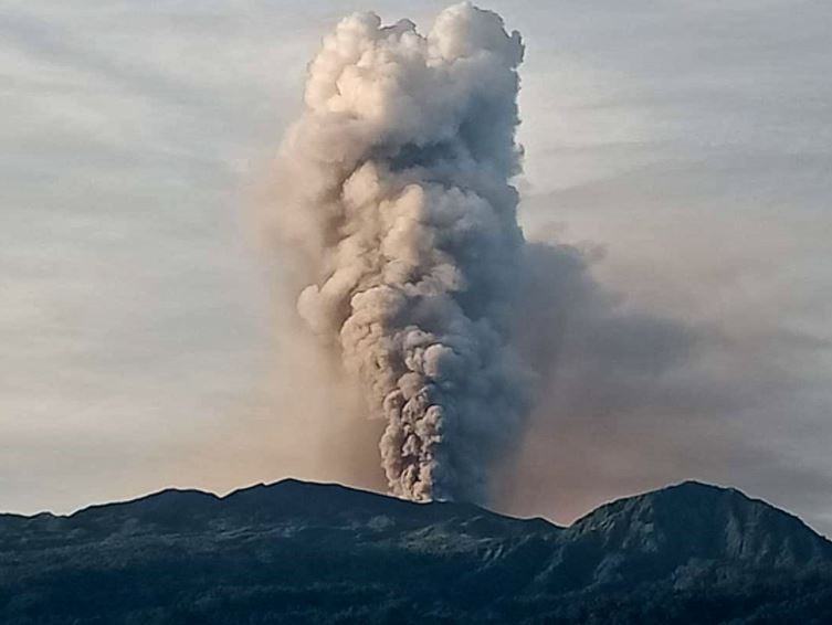
Guatemala , Pacaya :
Activity:
Strombolian type explosions are recorded, mostly weak and some moderate, which expel incandescent materials. At the same time, long periods of incandescence accompanied by a degassing in blue and white tones are observed in the crater which disperses towards the west. The activity of the lava flows continues on the southwest flank.
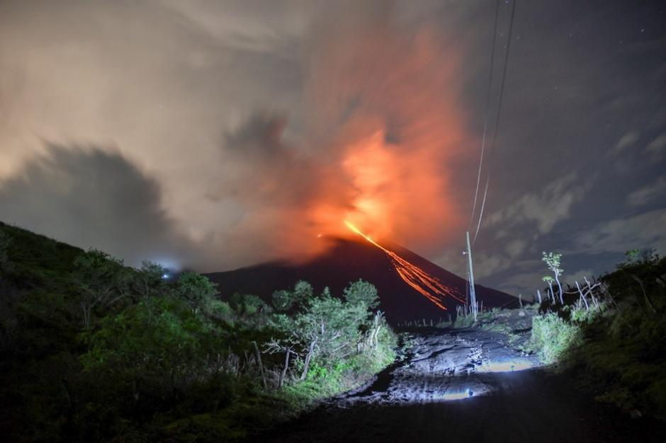
The length of the lava flow varies between 800 and 1200 meters approximately and moves towards the southwest. Observations made during the night and early in the morning allowed us to observe a new lava flow, which begins in an upper part of this same flank. The appearance of more lava flows on other flanks or the generation of degassing columns with abundant ash is not excluded. INSIVUMEH seismic stations continuously record tremors, associated with the rise of magma, as well as the permanent degassing observed in the crater.
Source : Insivumeh
Photo : photographe inconnu via objectif volcan
Alaska , Korovin :
52°22’54 » N 174°9’55 » W,
Summit Elevation 5030 ft (1533 m)
Current Volcano Alert Level: ADVISORY
Current Aviation Color Code: YELLOW
Low-level seismicity, composed of small, mainly low-frequency earthquakes, was recorded at Korovin Volcano throughout the past week. No eruptive activity was detected by infrasound sensors or in satellite views of the volcano.
Korovin is monitored by local seismic and infrasound sensors, satellite data, and regional lightning detection instruments.
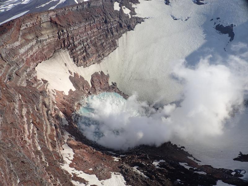
Korovin Volcano’s crater and its lake during helicopter flight to measure gas emissions.
Korovin Volcano is a 1553-m-high (5030 ft) stratovolcano located on the northern part of Atka Island in the central Aleutian Islands, about 21 km (13 mi) north of the community of Atka, 538 km (350 mi) west of Dutch Harbor, and 1760 km (1100 mi) southwest of Anchorage. The volcano has two distinct summit vents about 0.6 km (2000 ft) apart, that have been the sites of eruptive activity in historical time. The most recently active of the vents maintains a small, roiling, lake that occasionally produces energetic steam emissions. Thermal springs and fumaroles located on and near the volcano indicate an active hydrothermal system. Korovin has erupted several times in the past 200 years, including 1973, 1987, and 1998, and has likely had small ash emissions as recently as 2005. Typical recent Korovin eruptions produce minor amounts of ash and occasional but small lava flows. Reports of the height of the ash plume produced by the 1998 eruption ranged from 4,900 to 10,600 m (16,000 to 35,000 feet) above sea level.
Source : AVO.
Photo : Kelly, Peter