September 09 , 2020.
Italy / Sicily , Etna :
Weekly bulletin from August 31, 2020 to September 06, 2020, (issue date September 08, 2020)
SUMMARY OF THE STATE OF ACTIVITY
In the light of the surveillance data, it is highlighted:
1) VOLCANOLOGICAL OBSERVATIONS: Strombolian activity alternating with ash emission at the New Southeast Crater, Strombolian activity within the crater of the Northeast Crater. The crater of Voragine and Bocca Nuova showed degassing activity.
2) SEISMOLOGY: Low seismic activity of fracturing; mean amplitude of volcanic tremor fluctuating in the range of mean values.
3) INFRASON: Low infrasound activity.
4) DEFORMATIONS: The Etna soil deformation monitoring networks did not show any significant variations during the last week. The inflationary tendency of the whole volcanic building remains.
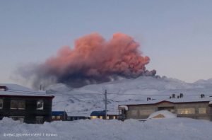
The Southeast Crater complex with the « mood swings » of its Bocca della Sella, Sud Etna September 8, 2020
5) GEOCHEMISTRY: The flow of SO2 occurs at a medium-low level
The flow of HCl is at a medium-low level The flow of CO2 emitted by the soil is at a medium-low level.
The partial pressure of dissolved CO2 in groundwater is at average values.
There are no new measures relating to the C / S report (last measure of 17/07/2020)
Helium isotope ratio measurements show a slight increasing trend (last measurement dated 08/31/2020)
6) SATELLITE OBSERVATIONS: The thermal activity in the summit area is at a medium-low level.
VOLCANOLOGICAL OBSERVATIONS
The monitoring of the volcanic activity of Etna, during the week in question, was carried out by analyzing the images of the surveillance cameras of the INGV, Etneo Observatory (INGV-OE), and through observations carried out by INGV staff. OE in the summit area.
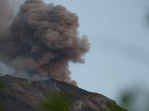
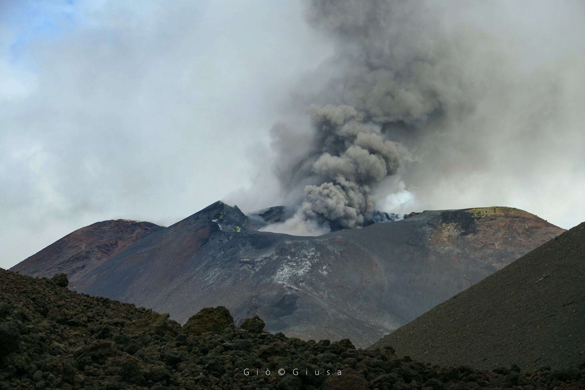
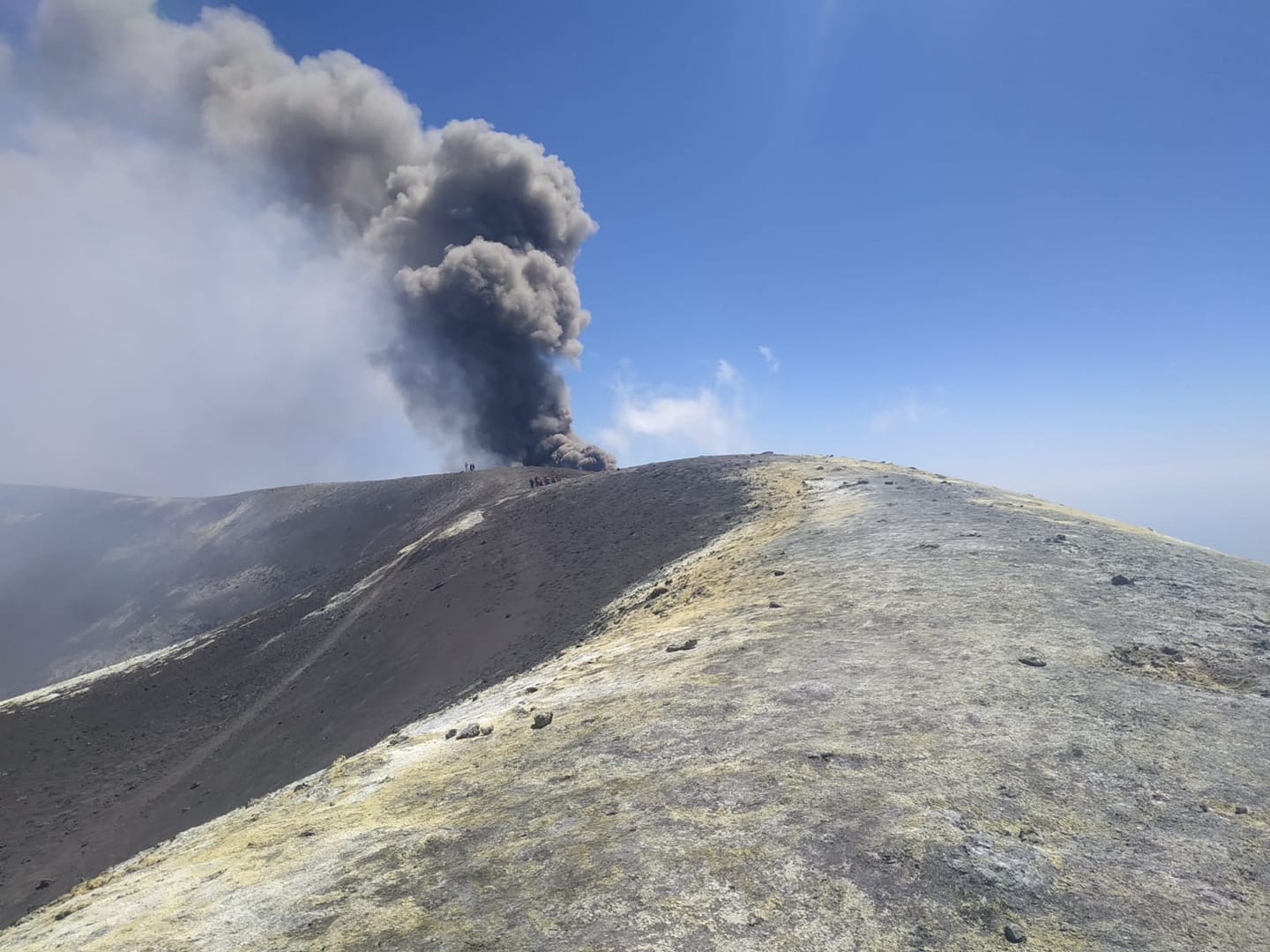
In particular, the New Southeast Crater was characterized by an intracrater explosive activity variable in frequency and intensity which, during the most energetic phases, produces the launch of coarse pyroclastic material above the crater rim. Finally, volcanic ash emissions persist sporadically, with the formation of diluted clouds that are rapidly dispersed in the atmosphere. This activity continues to contribute to the widening of the mouth of the « saddle cone », which now also affects the Southeast Crater, forming a single volcanic system as a whole.
Volcanic tremor:
The average amplitude of the volcanic tremor showed a similar trend to that of the last few weeks, with fluctuations, both gradual and sudden, almost exclusively in the range of average values. Only at the beginning of the week, that is to say on the morning of August 31, the amplitude values reached the high level. The source of the tremor was located between 2800 and 3000 m above sea level and in the area of the New Southeast Crater.
Source : INGV .
Photos : Gio Giusa , Guide Alpine Vulcanologiche Etna.
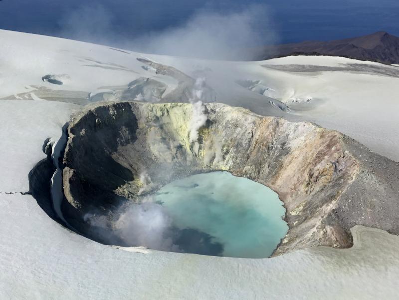
Alaska , Makushin :
AVO/USGS Volcanic Activity Notice
Current Volcano Alert Level: NORMAL
Previous Volcano Alert Level: ADVISORY
Current Aviation Color Code: GREEN
Previous Aviation Color Code: YELLOW
Issued: Tuesday, September 8, 2020, 1:52 PM AKDT
Source: Alaska Volcano Observatory
Location: N 53 deg 53 min W 166 deg 55 min
Elevation: 5906 ft (1800 m)
Area: Aleutians
Volcanic Activity Summary:
Seismicity at Makushin Volcano has been steadily declining for months, following an earthquake sequence that began on June 15, 2020. This earthquake sequence was focused within an area about 6 miles (10 km) east of the summit at a depth of about 5 miles (8 km). Current observations indicate seismic activity has returned to background levels, and thus the Aviation Color Code and the Volcano Alert Level are being decreased to GREEN/NORMAL. Other data streams showed no signs of surface changes during the seismic sequence that started in June. The volcano is monitored with a network of seismic instruments, web camera, GPS, satellite data, and regional infrasound and lightning detection instruments.
Recent Observations:
[Volcanic cloud height] n/a
[Other volcanic cloud information] n/a
Remarks:
Makushin volcano is located on northern Unalaska Island in the eastern Aleutian Islands. Makushin is a broad, ice-capped stratovolcano which rises to an elevation of 6680 feet. The summit caldera, 3 km diameter, is the site of frequent steam and minor ash eruptions; however, no large eruptions have occurred in this century. The community of Unalaska and port of Dutch Harbor are located 25 km (16 miles) east of Makushin volcano.
Source : AVO .
Photo : Herstand, Malcolm
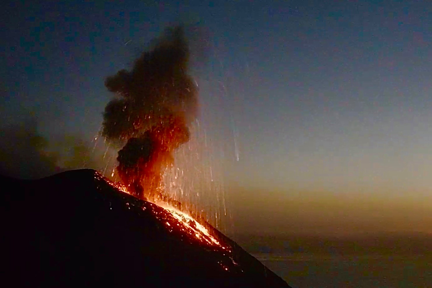
Italy , Stromboli :
Weekly bulletin from August 31, 2020 to September 06, 2020, (issue date September 08, 2020)
SUMMARY OF THE STATE OF ACTIVITY
In the light of the surveillance data, it is highlighted:
VOLCANOLOGICAL OBSERVATIONS: Strombolian explosive activity characterized by an hourly frequency ranging from medium-low to medium (9-12 events / h), average intensity of the North crater area and medium-high of the Center-South.
2) SEISMOLOGY: The seismological parameters do not show significant variations.
4) DEFORMATIONS: The island’s soil deformation monitoring networks did not show any significant changes during the period under review.
5) GEOCHEMISTRY: SO2 flow at a medium-low level
There are no updates on the soil CO2 flux data.
The CO2 / SO2 ratio measurement station was restored on 09/02/2020 and the last measurement is at medium – low values.
The isotopic values of Helium (last update on 08/24/2020) are at medium-low values.
6) SATELLITE OBSERVATIONS: The thermal activity in the summit area is at a medium-low level.
VOLCANOLOGICAL OBSERVATIONS
In the period under observation, the eruptive activity of Stromboli was characterized by the analysis of the images recorded by the surveillance cameras INGV-OE located at an altitude of 190 m, from Punta dei Corvi and 400 m. The Pizzo camera was damaged during the event of July 19, 2020 and the station is being restored in the INGV-OE laboratories.
The eruptive activity of the North crater area, with three emission points, produced low to high intensity explosions from vent N1 (the products of some explosions exceeded 200 m in height) with coarse material (lapilli and bombs) mixed with fine materials (ash) which fell with a radial distribution. Vent N2 showed low intensity explosive activity (less than 80 m in height) with release of coarse materials. The average frequency of explosions varied between 3 and 12 events / h.
From the Center-South zone, the explosions emitted mainly fine materials mixed with coarse materials, with a medium-high intensity (the products emitted often exceeded 250 m in height).
The frequency of the explosions varied between 3 and 8 events / h.
The amplitude of the volcanic tremor generally had values between low and medium-low.
Source : INGV .
Photo : Webcam
Colombia , Nevado del Ruiz :
Nevado del Ruiz volcano activity bulletin.
The activity level continues at the yellow activity level or (III): changes in the behavior of volcanic activity.
Seismicity generated by rock fracturing showed a decrease in the number of earthquakes and the seismic energy released, compared to the previous week. This type of seismicity was located mainly in the Arenas crater and in the North-East and East sectors and, to a lesser extent, in the South and South-East of the volcano. The depth of the earthquakes varied between 0.5 and 5.8 km. The maximum magnitude recorded during the week was 1.6 ML (local magnitude) corresponding to the earthquake recorded on 06 September at 8:21 am (local time), located 2.4 km northeast of the Arenas crater, 3.5 km deep.

Seismicity linked to fluid dynamics inside volcanic conduits showed an increase in the number of events and the seismic energy released, compared to the previous week. This seismic activity was characterized by the appearance of continuous volcanic tremor, of tremor pulses, of long and very long period type earthquakes, which presented variable energy levels and spectral content. This seismicity was localized around the Arenas crater.
The deformation of the volcanic surface, measured from GNSS (Global Navigation Satellite System) stations and electronic inclinometers, did not show any additional changes compared to those reported in recent weeks.
Source et photo : SGC.
Iceland , Reykjanes Peninsula :
Around 750 earthquakes were detected by the IMO¿s SIL seismic network this week. This is a lot less activity than last week when around 2000 earthquakes were located due to the seismic swarms in the North and on Reykjanes peninsula. The activity in the North continues and a little less than 400 earthquakes were located there this week.
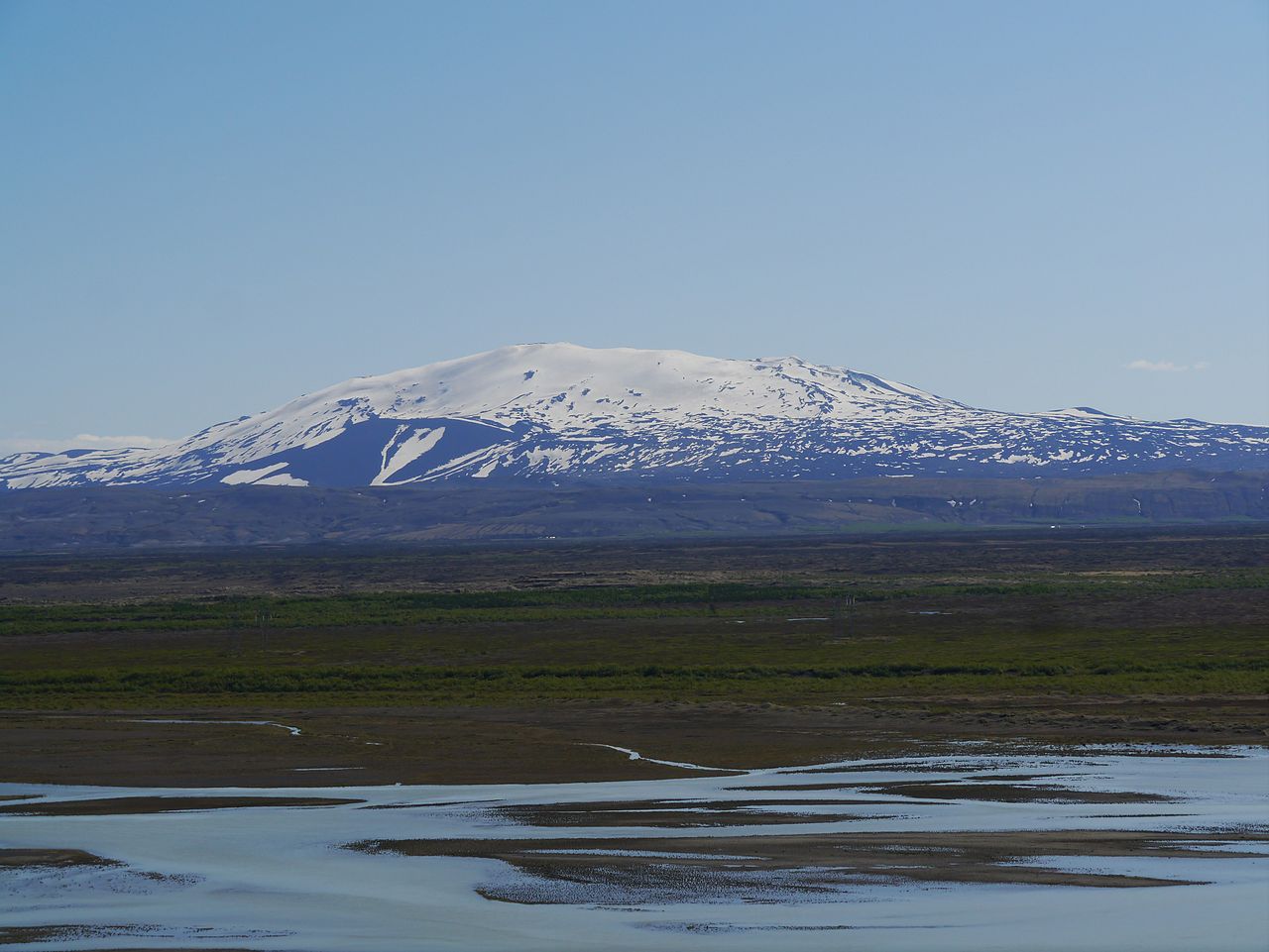
The activity on Reykjanesskagi also continues and around 230 earthquakes were located there this week. The largest earthquake of the week was detected on Kolbeinsey ridge, M3,2 on September 3rd at 04:01 am. It was followed by few other events around M3,0. On September 3rd at 22:53 an M3,0 was detected near Kleifarvatn and was felt in large parts of the SW corner of Iceland. On September 3rd at 12:39 pm an earthquake of M3,1 was detected in the northern part of Katla caldera. Two earthquakes where detected in both Grímsvötn and Öræfajökull this week and all was quiet near Mt. Hekla.
Source : Vedur is .
Photo : Hekla : Zairon / wikipedia .