September 04 , 2020.
Hawaii , Kilauea :
19°25’16 » N 155°17’13 » W,
Summit Elevation 4091 ft (1247 m)
Current Volcano Alert Level: NORMAL
Current Aviation Color Code: GREEN
Activity Summary:
Kīlauea Volcano is not erupting. Monitoring data for the month of August show variable but typical rates of seismicity and ground deformation, low rates of sulfur dioxide emissions, and only minor geologic changes since the end of eruptive activity in September 2018.
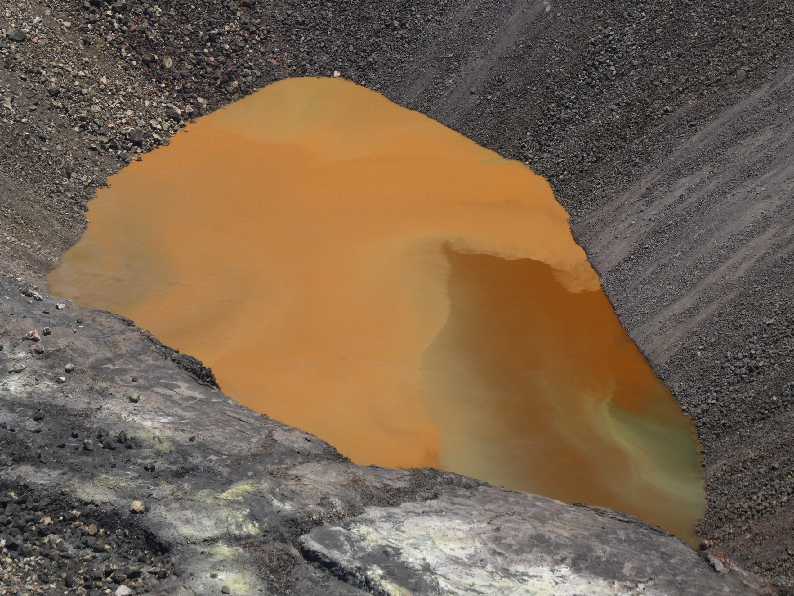
Kīlauea summit lake colors were vibrant today, and shifting from minute to minute. This photo was taken from the KWcam site shortly after the photo above. The western end of the lake (lower right in photo) was darker brown with a greenish patch of transparent water. USGS photo by M. Patrick.
Observations:
There were approximately 950 earthquakes during the month of August at Kīlauea, a decrease of roughly 10% from the number of July earthquakes. Of these, one was a M4.2 under the Pāhala region/Kīlauea SWRZ.
Over the past month, summit tiltmeters recorded 12 deflation-inflation events–an slight decrease from last month’s total. The long-term trend of deformation at Kilauea’s summit and middle East Rift Zone continue to show inflation, consistent with magma supply to the volcano’s shallow storage system. GPS stations on Kīlauea’s south flank continue to show elevated rates of seaward motion. HVO continues to carefully monitor all data streams along the Kīlauea East Rift Zone and south flank for important changes.
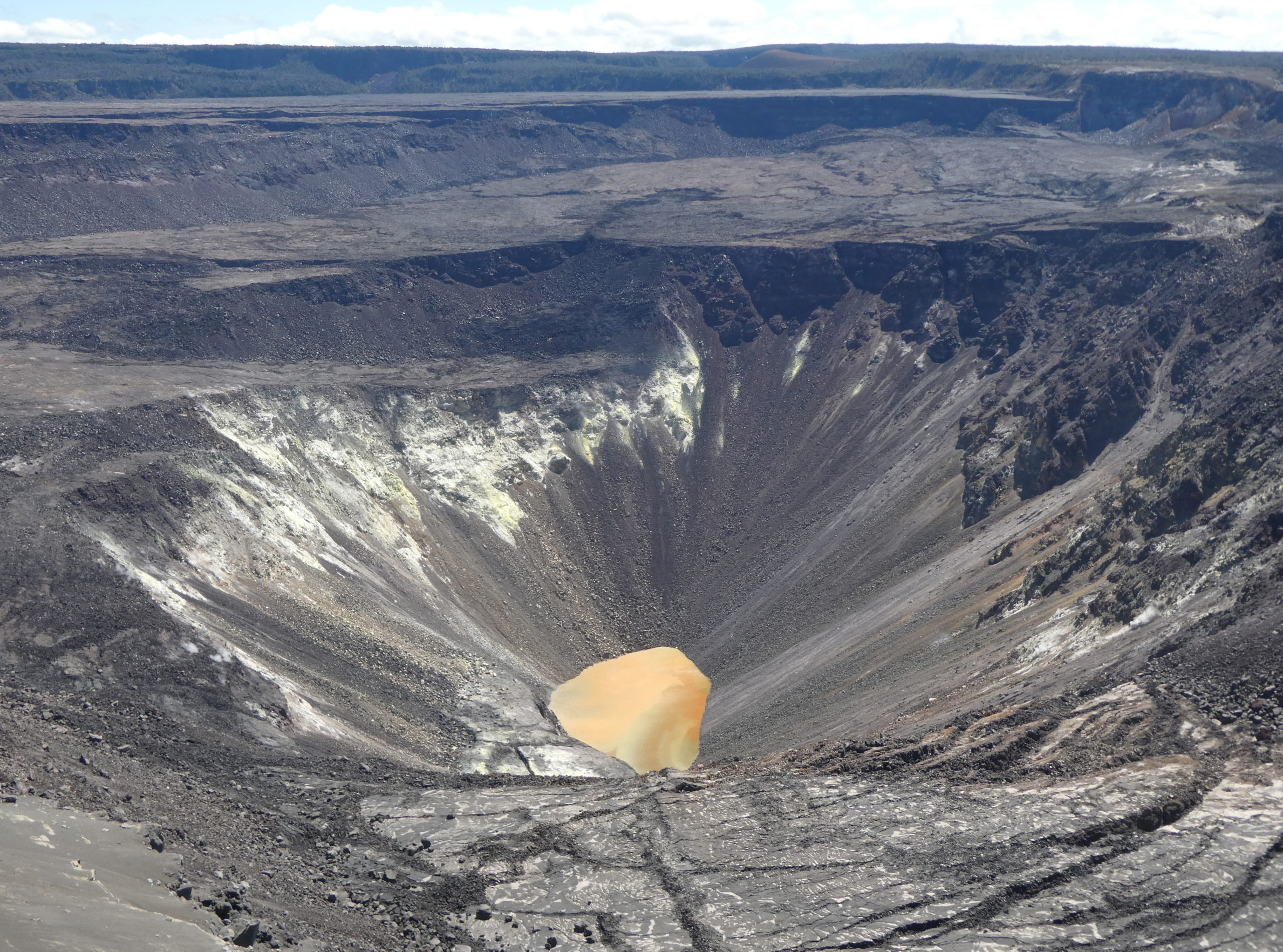
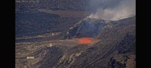
No major changes were observed at Kīlauea’s summit water lake during today’s visit. The lake color was mostly tan to brown, with a patch of greenish water in the western end . USGS photo by M. Patrick.
Sulfur dioxide emission rates are low at the summit, consistent with no significant shallowing of magma. Some amount of sulfur dioxide is being dissolved into shallow groundwater and the crater lake at the bottom of Halema’uma’u; work continues to try and quantify this process. As of September 1st, the lake depth was approximately 43 meters or 140 feet. The crater lake was last sampled by UAS in January and additional sampling with UAS is planned. Sulfur dioxide emission rates are below detection limits at Puʻu ʻŌʻō and the lower East Rift Zone
Although not currently erupting, areas of persistently elevated ground temperatures and minor release of gases are still found in the vicinity of the 2018 lower East Rift Zone fissures. These include steam (water), very small amounts of hydrogen sulfide, and carbon dioxide. These conditions are expected to be long-term. Similar conditions following the 1955 eruption continued for years to decades.
Source : HVO.
Photos : USGS par M. Patrick.
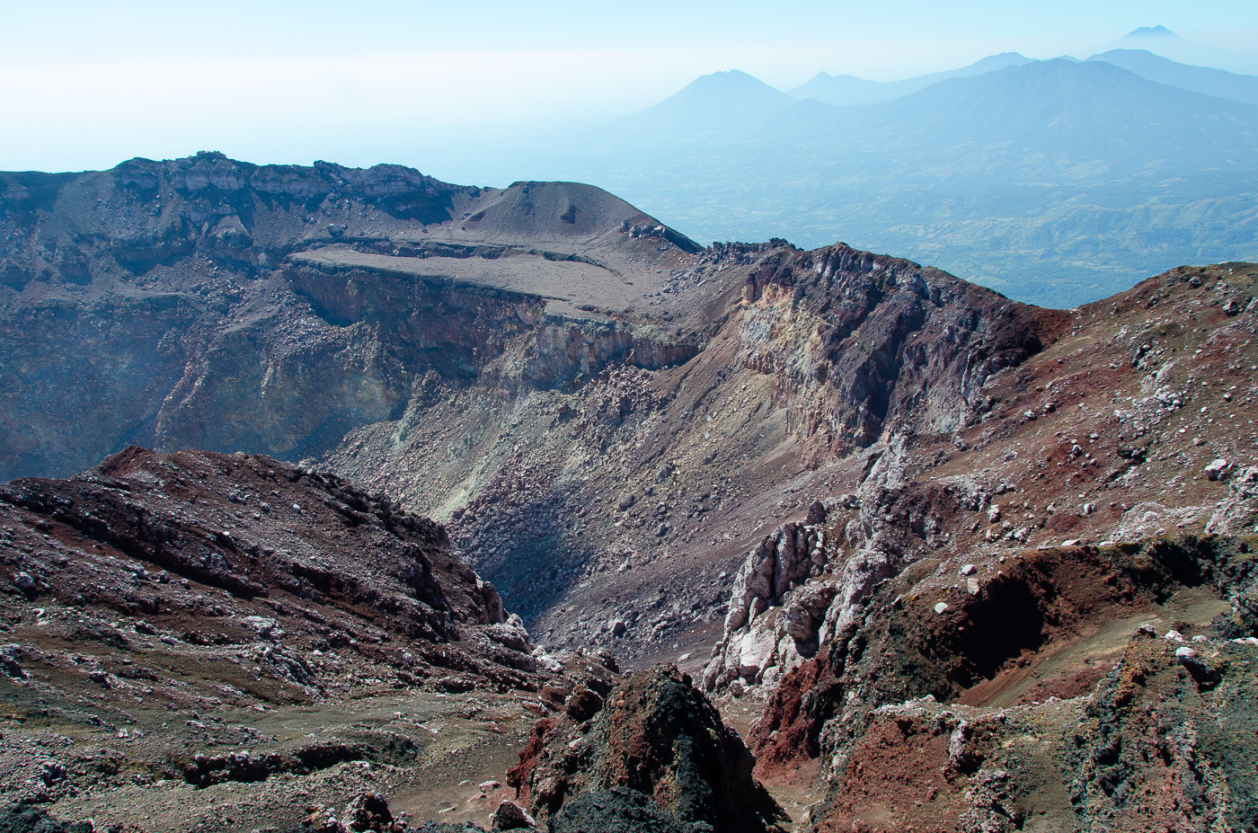
El Salvador , San Miguel ( Chaparrastique ) :
Location: San Miguel department
Altitude: 2130 meters above sea level
Type of volcano: Stratovolcano
Type of activity: Strombolian-Vulcanian
Last significant eruption: December 29, 2013
It is important to point out that in June, July and August of this year, the San Miguel volcano presented a stable level of activity, that is, it did not show signs of unrest, despite the heavy rains received.
During the month of August, the seismic vibration of the volcano in RSAM units remained below the threshold of 150 units, fluctuating between 46 and 67 RSAM units per day on average. No earthquake was perceived by the population living in the region of the volcano.
Sulfur dioxide (SO2) emissions remained fluctuating between 61 and 361 tonnes / d, that is to say below the threshold of 620 tonnes / d, indicating that there was no increase of magma. So, in August, the volcano was calm. However, it is not excluded that the subduction earthquakes south of the volcano may induce another magmatic rise and suddenly change the activity of the volcano, as it did before, so it is suggested to mountaineers and the general population, to avoid visiting the crater area.
Source : Marn .
Photo : Auteur inconnu.
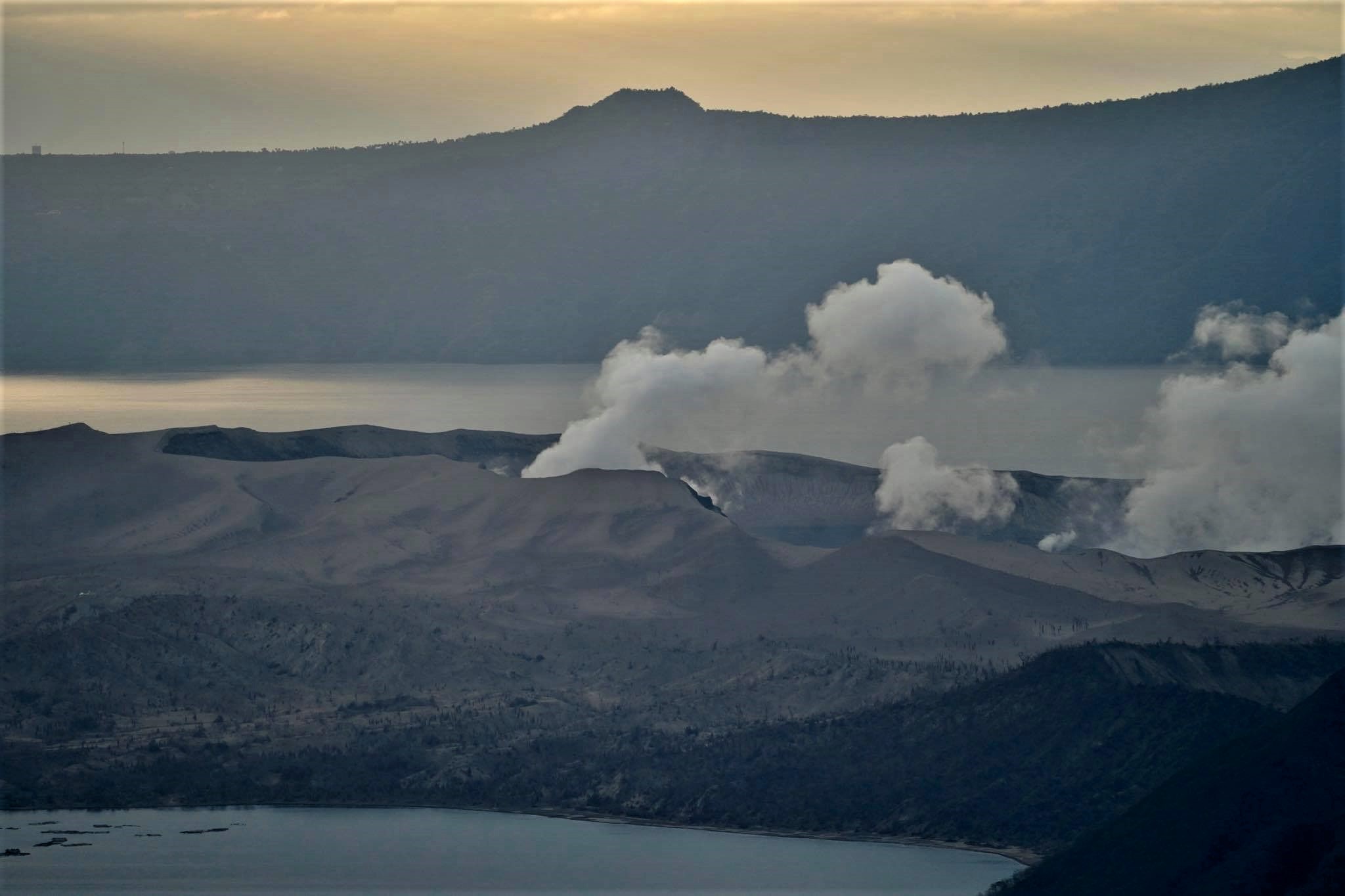
Philippines , Taal :
TAAL VOLCANO BULLETIN: 04 September 2020 08:00 A.M.
In the past 24-hour period, the Taal Volcano Network recorded seven (7) volcanic earthquakes. Weak steaming or fumarolic activity rising 10 meters high before drifting southwest was observed from vents on the Main Crater and fissure vents along the Daang Kastila Trail.
Alert Level 1 (Abnormal) is maintained over Taal Volcano. DOST-PHIVOLCS reminds the public that at Alert Level 1, sudden steam-driven or phreatic explosions, volcanic earthquakes, minor ashfall, and lethal accumulations or expulsions of volcanic gas can occur and threaten areas within the Taal Volcano Island (TVI). DOST-PHIVOLCS strongly recommends that entry into TVI, Taal’s Permanent Danger Zone or PDZ, especially the vicinities of the Main Crater and the Daang Kastila fissure, must remain strictly prohibited. Local government units are advised to continuously assess previously evacuated barangays around Taal Lake for damages and road accessibilities and to strengthen preparedness, contingency, and communication measures in case of renewed unrest. People are also advised to observe precautions due to ground displacement across fissures, possible ashfall, and minor earthquakes. Civil aviation authorities must advise pilots to avoid flying close to the volcano as airborne ash and ballistic fragments from sudden explosions and wind-remobilized ash may pose hazards to aircraft.
DOST-PHIVOLCS is closely monitoring Taal Volcano’s activity and any new significant development will be immediately communicated to all stakeholders.
Source : Phivolcs .
Photo : Raffy Tima ( archive)
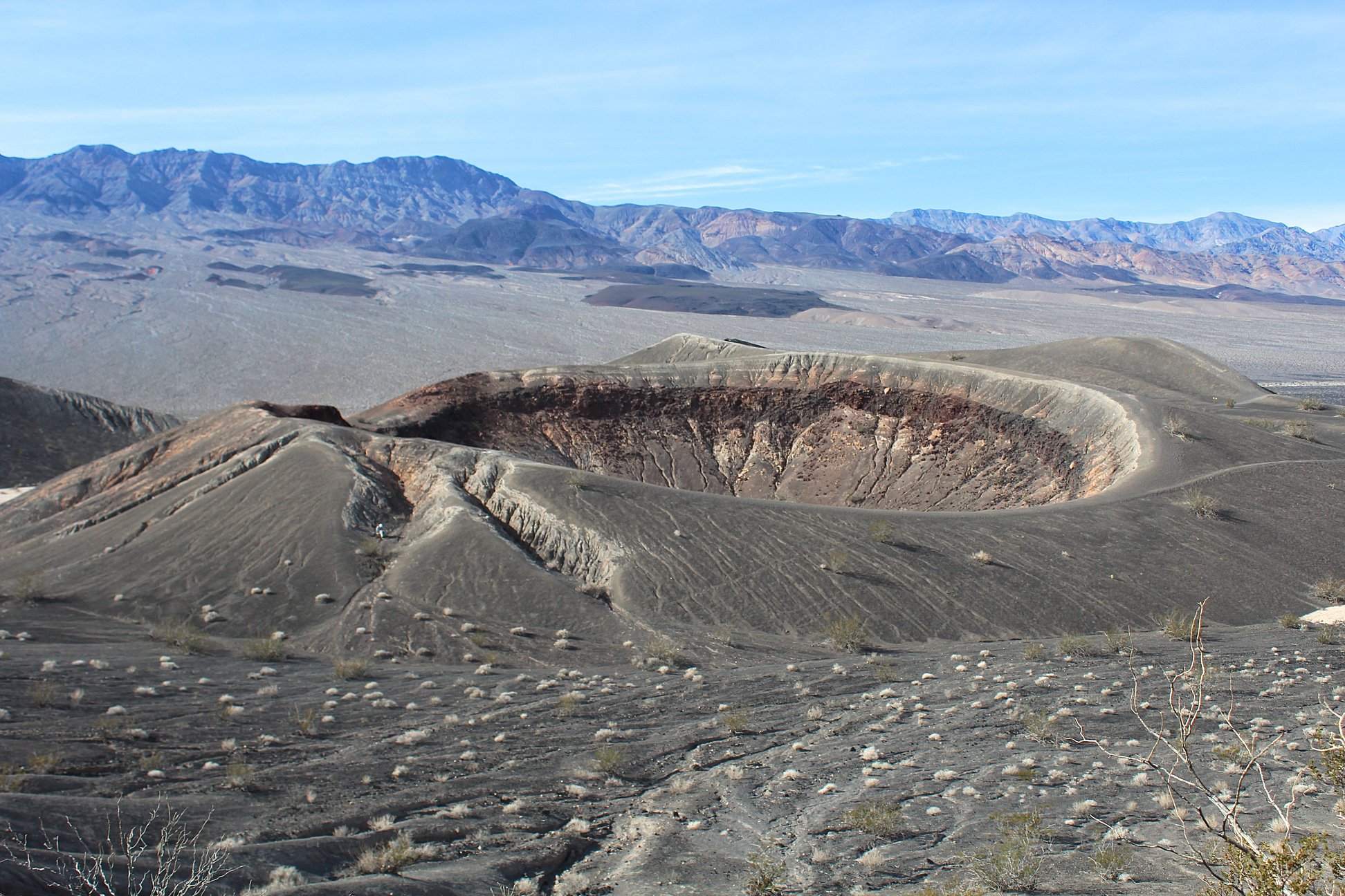
United States , California Volcanoes :
Current Volcano Alert Level: all NORMAL
Current Aviation Color Code: all GREEN
Activity Update:
All volcanoes monitored by CalVO using telemetered, real-time sensor networks exhibit normal levels of background seismicity and deformation. Volcanoes monitored include Mount Shasta, Medicine Lake Volcano, Clear Lake Volcanic Field, Lassen Volcanic Center, Long Valley Volcanic Region, Coso Volcanic Field, Ubehebe Craters, and Salton Buttes.
Observations for August 24, 2020 (0000h PDT) through August 30, 2020 (2359h PDT):
Clear Lake Volcanic Field: No earthquakes at or above M1.0 were detected. As is typical, moderate levels of seismicity were recorded at the Geysers geothermal steam field south of the Clear Lake Volcanic Field; 41 earthquakes at or above M1.0 were detected, with the largest event measuring M2.2.
Lassen Volcanic Center: No earthquakes at or above M1.0 were detected.
Long Valley Volcanic Region: In the Long Valley Caldera, 10 earthquakes of M1.0 or greater were detected, the largest measuring M1.8. One earthquake at or above M1.0 was detected at Mammoth Mountain, measuring M1.2. No earthquakes at or above M1.0 were detected at Mono-Inyo Craters. As is typical, moderate levels of seismicity were observed south of the caldera in the Sierra Nevada range; 2 earthquakes at or above M1.0 were detected, with the largest event measuring M1.7.
Mount Shasta: No earthquakes at or above M1.0 were detected.
Medicine Lake: No earthquakes at or above M1.0 were detected.
Salton Buttes: 14 earthquakes at or above M1.0 were detected, with the largest measuring M2.8.
Coso Volcanic Field: 10 earthquakes at or above M1.0 were detected, with the largest event measuring M3.0.
Ubehebe Craters: No earthquakes at or above M1.0 were detected.
The U.S. Geological Survey will continue to monitor these volcanoes closely and will issue additional updates and changes in alert level as warranted.
Source : Calvo.
Photo : Judy Fierstein, USGS, 2018.