June 18 , 2018.
Pu’u ‘Ō’ō / Kilauea , Hawai :
Saturday, June 16, 2018, 10:15 PM HST (Sunday, June 17, 2018, 08:15 UTC)
19°25’16 » N 155°17’13 » W,
Summit Elevation 4091 ft (1247 m)
Current Volcano Alert Level: WARNING
Current Aviation Color Code: RED
Kīlauea Volcano Lower East Rift Zone
The Lower East Rift Zone (LERZ) eruption in Leilani Estates continues with little change.
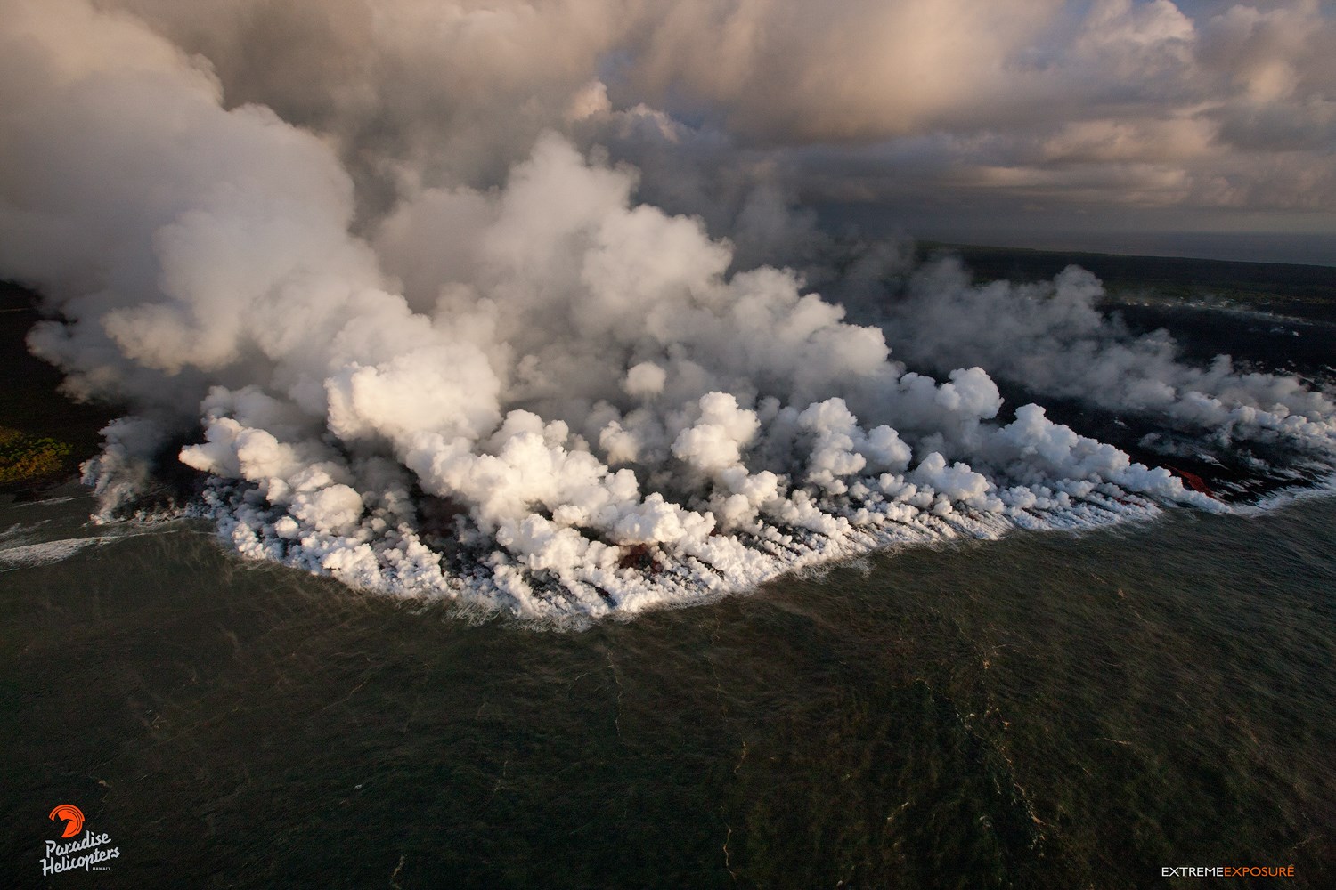
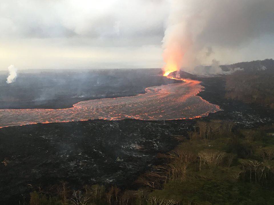
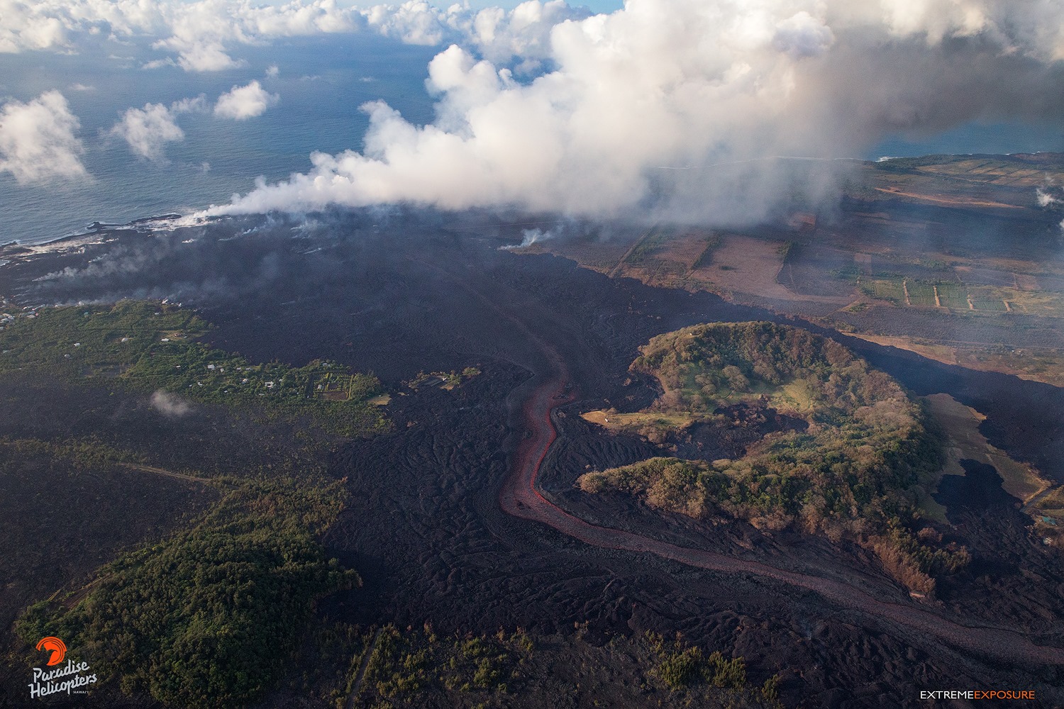
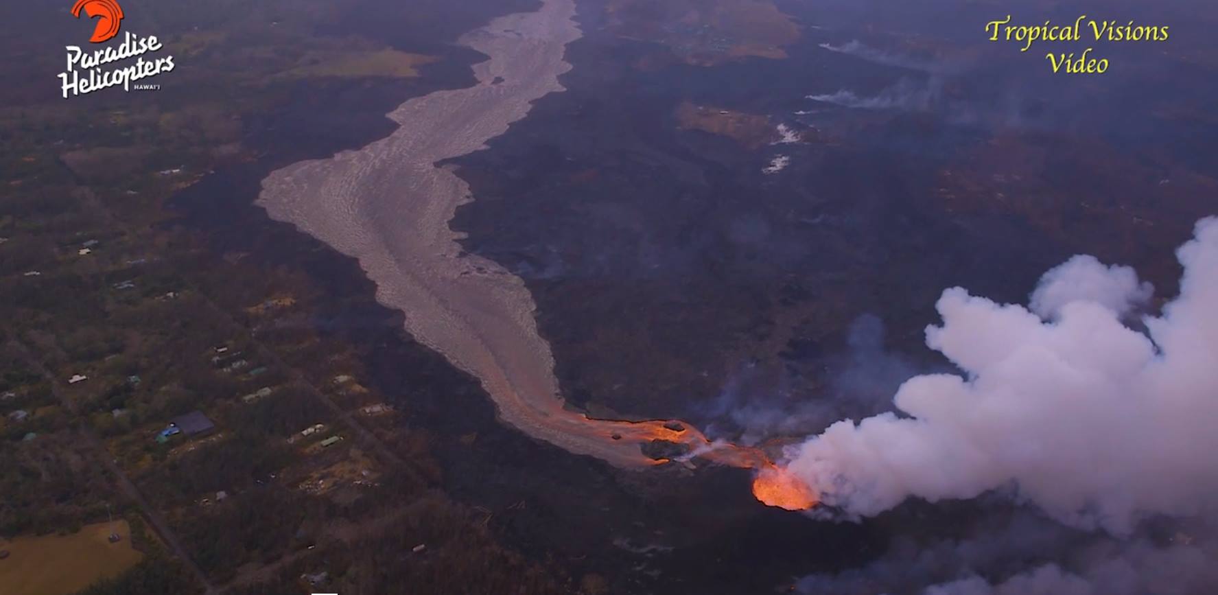
Fountains from the Fissure 8 spatter cone continue to feed lava into the well-established channel that flows to the ocean at Kapoho. Occasionally, lava spills over the channel levees. The ocean entry remained fairly broad with laze blown onshore. Fissures 16 and 18 continue to ooze lava and mild spattering from Fissure 15 was observed late in the day. The flow field is relatively stable with little change to its size and shape for the past few days.
Pele’s hair and other lightweight volcanic glass fragments from the lava fountain at Fissure 8 continue to fall downwind of the fissure, dusting the ground within a few hundred meters (yards) of the vent. High winds may waft lighter particles to greater distances. Residents are urged to minimize exposure to these volcanic particles, which can cause skin and eye irritation similar to volcanic ash.
HVO field crews are on site tracking the fountains, lava flows, and spattering from Fissure 8 as conditions allow and are reporting information to Hawaii County Civil Defense. Observations are also collected on a daily basis from cracks in the area of Highway 130; no changes in temperature, crack width, or gas emissions have been noted for several days.
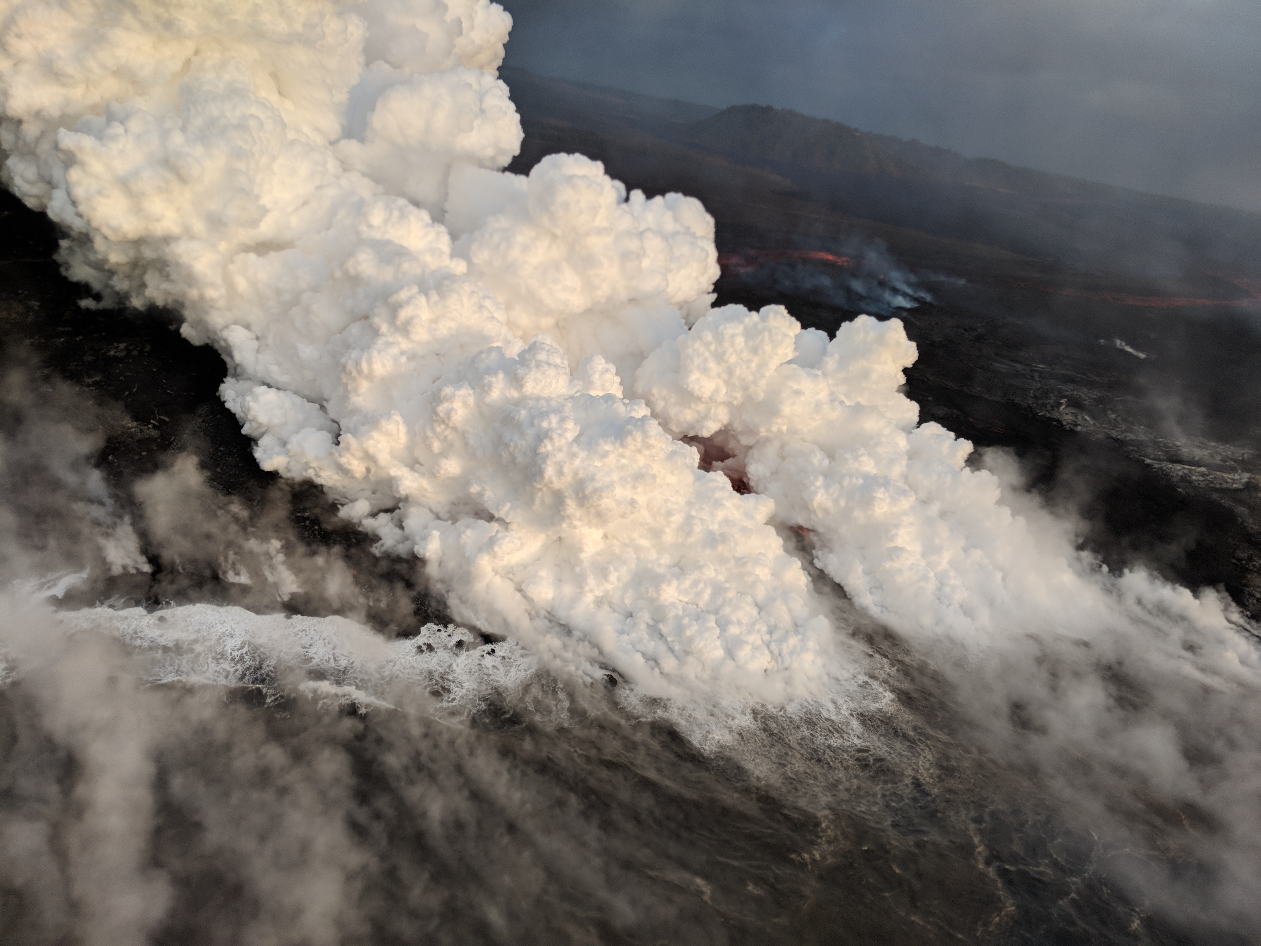
View of the active ocean entry in the vicinity of Vacationland. The interaction of hot lava with the ocean creates « laze », a corrosive seawater plume laden with hydrochloric acid and fine volcanic particles that can irritate the skin, eyes, and lungs, but that dissipates quickly with distance.
Volcanic gas emissions remain very high from Fissure 8 eruptions. Winds are expected to bring VOG to the central, south, and western parts of the Island of Hawaii.
Kīlauea Volcano Summit
Seismicity peaked at about 35 earthquakes per hour this morning. At 10:22 AM HST, a weak gas and ash emission rose from Halemaʻumaʻu crater produced by a subsurface explosion with energy equivalent to a magnitude-5.3 earthquake. Afterward, seismicity dropped abruptly at Kīlauea’s summit but slowly increased during the day reaching 25 earthquakes per hour (magnitude <3.0) by 9PM HST. Inward slumping of the rim and walls of Halemaʻumaʻu continues in response to ongoing subsidence at the summit.
Sulfur dioxide emissions from the volcano’s summit have dropped to levels that are about half those measured prior to the onset of the current episode of eruptive activity. This gas and minor amounts of ash are being transported downwind, with small bursts of ash and gas accompanying intermittent explosive activity.
Sunday, June 17, 2018, 9:09 AM HST (Sunday, June 17, 2018, 19:09 UTC)
Kīlauea Volcano Lower East Rift Zone
The Lower East Rift Zone (LERZ) eruption in Leilani Estates continues with little change.
Fountains from the Fissure 8 spatter cone continue to feed lava into the well-established channel that flows to the ocean at Kapoho. Occasionally, minor amounts of lava briefly spill over the channel levees. The ocean entry remained fairly broad with laze blown onshore. Fissures 16/18 continue to ooze lava and incandescence and mild spattering were observed from Fissure 6/15 vicinity yesterday. The flow field is relatively stable with little change to its size and shape for the past few days.
Kīlauea Volcano Summit
Seismicity at Kīlauea’s summit gradually increased to about 30 earthquakes per hour overnight and a few events were felt in the Volcano area. At 06:26 AM HST, HVO instruments recorded energy release consistent with a subsurface explosion but the resulting gas plume, reported to be brief and nearly devoid of ash, was observed to 5,000 to 7,000 ft above sea level. Inward slumping of the rim and walls of Halemaʻumaʻu continues in response to ongoing subsidence at the summit.
Sunday, June 17, 2018, 4:40 PM HST (Monday, June 18, 2018, 02:40 UTC)
Kīlauea Volcano Lower East Rift Zone
The Lower East Rift Zone (LERZ) eruption in Leilani Estates continues with little change.
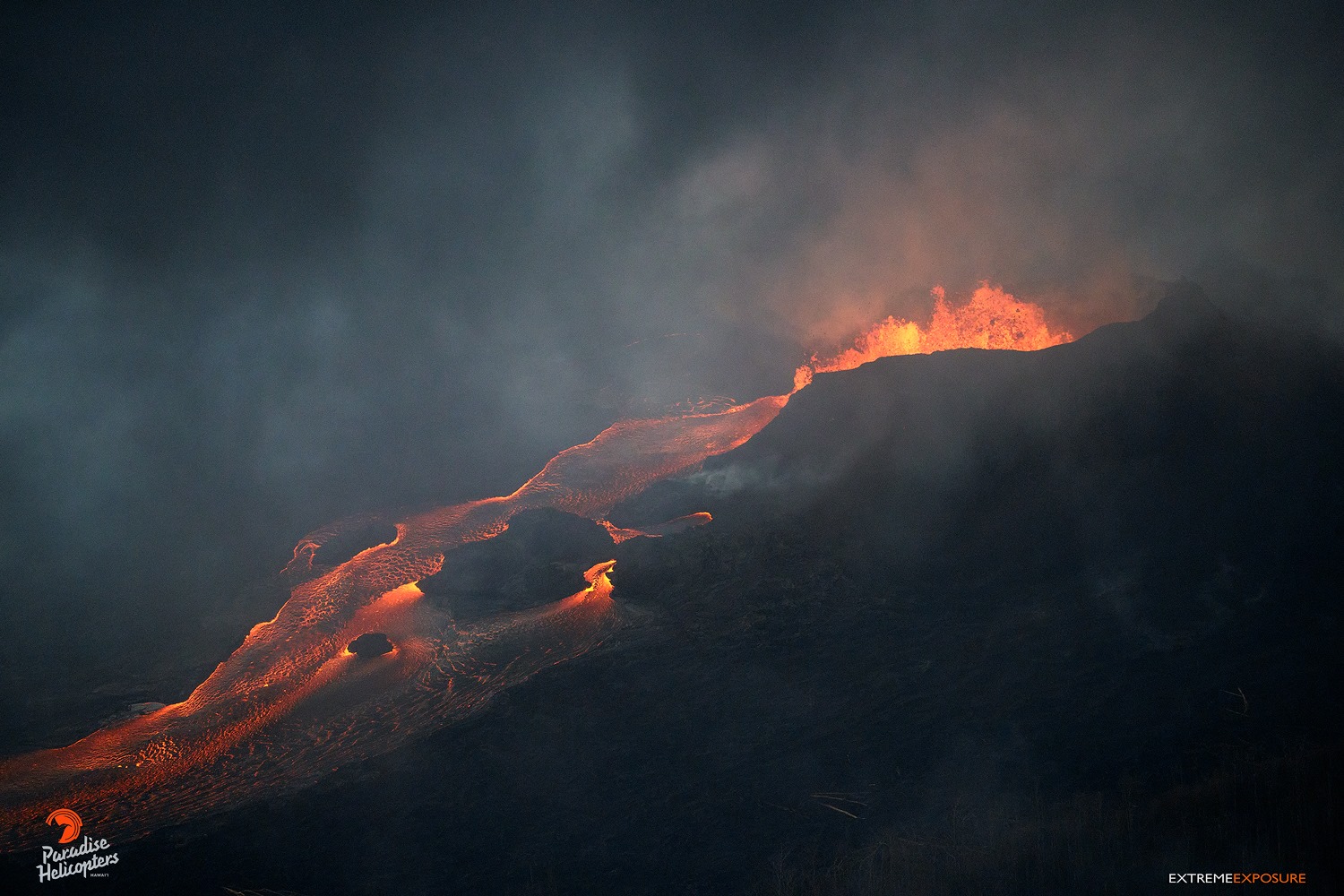
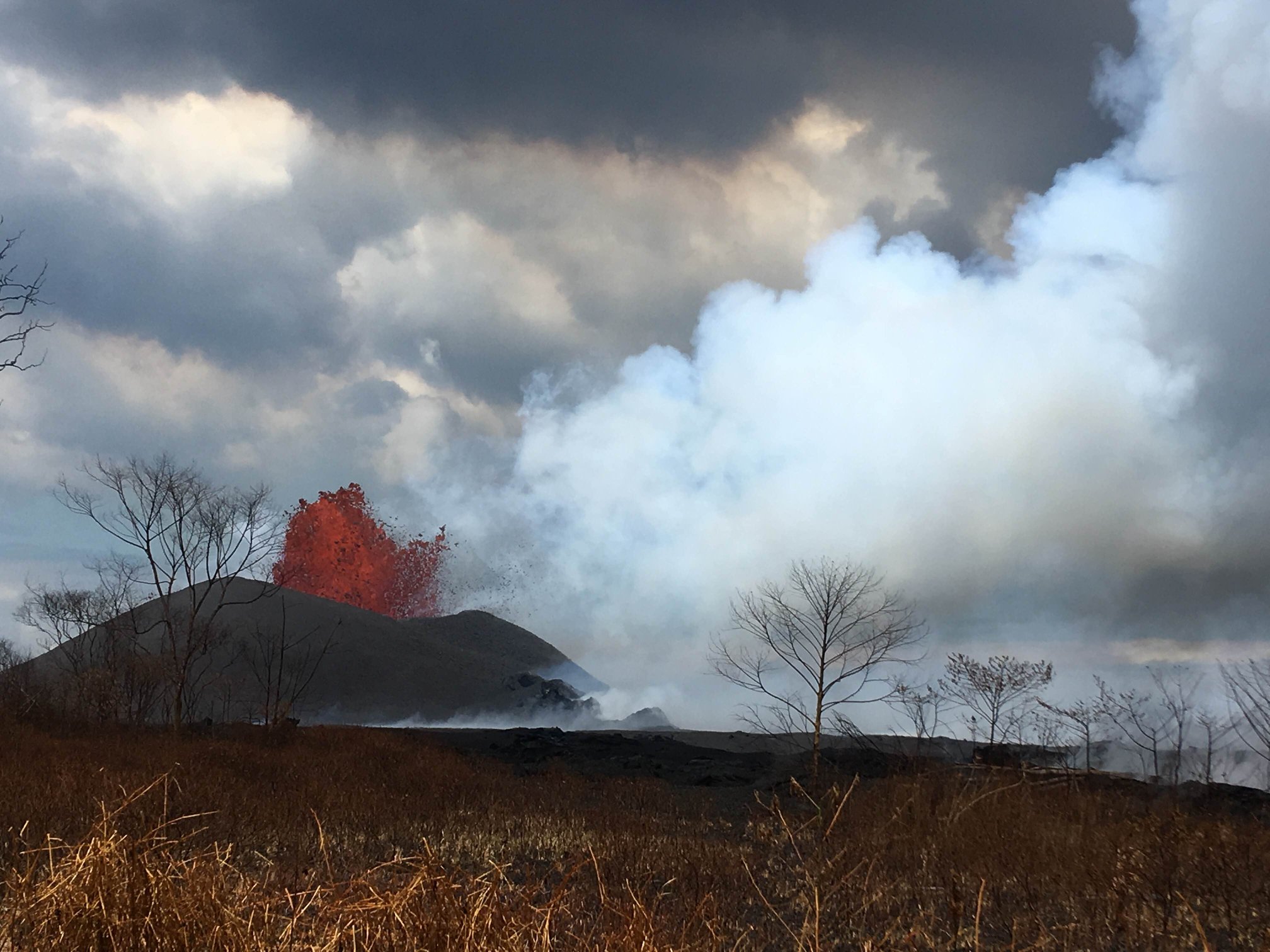
Fountains as high as 165 ft rise from the Fissure 8 spatter cone and continue to feed lava into the well-established channel that flows to the ocean at Kapoho. Occasionally, minor amounts of lava briefly spill over the channel levees. The ocean entry remained fairly broad with laze blown onshore. Fissures 16/18 continue to ooze lava. Incandescence (visible in PGcam to the left of fissure 8 most nights) and mild spattering were observed from Fissure 6. The flow field is relatively stable with little change to its size and shape for the past few days.
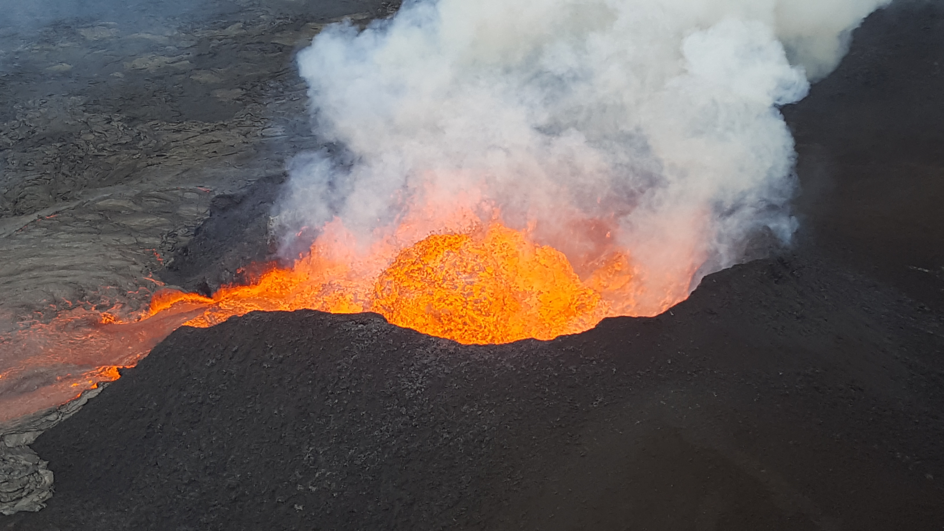
The fissure 8 lava fountain pulses to heights of 50 m (165 ft) within a cinder spatter cone. Fissure 8 feeds lava into the well-established channel that flows to the ocean.
Kīlauea Volcano Summit
After this morning’s explosive event, seismicity at Kīlauea’s summit is slowly increasing. Inward slumping of the rim and walls of Halemaʻumaʻu continues in response to ongoing subsidence at the summit.
Sulfur dioxide emissions from the volcano’s summit have dropped to levels that are about half those measured prior to the onset of the current episode of eruptive activity. This gas and minor amounts of ash are being transported downwind, with small bursts of ash and gas accompanying intermittent explosive activity.
Source : HVO
Photos : USGS , Allan Lerner , Mick Kalber.
Video : Big Island Video news
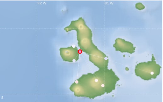
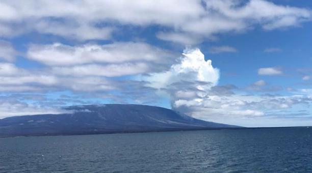
Fernandina , Galapagos /Ecuador :
Special Report of the Fernandina Volcano N ° 4 – 2018
The eruption continues
The Fernandina volcano, located in the Galapagos province 90 km north-west of Puerto Villamil and 140 km west of Puerto Ayora, started a new eruptive process yesterday June 16, 2018 between 11:00 and 11:15 Galapagos time ( See the Fernandina Volcano Special Report N ° 3 – 2018). The continuous eruptive process, characterized by the emission of lava flows and gas cloud, associated with a tremor (Figure 1) recorded in the seismic stations located on the island of Fernandina.
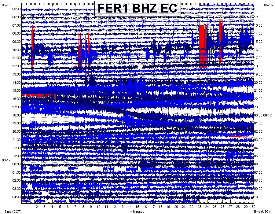
Figure 1. Seismic recording of trenches in FER1 station, located on Fernandina Island (source: IGEPN)
Observations from photos and videos received at the Institute of Geophysics indicate a radial crack eruption located on the NNE flank of the volcano (Figure 2). The lava flows have reached the sea and the low-ash gas cloud extends more than 250 km west-northwest (Figure 3). The past eruptions of this volcano lasted from a few days to several weeks, so we estimate similar durations for this eruptive process.
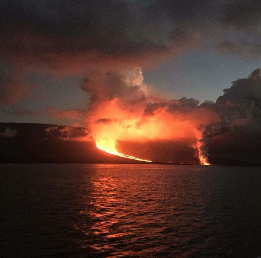
Figure 2. Photograph showing the crack spilling lava during eruption of Fernandina volcano.
It should be noted that there are no human settlements in the eruption region and that the wind direction carries the gas west-northwest, contrary to the direction of the populated islands (Isabela , Santa Cruz, Floreana and San Cristobal). It is recommended to stay away from the eruption and in particular the entry of the lava into the sea as explosions can occur when the lava comes into contact with the water and this phenomenon produces a large amount of toxic gas. Lava flows can also cause fires. The IGEPN continues volcanic monitoring and will inform if changes in the internal or external activity of the volcano are observed.
Source : IGEPN
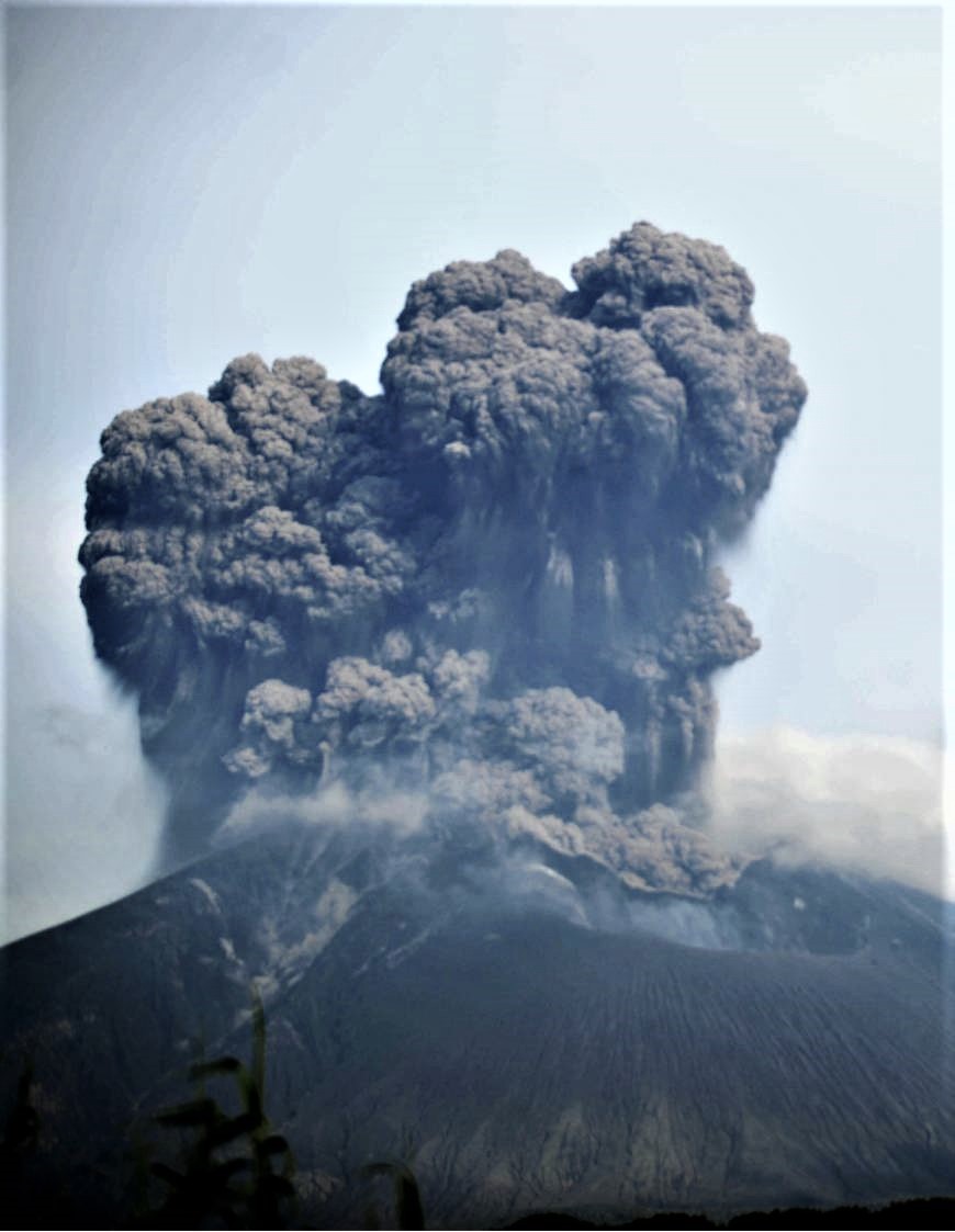
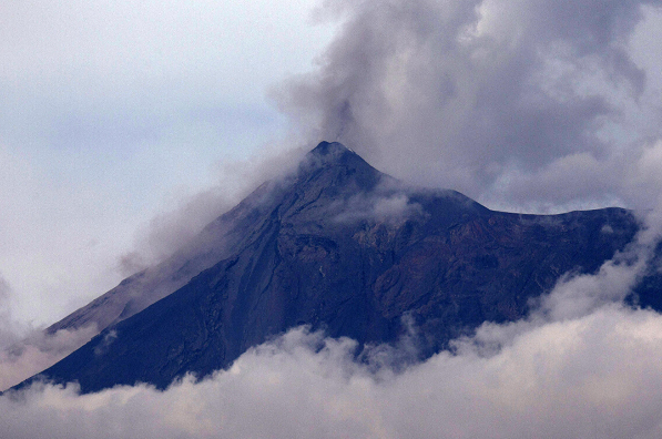
Fuego , Guatemala :
SPECIAL BEFGO VULCANOLOGICAL BULLETIN # 79-2018 Lahars Descent in the canyons SECA AND MINERAL, Guatemala 17 June 2018, 14:40 (local time)
Type of activity: Vulcanian
Morphology: Composite Stratovolcan
Location: 14 ° 28’54˝ Latitude N; 90 ° 52’54˝ Longitude W.
Height: 3,763msnm.
Due to continuous rains in the Fuego Volcano region and the abundant accumulation of material from the recent eruption, the descent of strongs lahar into the Seca and Mineral canyons, tributaries of the Pantaleon River, is currently recorded.
They have a width of about 40 meters by 2 meters high, these lahares cause vibrations in their path. The materials of these lahar are pasty, abundant in fine materials, carrying blocks up to 2 meters in diameter, they tear the trunks and branches of trees in their path. Because of the last rash, they come down hot, smelling of sulfur and emanating from the steam because of their temperature.
Due to the rains that occur in the afternoon and evening, the probability of lahars occurring in one of the main ravines persists.
Activity of the volcano:
A weak degassing, of white color, at a low height, which disperses towards the west is recorded. 4 to 5 weak explosions per hour, expelling columns of gray ash at 4500-4700 meters (14765 to 15750 feet) are noted. They disperse towards the West. Small rumblings are reported with moderate shock waves. Moderate avalanches are noted on the contour of the crater.
Source : Insivumeh.
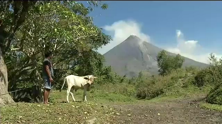
Mayon , Philippines :
MAYON VOLCANO BULLETIN 18 June 2018 08:00 A.M.
Mayon Volcano’s seismic monitoring network recorded one (1) volcanic earthquake during the past 24 hours. Degassing at the active vent could not be observed due to thick clouds covering the summit. Fair crater glow from the summit could be observed at night. Sulfur dioxide (SO2) emission was measured at an average of 2,229 tonnes/day on 16 June 2018. Precise leveling data obtained on 02-14 April 2018 indicate inflation of the edifice relative to 22-29 March 2018, while electronic tilt data show sudden slight inflation of the mid-slopes beginning 05 May 2018. Medium-term ground deformation data, however, show that the edifice is still deflating consistent with the decline in unrest but is still inflated relative to 2010 baselines.
Alert Level 2 currently prevails over Mayon Volcano. This means that Mayon is at a moderate level of unrest. DOST-PHIVOLCS reminds the public that sudden explosions, lava collapses, pyroclastic density currents or PDCs and ashfall can still occur and threaten areas in the upper to middle slopes of Mayon. DOST-PHIVOLCS recommends that entry into the six kilometer-radius Permanent Danger Zone or PDZ and a precautionary seven kilometer-radius Extended Danger Zone or EDZ in the south-southwest to east-northeast sector, stretching from Anoling, Camalig to Sta. Misericordia, Sto. Domingo must be strictly prohibited. People residing close to these danger areas are also advised to observe precautions associated with rockfalls, PDCs and ashfall. Active river channels and those perennially identified as lahar prone areas in the southern and eastern sectors should also be avoided especially during bad weather conditions or when there is heavy and prolonged rainfall. Civil aviation authorities must advise pilots to avoid flying close to the volcano’s summit as airborne ash and ballistic fragments from sudden explosions and PDCs may pose hazards to aircrafts.
DOST-PHIVOLCS is closely monitoring Mayon Volcano’s activity and any new significant development will be immediately communicated to all stakeholders.
Source : Phivolcs