June 17 , 2018.
Pu’u ‘Ō’ō / Kilauea , Hawai :
Friday, June 15, 2018, 10:27 PM HST (Saturday, June 16, 2018, 08:27 UTC)
19°25’16 » N 155°17’13 » W,
Summit Elevation 4091 ft (1247 m)
Current Volcano Alert Level: WARNING
Current Aviation Color Code: RED
Kīlauea Volcano Lower East Rift Zone
The East Rift Zone (LERZ) eruption in Leilani Estates continues with little change over the past few days.
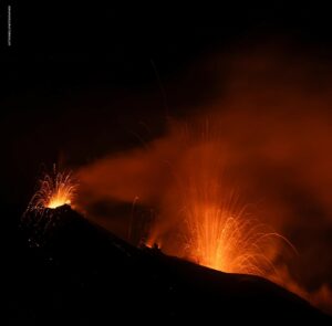
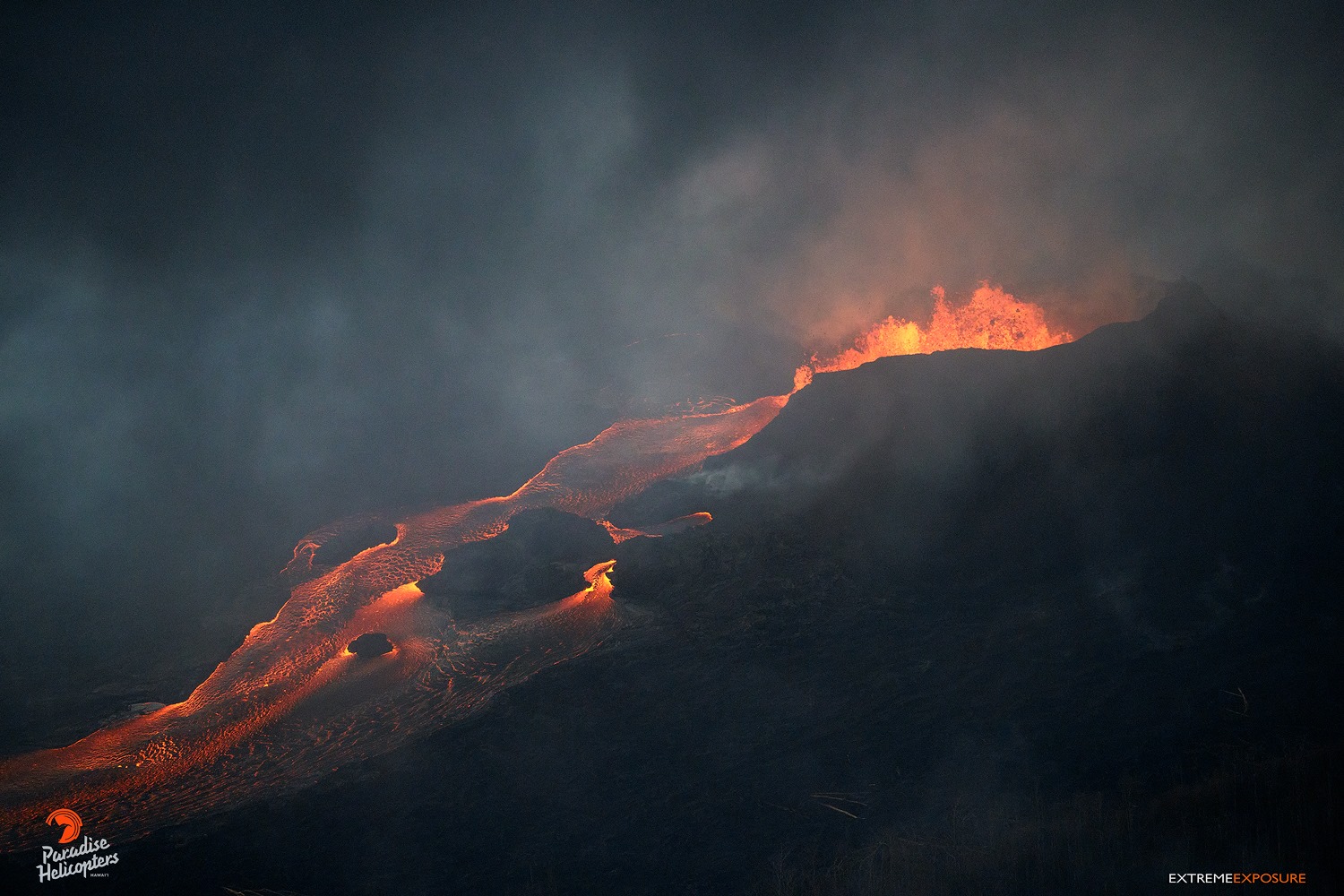
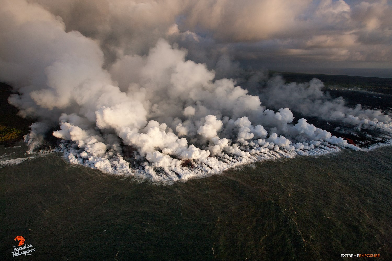
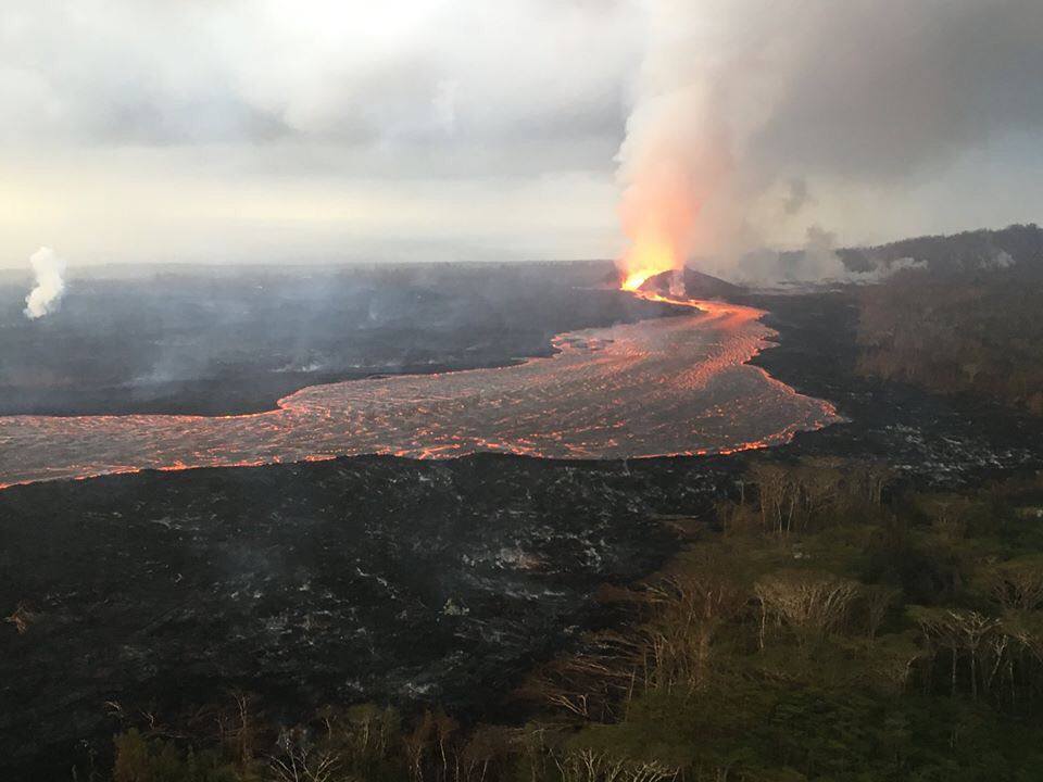
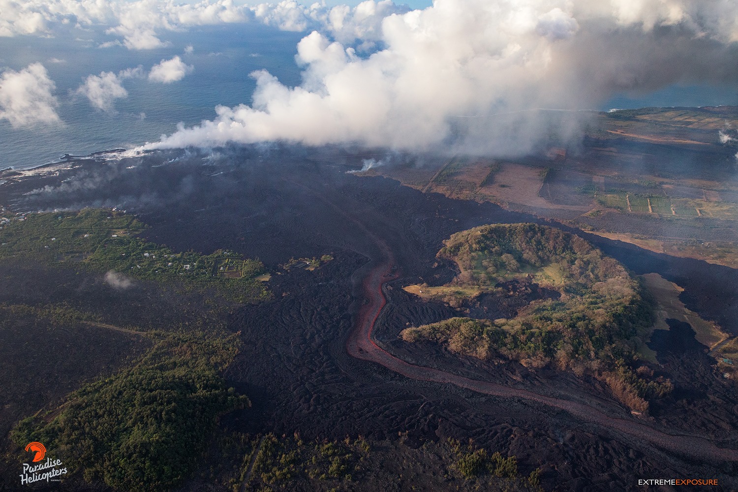
This afternoon, lava fountains from Fissure 8 spatter cone pulsed to heights of 180 ft at times. Lava continues to flow through the well-established channel to the ocean at Kapoho. Occasionally, lava spills over the channel levees. The ocean entry remained fairly broad with laze blown onshore. Fissures 16 and 18 continue to ooze lava. Fissure 8, the channel, and the ocean entry are relatively stable with only a small amount of expansion at the southern boundary of the flow near the coast and south of Vacationland.
Pele’s hair and other lightweight volcanic glass fragments from the lava fountain at Fissure 8 continue to fall downwind of the fissure, dusting the ground within a few hundred meters (yards) of the vent. High winds may waft lighter particles to greater distances. Residents are urged to minimize exposure to these volcanic particles, which can cause skin and eye irritation similar to volcanic ash.
HVO field crews are on site tracking the fountains, lava flows, and spattering from Fissure 8 as conditions allow and are reporting information to Hawaii County Civil Defense. Observations are also collected on a daily basis from cracks in the area of Highway 130; no changes in temperature, crack width, or gas emissions have been noted for several days.
Volcanic gas emissions remain very high from Fissure 8 eruptions. Shifting wind conditions may bring VOG to the central, south, and western parts of the Island of Hawaii.
Magma continues to be supplied to the lower East Rift Zone. Seismicity remains relatively low in the area with numerous small magnitude earthquakes and low amplitude background tremor.
Higher amplitude tremor is occasionally being recorded on seismic stations close to the ocean entry.
Kīlauea Volcano Summit
Between 6 am and noon, more than 180 earthquakes occurred in the summit area, 18 of which were stronger than magnitude-3.0. An explosive event occurred at noon today that produced an ash and gas plume to nearly 10,000 ft. Seismicity dropped abruptly after the explosive event but is expected to build up slowly over the next hours. Inward slumping of the rim and walls of Halema`uma`u continues in response to ongoing subsidence at the summit.
Sulfur dioxide emissions from the volcano’s summit have dropped to levels that are about half those measured prior to the onset of the current episode of eruptive activity. This gas and minor amounts of ash are being transported downwind, with small bursts of ash and gas accompanying intermittent explosive activity.
https://www.facebook.com/ann.kobsa/videos/10156413016209493/
Saturday, June 16, 2018, 8:38 AM HST (Saturday, June 16, 2018, 18:38 UTC)
Kīlauea Volcano Lower East Rift Zone
The East Rift Zone (LERZ) eruption in Leilani Estates continues with little change over the past few days.
Lava fountains from the 170 ft-tall Fissure 8 spatter cone pulsed to heights of 185 to 200 ft overnight. Lava continues to flow through the well-established channel to the ocean at Kapoho. Occasionally, lava spills over the channel levees. The ocean entry remained fairly broad with laze blown onshore. Fissures 16 and 18 continue to ooze lava. Fissure 8, the channel, and the ocean entry are relatively stable with only a small amount of expansion at the southern boundary of the flow near the coast and south of Vacationland.
Kīlauea Volcano Summit
Seismicity continued to increase gradually overnight at Kīlauea’s summit and several earthquakes, including 3 stronger than magnitude-3.0, were felt in the Volcano area. Inward slumping of the rim and walls of Halema`uma`u continues in response to ongoing subsidence at the summit.
Saturday, June 16, 2018, 5:41 PM HST (Sunday, June 17, 2018, 03:41 UTC)
Kīlauea Volcano Lower East Rift Zone
The Lower East Rift Zone (LERZ) eruption in Leilani Estates continues with little change over the past few days.
Lava fountains from the 170 ft-tall Fissure 8 spatter cone pulsed to heights of 185 to 200 ft overnight. Lava continues to flow through the well-established channel to the ocean at Kapoho. Occasionally, lava spills over the channel levees. The ocean entry remained fairly broad with laze blown onshore. Fissures 16 and 18 continue to ooze lava. Fissure 8, the channel, and the ocean entry are relatively stable with only a small amount of expansion at the southern boundary of the flow near the coast and south of Vacationland.
Kīlauea Volcano Summit
Seismicity peaked at about 35 earthquakes per hour this morning. At 10:22 AM HST, a weak gas and ash emission rose from Halemaʻumaʻu crater produced by a subsurface explosion with energy equivalent to a magnitude-5.3 earthquake. Afterward, seismicity dropped abruptly at Kīlauea’s summit and has not yet started to increase. Inward slumping of the rim and walls of Halemaʻumaʻu continues in response to ongoing subsidence at the summit.
Sulfur dioxide emissions from the volcano’s summit have dropped to levels that are about half those measured prior to the onset of the current episode of eruptive activity. This gas and minor amounts of ash are being transported downwind, with small bursts of ash and gas accompanying intermittent explosive activity.
Source : HVO.
Photos : Bruce Omori ,
Video : Ann Kobsa
Sakurajima , Japan :
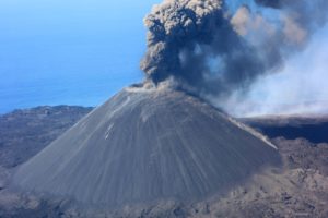
The Sakurajima volcano in southwest Japan is erupting.
TOKYO, June 16 (Xinhua) – The Sakurajima volcano in Kagoshima prefecture in southwest Japan had an explosive eruption on Saturday morning. No injuries were reported.
The eruption was observed around 7:20 local time on one of the peaks of the volcano, emitting volcanic ash to 4,700 meters in the sky, according to the local weather agency.
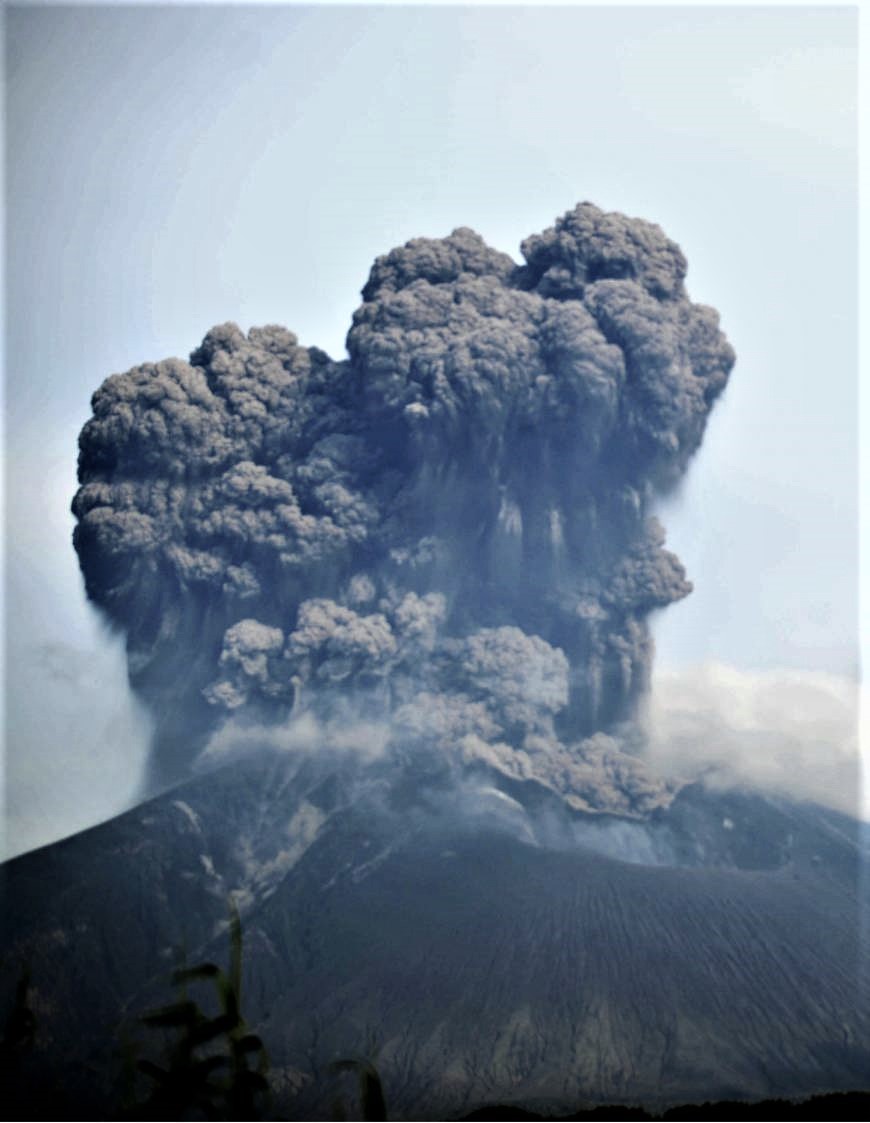
Mount Sakurajima is captured here in eruption this Saturday, seen from Tarumizu, Kagoshima Prefecture. The eruption, just after 7 am, projected debris up to 1.1 km, sent a pyroclastic flow along its southwest side and projected smoke about 5 km into the sky. This is the highest since May 2017.
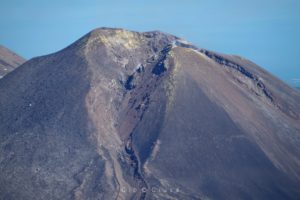
Sakurajima is an active composite volcano and an ancient island in Kagoshima Prefecture. The most recent eruption began on May 2, 2017.
The meteorological agency maintained the alert level of the volcano at level 3 on a scale of 5, limiting the entrance to the volcano and warning of falling rocks.
Source: Xinhua 2018-06-16 13:39:24.
Fernandina , Ecuador , Galapagos :
Fernandina Volcano Special Report N ° 1 – 2018
New seismic agitation on the Fernandina volcano
Summary:
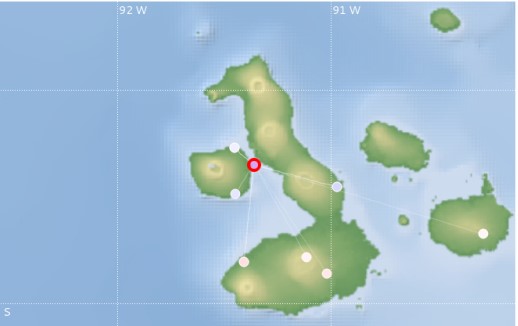
The Fernandina volcano, located in the province of Galapagos, 90 km north-west of Puerto Villamil and 140 km northwest of Ust-Puerto Ayora, presents new seismic upheavals since June 16, 2018, nine months since its last eruption. From 08h37, Galapagos time (Ecuador time -1h), 9 earthquakes of magnitude greater than 2.5m were recorded. The largest, of magnitude M 4.1, was recorded at 09:22 am, with an estimated depth of 4 km. It was located north-east of Fernandina Island, as shown in Figure 1. The seismic swarm could be the precursor of an eruptive activity. . The IGEPN continues volcanic monitoring and will inform if changes in the internal or external activity of the volcano are observed.
Antecedents:
Fernandina (0.37 ° S, 91.55 ° W, 1476 m), also called Cerro la Cumbre, is a large volcano with a summit caldera (6.5 km NW-SE 4.8 km NE-SW, depth 900 m) of basaltic composition, which built the island of Fernandina (34 km NW-SE, NE-SW 30 km) at the western end of the Galapagos Islands.
Special Report of the Fernandina Volcano N ° 2 – 2018
Eruption of Fernandina volcano is confirmed
Summary:
The Fernandina volcano, located in the province of Galapagos, 90 km north-west of Puerto Villamil and 140 km north-west of Puerto Ayora, after a seismic swarm and tremors (As indicated in the report special Fernandina volcano – 2018 – No.1), is experiencing an eruptive period that began today June 16, 2018. The confirmation of the eruption was made by guides of a boat that crossed the area and that reported this peculiarity to the Galapagos National Park. In addition, satellite images show a thermal anomaly on the north-northwest flank of the volcano.
Fernandina Volcano Special Report N ° 3 – 2018
Lava flows reach the sea and generate gas clouds
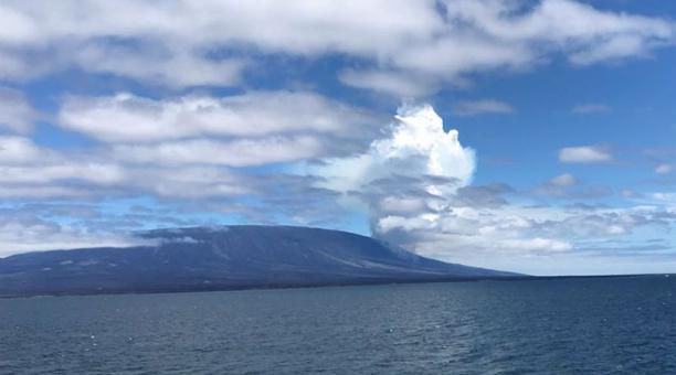
The Fernandina volcano, located in the Galapagos province, 90 km north-west of Puerto Villamil and 140 km northwest of Puerto Ayora, began a new eruption between 11:00 and 11:15 am Galapagos time ( Ecuador time TG = -1) today. This eruption occurred on the north-north-east flank of the volcano and has so far been characterized by the emission of lava flows and a column of gas 2 to 3 km in height directed by the wind towards the South. Where is. According to the staff of the Galapagos National Park, it has been observed from the Bolivar Canal that the lava flows have already reached the sea.
There are no human settlements in the eruption zone and until the date of the report, there is no evidence of ash emission. It is recommended to stay away from the erupting area and in particular the area where lava flows into the sea, as explosions can occur when the lava comes in contact with the water and this phenomenon produces a large amount of steam and toxic gas. Lava flows can also cause fires. The IGEPN continues volcanic monitoring and will inform if changes in the internal or external activity of the volcano are observed.
Source : IGEPN
Video : America hoy.
Photo : Parque del galapagos
Popocatepetl , Mexico :
June 16, 11:00 am (June 16, 16:00 GMT)
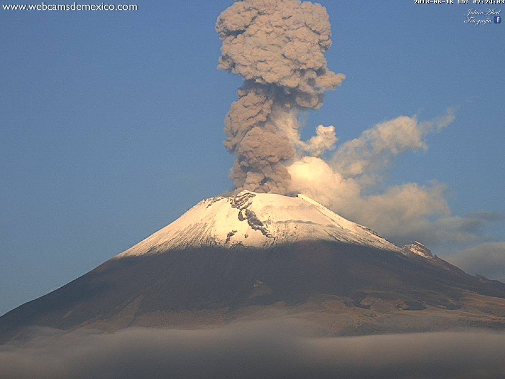
During the last 24 hours, through the monitoring systems of the Popocatepetl volcano, 63 low intensity exhalations have been identified, possibly accompanied by steam and gas. There was also an explosion yesterday at 3:36 pm (blind) and this morning two other explosions were recorded, which occurred at 03:54 and 07:22. The last was the most important, since it produced an eruptive column about 2 km high, which initially dispersed to the south.
In addition, a volcano-tectonic event of magnitude 3 was recorded yesterday at 18:13.
During the morning, continuous emissions of water vapor and other gases were observed. At the time of this report, there is no visibility on the volcano due to intense cloudiness that persists in the region.
CENAPRED asked not to approach the volcano and in particular the crater, because of the risk of falling of projectiles and in case of heavy rain to stay away from the bottom of the ravines because of the danger of landslides and mudslides .
The Popocatepetl volcanic warning light is located at Amarillo Phase 2.
Source : Cenapred.
Photo : Webcamdemexico , Julian Allbed