November 19 , 2022.
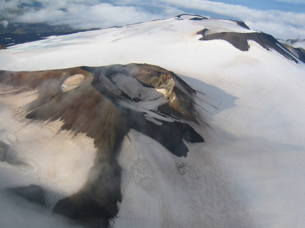
Alaska , Takawangha :
AVO/USGS Volcanic Activity Notice
Current Volcano Alert Level: ADVISORY
Previous Volcano Alert Level: NORMAL
Current Aviation Color Code: YELLOW
Previous Aviation Color Code: GREEN
Issued: Friday, November 18, 2022, 4:34 PM AKST
Source: Alaska Volcano Observatory
Notice Number: 2022/A1315
Location: N 51 deg 52 min W 178 deg 1 min
Elevation: 4754 ft (1449 m)
Area: Aleutians
Volcanic Activity Summary:
The number of small earthquakes detected near Takawangha volcano has increased over the past few days and has intensified over the past 24 hours. The earthquakes, the largest with magnitudes between 2 and 3, have preliminary depths of about 2 to 4 miles (3 to 6 km) below sea level. This activity may be due to the movement of magma beneath the volcano. It marks a departure from background activity and therefore AVO is raising the Aviation Color Code to YELLOW and Alert Level to ADVISORY for Takawangha volcano.
No eruptive activity has been detected in satellite or other monitoring data.
Takawangha is monitored with a local seismic network, a single local infrasound sensor, regional infrasound and lightning sensors, and satellite imagery.
Remarks:
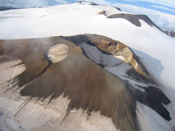
Takawangha is a remote, 1,449 m (4,754 ft)-high stratovolcano located on the northeast portion of Tanaga Island, roughly 95 km (59 miles) west of Adak in the Andreanof Islands. Takawangha’s summit is mostly ice-covered, except for four young craters that have erupted ash and lava flows in the last few thousand years. Parts of Takawangha’s edifice are hydrothermally altered and may be unstable, possibly leading to localized debris avalanches from its flanks. Takawangha lies across a saddle from historically active Tanaga volcano to the west. No historical eruptions are known from Takawangha; however, field work shows that recent eruptions have occurred, and it is possible that historic eruptions attributed to Tanaga may instead have come from Takawangha.
Source : AVO.
Photo : Coombs, M. L.
Ecuador , Sangay / Cotopaxi :
DAILY REPORT OF THE STATE OF SANGAY VOLCANO, Friday November 18, 2022.
Information Geophysical Institute – EPN.
Surface Activity Level: High, Surface Trend: No changes.
Internal activity level: High, Internal trend: No changes.
Seismicity: From November 17, 2022, 11:00 a.m. to November 18, 2022, 11:00 a.m.:
The transmission of data from the reference station for seismic statistics was continuous. The level of seismic activity recorded remains high.
Explosions (EXP) 997
Emission Tremors (TREMI ) 44
Long Period (LP): 10
Rains / Lahars:
Rains were recorded in the area which generated small mudslides and debris in the southeast area of the volcano. **In case of heavy rains, secondary lahars can be generated in the Volcán, Upano rivers and other tributaries**
Emission / Ash Column:
Yesterday afternoon, between the clouds, a steam emission with little ash was observed up to 500 meters above the level of the crater and was heading northwest. The Washington VAAC reported a column of gas and ash emissions up to 3000 meters above crater level to the south.
Other Monitoring Parameters:
The MIROVA system has not recorded any thermal anomalies over the past 24 hours.
Observation:
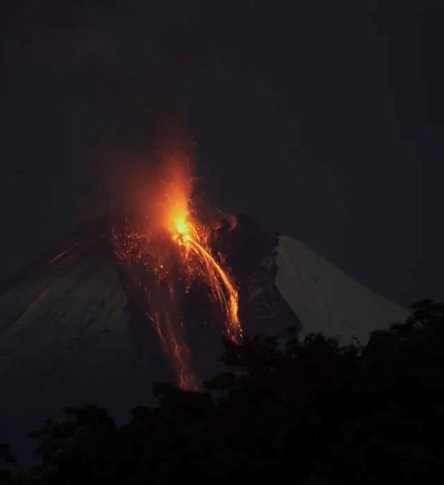
During the night, an incandescence was observed in the crater with the descent of incandescent material on the southeast flank of the volcano. Currently the area of the volcano is cloudy.
Alert level: Orange.
———————————————————————————————————————
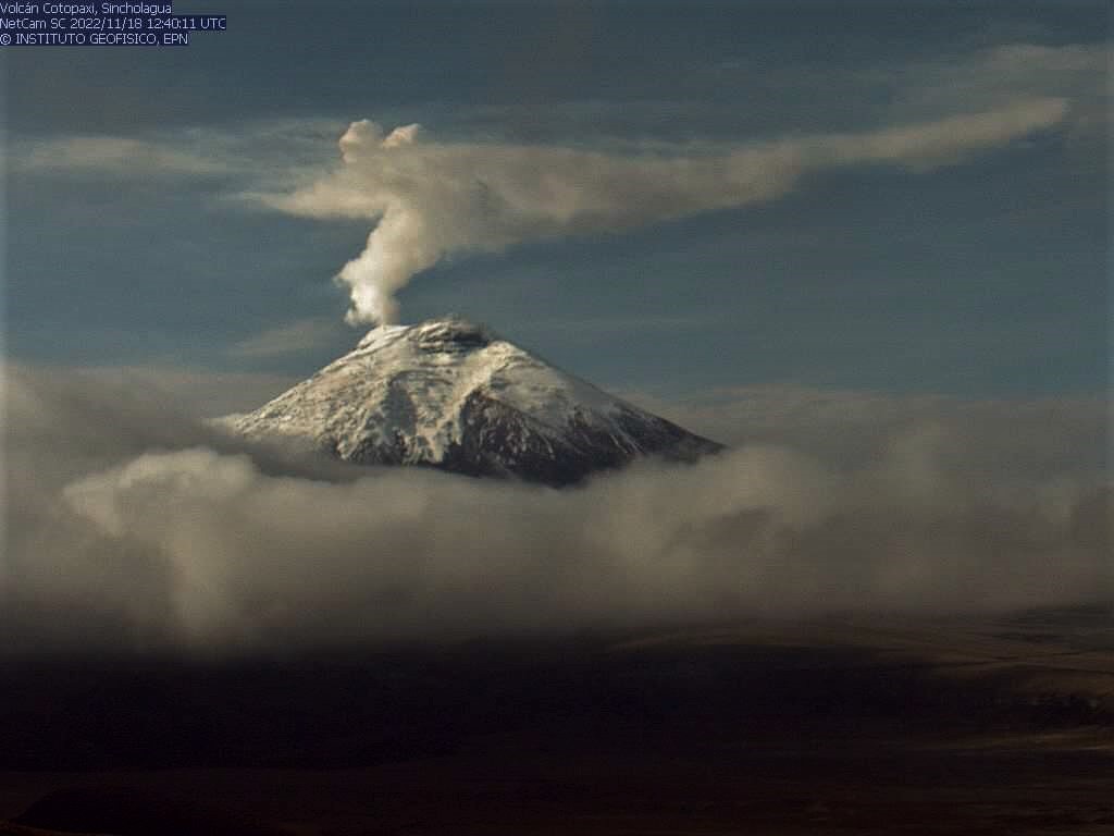
Information on the COTOPAXI volcano, Quito, Friday, November 18, 2022.
Since the early hours of the morning, a continuous emission of gas and water vapor has been observed at the level of the Cotopaxi volcano. This column has remained high since yesterday and today it reaches 1800 meters above crater level and is heading southeast. Internal activity remains at low levels, the volcano is NOT erupting.
IG-EPN continues to monitor the event and will timely inform if any changes in seismic signals are detected.
DAILY REPORT OF THE STATE OF COTOPAXI VOLCANO, Friday November 18, 2022.
Information Geophysical Institute – EPN.
Surface activity level: Low, Surface trend: Ascending.
Internal activity level: Low, Internal trend: No changes.
Seismicity: From November 17, 2022, 11:00 a.m. to November 18, 2022, 11:00 a.m.:
Data transmission from station BVC2 is terminated for seismic statistics. The level of recorded seismic activity remains low.
Volcano-tectonics (VT) 1
Long Period (LP): 48
Rains / Lahars:
Yesterday afternoon there were rains in the area which did not generate lahars.
Emission / Ash Column:
In the early hours of the morning, a continuous emission of gas and water vapor was observed. The column formed remains high since yesterday and today it reached 1800 meters above the level of the crater and headed towards the South-East.
Observation:
Currently the area of the volcano is cloudy.
Alert Level: Yellow
Source : IGEPN.
Photos : Diego Cardenas , IGEPN.
Indonesia , Merapi :
Report on the activity of Mount Merapi from November 11, 2022 to November 17, 2022, Published on November 19, 2022
RESULTS OF OBSERVATIONS
Visual
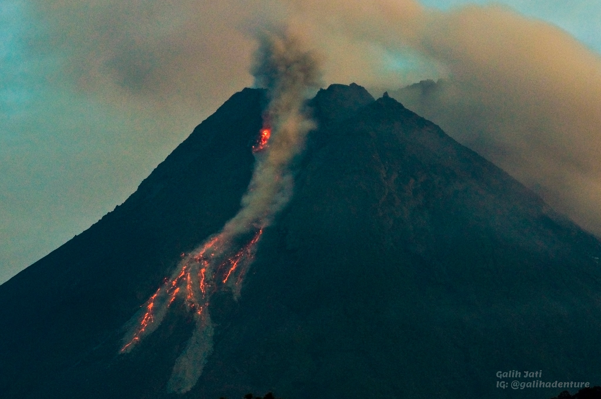
The weather around Mount Merapi is usually sunny in the morning and afternoon, while the evening is foggy. White, thin to medium thickness, low pressure, 150m high smoke was observed from the Kaliurang Mount Merapi observation post on November 12, 2022 at 07:25 WIB.
This week, there were 2 warm clouds in the southwest (Kali Boyong) with a slip distance of 1000 m. Lava avalanches were observed up to 4 times up to Kali Bebeng upstream with a maximum slip distance of 1,500 m. The noise of the descent was heard 1 time from Babadan Post with medium intensity.
– There is no significant morphological change in the South-West dome and the central dome. The volume of the South-West dome is calculated fixed, i.e. 1,616,500 m3, while for the middle dome it is 2,772,000 m3.
Seismicity
This week, the seismicity of Mount Merapi showed:
2 hot avalanche clouds
16 deep volcanic earthquakes (VTB)
333 deep volcanic earthquakes (VTA),
129 multi-phase earthquakes (MP),
282 avalanche earthquakes (RF),
7 emission earthquakes (DG),
9 tectonic earthquakes (TT).
The intensity of this week’s seismicity is still quite high.
Deformation
Mount Merapi’s deformation that was monitored using EDM and GPS this week showed a distance shortening rate of 0.3 cm/day.
Rain and lahars:
This week, there was rain at Kaliurang observation post with a rain intensity of 86 mm/h for 65 minutes on November 13, 2022. It is reported that there was an increase in flow in the Gendok and Kuning rivers.
Conclusion
Based on the results of visual and instrumental observations, it is concluded that:
-The volcanic activity of Mount Merapi is still quite high in the form of effusive eruption activity. The state of the activity is defined at the « SIAGA » level.
-The current potential dangers are lava avalanches and hot clouds in the South-South-West sector including the Boyong River up to 5 km, the Bedog, Krasak, Bebeng Rivers up to 7 km. In the South-East sector, they cover the Woro River with a maximum of 3 km and the Gendol River for 5 km. While the ejection of volcanic materials during an explosive eruption can reach a radius of 3 km around the summit.
Source : BPPTKG.
Photo :Yohannes Tyas Galih Jati
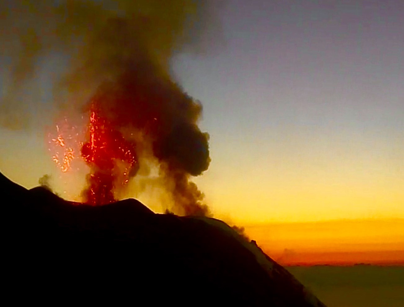
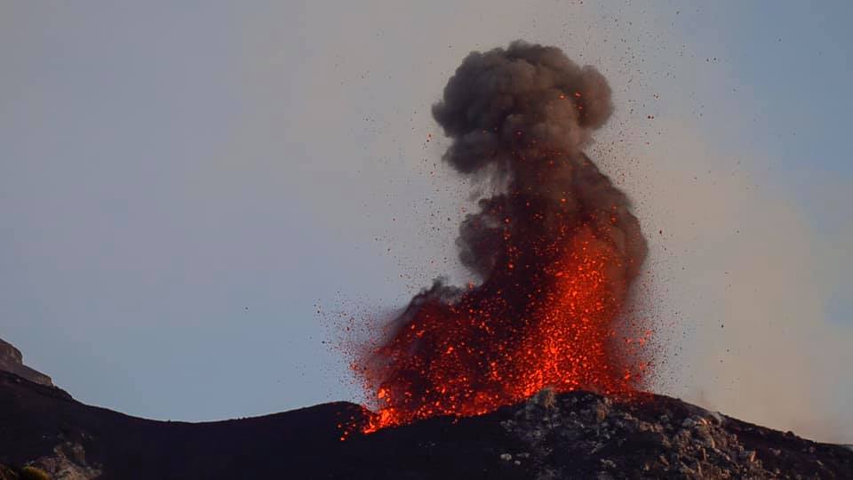
El Salvador , San Miguel ( Chaparrastique) :
Special Report No. 4
CAUTION: slight explosions and degassing continue intermittently on the San Miguel volcano, it is called to be vigilant and not to carry out activities around its central crater.
Broadcast date and time: November 18, 2022, 11:00:00 a.m.
The San Miguel volcano continues to record slight explosions, gas and water vapor emanations, with the probability of generating interruptions in the activities carried out near its crater.
This activity is expected to continue over the next few days, so residents of the area of the municipalities of San Jorge, Chinameca, San Rafael Oriente and areas near the volcano in the municipality of San Miguel are urged to BE ATTENTIVE.
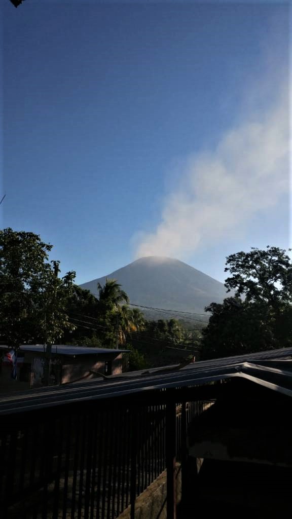
The behavior displayed consists of small explosive impulses, which may continue into the following days. The type of eruptive activity presented by the San Miguel volcano is classified as Strombolian and is characterized by explosions, generally not very violent, accompanied by hot mixtures of gas, ash and rock fragments.
On Tuesday, November 15, six explosions with gas and ash fumes were recorded; Wednesday, nine were registered; Thursday, 11; and so far this morning of Friday the 18th, five more explosions have been recorded.
For what is recommended to the population:
Do not carry out activities in the vicinity of the San Miguel volcano, as long as this activity continues, within a radius of at least 2 km around the crater.
Within a radius of 2 to 5 kilometers, respect the preparedness measures indicated by the National Civil Protection System; as well as identifying escape routes by ensuring that they are in good condition.
Stay tuned for official information as we will update.
Follow the instructions of the authorities of the national civil protection system.
Source : Marn .
Photo : Jorge Rivas.
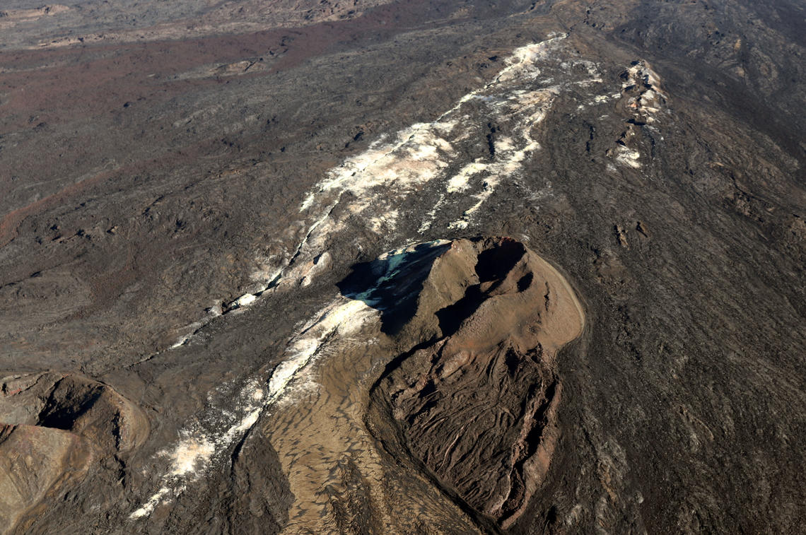
Hawaii , Mauna Loa :
19°28’30 » N 155°36’29 » W,
Summit Elevation 13681 ft (4170 m)
Current Volcano Alert Level: ADVISORY
Current Aviation Color Code: YELLOW
Activity Summary:
Mauna Loa is not erupting and there are no signs of an imminent eruption at this time. Monitoring data show no significant changes within the past 24 hours. Mauna Loa continues to be in a state of heightened unrest as indicated by increased earthquake activity and inflation of the summit. The current unrest is most likely being driven by renewed input of magma 2–5 miles (3–8 km) beneath Mauna Loa’s summit.
Observations:
During the past 24 hours, HVO detected 29 small-magnitude (M3.0 or below) earthquakes 2–3 miles (2–5 km) below Mokuʻāweoweo caldera and 4–5 miles (6–8 km) beneath the upper-elevation northwest flank of Mauna Loa. Both of these regions have historically been seismically active during periods of unrest on Mauna Loa.
Global Positioning System (GPS) instruments at the summit and on the flanks of Mauna Loa continue to measure inflation at rates elevated since mid-September. However, tiltmeters at the summit are not showing significant surface deformation over the past week.
Concentrations of sulfur dioxide (SO2), hydrogen sulfide (H2S), and carbon dioxide (CO2), as well as fumarole temperatures, remain stable at the summit and at Sulphur Cone on the upper Southwest Rift Zone. Webcam and thermal camera views have shown no changes to the volcanic landscape on Mauna Loa over the past week.
Source : HVO
Photo : Sulphur Cone , USGS.