
November 13 , 2023.
Iceland , Reykjanes Peninsula :
Significant likelihood of a volcanic eruption in the coming days
Around 1000 earthquakes within the dyke boundaries from midnight. Models show a 15-km long magma intrusion, located just northwest of Grindavík
Updated 12. November at 12:30 UTC
Since the morning of November 11th, seismic activity at the magma intrusion remains fairly constant. Since midnight November 12th, around 1000 earthquakes have been recorded within the dyke boundaries, and all of them have been below M3.0 in magnitude. The most seismic activity has been from the center of the corridor to the north and south under Grindavík. Most of the earthquakes are at a depth of 3-5 km at the lower part of the magma intrusion.
GPS measurements covering the past 24 hours show that deformation associated with the magma tunnel that formed on Friday, November 10th has slowed. It suggests magma is moving closer to the surface, no models have been run to determine its depth at this time.
It was a joint assessment from the meeting, based on the latest data, that there is scope for temporary measures under the control of the Department of Civil Protection and Emergency Management to collect necessities for the residents and attend to urgent errands in Grindavík and the surrounding area. During such operations, it is necessary to increase the vigilance of the area through additional monitoring with the aim of improving the detection of magma reaching the surface. It was the opinion of the scientists that it would be advisable to start these operations immediately, as uncertainty about the progress of the event grows as the day progresses. The final decision on whether these actions will be taken, and their implementation is in the hands of public safety and the Police Chief in Suðurnes.
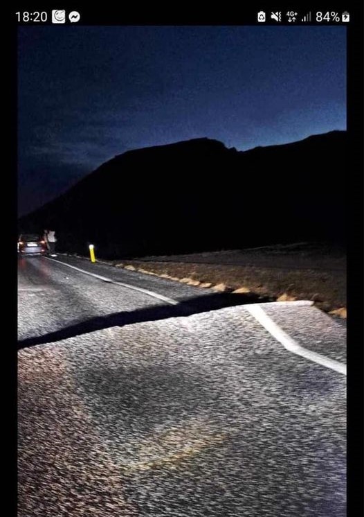
In light of this joint assessment has the Police Chief in Suðurnes decided to allow inhabitant to part of restricted area in Þorkötlustaðahverfi and it is only to retrieve vital items, pets and livestock. This will be organised and controlled operation by the Police. This permission only applies to Þorkötlustaðahverfi. Note, special operation is ongoing to pick up all horses in the area north of Austurver.
Source : IMO
Photo : Dodda lara
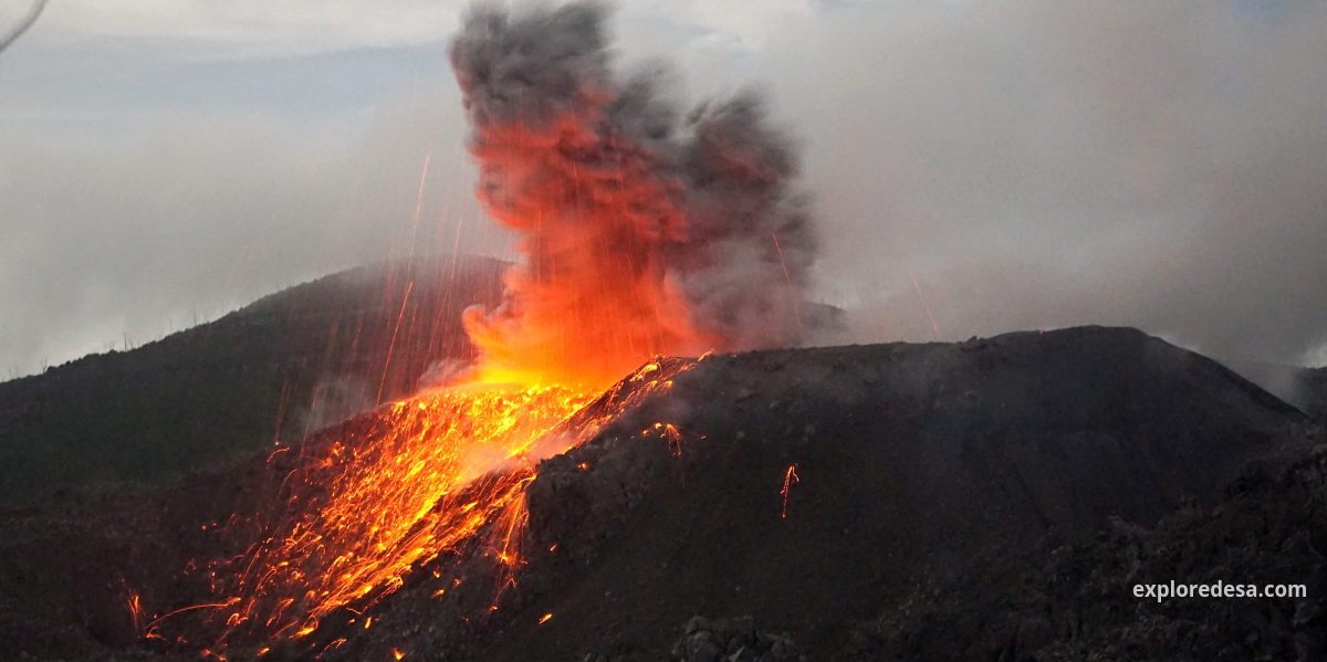
Italy / Sicily , Etna :
Press release on the activity of Etna, November 12, 2023, 2:02 p.m. (1:02 p.m. UTC).
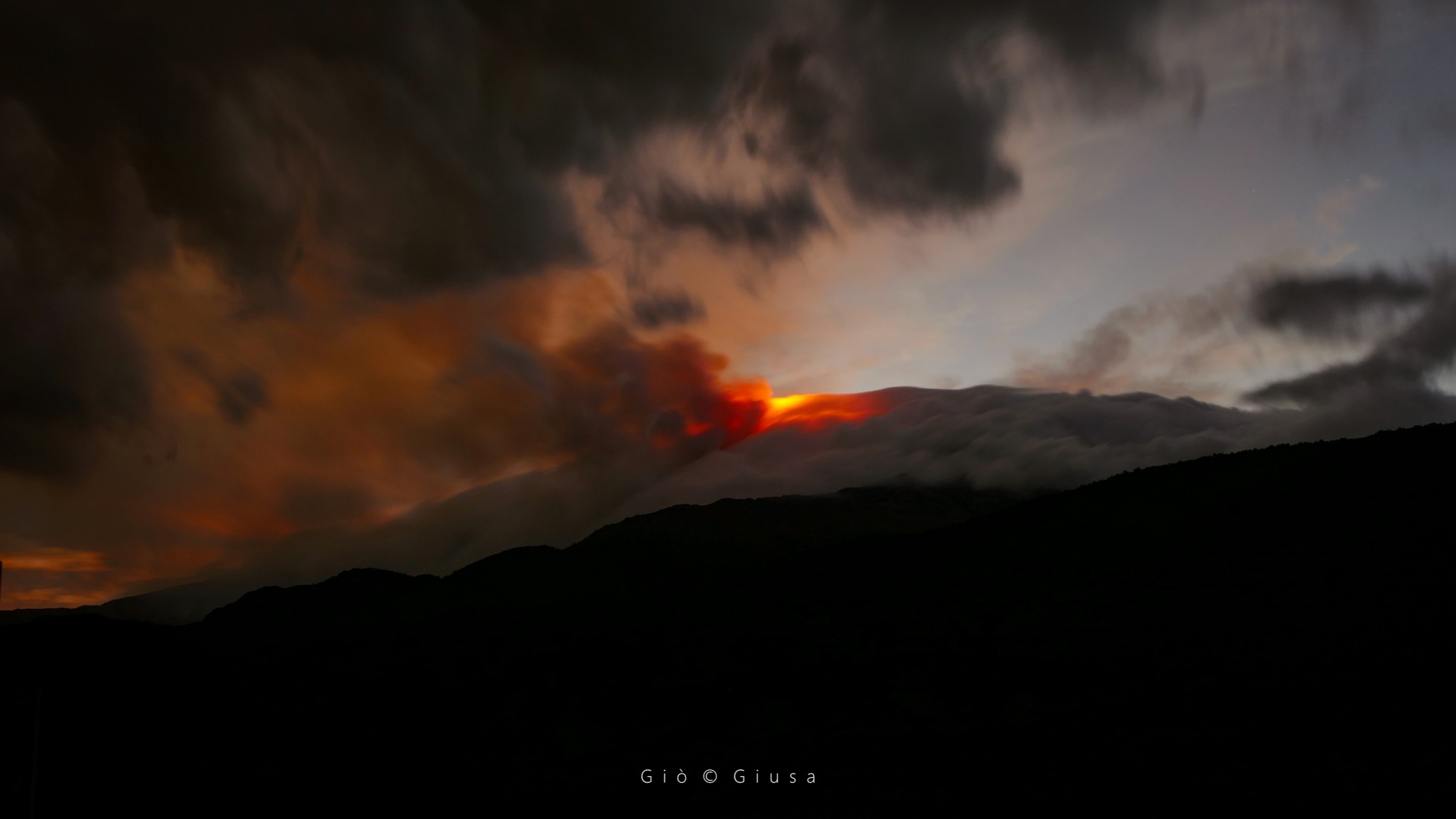
The National Institute of Geophysics and Volcanology, Osservatorio Etneo, communicates that the analysis of images from the surveillance camera network recorded an increase in Strombolian activity at the Southeast Crater at 9 a.m. GMT; this activity is accompanied by a modest overflow of lava, which remains confined in the saddle of the South East crater. From the forecast model for the dispersion of volcanic ash, the simulation of the possible dispersion of the volcanic plume indicates an East – South – East direction.
Starting today night, the volcanic tremor showed a clear increase, reaching high values at 9:00 UTC.
The source locations of the tremor gradually shifted to the Southeast Crater at a depth of approximately 2900 meters above sea level.
The locations of the hours’ infrasound events appear to correspond to the Southeast Crater, but there is a strong wind that could affect the detection ability of the infrasound network.
Signals from GNSS and inclinometer networks currently show no significant changes.
Press release on the activity of Etna, November 12, 2023, 5:03 p.m. (4:03 p.m. UTC).
The National Institute of Geophysics and Volcanology, Osservatorio Etneo, communicates that ash fallout was reported by INGV personnel on the ground in the town of Milo.
The volcanic tremor has further increased compared to the previous press release, remaining localized at the level of the Southeast crater. The amplitude of the infrasound signal has also increased and the events remain mainly localized in the Southeast crater.
The summit inclinometer station PDN records a change in trend from around 2:40 p.m. UTC, however accumulating minimal variations below one microradian. High-frequency GNSS stations do not currently record variations above background noise.
Further updates will be communicated shortly.
Press release on the activity of Etna, November 12, 2023, 6:43 p.m. (5:43 p.m. UTC).
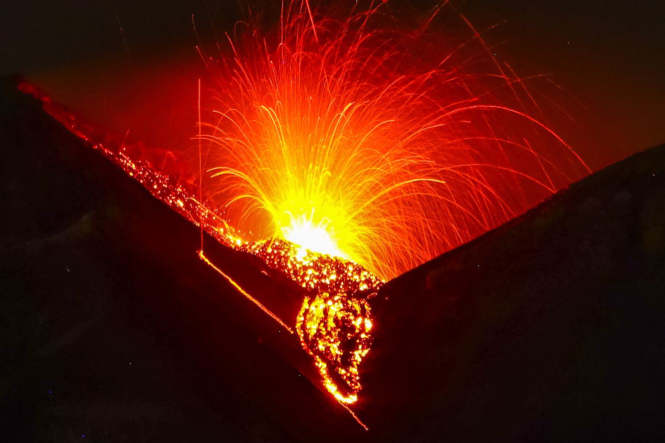
The National Institute of Geophysics and Volcanology, Osservatorio Etneo, announces that from the analysis of images from the surveillance camera network there is a lava fountain at the level of the Southeast crater, the height of the column eruptive is estimated at approximately 4500 m above sea level. From the forecast model of volcanic ash dispersion, the simulation of the dispersion of the volcanic plume indicates an East South East direction. Although the magnitude of volcanic tremor and infrasound events are still increasing, there is no significant variation in terms of location.
The PDN and PLC summit inclinometer stations show minimal variation below 0.3 micro-radiants, consistent with current phenomenology. The other stations do not show any significant variation.
Source : INGV.
Photo : Fabrizio Zuccarello, Gio Giusa .
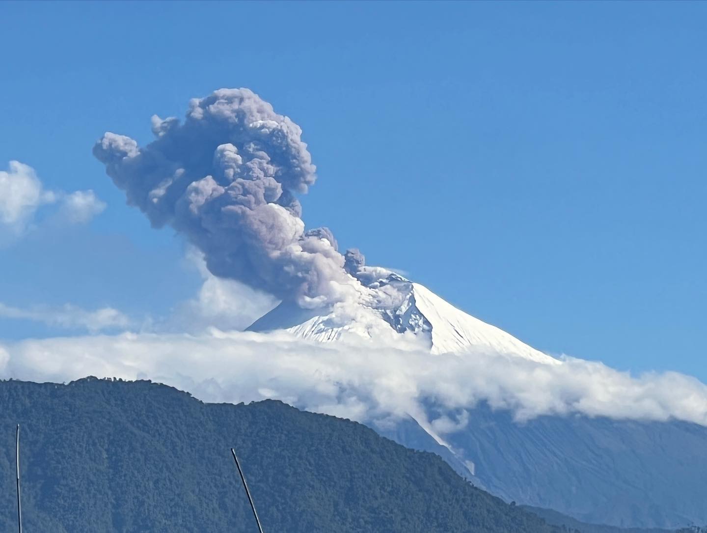
Philippines , Mayon :
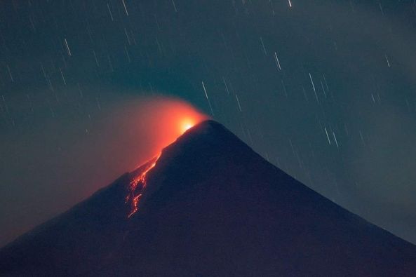
MAYON VOLCANO BULLETIN 13 November 2023 8:00 AM
In the past 24-hour period, the Mayon Volcano Network recorded one hundred twenty-seven (127) volcanic tremors having durations of one (1) to nineteen (19) minutes, one hundred fifty-seven (157) rockfall events, and two (2) pyroclastic density current (PDC) events. The lava flows have maintained their advances to approximately 3.4 kilometers in Bonga (southeastern), 2.8 kilometers in Mi-isi (south), and 1.1 kilometers in Basud (eastern) Gullies. Rockfalls and PDCs generated by the collapse of the summit dome deposited debris still within four (4) kilometers of the crater.
Volcanic sulfur dioxide (SO2) emission averaged 1387 tonnes/day on 12 November 2023. Short-term observations from electronic tilt and GPS monitoring indicate inflation of the northwestern upper and middle slopes since late July 2023 and October 2023, respectively. Longer-term ground deformation parameters from EDM, precise leveling, continuous GPS, and electronic tilt monitoring indicate that Mayon is still generally inflated relative to baseline levels.
Alert Level 3 is maintained over Mayon Volcano, which means that it is currently in a relatively high level of unrest, and hazardous eruption within weeks or even days could still be possible.
Source : Phivolcs
Photo : James Albert Polero
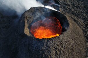
Indonesia , Ibu :
Mount Ibu erupted on Monday, November 13, 2023, at 12:23 WIT. The height of the eruptive column was observed to be ±1,500 m above the peak (±2,825 m above sea level). The ash column was observed to be gray with thick intensity, oriented towards the East. The eruption was recorded on a seismograph with a maximum amplitude of 28 mm and a duration of 96 seconds.
VOLCANO OBSERVATORY NOTICE FOR AVIATION – VONA
Issued : November 13 , 2023
Volcano : Ibu (268030)
Current Aviation Colour Code : ORANGE
Previous Aviation Colour Code : orange
Source : Ibu Volcano Observatory
Notice Number : 2023IBU055
Volcano Location : N 01 deg 29 min 17 sec E 127 deg 37 min 48 sec
Area : North Maluku, Indonesia
Summit Elevation : 4240 FT (1325 M)
Volcanic Activity Summary :
Eruption with volcanic ash cloud at 03h23 UTC (12h23 local).
Volcanic Cloud Height :
Best estimate of ash-cloud top is around 9040 FT (2825 M) above sea level or 4800 FT (1500 M) above summit. May be higher than what can be observed clearly. Source of height data: ground observer.
Other Volcanic Cloud Information :
Ash cloud moving to east. Volcanic ash is observed to be gray. The intensity of volcanic ash is observed to be thick.
Remarks :
Eruption recorded on seismogram with maximum amplitude 28 mm and maximum duration 96 second.
Source : Magma Indonésie.
Photo : Exploredesa .Com (archive).
Ecuador , Sangay :
DAILY REPORT ON THE STATE OF THE SANGAY VOLCANO, Sunday November 12, 2023.
Information Geophysical Institute – EPN.
Surface activity level: High, Surface trend: No changes
Internal activity level: High, Internal trend: No changes
Seismicity: From November 11, 2023, 11:00 a.m. to November 12, 2023, 11:00 a.m.:
The number of seismic events recorded at the reference station over the past 24 hours is shown below. The level of seismic activity of the volcano remains high.
Explosion Event (EXP): 583
Precipitation/Lahars:
During this morning, according to the surveillance camera system, rain was recorded in the areas surrounding the volcano, without generating mudslides and debris. In the event of heavy rains, these could remobilize the accumulated materials, generating mud and debris flows which would descend the sides of the volcano and flow into adjacent rivers.
Emissions/ash column:
Due to unfavorable weather conditions, since yesterday, monitoring of gas and ash emissions through the surveillance camera and the WVAAC reporting system, has recorded only two emissions with heights between 1476 and 1500 m au- above the level of the crater in a northwest and west-southwest direction.
Gas:
The Mounts satellite system reported 91.3 tons of SO2 recorded on 11/11/2023 at 1:05 p.m. TL.
Other monitoring parameters:
Through the MIROVA-MODIS satellite detection system, a high thermal anomaly of 221 MW was recorded and MIROVA-VIIRS recorded a high thermal anomaly of 213 MW in the last 24 hours.
Observation:
Since yesterday, we have been able to observe thanks to the surveillance camera system that the volcano has remained cloudy most of the time. On the other hand, during the night of yesterday and early today several episodes of incandescence could be observed at the level of the crater with a fall of material between 1400 to 1800 m below the level of the crater.
Alert level: yellow
Source : IGEPN.
Photo : AdriáLou Garay Véle


No comment yet, add your voice below!