September 02 , 2023.
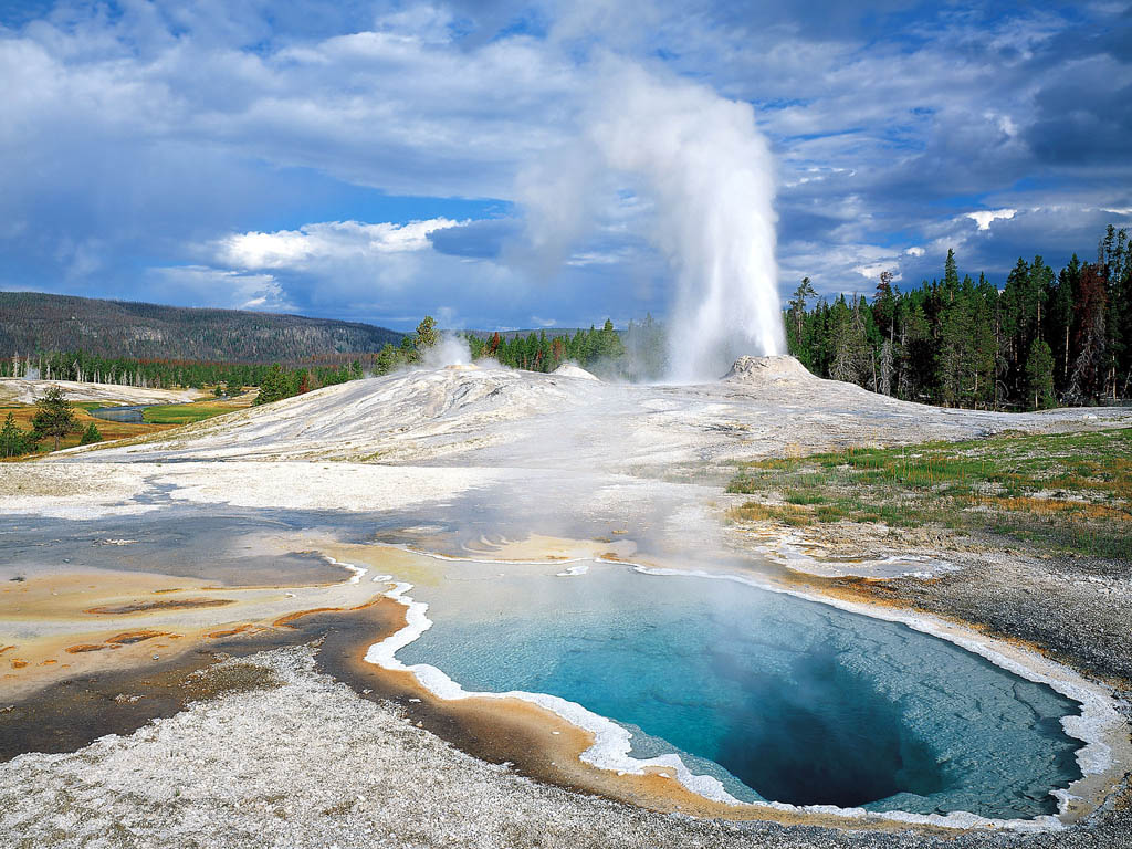
United States , Yellowstone :
Friday, September 1, 2023, 5:41 AM MDT (Friday, September 1, 2023, 11:41 UTC)
44°25’48 » N 110°40’12 » W,
Summit Elevation 9203 ft (2805 m)
Current Volcano Alert Level: NORMAL
Current Aviation Color Code: GREEN
Recent Work and News
Steamboat Geyser erupted on August 25—it’s first eruption in 77 days! This was the sixth eruption of the year.
The section of boardwalk between Sponge Geyser and Doublet Pool on Geyser Hill, not far from Old Faithful, reopened in August after some new and reactivated thermal features, which were splashing hot water and debris onto the pathway in May and June, remained quiescent for the month.
Summer field work by Yellowstone Volcano Observatory scientists continued throughout August, including maintenance of the seismic and GPS networks and the installation of infrastructure for a new combined seismic, infrasound, and GPS monitoring station at Norris Geyser Basin. The work on this site will be completed in September. In addition, the coming month will include maintenance of the continuous gas monitoring station near Mud Volcano and collection of geological and geochemical datasets to better understand Yellowstone’s past geologic history and present conditions.
Seismicity
During August 2023, the University of Utah Seismograph Stations, responsible for the operation and analysis of the Yellowstone Seismic Network, located 136 earthquakes in the Yellowstone National Park region. The largest event of the month was a minor earthquake of magnitude 2.7 located about 18 miles northeast of Moran, Wyoming, on August 12 at 12:38 PM MDT.
August seismicity in Yellowstone was marked by one swarm of 14 earthquakes, located approximately 10 miles north-northeast of Old Faithful, in Yellowstone National Park, during August 2–4. The largest earthquake in the sequence, a magnitude 1.7, occurred on August 2 at 05:22 AM MDT.
Yellowstone earthquake activity is currently at background levels.
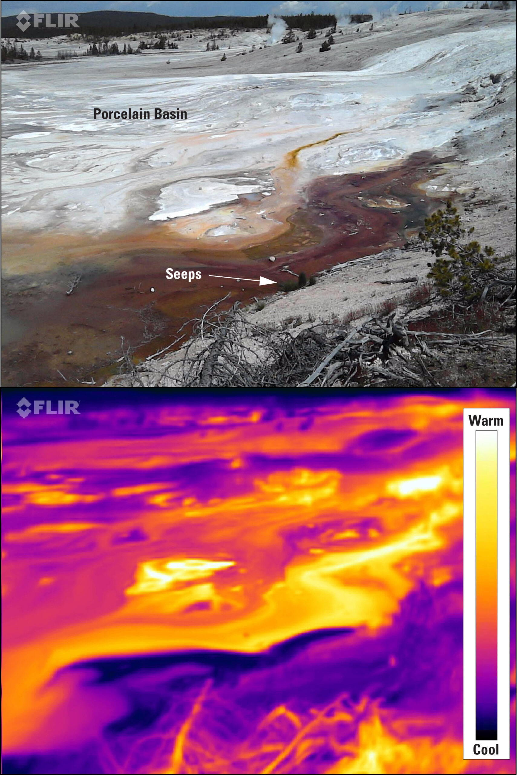
Visible (top) and thermal (bottom) images of Porcelain Basin looking to the north from the old roadbed. Nuphar Lake is off the photograph to the right. Cool-water seeps into Porcelain Basin are clearly evident in the thermal image and appear to flow underground from Nuphar Lake.
Ground Deformation
During the month of August, continuous GPS stations in Yellowstone Caldera recorded a pause in long-term ground subsidence, which has been ongoing since 2015 at rates of a few centimeters (about 1–2 inches) per year. A small amount of seasonal uplift of about 1 cm (0.4 inch) has been recorded as water from snowmelt and runoff percolates into the subsurface, causing the ground to swell like a wet sponge—a style of deformation that occurs each summer—although all of that seasonal uplift occurred during May–July, with no change in August. A GPS station near Norris Geyser Basin did not record any deformation during the past two months after measuring steady subsidence totaling about 3 cm (slightly more than 1 inch) between October 2022 and June 2023.
Source : YVO
Photos : USGS , USGS / Mike Poland,
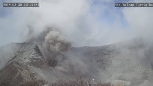
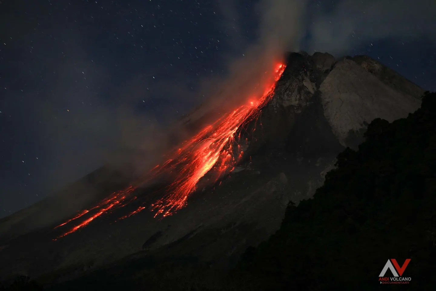
Indonesia , Merapi :
Report on the activity of Mount Merapi from August 25, 2023 to August 31, 2023, Published on September 1, 2023.
OBSERVATION RESULTS
Visual
The weather around Mount Merapi is generally sunny in the morning and afternoon, while the evening is foggy. White smoke, fine to thick, low to medium pressure and 300 m high was observed from the observation post of Mount Merapi in Ngepos on August 31, 2023 at 6:00 a.m.
This week, lava avalanches were observed 198 times towards the South and South-West, including 2 times upstream of the Boyong River up to a maximum of 1,000 m, 115 times upstream of the Bebeng River up to at 2,300 m and 3 times upstream of the Senowo River up to a maximum of 500 m. The sound of avalanches was heard 22 times from the Babadan post with low to moderate intensity.
The morphology of the southwest dome underwent changes due to growth activity and lava avalanches, while no significant changes were observed for the central dome. Based on aerial photo analysis on August 30, 2023, the measured volume of the southwest dome was 2,858,600 m3 and the central dome was 2,355,100 m3.
Seismicity
This week, the seismicity of Mount Merapi showed:
149 shallow volcanic earthquakes (VTB),
1169 multi-phase (MP) earthquakes,
12 low frequency (LF) earthquakes,
1000 avalanche earthquakes (RF)
7 tectonic earthquakes (TT).
The intensity of seismicity this week is lower than last week, but the number of earthquakes is still quite high.
Deformation
The deformation of Mount Merapi that was monitored using EDM this week showed a shortening of steepening distance of 2.5 cm/day.
Rain and lahars:
There was no rain this week at Pengamatan’s Mount Merapi lookout post. There have been no reports of additional flows or lahars from rivers flowing down from Mount Merapi.
Conclusion
Based on the results of visual and instrumental observations, it is concluded that:
-Mount Merapi’s volcanic activity is still quite high in the form of effusive eruption activity. The activity status is defined at the “SIAGA” level.
The current danger potential is in the form of lava avalanches and hot clouds in the South-South-West sector including the Boyong river for a maximum of 5 km, the Bedog, Krasak, Bebeng rivers for a maximum of 7 km. In the South-East sector, it includes the Woro river for a maximum of 3 km and the Gendol river for 5 km. While the ejection of volcanic material in the event of an explosive eruption can reach a radius of 3 km from the summit.
Source : BPPTKG
Photo : Andi volcanist .
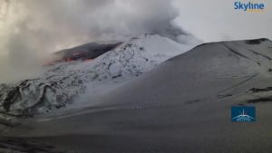
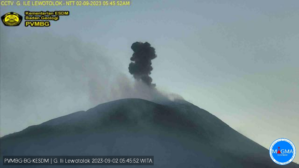
Indonesia , Ili Lewotolok :
Mount Ili Lewotolok erupted on Saturday, September 2, 2023, at 05:43 WITA. The height of the eruptive column was observed to be ± 700 m above the peak (± 2,123 m above sea level). The ash column was observed to be gray to black in color with thick intensity, oriented to the West and Northwest. The eruption was recorded on a seismograph with a maximum amplitude of 20.2 mm and a duration of 192 seconds.
VOLCANO OBSERVATORY NOTICE FOR AVIATION – VONA
Issued : September 01 , 2023
Volcano : Ili Lewotolok (264230)
Current Aviation Colour Code : ORANGE
Previous Aviation Colour Code : orange
Source : Ili Lewotolok Volcano Observatory
Notice Number : 2023LEW050
Volcano Location : S 08 deg 16 min 19 sec E 123 deg 30 min 18 sec
Area : East Nusa Tenggara, Indonesia
Summit Elevation : 4554 FT (1423 M)
Volcanic Activity Summary :
Eruption with volcanic ash cloud at 21h43 UTC (05h43 local).
Volcanic Cloud Height :
Best estimate of ash-cloud top is around 6794 FT (2123 M) above sea level or 2240 FT (700 M) above summit. May be higher than what can be observed clearly. Source of height data: ground observer.
Other Volcanic Cloud Information :
Ash cloud moving from west to northwest. Volcanic ash is observed to be gray to dark. The intensity of volcanic ash is observed to be thick.
Remarks :
Eruption recorded on seismogram with maximum amplitude 20.2 mm and maximum duration 192 second.
Source et photo : Magma Indonésie.
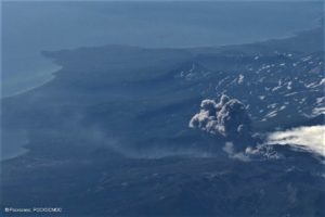
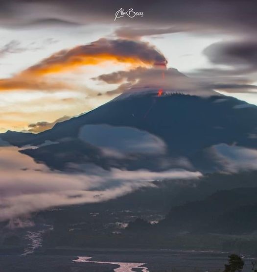
Ecuador , Sangay :
DAILY REPORT ON THE STATE OF THE SANGAY VOLCANO, Friday September 1, 2023.
Information Geophysical Institute – EPN.
Surface activity level: High, Surface trend: No changes
Internal activity level: High, Internal trend: No changes
Seismicity: From August 31, 2023, 11:00 a.m. to September 1, 2023, 11:00 a.m.:
The number of seismic events recorded at the reference station over the past 24 hours is shown below. The level of seismic activity of the volcano remains high.
Explosion Event (EXP): 358.
Precipitation/Lahars:
No rain was recorded in the volcano area which could generate mud and debris flows. **In the event of heavy rains, these could remobilize the accumulated materials, generating mud and debris flows which would descend the sides of the volcano and flow into adjacent rivers.
Emissions/ash column:
There are no emissions reports.
Gas:
The Mounts satellite system recorded 206.3 tonnes of sulfur dioxide (SO2), measured on 08/31/2023 at 1:54 p.m. TL.
Other monitoring parameters:
According to the MIROVA-MODIS satellite system, a weak thermal anomaly of 7 MW was recorded over the last 24 hours.
Observation:
Since yesterday, thanks to the surveillance camera system, it has been observed that the volcano remains completely cloudy. However, during the evening of yesterday and early today, several episodes of incandescence were observed at the level of the crater, accompanied by the descent of volcanic materials through the ravine and the southeastern flanks of the volcano, which reached between 1,000 and 1,800 m below the level of the crater.
Alert level: Orange.
Source : IGEPN.
Photo : AlexBoasphoto.
Peru , Sabancaya :
o Moderate level eruptive process.
o Over the past 24 hours, 14 volcanic explosions were recorded with emissions of ash and water vapor that reached heights of up to 1,000 m above the volcano summit.
o 58 Long Period (LP) seismic signals were recorded, linked to the movement of magma and gases typical of the current eruptive process.
o Monitoring the deformation of the volcanic structure, using GNSS data (processed with fast orbits), does not present significant anomalies; However, in general, a slight inflation was recorded in the station located in the North sector (Hualca Hualca).
o According to the analysis of satellite images and the SENAMHI dispersion model, the dispersion of ashes and gases took place towards the South-East and East sectors, towards the areas of
pasture
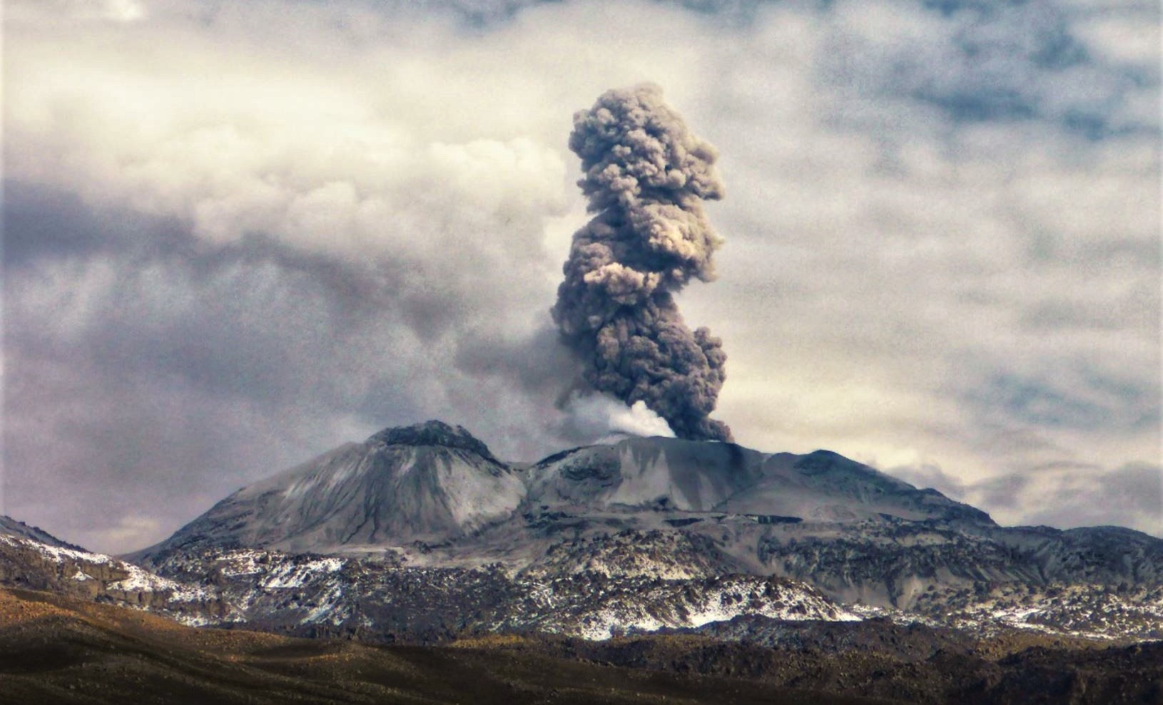
o The approximate radius of impact due to ashfall after today’s emissions is less than 15 km from the crater, that is, in the Sabancaya volcano area.
o Satellite systems detected 1 thermal anomaly of 2 MW linked to the presence of a lava body on the surface of the volcano crater.
Conclusion:
The eruptive activity of the Sabancaya volcano remains at moderate levels, that is, with the continuous recording of emissions of columns of gas and ash up to 1,000 m in height above the summit of the volcano and their resulting dispersion. The population must remain vigilant in the face of possible ash falls and follow the recommendations made by the Civil Protection authorities.
Recommendation: Stay attentive to volcanological reports and bulletins issued by the IGP through CENVUL.
Current volcanic alert level: orange.
Source : IGP
Photo : Andina