
July 30 , 2023.
La Réunion , Piton de la Fournaise :
Press release from the Institute of Earth Physics in Paris, Volcanological Observatory of Piton de la Fournaise. July 29, 2023 – 13:00 – 09:00 UTC
Ongoing eruption
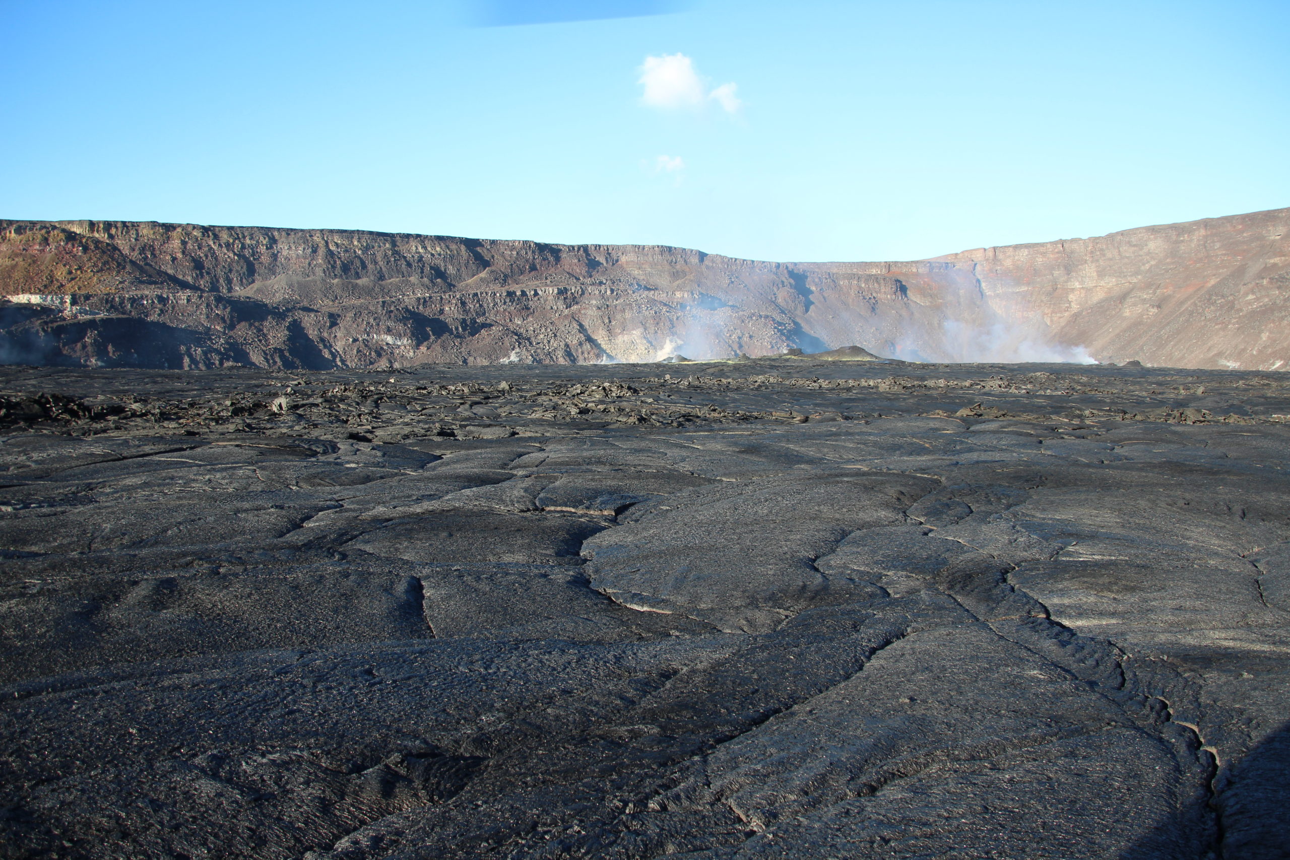
The eruption which began on July 02, 2023, around 08:30 local time continues. The amplitude of the volcanic tremor (indicator of an emission of lava and gas on the surface) still remains very low compared to the start of the eruption.
Over the past 24 hours, the flows – estimated by satellite method on the HOTVOLC platform (OPGC – Clermont Auvergne University) – were always < 4 m3/sec. Given the cloud mass present regularly on the eruptive site as well as the presence of lava tunnels, these flows may be underestimated.
With the low surface activity, the morphology of the active volcanic cone – located southeast of the Enclos Fouqué at 1720 m altitude – hardly changes. Lava projections are rare and the flow of the lava takes place mainly in lava tunnels. The resurgence points – and therefore the visible flows – are currently located at lower altitudes at distances between 1200 and 2500 m from the eruptive cone, i.e. up to a minimum altitude of 900 m.
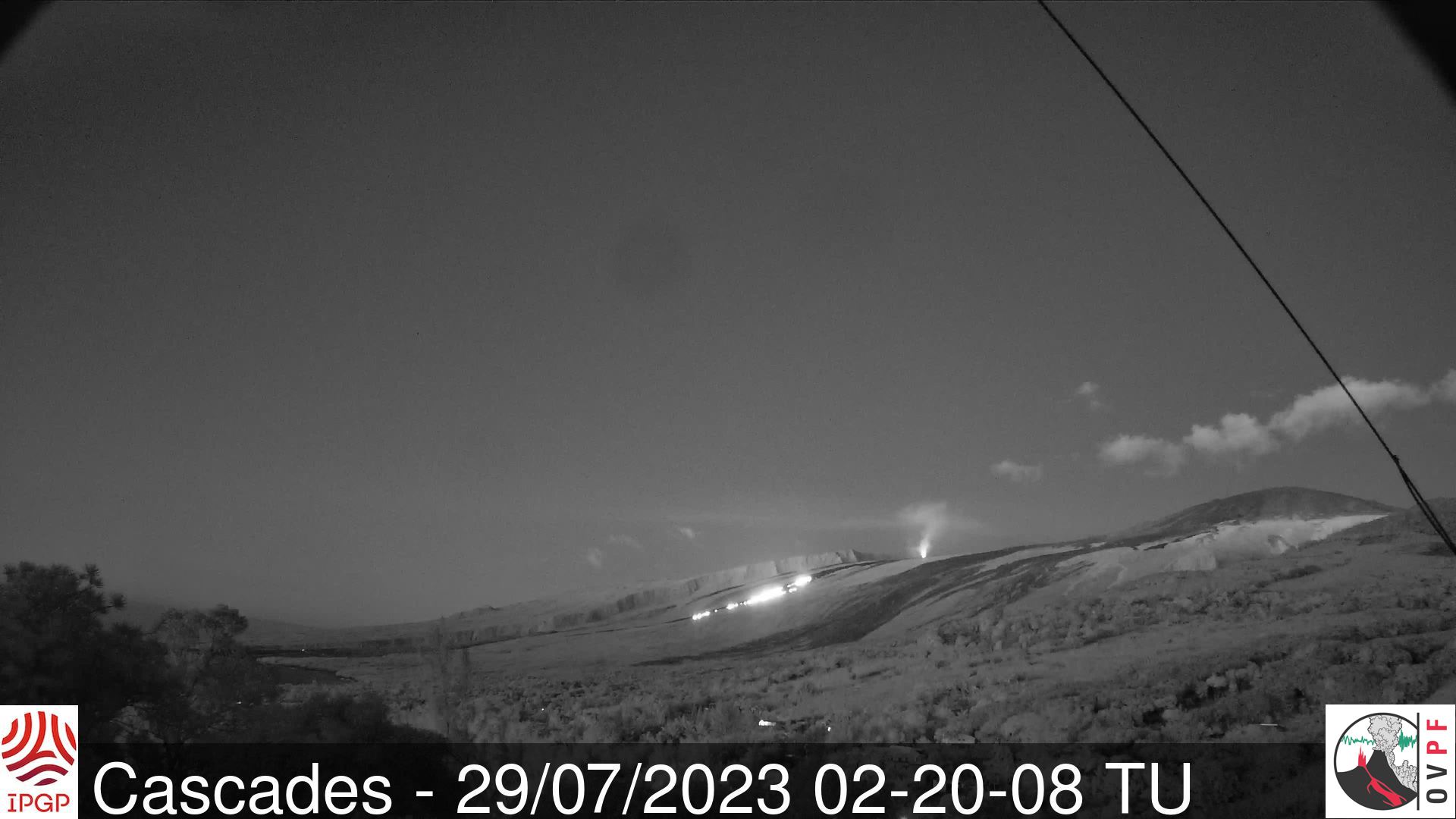
The flow front has not changed since July 5 and is now frozen. It is 1.8 km from the road.
A weak inflation of the summit zone is always recorded since mid-July, indicating a re-pressurization of the feeding system of the volcano centered under the summit zone with possibly the transfer of deep magma towards the latter, then coming to feed the eruption. .
The seismic activity recorded under the summit zone remains weak. Thus over the last 24 hours, no superficial volcano-tectonic earthquake has been recorded. This low seismic activity leads to a reduction in the risk of the appearance of a new crack and/or collapse in the crater, but does not mean that it can be excluded, as shown by the continuation of the summit inflation and the fluctuations in the amplitude of the tremor which are regularly observed.
Alert level: Alert 2-1 (eruption in the Enclos without any particular threat to the safety of people, property or the environment)
Source et photo : OVPF.
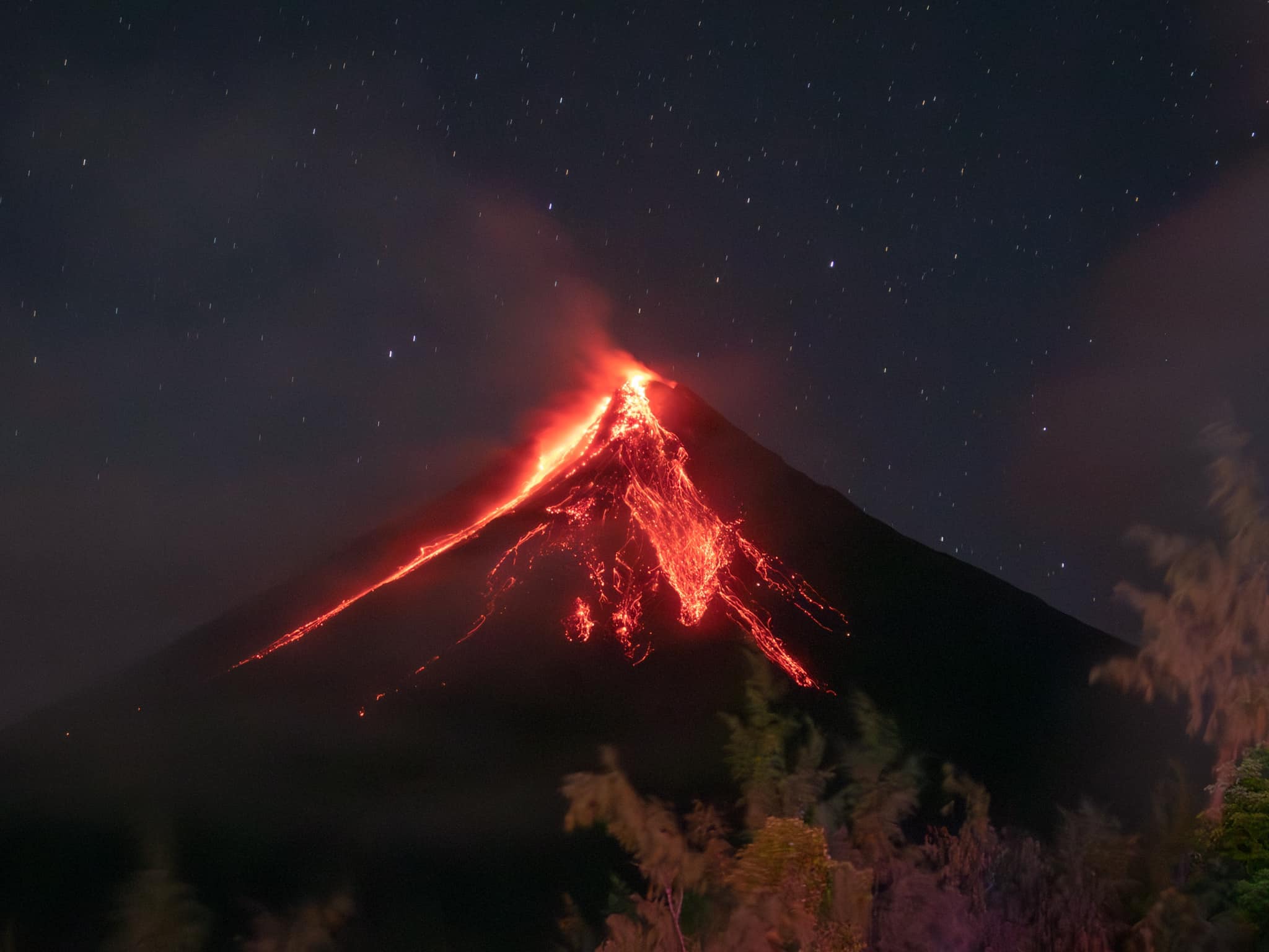
Philippines , Mayon :
MAYON VOLCANO BULLETIN 30 July 2023 8:00 AM
In the past 24-hour period, there has been a marked weakening of slow lava effusion from the summit crater of Mayon Volcano that fed lava flows on the Mi-isi (south), Bonga (southeastern), and Basud (eastern) gullies. Respectively, these lava flows have maintained distal lengths of approximately 2.8 kilometers, 3.4 kilometers, and 600 meters from the crater. No pyroclastic density currents (PDC) and fewer rockfall events were detected.* In total, sixty-eight (68) low-frequency volcanic earthquakes or LFVQs, as well as eighteen (18) rockfall events, were recorded by the Mayon Volcano Network
.
Volcanic sulfur dioxide (SO2) emission averaged 2,356 tonnes/day on 29 July 2023. Short-term observations from electronic tilt and GPS monitoring indicate a deflation of the eastern lower flanks in early July 2023 and inflation of the northwest middle flanks in the third week of July 2023. Longer-term ground deformation parameters from EDM, precise leveling, continuous GPS, and electronic tilt monitoring indicate that Mayon is still generally inflated relative to baseline levels.
Alert Level 3 is maintained over Mayon Volcano, which means that it is currently in a relatively high level of unrest and hazardous eruption within weeks or even days could still be possible.
Source : Phivolcs
Photo : Rick Estillomo
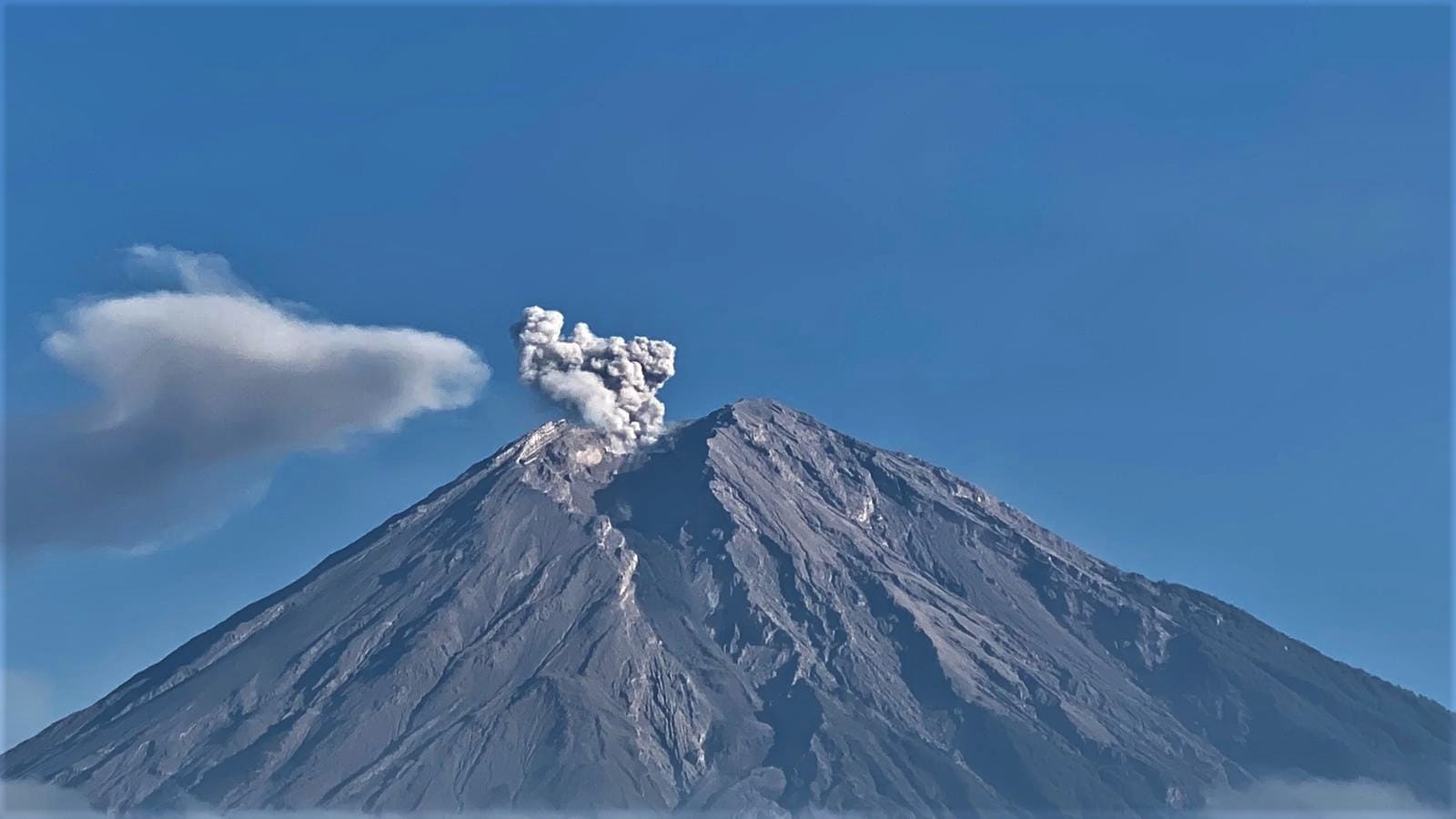
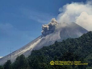
Indonesia , Semeru :
VOLCANO OBSERVATORY NOTICE FOR AVIATION – VONA
Issued : July 30 , 2023
Volcano : Semeru (263300)
Current Aviation Colour Code : ORANGE
Previous Aviation Colour Code : orange
Source : Semeru Volcano Observatory
Notice Number : 2023SMR250
Volcano Location : S 08 deg 06 min 29 sec E 112 deg 55 min 12 sec
Area : East java, Indonesia
Summit Elevation : 11763 FT (3676 M)
Volcanic Activity Summary :
Eruption with volcanic ash cloud at 05h06 UTC (12h06 local).
Volcanic Cloud Height :
Best estimate of ash-cloud top is around 14003 FT (4376 M) above sea level or 2240 FT (700 M) above summit. May be higher than what can be observed clearly. Source of height data: ground observer.
Other Volcanic Cloud Information :
Ash cloud moving from southeast to south. Volcanic ash is observed to be gray. The intensity of volcanic ash is observed to be thick.
Remarks :
Eruption recorded on seismogram with maximum amplitude 22 mm and maximum duration 107 second.
Source : Magma Indonésie.
Photo : Andi Volcanist.
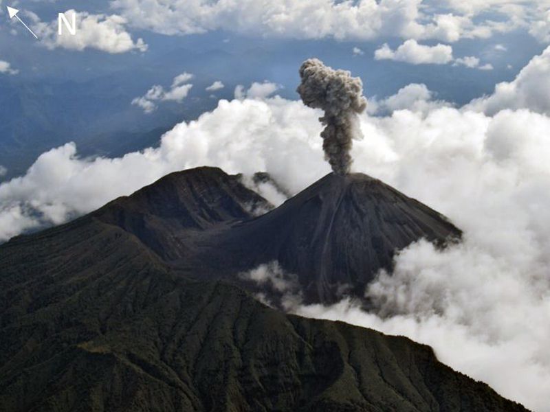
Ecuador , Reventador :
DAILY REPORT OF THE STATE OF THE REVENTADOR VOLCANO, Saturday July 29, 2023.
Information Geophysical Institute – EPN.
Surface Activity Level: High, Surface Trend: Unchanged
Internal activity level: Moderate, Internal trend: No change
Seismicity: From June 24, 2023, 11:00 a.m. to June 25, 2023, 11:00 a.m.:
The following table shows the number of seismic events from the reference station over the past 24 hours.
Explosion(EXP): 59
Long period (LP): 25
Transmit Tremor (TREM): 7
Rains / Lahars:
There is no rain report. “In the event of heavy rains, these could remobilize the accumulated materials, generating mudslides and debris that would descend the flanks of the volcano and pour into the adjacent rivers.
Emission / Ash Column:
During yesterday afternoon, three gas and ash emissions were recorded with heights less than 600 meters above crater level, heading west.
Observation:
During the afternoon yesterday, the volcano remained partially clear. In addition, in the early hours of today, incandescence was recorded at the crater level as well as incandescent material descending along the flanks to 400 meters below the crater level. At the moment, the volcano is completely cloudy.
Alert level: Orange.
Source : IGEPN.
Photo : F-Naranjo , GVP.
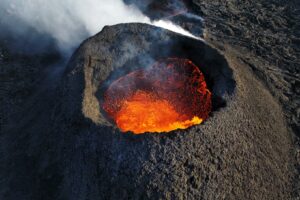
Hawaii , Kilauea :
Tuesday, July 25, 2023, 9:00 AM HST (Tuesday, July 25, 2023, 19:00 UTC)
19°25’16 » N 155°17’13 » W,
Summit Elevation 4091 ft (1247 m)
Current Volcano Alert Level: ADVISORY
Current Aviation Color Code: YELLOW
Activity Summary:
Kīlauea volcano is not erupting. The summit eruption of Kīlauea volcano, within Halemaʻumaʻu crater, paused on June 19th, 2023. Lava is no longer flowing on the crater floor. No significant changes have been observed at the summit or in either rift zone over the past week.
Summit Observations:
Over the past week, seismicity has been at background levels and summit tiltmeters recorded minor inflation. Sulfur dioxide (SO2) emissions from the summit remain low; the most recent SO2 emission rate, of approximately 115 tonnes per day, was measured on July 22.
Halemaʻumaʻu Lava Lake Observations:
No active lava has been observed since June 19.
East Rift Zone Observations:
No unusual activity has been noted along the East Rift Zone or Southwest Rift Zone; steady rates of ground deformation and seismicity continue along both. Measurements from continuous gas monitoring stations downwind of Puʻuʻōʻō in the middle East Rift Zone remain below detection limits for SO2, indicating that SO2 emissions from Puʻuʻōʻō are negligible.
Source : HVO.
Photo : USGS / N. Deligne.

No comment yet, add your voice below!