January 27 , 2023.
Chile , Lascar :
Special report on volcanic activity (REAV), Antofagasta region, Lascar volcano, January 26, 2023, 11:40 a.m. local time (mainland Chile).
The National Service of Geology and Mines of Chile (Sernageomin) publishes the following PRELIMINARY information, obtained through the monitoring equipment of the National Volcanic Monitoring Network (RNVV), processed and analyzed at the Volcanological Observatory of the Southern Andes ( Ovdas):
On Thursday January 26, 2023, at 10:31 a.m. local time (1:31 p.m. UTC), the monitoring stations installed near the Lascar volcano recorded an earthquake associated with fluid dynamics (long period type) in the volcanic system.
The characteristics of earthquakes after their analysis are as follows:
ORIGINAL TIME: 10:31 a.m. local time (1:31 p.m. UTC)
REDUCED TRAVEL: 78 (cm*cm)
COMMENTS:
This LP-type earthquake is the most energetic recorded in recent months. In addition, we note the presence of a lower energy VT-B seismicity before the mentioned earthquake. After the mentioned earthquake, the recording of this LP and VT-B type seismicity continued, with moderate energy, suggesting a possible change in the technical alert level. The surface activity of the Lascar volcano continues with low energy passive degassing.
The volcanic technical alert remains at the Green level.
Special report on volcanic activity (REAV), Antofagasta region, Lascar volcano, January 26, 2023, 2:00 p.m. local time (mainland Chile).
The National Service of Geology and Mines of Chile (Sernageomin) publishes the following PRELIMINARY information, obtained through the monitoring equipment of the National Volcanic Monitoring Network (RNVV), processed and analyzed at the Volcanological Observatory of the Southern Andes ( Ovdas):
On Thursday January 26, 2023, at 10:31 a.m. local time (1:31 p.m. UTC), the monitoring stations installed near the Lascar volcano recorded an increase in seismicity associated with the volcanic system, in the form of events related to the internal dynamics of volcanic fluids, which show more superficial origins. The presence of this seismic activity with energies stronger than usual are frequent in the high periods of volcanic activity, which can lead to the occurrence of new emissions of volcanic materials on the surface, as what occurred on December 1 2022.
For all this, the Sernageomin raises the technical alert level of the Lascar volcano to the YELLOW level.
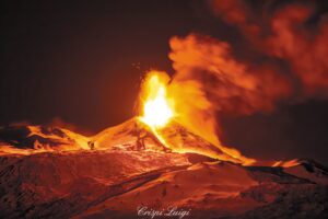
Special report on volcanic activity (REAV), Antofagasta region, Lascar volcano, January 27, 2023, 00:10 a.m. local time (mainland Chile).
The National Service of Geology and Mines of Chile (Sernageomin) publishes the following PRELIMINARY information, obtained through the monitoring equipment of the National Volcanic Monitoring Network (RNVV), processed and analyzed at the Volcanological Observatory of the Southern Andes ( Ovdas):
On Thursday January 26, 2023, at 22:59 local time (Friday January 27 at 01:59 UTC), the monitoring stations installed near the Lascar volcano recorded a tremor-type earthquake, associated with fluid dynamics (TR type) in the system. volcanic, with a manifestation on the surface corresponding to a pulse with incandescence and emission of a column of 1880 m altitude, dispersing towards the North-West, with probably a pyroclast content.
The characteristics of earthquakes after their analysis are as follows:
ORIGINAL TIME: 10:59 PM local time (Friday, January 27 at 01:59 UTC)
REDUCED TRAVEL: 1.31 (cm*cm)
MAXIMUM HEIGHT OF THE COLUMN: 1880 meters above the point of emission
DIRECTION OF DISPERSION: North West (NW).
COMMENTS:
At the time of issuing this report, the tremor-type seismicity continues.
The volcanic technical alert remains at the YELLOW level.
Source et photo : Sernageomin.
Indonesia , Anak Krakatau :
An eruption of Mount Anak Krakatau occurred on Friday January 27, 2023 at 1:12 p.m., with the height of the ash column observed at ± 350 m above the peak (± 507 m above sea level). The ash column was observed to be gray with light to medium intensity oriented to the northeast. At the time of writing this report, the eruption was still ongoing.
VOLCANO OBSERVATORY NOTICE FOR AVIATION – VONA
Issued : January 27 , 2023
Volcano : Anak Krakatau (262000)
Current Aviation Colour Code : ORANGE
Previous Aviation Colour Code : orange
Source : Anak Krakatau Volcano Observatory
Notice Number : 2023KRA032
Volcano Location : S 06 deg 06 min 07 sec E 105 deg 25 min 23 sec
Area : Lampung, Indonesia
Summit Elevation : 502 FT (157 M)

Volcanic Activity Summary :
Eruption with volcanic ash cloud at 06h12 UTC (13h12 local).
Volcanic Cloud Height :
Best estimate of ash-cloud top is around 1622 FT (507 M) above sea level or 1120 FT (350 M) above summit. May be higher than what can be observed clearly. Source of height data: ground observer.
Other Volcanic Cloud Information :
Ash cloud moving to northeast. Volcanic ash is observed to be gray. The intensity of volcanic ash is observed from thin to medium.
Remarks :
Eruption and ash emission is continuing.
Source et photo : Magma Indonésie.
Hawaii , Kilauea :
Thursday, January 26, 2023, 8:59 AM HST (Thursday, January 26, 2023, 18:59 UTC)
19°25’16 » N 155°17’13 » W,
Summit Elevation 4091 ft (1247 m)
Current Volcano Alert Level: WATCH
Current Aviation Color Code: ORANGE
Activity Summary:
The summit eruption of Kīlauea Volcano, within Halemaʻumaʻu crater, continued over the past 24 hours. All recent eruptive activity has been confined to the crater. No significant changes have been observed at the summit or in either rift zone.
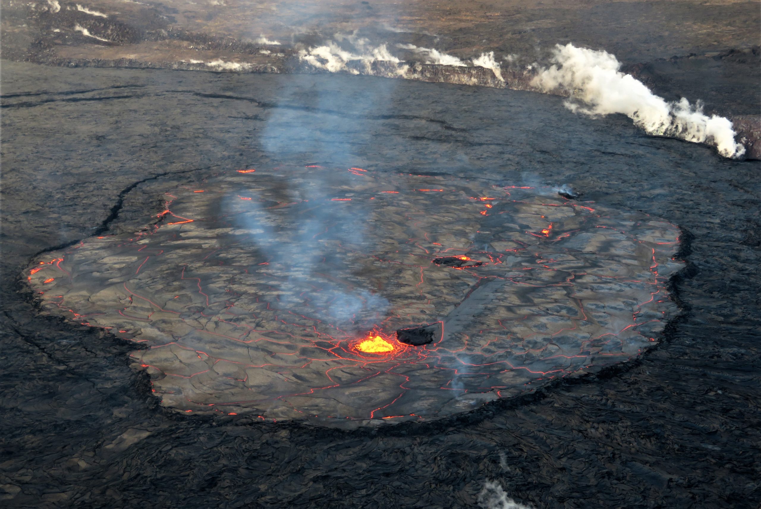
A wide view of the entire eastern lake in Halema‘uma‘u, at the summit of Kīlauea, on January 20. .
Halemaʻumaʻu Lava Lake Observations:
Eruption of lava in the eastern portion of Halemaʻumaʻu crater floor continued over the past 24 hours. Activity is concentrated in a large lava lake in the eastern half of the crater, as well as a smaller lake to the west, in the basin of the 2021–2022 lava lake. The eastern lava lake has one dominant fountain and an area of approximately 25 acres as of January 17. The lake is currently well-defined by its levee boundaries, though there are periods of frequent overflows.
Summit Observations:
Summit tiltmeters have been flat over the past 24 hours. Volcanic tremor remains above background levels. A sulfur dioxide (SO2) emission rate of approximately 3,000 tonnes per day (t/d) was measured on January 20, 2023.
Source : HVO.
Photo : USGS / M. Patrick
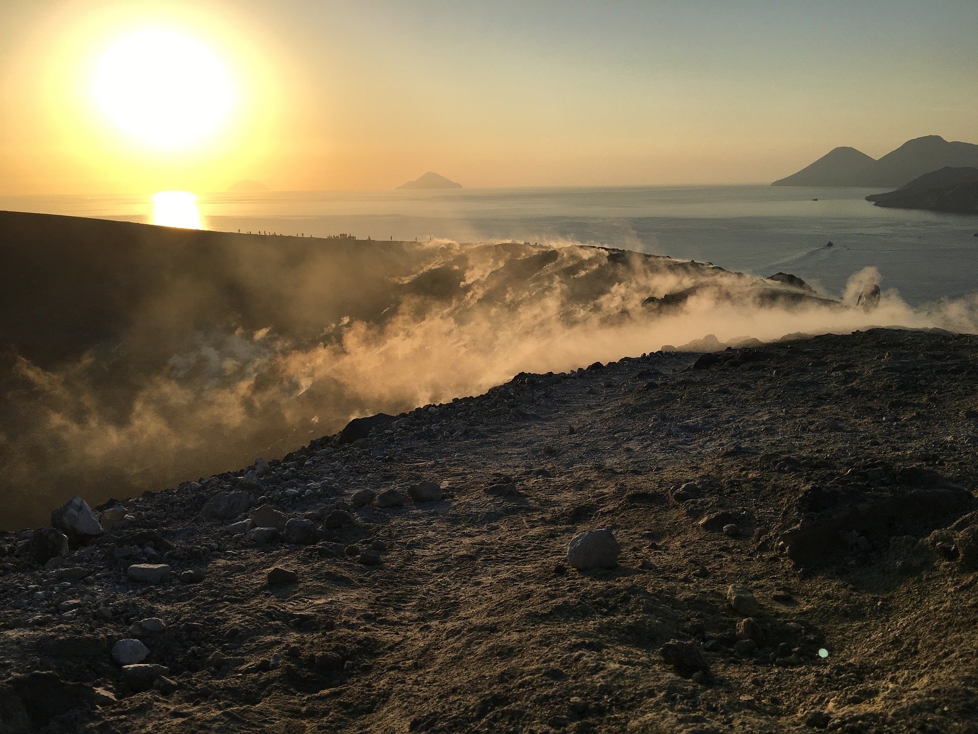
Italy , Vulcano :
WEEKLY BULLETIN, from January 16, 2023 to January 22, 2023. (issue date 24 January 2023)
ACTIVITY STATUS SUMMARY
In the light of the monitoring data, it is highlighted:
1) Temperature of the crater fumaroles: The temperatures recorded on the edge of the crater are stable at high values.
2) CO2 flux in the crater area: The CO2 flux in the crater area remains at high values.
3) SO2 flux in the crater area: On a moderately medium-high level.
4) Geochemistry of fumarolic gases: There are no updates.
5) CO2 fluxes at the base of the La Fossa cone and in the Vulcano Porto area: In the C. Sicilia, P4max and Rimessa sites, the CO2 fluxes present values above the background and stable levels; on the Faraglione site, the values recorded are decreasing and close to the background level.
6) Geochemistry of thermal aquifers: In the Camping Sicilia well, there is an increasing trend in conductivity and stable values for temperature; in the Bambara well, no significant variation in the monitored parameters is observed.
7) Local seismicity: Low occurrence rate of local microseismicity.
8) Regional seismicity: No earthquake with Ml>=1.0 was located, during the week in question, in the area of the island of Vulcano.
9) Deformations – GNSS: The network of permanent GNSS stations has not recorded any significant variations.
10) Deformations – Inclinometry: The inclinometric network did not record any significant variations.
11) Gravimetry: No significant medium-long term variation was recorded.
CRATER FUMEROLES TEMPERATURE:
The fumarolic field presented homogeneous emission temperatures along the summit fracture line, confirming a thermal anomaly maintained by a stable vapor flow. Along the summit rim, the emission temperature showed an hourly maximum of 366°C (T3). The hourly temperature range recorded on board is 309 to 366°C. Following an extraordinary rainy event, which influenced the exhalation dynamics, we recorded a considerable decrease in emission temperatures on 2 sensors (T1 and T2, the temperature has not yet been recovered), while the signal temperature at reference sensor T3 remained unchanged.
N.B. On January 21, more than 34 mm of rain fell, 23 mm concentrated in the first hour alone – Meteo System data).
Source : INGV.
Photo : Ketty Zambuto via Vulcano Trekking.
Guatemala , Fuego :
Activity:
The Fuego Volcano Observatory reports 3 to 5 weak, moderate and a few strong explosions per hour, these explosions generate columns of ash at a height of 4,300 to 4,700 meters above sea level (14,107 – 15,419 feet) which are disperse over 12 kilometers to the West, South-West and East due to the variable wind. These explosions generated low to moderate rumblings, which caused shock waves that rattled the roofs and windows of houses near the volcano.

Incandescent pulses were observed 300 to 350 meters above the crater. This generated weak to moderate avalanches around the crater and towards the ravines of Ceniza, Santa Teresa, Las Lajas and Taniluyá, whose material reached the edge of the vegetation. Light sounds similar to a train locomotive were heard for a duration of 1 minute. Ashfall is recorded in Alotenango, among other nearby communities, with a likelihood of ashfall in communities to the west and northwest.
Source : Insivumeh.
Photo : Diego Rizzo.