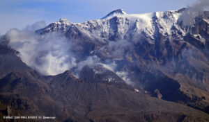
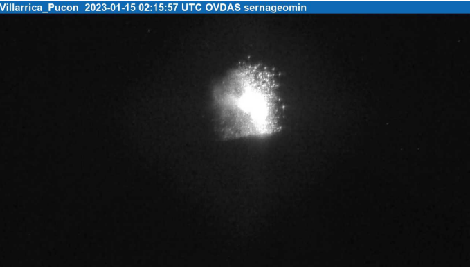
January 15 , 2023 .
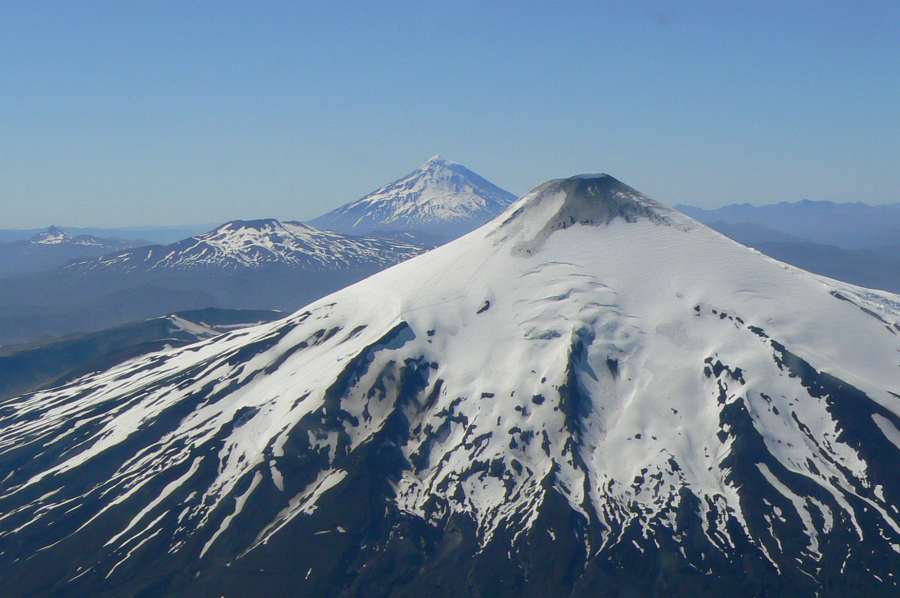
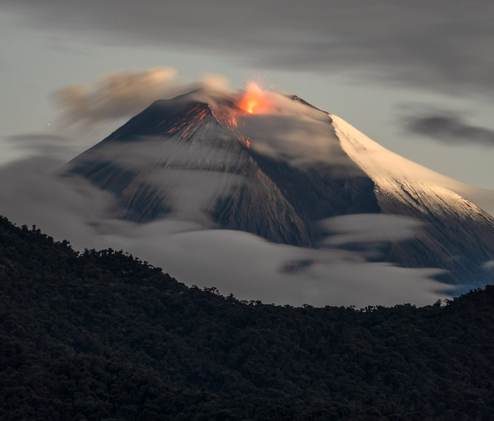
Chile , Villarica :
Special Report on Volcanic Activity (REAV), La Araucanía and Los Ríos regions, Villarrica volcano, January 14, 2023, 11:50 p.m. local time (mainland Chile)
The National Geology and Mining Service of Chile (Sernageomin) announces the following PRELIMINARY information, obtained through the monitoring equipment of the National Volcanic Monitoring Network (RNVV), processed and analyzed at the Observatory of Volcanoes of the Southern Andes (Ovdas):
During the night of Saturday January 14, 2023, monitoring stations installed near the Villarrica volcano recorded Strombolian activity with seismicity associated with fluid dynamics within the volcanic system. (type LP).
The characteristics of the earthquake, after its analysis, are as follows:
ORIGINAL TIME: 11:15 p.m. local time (02:15 UTC Jan 15, 2023)
REDUCED TRAVEL: 18.9 (cm*cm)
ACOUSTIC SIGNAL: 2.1 Pascals (Pa) reduced to 1 km
The characteristics of this activity are as follows:
MAXIMUM HEIGHT OF THE COLUMN: 140 meters above the point of emission
DIRECTION OF DISPERSION: Southwest (SW).
COMMENTS:
Since 22:11 HL (01:00 UTC on January 15, 2023) there has been an increase in the frequency of Strombolian explosions at a height of around 100 m above the crater. The observed explosions are characterized by the emission of incandescent materials on the surroundings of the crater. At the time of issuing this report, a total of 20 explosions have been counted, with heights of 60 to 150 m as indicated above.
The volcanic technical alert is maintained at the Yellow level.
Source : Sernageomin .
Photos : Sernageomin , ameriquedusud.org
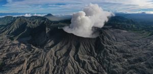
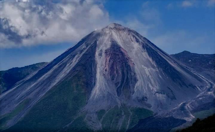
Ecuador , Sangay / Reventador :
DAILY REPORT OF THE STATE OF SANGAY VOLCANO, Saturday January 14, 2023.
Information Geophysical Institute – EPN.
Surface Activity Level: High, Surface Trend: No change
Internal activity level: High, Internal trend: No change.
Seismicity: From January 13, 2023, 11:00 a.m. to January 14, 2023, 11:00 a.m.:
The data corresponds to 12 hours of transmission from the reference station (SAGA).
Explosion (EXP) 65
Emission Tremors (TREMI ) 70
Long Periods (LP): 10
Rains / Lahars:
Moderate rains occurred yesterday afternoon which did not generate lahars. ** In the event of heavy rains, these could remobilize the accumulated material, generating mudslides and debris that would descend the flanks of the volcano and flow into the adjacent rivers. **
Emission / Ash Column:
At the end of the afternoon yesterday, the volcano was clear and an emission of gas with a low ash content was observed. Its height reached about 1000 meters above the level of the crater in a northeast direction. The Washington VAAC published 3 reports of ash emissions that reached a height of 1,170 meters above summit level and in a north and northeast direction.
Gas:
The MOUNTS system reported 3019.7 tons of sulfur dioxide (SO2), measured on 2023-01-13 at 2:09 p.m. TL.
Other Monitoring Parameters:
The FIRMS system records 19 thermal anomalies and MIROVA-VIIRS records 1 high thermal anomaly (226 MW) in the last 24 hours.
Observation:
During the night and early in the morning, the volcano was clear and an incandescence could be observed at the top. At the moment, the volcano is cloudy.
Alert level: Orange.
——————————————————————————————————————————————–
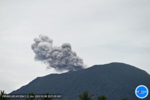
DAILY REPORT OF THE STATE OF THE REVENTADOR VOLCANO, Saturday January 14, 2023.
Information Geophysical Institute – EPN.
Surface Activity Level: Moderate, Surface Trend: No change
Internal activity level: Moderate, Internal trend: No change.
Seismicity: From January 13, 2023, 11:00 a.m. to January 14, 2023, 11:00 a.m.:
The seismicity data correspond to 24 hours of emission from the reference station (REVS).
Explosion (EXP): 40
Long periods (LP): 29
Emission Tremors (TREMI ): 5.
Harmonic Trempor (TRARM): 2
Rains / Lahars:
Yesterday afternoon, there were rains which did not generate lahars.
Emission / Ash Column:
In the late afternoon of yesterday, the volcano was clear and an emission of gas and ash was observed less than 600 meters above the summit to the west. The Washington VAAC issued 4 reports related to the ash emission with a maximum height of 1,338 meters and maintained directions to the West, Northwest and Northeast.
Gas:
The MOUNTS system reported 679 tons of sulfur dioxide (SO2), measured on 2023-01-12 at 2:09 p.m. TL
Observation:
During the night and early morning, the volcano was clear, observing the rolling of blocks on all sides of the volcano up to 500 meters below crater level. Later it darkened and remains so to this day.
Alert level: Orange.
Source : IGEPN.
Photos : Robinsky , Henry Vasconez .
Hawaii , Kilauea :
Saturday, January 14, 2023, 9:09 AM HST (Saturday, January 14, 2023, 19:09 UTC)
19°25’16 » N 155°17’13 » W,
Summit Elevation 4091 ft (1247 m)
Current Volcano Alert Level: WATCH
Current Aviation Color Code: ORANGE
Activity Summary:
The summit eruption of Kīlauea Volcano, within Halemaʻumaʻu crater, continued over the past 24 hours. All recent eruptive activity has been confined to the crater. No significant changes have been observed at the summit or in either rift zone.
Halemaʻumaʻu Lava Lake Observations:
Eruption of lava in the eastern portion of Halemaʻumaʻu crater floor continued over the past 24 hours. Activity is concentrated in a large lava lake in the eastern half of the crater, as well as a smaller area of lava within the basin in the western half of the crater that was the focus of activity in 2021–2022. The active lava lake in the eastern half of the crater has one dominant fountain, measured at 6-7 yards (meters) high. The eastern lava lake had an area of approximately 30 acres (12 hectares) on January 10, and the surface area has fluctuated slightly over the past 24 hours with several small overflows from the perched lake.

Summit Observations:
Over the past 24 hours, summit tiltmeters showed deflationary tilt. Volcanic tremor remains above background levels. A sulfur dioxide (SO2) emission rate of approximately 3,500 tonnes per day (t/d) was measured on January 9, 2023.
Rift Zone Observations:
No unusual activity has been noted along the East Rift Zone or Southwest Rift Zone; low rates of ground deformation and seismicity continue along both. Measurements from continuous gas monitoring stations downwind of Puʻuʻōʻō in the middle East Rift Zone have been below detection limits for SO2, indicating that SO2 emissions from Puʻuʻōʻō are negligible.
Source : HVO
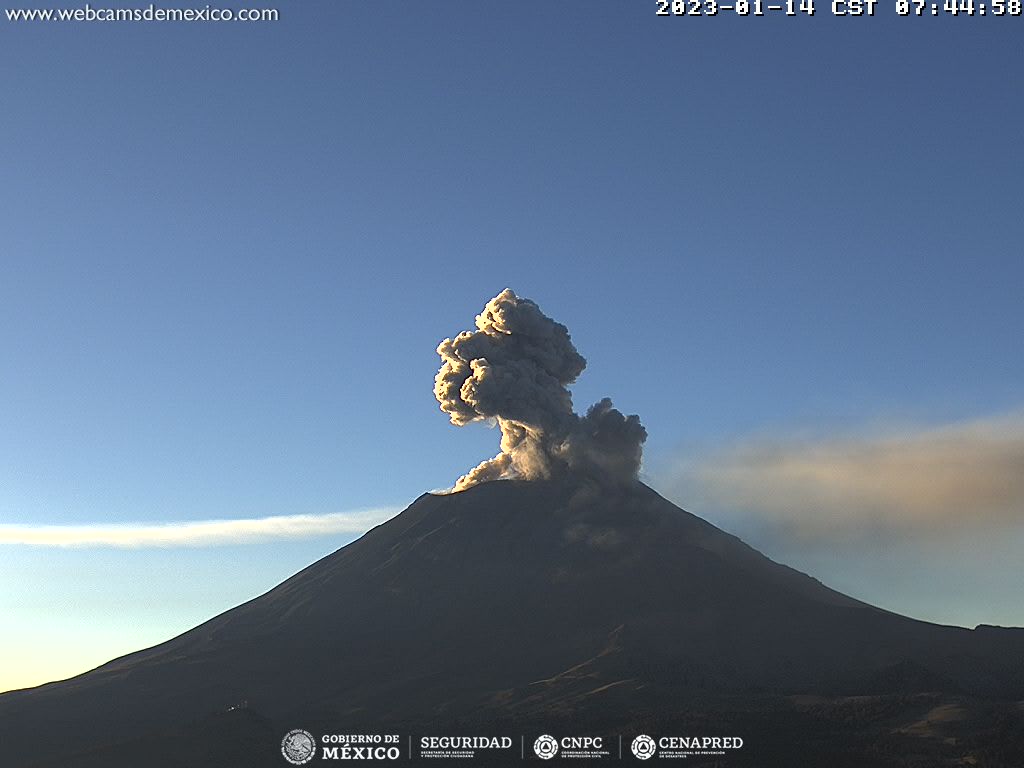
Mexico , Popocatepetl :
January 14, 11:00 a.m. (January 14, 5:00 p.m. GMT)
During the past 24 hours, according to the monitoring systems of the Popocatépetl volcano, 214 exhalations accompanied by water vapor, volcanic gases and ash have been detected. In addition, 256 minutes of tremor were recorded.
During the morning and at the time of this report, an emission of water vapor, volcanic gases and sometimes ash was observed in an East-North-East direction.
CENAPRED strongly reiterates the recommendation not to climb towards the crater of the volcano because there is a possibility of explosions, as has been seen several times in the past, involving the emission of incandescent fragments and in the event of heavy rains , to move away from the bottom of the ravines because of the danger of mudslides and debris.
The Popocatépetl volcanic alert traffic light is in YELLOW PHASE 2.
The recommendations to the population in the face of this activity are: Ignore rumors and be attentive to information issued by the National Coordination of Civil Protection
Source : Cenapred.