January 09 , 2023.
Hawaii , Kilauea :
Saturday, January 7, 2023, 9:00 AM HST (Saturday, January 7, 2023, 19:00 UTC)
19°25’16 » N 155°17’13 » W,
Summit Elevation 4091 ft (1247 m)
Current Volcano Alert Level: WATCH
Current Aviation Color Code: ORANGE
Activity Summary:
The summit eruption of Kīlauea Volcano, within Halemaʻumaʻu crater, continued over the past 24 hours. All recent eruptive activity has been confined to the crater. No significant changes have been observed at the summit or in either rift zone.
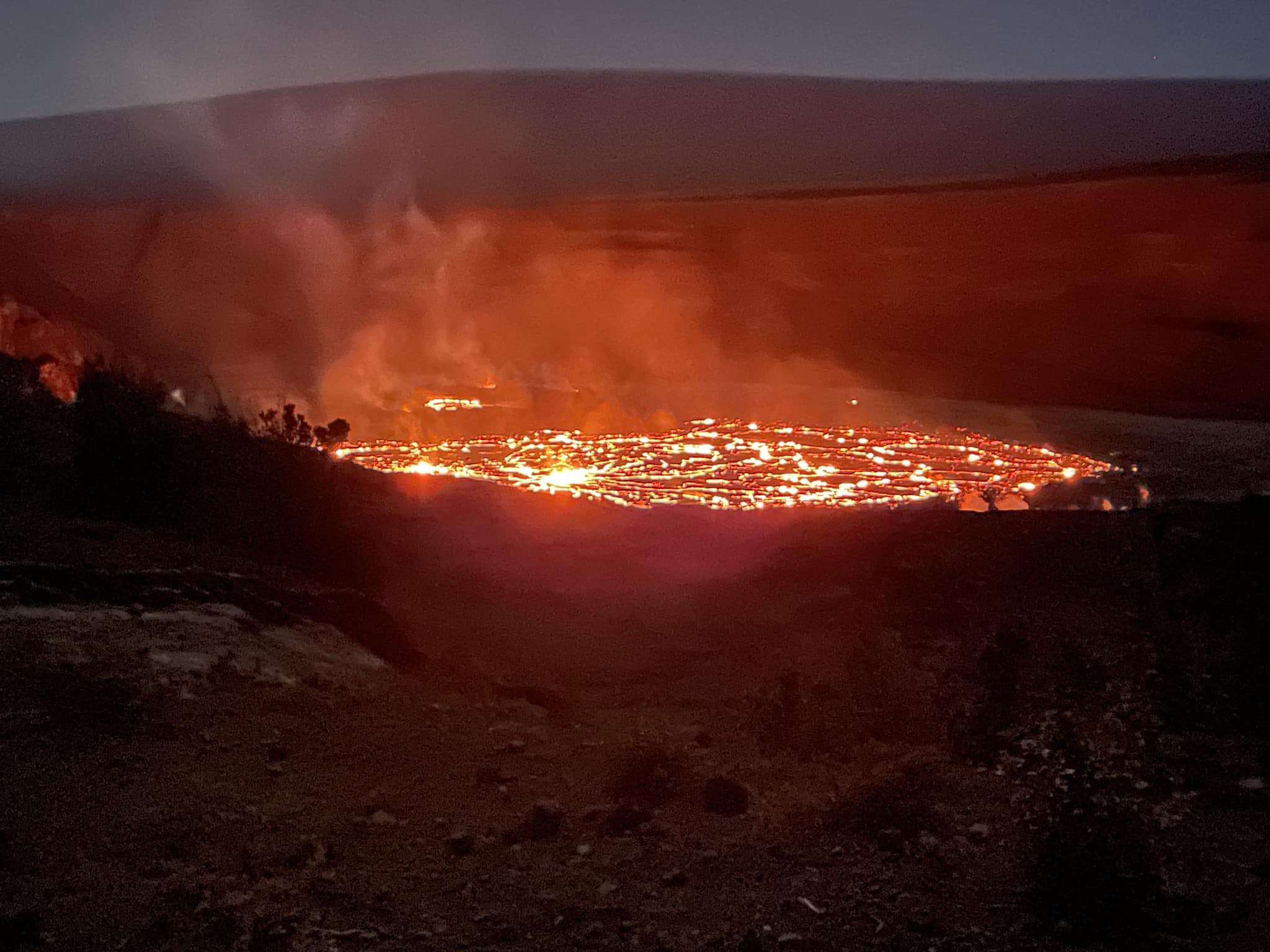
Halemaʻumaʻu Lava Lake Observations:
Eruption of lava from vents on the central eastern portion of Halemaʻumaʻu crater floor continued over the past 24 hours. Activity is concentrated in the eastern half of the crater and within the basin in the western half of the crater that was the focus of activity in 2021-2022.
Summit Observations:
Summit tiltmeters have recorded deflation over the past 24 hours. Volcanic tremor remains above background levels. A sulfur dioxide (SO2) emission rate of approximately 12,500 tonnes per day (t/d) was measured on January 6, 2023.
Rift Zone Observations:
No unusual activity has been noted along the East Rift Zone or Southwest Rift Zone; low rates of ground deformation and seismicity continue along both. Measurements from continuous gas monitoring stations downwind of Puʻuʻōʻō in the middle East Rift Zone remain below detection limits for SO2, indicating that SO2 emissions from Puʻuʻōʻō are negligible.
Source ; HVO.
Photo : David Ford .
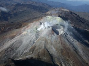
Alaska , Semisopochnoi :
51°55’44 » N 179°35’52 » E,
Summit Elevation 2625 ft (800 m)
Current Volcano Alert Level: WATCH
Current Aviation Color Code: ORANGE
Minor steam emissions were seen in clear web camera views during the last 24 hours. Satellite images were cloudy and no significant plumes were observed. Elevated seismicity has been occurring over the past day in the form of volcanic tremor. No noteworthy signals were detected in infrasound data.
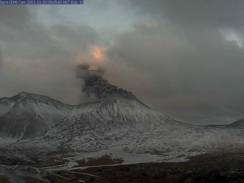
Small eruptions producing minor ash deposits within the vicinity of the active north crater of Mount Young (formerly known as Mount Cerberus) and ash clouds usually under 10,000 ft (3 km) above sea level have characterized the recent activity. Additional ash-producing events could occur again with little warning.
Semisopochnoi volcano is monitored by local seismic and infrasound sensors, satellite data, web cameras, and regional infrasound and lightning networks.
Source : AVO.
Photo : Loewen, M. W.
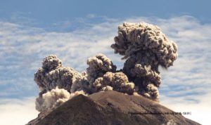
Indonesia , Marapi :
The volcano was clearly visible until it was covered in Mist. The smoke from the main crater was observed to be white / gray with high intensity, thick, around 150-200 meters above the summit. Cloudy to rainy weather, weak winds from the East, South-East and South-West.
SEISMICTIC OBSERVATION
27 eruption earthquakes with amplitudes of 1 to 6.8 mm and durations of 15 to 99 seconds.
9 emission earthquakes with an amplitude of 1 to 3 mm and a duration of 30 to 91 seconds.
1 « Tornillo » type earthquake with an amplitude of 11.5 mm and a duration of 15 seconds.
2 deep volcanic earthquakes with an amplitude of 3.1-5.8 mm, S-P 0.3-0.5 seconds and a duration of 4-5 seconds.
1 Continuous tremor with an amplitude of 0.5 to 3.7 mm, dominant value 1.5 mm.
VOLCANO OBSERVATORY NOTICE FOR AVIATION – VONA
Issued : January 08 , 2023
Volcano : Marapi (261140)
Current Aviation Colour Code : ORANGE
Previous Aviation Colour Code : orange
Source : Marapi Volcano Observatory
Notice Number : 2023MAR016
Volcano Location : S 0 deg 22 min 52 sec E 100 deg 28 min 23 sec
Area : West Sumatra, Indonesia
Summit Elevation : 9251 FT (2891 M)
Volcanic Activity Summary :
Eruption with volcanic ash cloud at 23h34 UTC (06h34 local).
Volcanic Cloud Height :
Best estimate of ash-cloud top is around 10051 FT (3141 M) above sea level or 800 FT (250 M) above summit. May be higher than what can be observed clearly. Source of height data: ground observer.
Other Volcanic Cloud Information :
Ash cloud moving from east to southeast. Volcanic ash is observed to be white. The intensity of volcanic ash is observed to be thick.
Remarks :
Eruption recorded on seismogram with maximum amplitude 3.2 mm and maximum duration 61 second.
Source : Magma Indonésia .
Photo : Tibavelo .
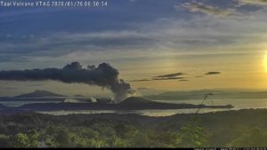
Philippines , Taal :
TAAL VOLCANO ACTIVITY BULLETIN, January 08, 2023, 08:00.
Over the past 24 hours, the Mayon Volcano sensor network has recorded:
Seismicity: 136 volcanic tremors (2 to 4 minutes long), Crater Lake Acidity: 0.76 (October 12, 2022). Flow of sulfur dioxide (SO2) 8575 tons / day (05 January 2023); Upwelling of hot volcanic fluids is recorded in Main Crater Lake. A plume 600 meters high and a weak emission is noted
For the deformation of the ground, there is a short-term inflation of the South-East of the island of the Taal volcano; long-term deflation of the Taal caldera
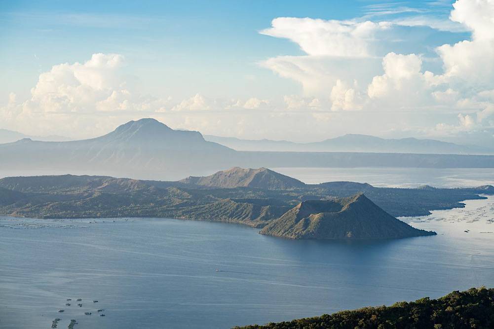
DOST-PHIVOLCS reminds the public that Alert Level 1 prevails over Taal Volcano, which means it is still in an abnormal state and should not be interpreted as having ceased unrest or ceased the threat of activity. eruptive. If the current phreato-magmatic activity worsens or if pronounced changes in monitored parameters herald an increase in unrest, the Alert Level may be raised to Alert Level 2. At Alert Level 1, sudden explosions steam-driven or phreatic, volcanic earthquakes, minor ashfall, and lethal accumulations or expulsions of volcanic gases may occur and threaten areas within TVI. DOST-PHIVOLCS strongly recommends that entry into TVI, the Taal Permanent Danger Zone or PDZ, particularly the vicinity of the Main Crater and Daang Kastila Fissure, remains strictly prohibited. Local government units are advised to continuously assess previously evacuated barangays around Lake Taal for damage and road accessibility and to strengthen preparedness, emergency and communication measures in the event of further unrest. People are also advised to take precautions due to soil shifting through cracks, possible ash fall and minor earthquakes. Civil aviation authorities should advise pilots to avoid flying near the volcano as airborne ash and ballistic fragments from sudden explosions and wind-remobilized ash may pose hazards to aircraft.
DOST-PHIVOLCS maintains close monitoring of Mayon Volcano and any new developments will be communicated to all relevant stakeholders.
Source : Phivolcs.
Photo : pixabay
Mexico , Popocatepetl :
January 08, 11:00 (January 08, 17:00 GMT)
During the last 24 hours, according to the monitoring systems of the Popocatépetl volcano, 118 exhalations accompanied by water vapor, volcanic gases and ash have been detected. In addition, 29 minutes of high frequency, low amplitude tremors were recorded.
During the morning and at the time of this report, an emission of water vapor, volcanic gases and sometimes ash was observed in a southeasterly direction.
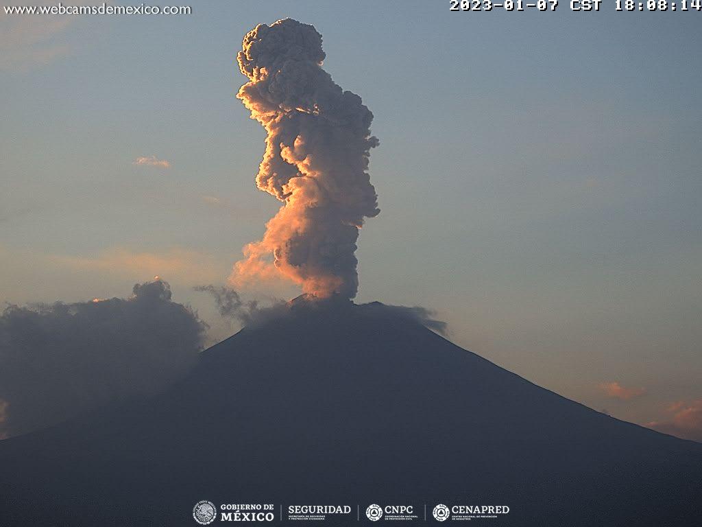
CENAPRED insistently reiterates the recommendation not to climb to the crater of the volcano because there is a possibility of explosions, as has been seen on several occasions in the past, involving the emission of incandescent fragments and in the event of heavy rains , move away from the bottom of the ravines due to the danger of mudslides and debris.
The Popocatépetl volcanic alert traffic light is in YELLOW PHASE 2.
Source : Cenapred .