April 14 , 2024.
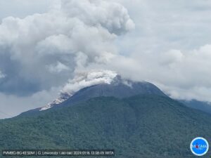
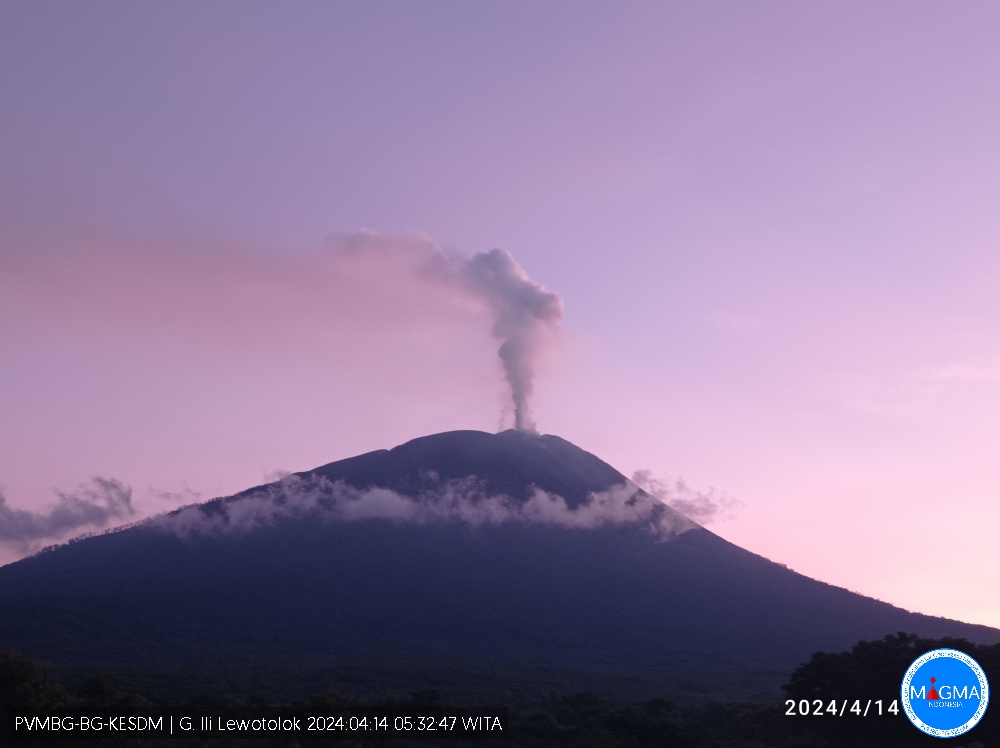
Indonesia , Ili Lewotolok :
An eruption of Mount Ili Lewotolok occurred on Sunday, April 14, 2024 at 05:26 WITA with the height of the ash column observed at ±500 m above the summit (±1923 m above sea level). The ash column was gray in color with moderate intensity, oriented to the South-West and North-West. This eruption was recorded on a seismograph with a maximum amplitude of 17.4 mm and a duration of 87 seconds.
Observation of seismicity:
6 eruption/explosion earthquakes with an amplitude of 14.5 to 24.5 mm and earthquake duration of 46 to 64 seconds.
72 emission earthquakes with an amplitude of 2 to 16 mm and earthquake duration of 29 to 187 seconds.
6 non-harmonic tremors with an amplitude of 1.9 to 4.9 mm and an earthquake duration of 155 to 266 seconds.
1 Shallow volcanic earthquake with an amplitude of 2.4 mm and an earthquake duration of 4 seconds.
Recommendation
At Level III activity level (SIAGA), it is recommended:
(1) Communities around Mount Ili Lewotolok as well as visitors/climbers/tourists should not enter or conduct activities within a 2 km radius around the Mount Ili Lewotolok activity center, and residents of Lamatokan Village and Jontona should always be aware of potential threats from warm cloud avalanches and lahars originating from the eastern summit/crater of Mt. Ili Lewotolok.
(2) To avoid respiratory problems (ARI) and other health problems caused by volcanic ash, people living around Mount Ili Lewotolok can use masks to protect their mouth and nose and other equipment to protect their eyes and their skin.
Source et photo : Magma Indonésie.
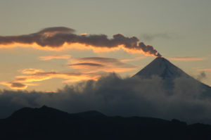
Colombia , Cumbal :
Weekly activity bulletin: Cumbal Volcanic Complex
Regarding the monitoring of the activity of the CUMBAL VOLCANIC COMPLEX (CVC), the MINISTRY OF MINES AND ENERGY, through the COLOMBIAN GEOLOGICAL SERVICE (SGC), reports that:
For the week of April 2 to 8, 2024, compared to what was reported the previous week, the seismic occurrence increased mainly due to the recording of fracture earthquakes; However, the energy decreased by almost half of what was assessed for the previous period, showing that even when many events were occurring, most of them had low energy levels. The predominance of processes linked to rock fracture remains. These fracture events were located near the La Plazuela crater, slightly aligned with the Río Blanco fault, at distances less than 1 km and at depths up to 3 km, relative to its summit (4,700 m altitude) and with a maximum magnitude of 0.1.
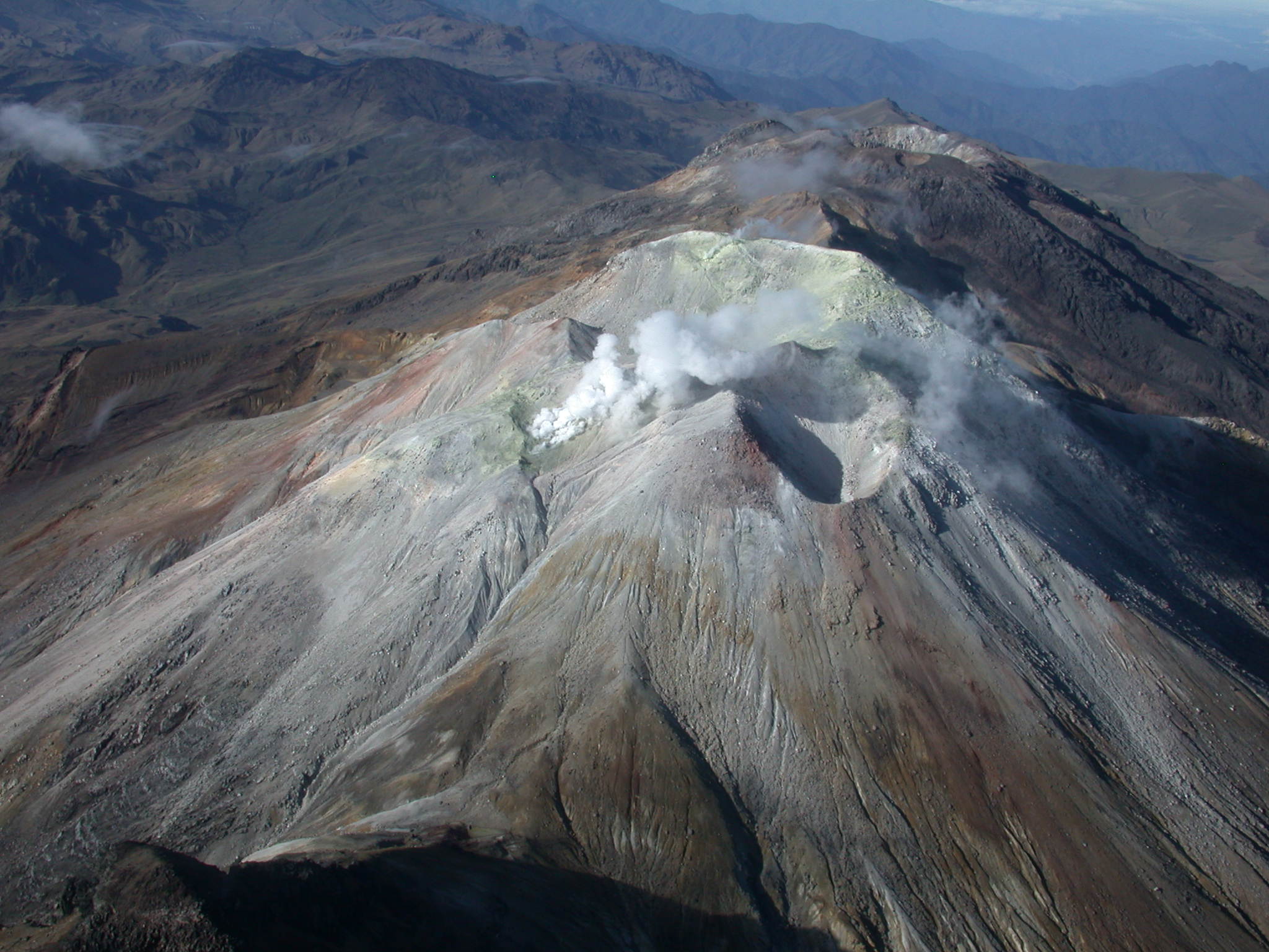
Gas emissions have been observed in different fumarole fields such as: El Verde, northeast of the CVC; Los Rastrojos and Boca Vieja, southwest of the CVC, with white columns, of low height and variable dispersion direction depending on the direction of the wind. No significant variation was observed in the other geophysical and geochemical parameters of volcanic monitoring.
Volcanic activity remains in a YELLOW ALERT state: Active volcano with changes in the behavior of the base level of monitored parameters and other manifestations.
Source et photo : SGC
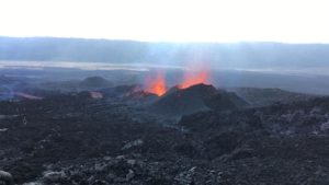
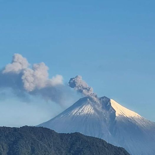
Ecuador : Sangay
DAILY REPORT ON THE STATE OF THE SANGAY VOLCANO, Saturday April 13, 2024.
Information Geophysical Institute – EPN.
Surface activity level: High, Surface trend: No change
Internal activity level: High, Internal trend: No change
Seismicity: From April 12, 2024, 11:00 a.m. to April 13, 2024, 11:00 a.m.:
The number of seismic events recorded at the reference station over the past 24 hours is shown below. The level of seismic activity of the volcano remains high.
Explosion Event (EXP): 77
Precipitation/Lahars:
Thanks to the surveillance camera system, no rain has been recorded in the areas surrounding the volcano. **Heavy rains could remobilize accumulated material and generate flows of mud and debris that would flow down the volcano’s flanks and flow into adjacent rivers.
Emissions/ash column:
Since yesterday afternoon, using GOES-16 satellite images, emissions of gas and ash have been recorded at heights of approximately 900 meters above the level of the crater in the northwest direction. This activity was also reported by the Washington VAAC.
Observation:
During yesterday afternoon at the time of this report, thanks to the surveillance camera system and GOES-16, the volcano remained cloudy most of the time, with the exception of small episodes which allowed the recording of an incandescence at the level of the crater.
Alert level: yellow
Source : IGEPN.
Photo : Juan Guapa
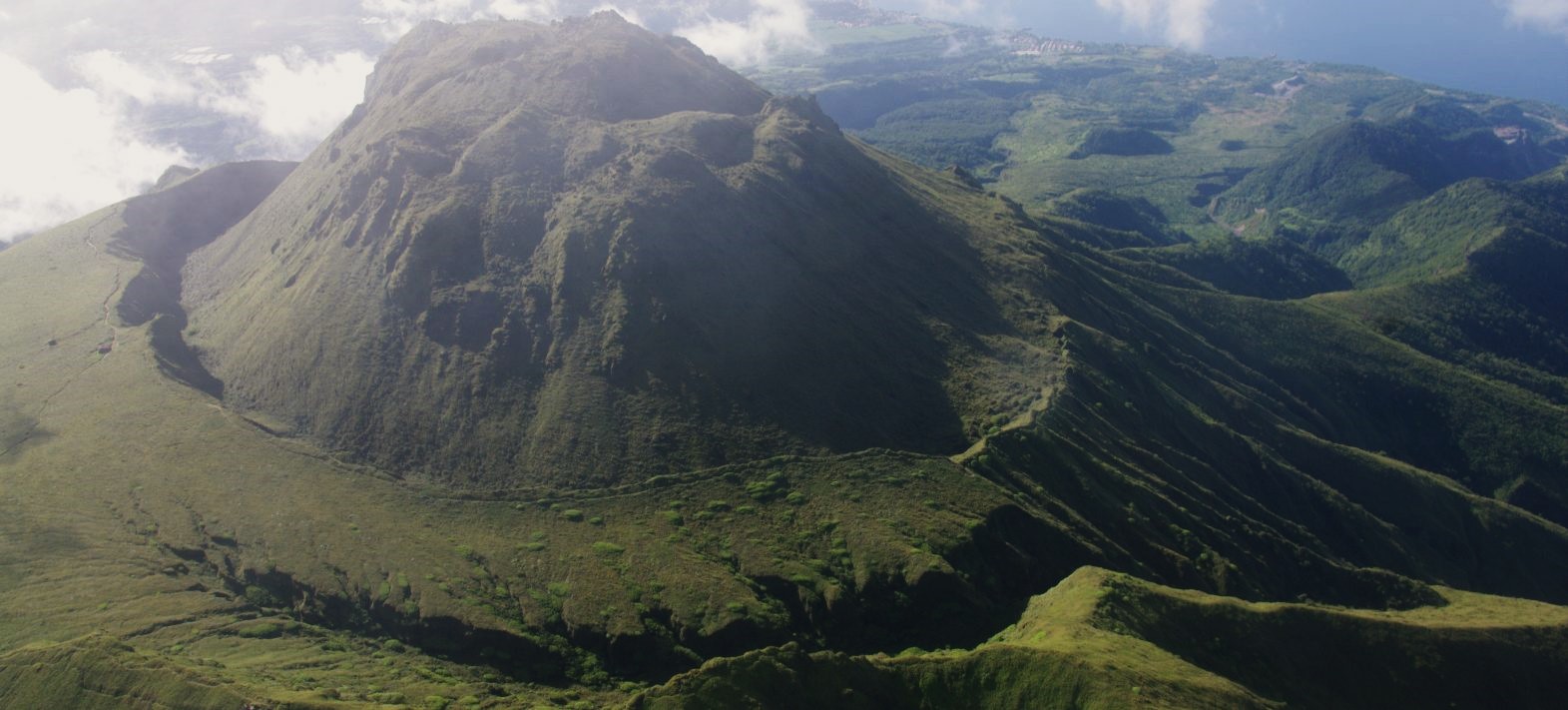
La Martinique , Montagne Pelée :
Weekly report, Paris Institute of Globe Physics, Martinique Volcanological and Seismological Observatory
Activity on Montagne Pelée, Saint-Pierre, April 12, 2024 at 2:00 p.m. local time (GMT-4)
Volcanic activity is low this week with 8 earthquakes of volcanic origin observed. Between April 5, 2024 at 4:00 p.m. (UT) and April 12, 2024 at 4:00 p.m. (UT), the OVSM recorded 8 low-energy volcano-tectonic earthquakes. Six of them were clearly identified as coming from one of the well-known seismically active zones at Montagne Pelée, located between 1.0 and 1.4 km depth below the summit of the volcano. The other two were located approximately 6 km northeast of the summit and 7 km deep.
Surface seismicity of the volcano-tectonic type is associated with micro-fracturing in the volcanic edifice linked to the global reactivation of the volcano observed since the end of 2018.
No earthquake was felt by the population.
The previous week, the OVSM had recorded 26 earthquakes of volcanic origin. As of April 12, 2024 and during the last 4 weeks, the OVSM has therefore observed a total of 65 volcanic earthquakes, or an average of 16 to 17 earthquakes per week.
During phases of volcanic reactivation of volcanoes similar to Montagne Pelée, it is usual to observe seismic activity varying in intensity and frequency.
For more details on observations and interpretations of volcanic activity over the longer term, refer to the OVSM monthly bulletins.
The alert level is currently YELLOW: vigilance.
Source et photo : Direction de l’OVSM-IPGP.
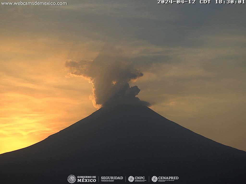
Mexico , Popocatepetl :
April 13, 11:00 a.m. (April 13, 5:00 p.m. GMT). Activity from the last 24 hours
45 exhalations were detected, accompanied by water vapor, volcanic gases and slight amounts of ash.
During the morning and at the time of this report, a continuous emission of water vapor and volcanic gases is observed, with dispersion towards the West (W).
The Popocatépetl volcanic warning fire is in yellow phase 2.
The scenarios planned for this phase are:
A few small to moderate explosions
Appearance of tremors of variable amplitude
Light to moderate ash rain in surrounding towns and some more distant towns
Ejection of incandescent fragments within the exclusion radius of 12 kilometers
Source : Cenapred.