January 03 , 2023 .
Italy , Stromboli :
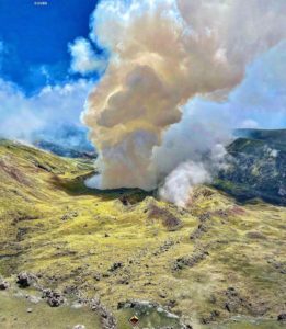
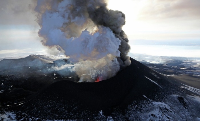
Press release on Stromboli’s activity. 02 January 2023 , 22:44 (21:44 UTC).
The National Institute of Geophysics and Volcanology, Osservatorio Etneo, communicates that from 9:15 p.m. UTC, surveillance cameras observed an overflow of lava from the northern area of the crater. The phenomenon is still ongoing.
During the last 24 hours, the average amplitude of the volcanic tremor did not show significant variations remaining within the range of average values.
The GNSS surveillance network does not currently show significant variations.
Further updates will be communicated soon
Source : INGV.
Photo : Stromboli stati d’animo.
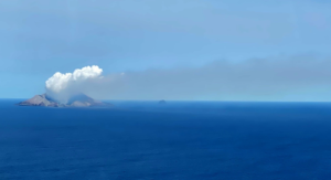
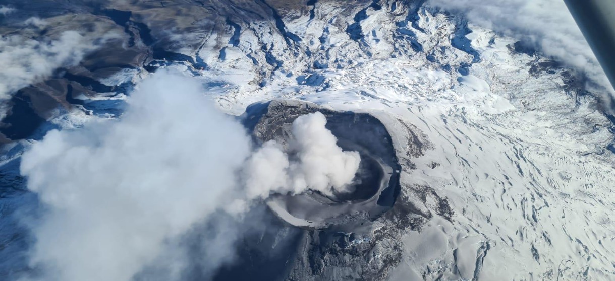
Russia / Kuril Islands : Ebeko ,
VOLCANO OBSERVATORY NOTICE FOR AVIATION (VONA)
Issued: 20230102/0312Z
Volcano: Ebeko (CAVW #290380)
Current aviation colour code: ORANGE
Previous aviation colour code: orange
Source: KVERT
Notice Number: 2023-01
Volcano Location: N 50 deg 41 min E 156 deg 0 min
Area: Northern Kuriles, Russia
Summit Elevation: 1156 m (3791.68 ft)
Volcanic Activity Summary:
A moderate explosive activity of the volcano continues. According to visual data by volcanologists from Severo-Kurilsk, an explosion sent ash up to 2.0 km a.s.l., an ash cloud is drifting to the north of the volcano.
A moderate eruptive activity of the volcano continues. Ash explosions up to 6 km (19,700 ft) a.s.l. could occur at any time. Ongoing activity could affect low-flying aircraft and airport of Severo-Kurilsk.
Volcanic cloud height:
2000 m (6560 ft) AMSL Time and method of ash plume/cloud height determination: 20230102/0248Z – Visual data
Other volcanic cloud information:
Distance of ash plume/cloud of the volcano: 5 km (3 mi)
Direction of drift of ash plume/cloud of the volcano: N / azimuth 350 deg
Time and method of ash plume/cloud determination: 20230102/0248Z – Visual data
Source : Kvert.
Photo : Yuri Demyanchuk
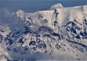
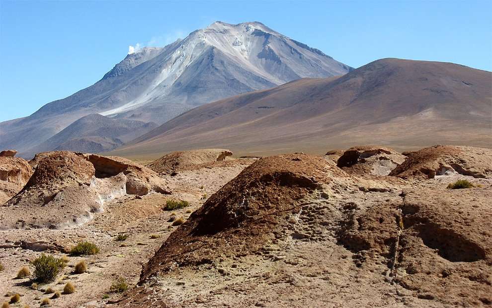
Chile , Ollagüe :
Special Report on Volcanic Activity (REAV), Antofagasta Regions, Ollagüe Volcano, January 02, 2023, 08:45 local time (mainland Chile)
The National Geology and Mining Service of Chile (Sernageomin) announces the following PRELIMINARY information, obtained through the monitoring equipment of the National Volcanic Monitoring Network (RNVV), processed and analyzed at the Observatory of Volcanoes of the Southern Andes (Ovdas):
On Monday, January 02, 2023, at 08:07 local time (11:07 UTC) the monitoring stations installed near the Ollagüe volcano recorded an earthquake associated with rock fracturing (Volcano Tectonic type).
The characteristics of the earthquake, after its analysis, are as follows:
ORIGINAL TIME: 08:07 local time (11:07 UTC)
LATITUDE: 21.221°S
LONGITY: 68.163°E
DEPTH: 2.4 km
LOCAL MAGNITUDE: 3 (ML)
COMMENTS:
4 other similar events are recorded with less energy. There were no significant changes in the seismic behavior of the volcano.
Currently, the volcano has a constant degassing of 560 m above the emission point. This degassing is not directly related to the event mentioned in this report.
The volcanic technical alert is maintained at the Green level
Source : Sernageomin
Photo : gigaplaces.com
Ecuador , Cotopaxi :
DAILY REPORT OF THE STATE OF COTOPAXI VOLCANO, Monday January 02, 2023.
Information Geophysical Institute – EPN.
Surface activity level: Moderate, Surface trend: Ascending.
Internal activity level: Moderate, Internal trend: Ascending.
Seismicity: From January 01, 2023, 11:00 a.m. to January 02, 2023, 11:00 a.m.:
There were no interruptions in the transmission of data from the reference station BREF
Emission Tremor (TREMI ) 3
Long Period (LP): 66
Rains / Lahars:
Moderate rains are observed using permanent cameras. These rains did not generate secondary lahars.
Emission / Ash Column:
Last night, the area cleared up for a moment and a gas emission was spotted which reached 500 meters above the level of the crater in a south-westerly direction. In the morning, the sector woke up completely cloudy and continues like this for the moment.
Observation:
The area is completely cloudy and there is no visibility of surface level activity.
Alert Level: Yellow
Source et photo : IGEPN.
Peru , Sabancaya :
Analysis period: from December 19, 2022 to December 25, 2022, Arequipa, December 26, 2022.
Alert level: ORANGE
The Geophysical Institute of Peru (IGP) reports that the eruptive activity of the Sabancaya volcano remains at moderate levels, that is to say with the recording of an average of 52 daily explosions, with columns of ash and of gas up to 3.5 km altitude above the summit of the volcano and their subsequent dispersion. Therefore, for the following days, no significant change is expected in eruptive activity.
The IGP recorded and analyzed the occurrence of 399 earthquakes of volcanic origin, associated with the circulation of magmatic fluids inside the Sabancaya volcano. An average of 52 explosions was recorded daily, in addition to recording Volcano-Tectonic (VT) type events associated with rock fracturing inside the Sabancaya volcano.
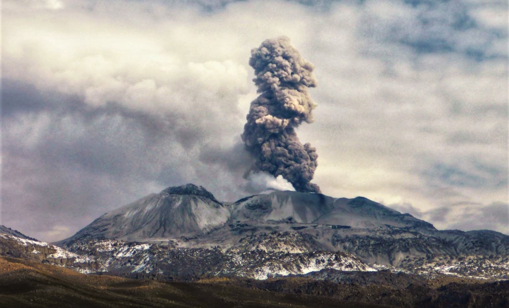
Monitoring the deformation of the volcanic structure using GNSS techniques (processed with fast orbits) does not show any significant anomalies. However, in general, an inflation process was observed in the northern sector (surroundings of the Hualca Hualca volcano). Visual surveillance identified columns of gas and ash up to 3.5 km above the summit of the volcano, which were dispersed towards the South-West, South, West, South-East sectors. and Northeast Sabancaya. Satellite recordings have identified the presence of 10 thermal anomalies, with a maximum value of 15 MW, associated with the presence of a lava body on the surface of the volcano’s crater.
RECOMMENDATIONS
• Keep the volcanic alert level orange.
• Do not approach within a radius of less than 12 km from the crater.
Source : Cenvul
Photo : Andina