
November 09 , 2022.
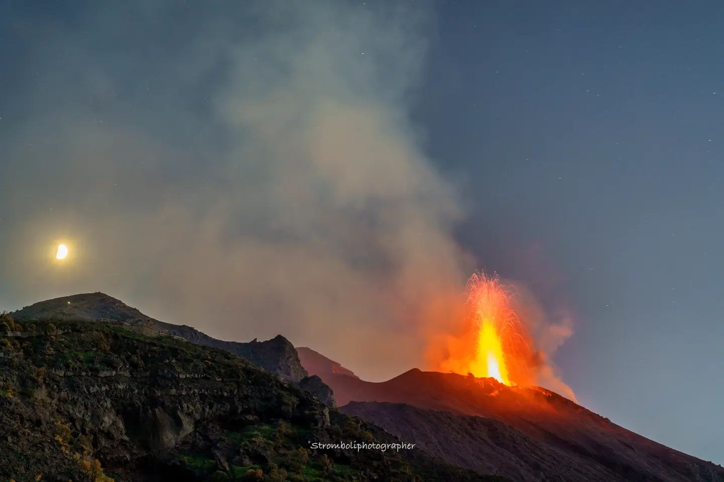
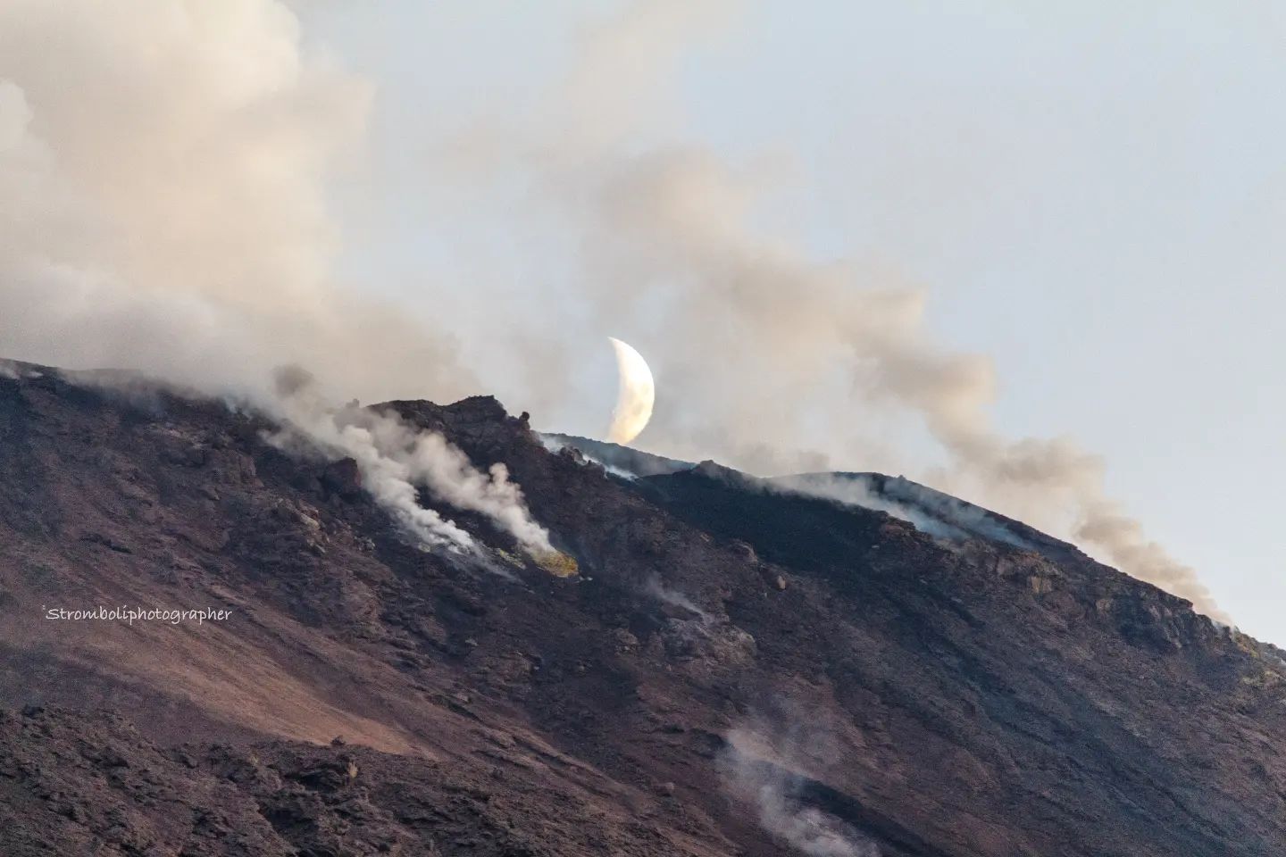
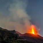
Italy , Stromboli :
WEEKLY NEWSLETTER, from October 31, 2022 to November 06, 2022, (issue date November 08, 2022) .
ACTIVITY STATUS SUMMARY
In the light of the surveillance data, it is highlighted:
1) VOLCANOLOGICAL OBSERVATIONS: During this period a normal explosive activity of the Strombolian type was observed with projection activity in the area of the North crater. The total hourly frequency oscillated between low (5 events/h) and medium (11 events/h). The intensity of the explosions was low to high in the North crater area and low to medium in the South Center crater area.
2) SEISMOLOGY: The seismological parameters do not show significant variations.
3) GROUND DEFORMATIONS: There are no significant variations in the time series of the tilt and GNSS stations.
4) GEOCHEMISTRY: SO2 flux at an average and increasing level
CO2 fluxes in the crater area are at medium to high values.
The C/S ratio in the plume is at high values (C/S = 16.5).
There are no updates on the isotope ratio of helium in groundwater.
5) SATELLITE OBSERVATIONS: The thermal activity observed by satellite in the summit area was weak.
VOLCANOLOGICAL OBSERVATIONS
During the observation period, the eruptive activity of Stromboli was characterized thanks to the analysis of the images recorded by the surveillance cameras of the INGV-OE at an altitude of 190m (SCT-SCV), Punta dei Corvi and Pizzo. Images from the cameras at an altitude of 400m are not available at the moment, due to the damage to the optical fiber connecting Punta Labronzo and COA due to the bad weather that hit the island on August 12, 2022.
The explosive activity was mainly produced by 4 (four) eruptive vents located in the North crater area and by 2 (two) vents located in the Center-South area. All vents are located within the depression that occupies the crater terrace.
Due to a technical failure, images from the Pizzo surveillance cameras and the 190m altitude were not available from 20:29 UTC on November 4 to 9:23 UTC on November 6.
Observations of explosive activity captured by surveillance cameras.
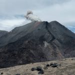
Sector N1, with two emission points, located in the area of the North crater produced low intensity explosions (less than 80 m high) emitting coarse materials (bombs and lapilli). Sector N2, with two emission points, showed explosive activity of variable intensity from low to medium-high, sometimes the products exceeded 150 m in height. This activity consisted of the emission of coarse materials and a continuous projection activity from November 2 of low intensity which became very intense during November 6.
The average frequency of explosions varied from 3 to 6 events/h.
In the Center-South zone, no explosive activity was observed in sectors S1 and C, while in sector S2, with two emission points, explosive activity of low and sometimes medium intensity (less than 150 m from height) was observed) emitting fine materials (ash) sometimes mixed with coarse materials.
The average frequency of explosions varied between 2 and 5 events/h.
Source : INGV.
Photos :Stromboli Stati d’animo / Sebastiani Cannavo.
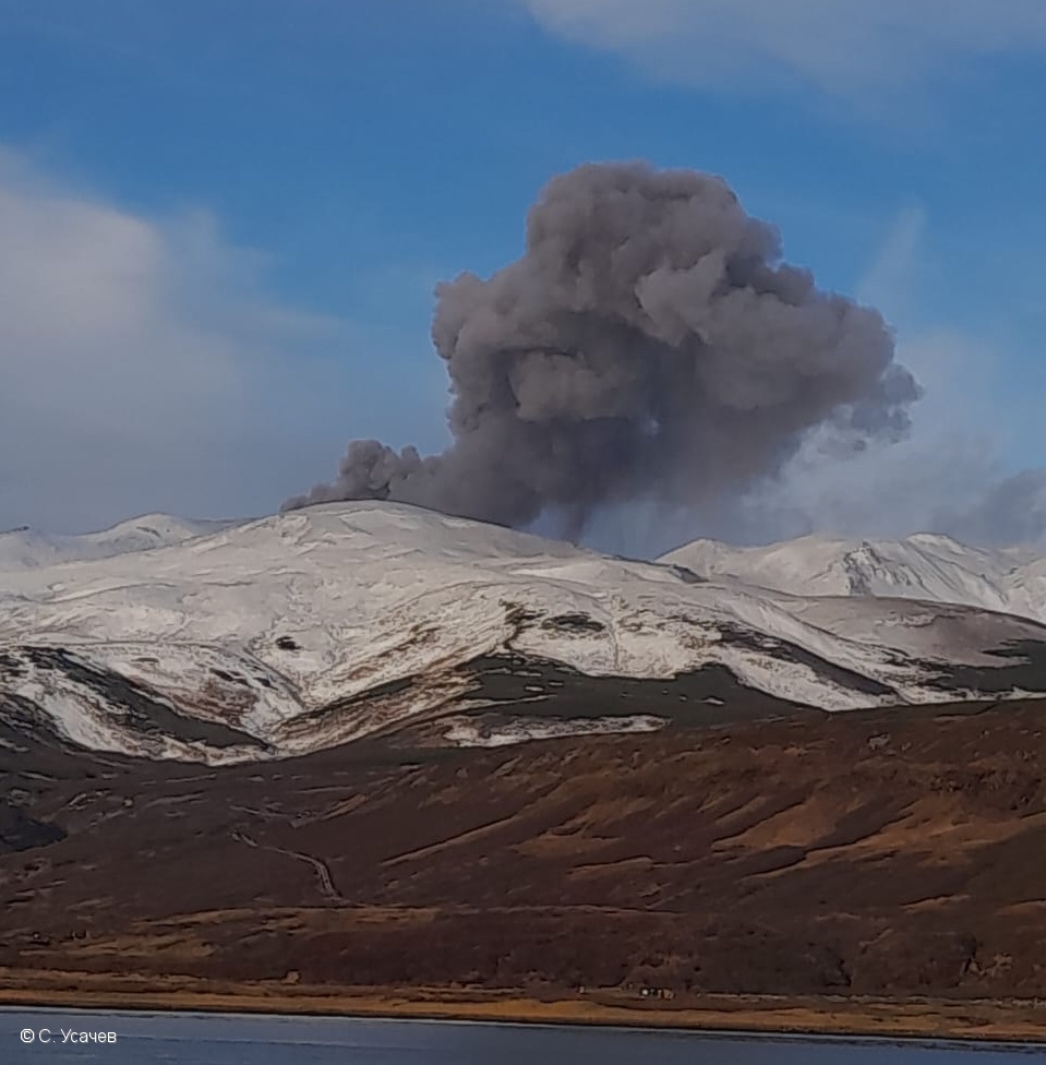
Russia / Kuril Islands , Ebeko :
Issued: November 08 , 2022
Volcano: Ebeko (CAVW #290380)
Current aviation colour code: ORANGE
Previous aviation colour code: orange
Source: KVERT
Notice Number: 2022-170
Volcano Location: N 50 deg 41 min E 156 deg 0 min
Area: Northern Kuriles, Russia
Summit Elevation: 1156 m (3791.68 ft)
Volcanic Activity Summary:
A moderate eruptive activity of the volcano continues. According to visual data by volcanologists from Severo-Kurilsk, explosions sent ash up to 3.1 km a.s.l., an ash cloud is drifting to the east of the volcano.
This activity of the volcano continues. Ash explosions up to 6 km (19,700 ft) a.s.l. could occur at any time. Ongoing activity could affect low-flying aircraft and airport of Severo-Kurilsk.
Volcanic cloud height:
3100 m (10168 ft) AMSL Time and method of ash plume/cloud height determination: 20221108/2225Z – Visual data
Other volcanic cloud information:
Distance of ash plume/cloud of the volcano: 5 km (3 mi)
Direction of drift of ash plume/cloud of the volcano: E
Time and method of ash plume/cloud determination: 20221108/2225Z – Visual data
Source : Kvert.
Photo : C. Usachev.
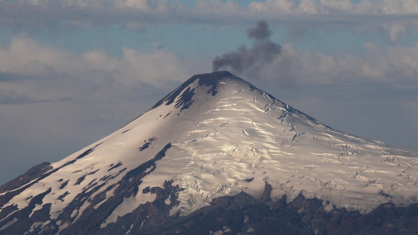
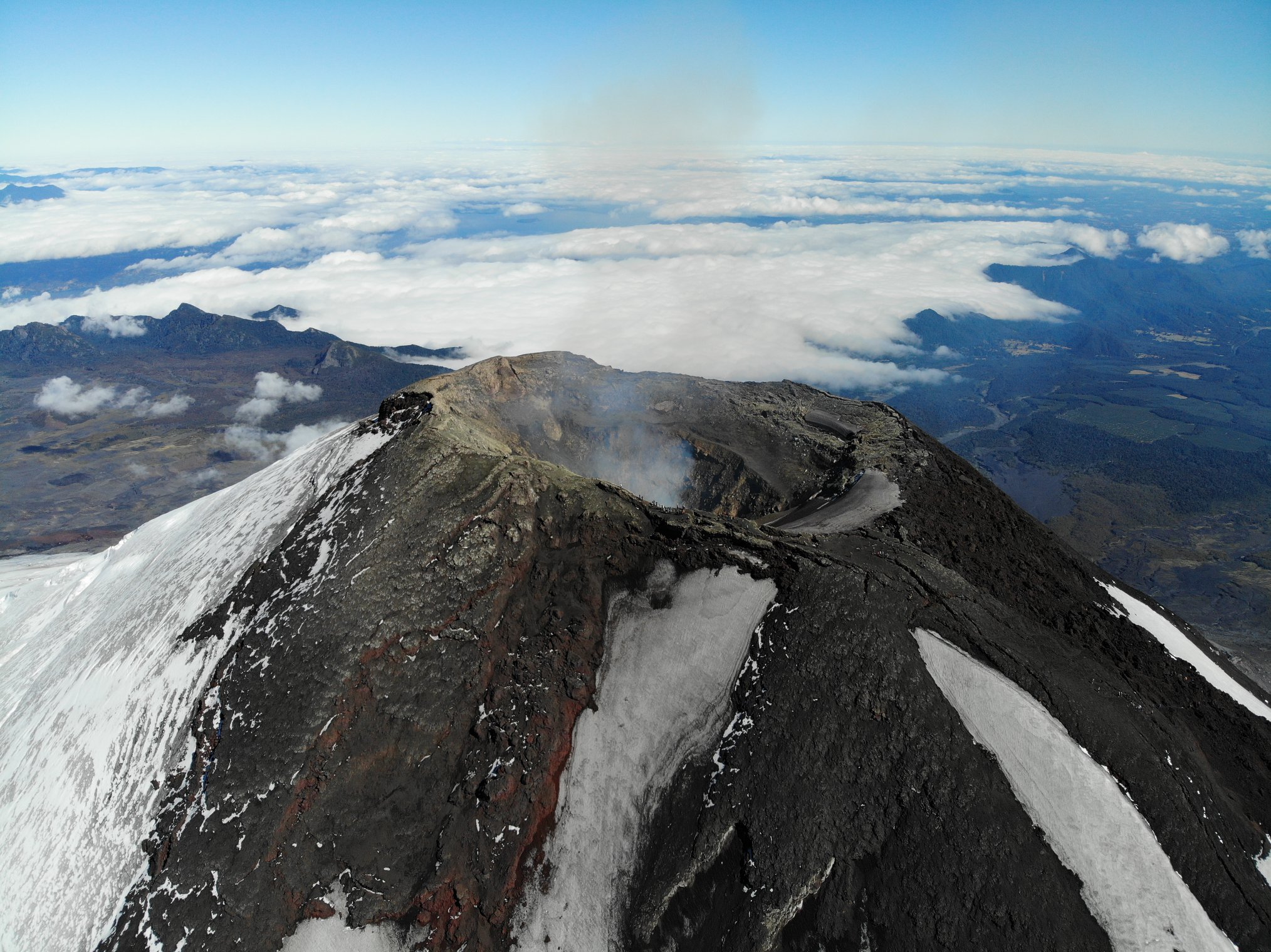
Chile , Villarica :
Seismology
The seismological activity of the period was characterized by the recording of:
A continuous tremor signal associated with fluid dynamics inside the volcano, which during the month showed an increase in its energy compared to previous periods, reaching RSAM values between 0.25 and 0.9 um /s, values considered above their base level. This seismic tremor signal had two dominant frequency ranges of 1.0-1.2 Hz and 1.6-2 Hz. Similarly, 99 discrete tremor episodes were recorded; the size of the largest earthquake estimated from the reduced displacement parameter (RD) was equal to 25 cm2.
44 VT-type seismic events associated with rock fracturing (Volcano-Tectonics). The most energetic earthquake presented a value of local magnitude (ML) equal to 2.3, located 5.3 km east-southeast of the volcanic edifice, with a depth of 4.8 km from the crater.
10,007 LP-type seismic events, also associated with fluid dynamics within the volcanic system (Long Period). The size of the earthquakes evaluated from the Reduced Displacement (DR) parameter, presented a sustained increase compared to previous periods, with values that reached a maximum equal to 37 cm2.
As for the acoustic signals, which mainly show explosive activity, these become larger and more abundant in the recordings.
Surveillance cameras
During the month of October, 4 eruptive columns were recorded which exceeded 400 m in height above the level of the crater. The largest occurred on October 16 and reached 460 m in height. This had a white coloration associated with outgassing and correlated with increases in RSAM. Pyroclastic emissions occurred on October 2, 18, 23 and 31, which generated pyroclastic deposits on the east, south and southwest flanks, near the crater (< 500 m). We can distinguish the occurrence of nocturnal Strombolian explosions on October 18 and 31, which generated emissions of incandescent fragments with a ballistic trajectory (recorded by P.O.V.I). The nocturnal incandescence recorded an increase in intensity during the month, with heights less than 200 m above the crater.
Satellite geomorphological analysis
Based on photo interpretation of a SkySat Collect satellite image from October 14, the exposed lava lake is observed in an area of 36 m2. In addition, variations in the internal scarps of the southwestern crater are identified, showing a decrease in the area of solid crust over the lava lake following a partial collapse of a rock level in the south- Southwest of the crater (<300 m2) which could be linked to pyroclastic emissions at the end of September or the beginning of October.
The thermal radiation anomaly area has seen a gradual increase since July 2022, reaching a maximum of 9,900 m2 as of October 31, a level similar to previous periods of intense surface activity (2019, 2020).
The Villarrica volcano has evolved in its activity, represented by an increase in seismicity associated with fluid dynamics and greater visible surface activity. In relation to seismicity, since the beginning of October, the quantity of LP-type events has increased with a notable range between October 9 and November 2, where maximums greater than 600 events per day have been recorded. Likewise, the sizes evaluated from the DR suggest a threshold with an average that remains up to ~28 cm2, standing out in the last days, 4 explosions whose associated LP signal recorded a DR greater than 30 cm2. The energy of the continuous tremor signal remains with values higher than its basic level.
In addition, during the last fortnight, SO2 emissions have remained within values considered normal, preceded by two months with high values and the presence of anomalies coinciding in the crater area. Images from the past few days show greater pyroclast coverage around the crater, associated with explosions that occurred primarily in the early hours of Sunday, November 6. From in situ observations by collaborators, a large number of pyroclasts were detected around the crater and on the snow, mainly oriented to the northwest, up to about 20 cm in size. In accordance with the above and taking into account the dynamics of the fluctuating lava lake and the ejection of volcanic material around the crater, the potential assignment area is modified, considering a radius of 500 m from the center of the crater major.
In addition, the technical alert changes to YELLOW level.
YELLOW TECHNICAL ALERT: Changes in volcanic activity behavior
Source : Sernageomin .
Read the article: https://rnvv.sernageomin.cl/rnvv/TI_Santiago_prod/reportes_LB/2022/RAV_20221108_LosRios_v10.pdf
Photos : 24 Horas , Take a Way .
Hawaii , Mauna Loa :
19°28’30 » N 155°36’29 » W,
Summit Elevation 13681 ft (4170 m)
Current Volcano Alert Level: ADVISORY
Current Aviation Color Code: YELLOW
Activity Summary:
Mauna Loa is not erupting and there are no signs of an imminent eruption at this time. Monitoring data show no significant changes within the past 24 hours. Mauna Loa continues to be in a state of heightened unrest as indicated by increased earthquake activity and inflation of the summit. The current unrest is most likely being driven by renewed input of magma 2–5 miles (3–8 km) beneath Mauna Loa’s summit.
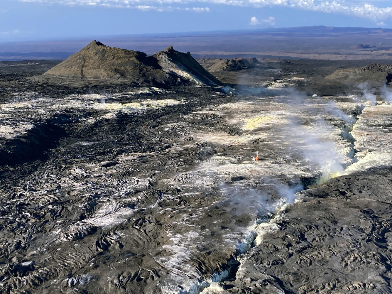
Observations:
During the past 24 hours, HVO detected 47 small-magnitude (below M3.0) earthquakes 2–3 miles (2–5 km) below Mokuʻāweoweo caldera and 4–5 miles (6–8 km) beneath the upper-elevation northwest flank of Mauna Loa. Both of these regions have historically been seismically active during periods of unrest on Mauna Loa.
Global Positioning System (GPS) instruments at the summit and on the flanks of Mauna Loa continue to measure inflation at rates elevated since mid-September. However, tiltmeters at the summit are not showing significant surface deformation over the past week.
Concentrations of sulfur dioxide (SO2), hydrogen sulfide (H2S), and carbon dioxide (CO2), as well as fumarole temperatures, remain stable at the summit and at Sulphur Cone on the upper Southwest Rift Zone. Webcam and thermal camera views have shown no changes to the volcanic landscape on Mauna Loa over the past week.
Source : HVO
Photo : USGS/ T. Elias
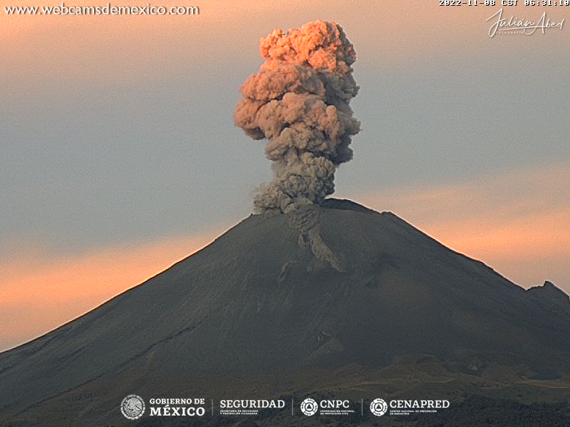
Mexico , Popocatepetl :
November 08, 11:00 (November 8, 17:00 GMT)
In the past 24 hours, according to the monitoring systems of the Popocatépetl volcano, 94 exhalations have been detected, accompanied by water vapor, volcanic gases and sometimes slight amounts of ash. In addition, 17 minutes of low amplitude tremor were recorded.
At the time of this report, the volcano is observed with a constant emission of water vapor and gas to the southwest.
CENAPRED insistently reiterates the recommendation not to climb to the crater of the volcano because there is the possibility of explosions, as we have seen on several occasions in the past, which involve the emission of incandescent fragments and in the event of strong rains, to stay away from the bottom of the ravines because of the danger of mudslides and debris.
The Popocatépetl volcanic alert traffic light is in YELLOW PHASE 2.
Source et photo : Cenapred .


No comment yet, add your voice below!