July 14 , 2022.
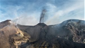
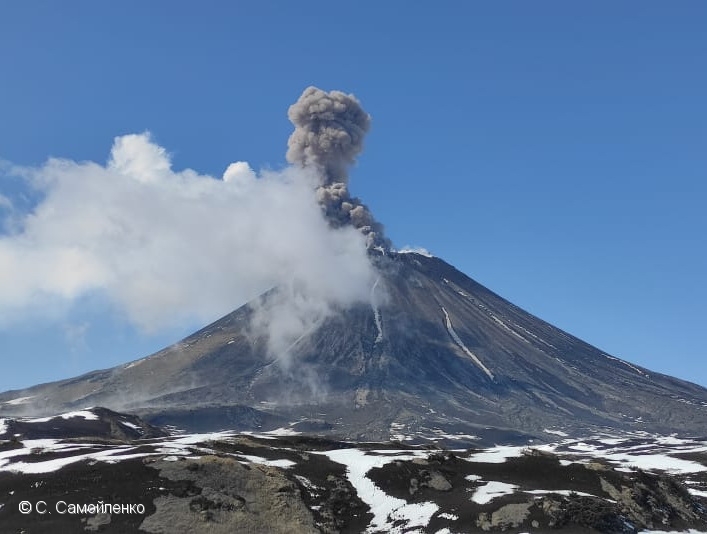
Kamchatka , Karymsky :
VOLCANO OBSERVATORY NOTICE FOR AVIATION (VONA)
Issued: July 14 , 2022
Volcano: Karymsky (CAVW #300130)
Current aviation colour code: ORANGE
Previous aviation colour code: orange
Source: KVERT
Notice Number: 2022-72
Volcano Location: N 54 deg 2 min E 159 deg 26 min
Area: Kamchatka, Russia
Summit Elevation: 1486 m (4874.08 ft)
Volcanic Activity Summary:
A moderate explosive activity of the volcano continues. Satellite data showed an ash cloud is drifting to the south-east of the volcano.
A moderate activity of the volcano continues. Ash explosions up to 12 km (39,400 ft) a.s.l. could occur at any time. Ongoing activity could affect international and low-flying aircraft.
Volcanic cloud height:
3000 m (9840 ft) AMSL Time and method of ash plume/cloud height determination: 20220713/0010Z – Himawari-8
Other volcanic cloud information:
Distance of ash plume/cloud of the volcano: 369 km (229 mi)
Direction of drift of ash plume/cloud of the volcano: SW / azimuth 233 deg
Time and method of ash plume/cloud determination: 20220714/0010Z – Himawari-8
Start time of explosion and how determined: 20220713/1050Z – Satellite data
Source : Kvert
Photo : S. Samoylenko.
Italy , Vulcano :
WEEKLY BULLETIN, from July 4, 2022 to July 10, 2022. (issue date July 12, 2022)
SUMMARY OF STATUS OF ACTIVITY
In the light of the surveillance data, it is highlighted:
1) Temperature of the crater fumaroles: The updated data of the temperatures recorded on the rim of the crater show very stable values with a weekly average of 376°C. The sensor on the inner side requires maintenance.
2) CO2 flux in the crater area: The CO2 flux in the crater area remains at medium-high values.
3) SO2 flux in the crater area: SO2 flux at a medium-high and stable level
4) Geochemistry of fumarolic gases: The concentration of magmatic species (CO2, He, N2) is slightly increasing (15 mol% CO2 on 06/27/2022).
5) CO2 fluxes at the base of the La Fossa cone and in the Vulcano Porto area: The CO2 fluxes recorded in the Rimessa, C. Sicilia and P4max sites show a slight downward trend, but remain on values above the background level, while in the Faraglione site there are values close to the background level.
6) Geochemistry of thermal aquifers: The physico-chemical parameters recorded in the Camping Sicilia well show unreliable values due to problems with the probe that will be replaced at the end of the current month. In the Bambara well, there is a stabilization of the piezometric level and a slight decrease in salinity.
7) Local seismicity: Low occurrence rate of local micro-seismicity.
8) Regional seismicity: No regional earthquake was recorded.

9) Deformations – GNSS: The network of GNSS stations has not recorded any significant changes.
10) Deformations – Inclinometry: The inclinometric network has not recorded any significant changes.
11) Other Notes: Mobile GNSS. The GNSS mobile network has been successfully installed and has started to acquire and transmit real-time displacements at a frequency of 1 Hz. Currently, the series are still very short and do not show significant variations.
Gravimetry: No significant medium-long term change has been recorded.
LOCAL SEISMICITY
In the week in question, local micro-seismicity related to hydrothermal fluid dynamics was generally low. In particular, the number of microshocks with a spectral peak greater than 1 Hz is on average comparable to that observed the previous week, while the rate of occurrence of VLP events after having decreased significantly, in the last 2 days shows a slight recovery. (VLP; spectral peak below 1 Hz).
Source : INGV.
Photo : INGV
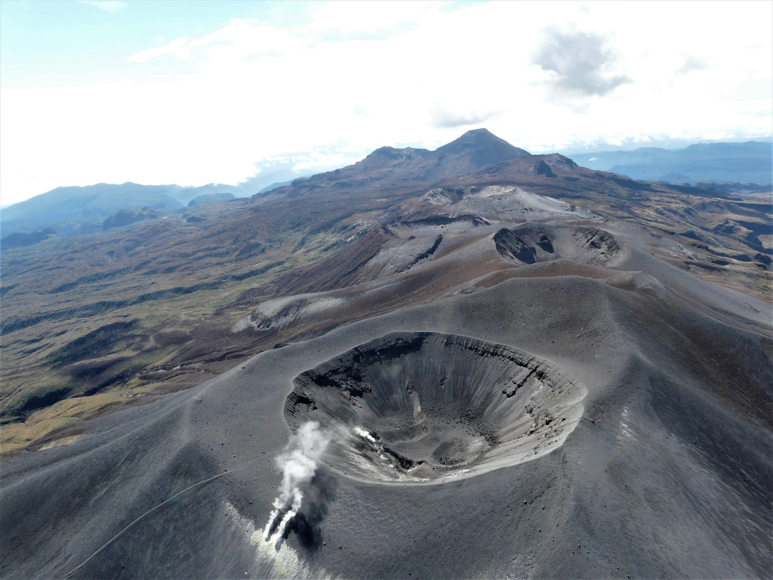
Colombia , Puracé / Los Coconucos volcanic chain:
Weekly bulletin of the activity of the Puracé volcano – Los Coconucos volcanic chain.
The activity level of the volcano continues at the yellow Activity Level or (III): changes in the behavior of volcanic activity.
From the analysis and evaluation of the information obtained through the monitoring network of the Puracé volcano – Los Coconucos volcanic chain, during the week of July 5 to 11, 2022, the COLOMBIAN GEOLOGICAL SERVICE – Volcanological and Seismological Observatory of Popayan reports that:
During this week, the strong occurrence of earthquakes associated with the movement of fluids inside the volcano continues. A total of 993 seismic events were presented, of which 117 were associated with rock fracturing processes (type VT) and 917 with fluid dynamics in volcanic conduits; of these, 770 were classified as long duration events (type LP), 76 were associated with both failure mechanisms and fluid dynamics and were classified as hybrid (type HB), 17 were classified as low frequency events (type BF), two (2) as « tornillos » type earthquakes (type TO) and 57 as low energy tremor pulses (type TR).
The geodetic network of GNSS (Global Navigation Satellite System) stations monitoring ground deformation continues to record a process linked to inflation.
While monitoring surface activity, images obtained during the week from Anambío, Mina, Lavas Rojas and Cerro Sombrero web cameras showed degassing of the volcanic system, with a white column oriented preferentially to the North -West.
Sensors monitoring magnetic and electric fields and infrasonic waves did not record variations associated with changes in volcanic activity.
Therefore, it is concluded that significant variations in volcanic activity continue to be recorded, in accordance with the behavior expected at activity level III (yellow level), which could evolve towards states of greater activity.
Source et photo : Ingeominas.
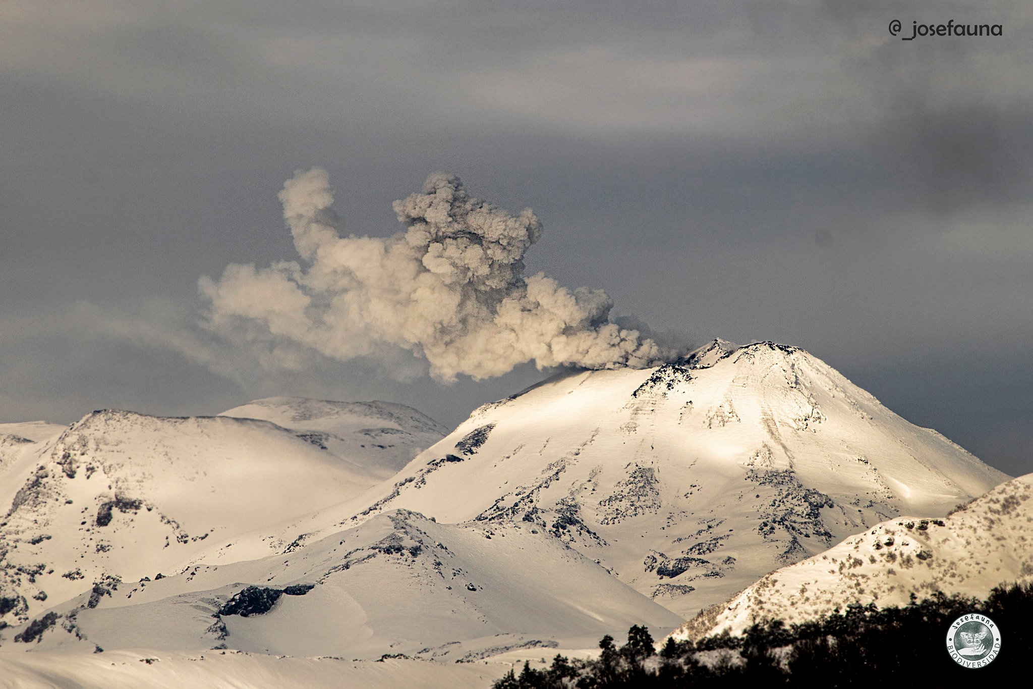
Chile , Nevados de Chillan :
Special Report on Volcanic Activity (REAV), Ñuble Region, Nevados de Chillán Volcanic Complex, July 13, 2022, 22:45 local time (mainland Chile)
The National Geology and Mining Service of Chile (Sernageomin) publishes the following PRELIMINARY information, obtained through the monitoring equipment of the National Volcanic Monitoring Network (RNVV), processed and analyzed in the Volcanological Observatory of the Southern Andes (Ovdas) :
On Wednesday July 13, at 10:31 p.m. (2:31 a.m. local time) the monitoring stations installed near the Nevados de Chillán volcanic complex recorded an earthquake, associated with fluid dynamics inside the volcanic system (long period type).
The characteristics are as follows:
ORIGINAL TIME: 10:31 p.m. (2:31 a.m. local time)
LATITUDE: 36.854°S
LONGITUDE: 71.371° W
DEPTH: 0.3 km
REDUCED DISPLACEMENT: 765 (cm2)
ACOUSTIC SIGNAL: 3.4 Pascals (Pa) reduced to 1 km
COMMENTS:
The characteristics of the superficial activity following this event are as follows:
Despite the cloudiness present in the area, it was possible to observe a change in brightness of the images of the IP camera, attributed to a superficial explosion associated with the event.
The volcanic technical alert remains at the yellow level.
Source : Sernageomin.
Photo : josefauna.
Guatemala , Fuego :
SPECIAL VOLCANOLOGICAL BULLETIN:
Geographical location:
latitude 14°28’54˝N;
90°52’54˝Longitude W.
Altitude: 3,763 meters above sea level.
LAHAR IN THE BARRANCA LAS LAJAS, TRIBUTARY OF THE GUACALATE RIVER
The rains in the area of the volcanic complex are currently generating a lahar in the Barranca Las Lajas, a tributary of the Guacalate River, with weak to moderate characteristics, but with the probability of increasing in the next few minutes due to the rains that persist in the region. . The lahar descends with fine volcanic material, in addition to carrying branches and tree trunks, as well as blocks from 30 cm to 1.5 meters in diameter. If the rain persists, the generation of larger lahars in this or other ravines of the volcanic complex is not excluded.
Source: Insivumeh