September 04 , 2021 .
Indonesia , Merapi :
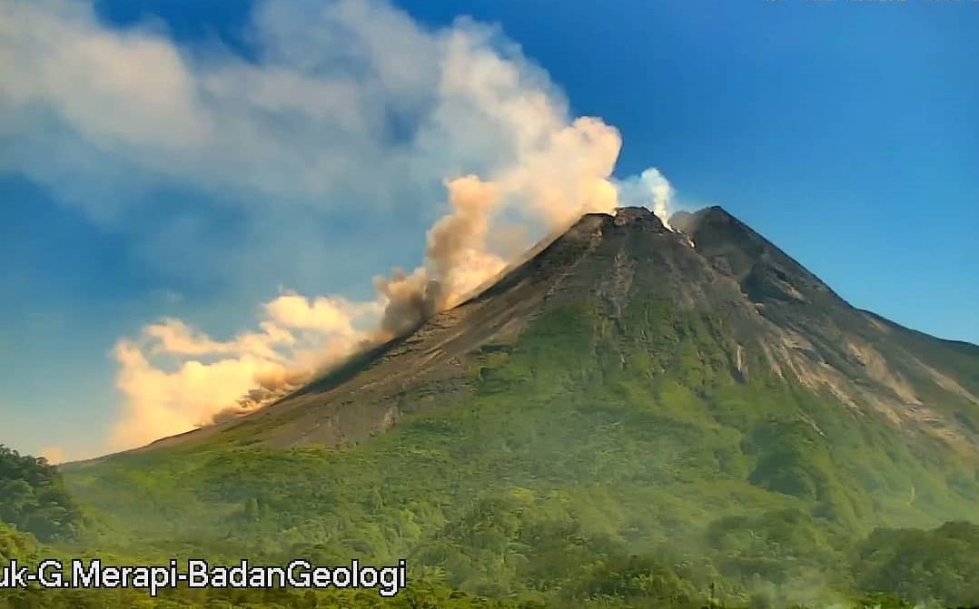
Report on the activity of Mount Merapi from August 27 to September 2, 2021
RESULT OF OBSERVATIONS
Visual
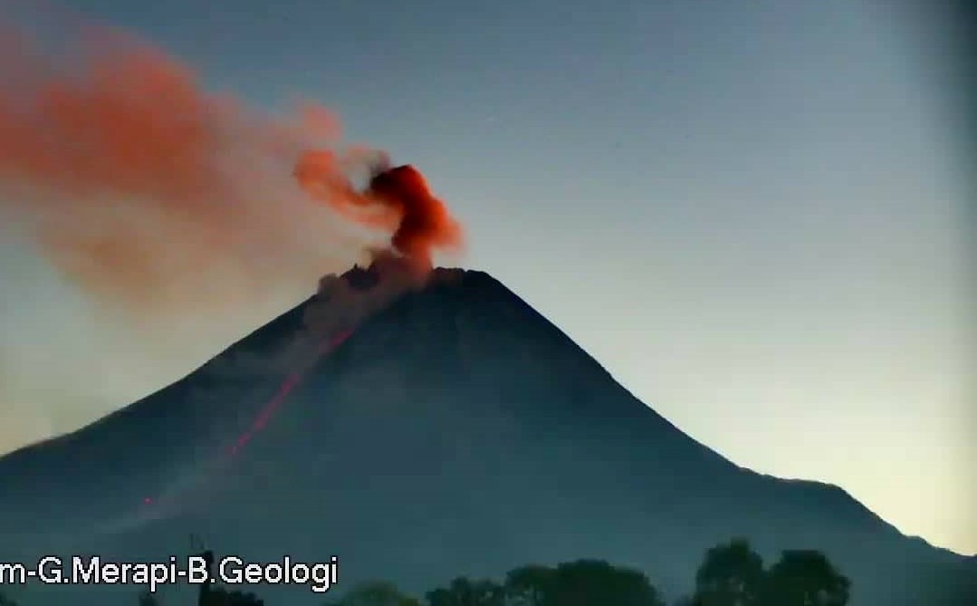
The weather around Mount Merapi is generally sunny in the morning and evening, while it is foggy in the afternoon. White, weak to thick, low pressure, 600m high smoke was observed from the Mount Merapi observation post in Selo on August 27, 2021 at 10:00 a.m. WIB.
This week, there were 6 hot avalanche clouds to the southwest with a maximum slide distance of 2,500 m. Ash rains were reported on August 28 and September 1, 2021 in several regions, including Srumbung, Salam, Ngluwar, Dukun, Mungkid, Sawangan, Muntilan and Salaman sub-districts. Lava avalanches have been observed 80 times to the southwest with a maximum slide distance of 2000 m.
According to the results of aerial photos taken with drones on September 1, 2021, the Southwest dome and the central dome continue to grow. It was observed that there were morphological changes in the southwest lava dome and the central dome, namely the height of the southwest dome increased by about 2 m and the central dome increased by approximately 1 m. The volume of the southwest lava dome is 1,440,000 m3 and the central dome is 2,842,000 m3.
Seismicity
This week, the seismicity of Mount Merapi showed
6 Warm Cloud Avalanche (PA) earthquakes,
1 shallow volcanic earthquake (VTB),
62 low frequency earthquakes (LF),
68 multi-phase earthquakes (MP),
1,978 avalanche earthquakes (RF),
1,289 emission earthquakes (DG),
3 tectonic earthquakes (TT).
The intensity of this week’s earthquake was higher than last week.
Deformation
The deformation of Mount Merapi which was monitored using EDM and GPS this week showed no significant changes.
Rain and lahars
This week, it rained at the Mount Merapi observation post with an intensity of 48 mm / hour for 10 minutes at the Ngepos post on August 30, 2021. There were no reports of lahars or additional flow in the mountains. rivers that take their source on Mount Merapi.
Conclusion
Based on the results of visual and instrumental observations, it is concluded that:
The volcanic activity of Mount Merapi is still quite high in the form of effusive eruption activity. The status of the activity is defined in the “SIAGA” level.
Source : BPPTKG.
Photos : PVMBG , Frekom .
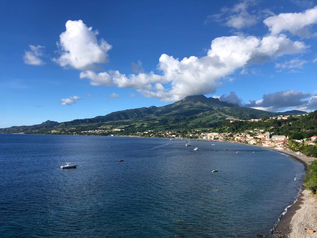
La Martinique , Montagne Pelée :
Weekly report on the activity of Mount Pelée for the period from August 27 to September 03, 2021.
Between August 27, 2021 at 4 p.m. (UTC) and September 3, 2021 at 4 p.m. (UTC), OVSM recorded at least 178 volcano-tectonic earthquakes of magnitude less than or equal to 0.5. These earthquakes were located inside the volcanic edifice between 0.2 and 1.2 below sea level. None of these earthquakes were felt by the population. This volcano-tectonic-type superficial seismicity is associated with the formation of micro-fractures in the volcanic edifice.
A degassing zone at sea was detected at shallow depth (between St Pierre and le Prêcheur). The IGP is currently setting up experiments to map this gas emanation zone, carry out physicochemical measurements of the fluids and samples of these fluids in order to understand the origin of this degassing and to assess its possible relationship. with the hydrothermal system of Mount Pelée. This kind of manifestation is frequent on active or not active underwater volcanic sites. The analyzes underway by the OVSM-IPGP will make it possible to determine the possible relationship of this underwater degassing with the activity of Mount Pelée recorded by the OVSM since 2019.
A main area of heavily degraded vegetation is still observed on the southwest flank of Mount Pelée, between the upper Claire River and the Chaude River.
The alert level remains YELLOW: vigilance.
Source : Direction de l’OVSM IPGP.
Photo : rci.fm
Philippines , Taal :
TAAL VOLCANO BULLETIN 04 September 2021 8:00 AM
In the past 24-hour period, the Taal Volcano Network recorded thirty-eight (38) volcanic earthquakes, including twelve (12) volcanic tremor events having durations of one (1) to five (5) minutes, twenty-five (25) low-frequency volcanic earthquakes, one (1) hybrid event, and low-level background tremor that has persisted since 07 July 2021.
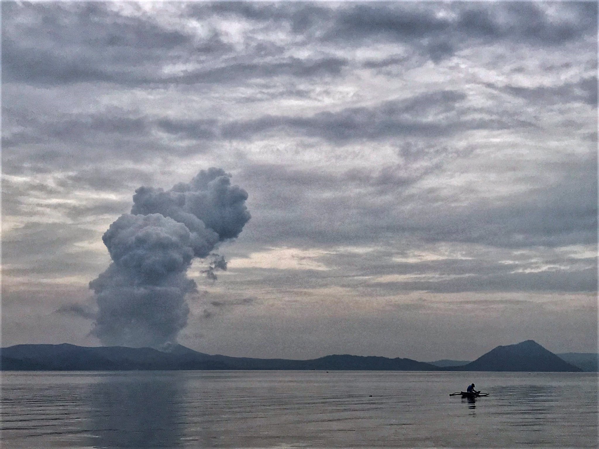
Activity at the Main Crater was dominated by upwelling of hot volcanic fluids in its lake which generated plumes 1,500 meters tall that drifted southeast. Sulfur dioxide (SO2) emission averaged 7,626 tonnes/day on 3 September 2021. Based on ground deformation parameters from electronic tilt, continuous GPS and InSAR monitoring, Taal Volcano Island has begun deflating in April 2021 while the Taal region continues to undergo very slow extension since 2020.
Source : Phivolcs
Photo : Rizal M.
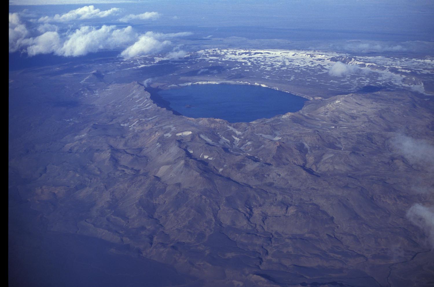
Iceland , Askja :
Uplift signal detected in Askja volcano , 3.9.2021
GPS observations and ground deformation maps derived from Sentinel-1 satellite data reveal that Askja volcano began inflating at the beginning of August 2021. The uplift signal is centered on the western edge of Öskjuvatn, close to Ólafsgígar, and corresponds to ~5 cm/month of vertical motion. Geodetic modelling (performed using both GPS and satellite data) indicates that the source of this inflation is located at a depth of approximately 3 km and corresponds to a volume change of approximately 0.001 km³/month.
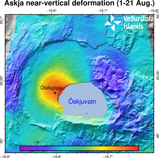
Inflation map of Askja volcano. Triangle in the centre of Askja volcano caldera show the location of the inflation in red to blue colour. Copyright of this image belongs to Icelandic Met Office.
The cause of such inflation is uncertain, but most likely it is due to the inflow of new magma. Askja volcano is seismically active and earthquakes are regularly measured in the area.
The last eruption at Askja was in 1961. Regular geodetic measurements were done in 1970-1972 and showed a period of uplift, however no further measurements were acquired until 1983. Since then, a continued subsidence of a rate of 1 cm/year was detected until this current inflation phase started.
Active volcanoes in Iceland are often characterized by periods of inactivity, lasting years to decades, with intervals of enhanced seismicity, geothermal activity, and inflation. In most cases, magmatic intrusions do not culminate into an eruption. At the stage it is then very difficult to anticipate how the situation will evolve. The inflation is continuing at present (3. Sept 2021) and will be closely monitored by IMO which will distribute additional information in case of further changes.
The Askja volcanic system has been moderately active in the Holocene. The last eruption was a moderate, predominantly effusive eruption in 1961 CE that lasted 5-6 weeks and produced about 0.1 km3 of basaltic lava and 0.004 km3 of tephra.
The Askja volcanic system is part of the Northern Volcanic Zone and is about 190 km long and up to 20 km wide, consisting of a central volcano rising to 1516 m a.s.l. and a fissure swarm. Ice cover is limited to the southernmost tip of the system. A caldera complex lies within the central volcano. The youngest caldera is the Öskjuvatn caldera, now occupied by a 12 km2 and ~200 m-deep lake.
The most common volcanic activity is basaltic fissure eruptions with lava volumes of 0.05-0.2 km3. Large explosive silicic eruptions with tephra volumes <2.0 km3 have occurred sporadically throughout the Holocene. Eruption frequency during the last 7000 years is 2-3 eruptions per 100 years on average.
The youngest caldera formed in the 1875 CE Plinian eruption, and is now filled with lake Öskjuvatn
Sources : vedur is .
Read the article : https://en.vedur.is/about-imo/news/uplift-signal-detected-in-askja-volcano
Photos : Vedur is , Oddur Sigurðsson
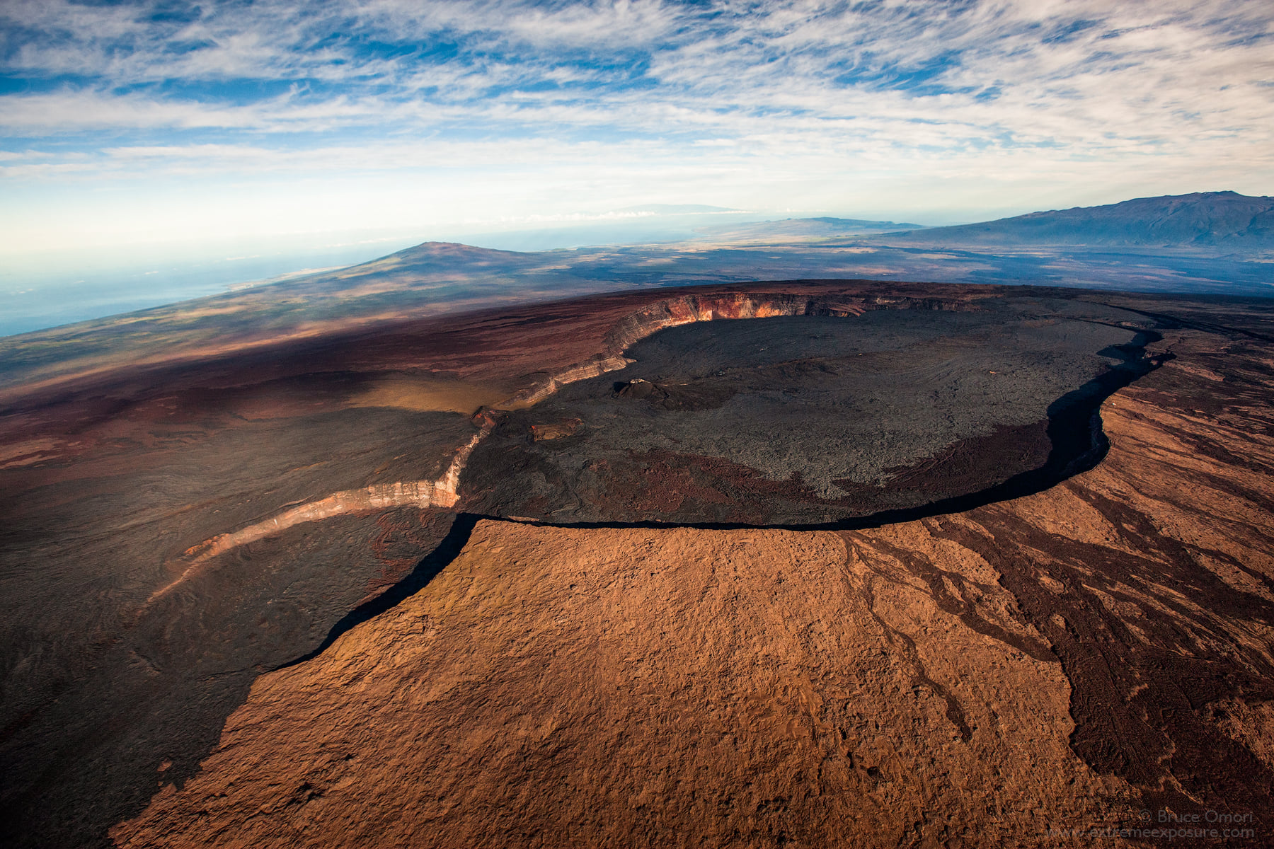
Hawaii , Mauna Loa :
19°28’30 » N 155°36’29 » W,
Summit Elevation 13681 ft (4170 m)
Current Volcano Alert Level: ADVISORY
Current Aviation Color Code: YELLOW
Activity Summary:
Mauna Loa Volcano is not erupting. Rates of seismicity at the summit remain slightly above long-term background levels, but have not changed significantly over the past week. Other monitoring data streams—ground deformation, gas discharge, and visual observations—show no significant changes.
Observations:
During the past week, HVO seismometers recorded 58 small-magnitude earthquakes—below M2.5—beneath the summit and upper-elevation flanks of Mauna Loa. The majority of these earthquakes occurred at shallow depths less than 8 kilometers (5 miles) below sea level.
Measurements of ground deformation, using Global Positioning System (GPS) instruments, confirm that the surface of the volcano has not moved appreciably over the past week.
Gas concentrations and fumarole temperatures at both the summit caldera and at Sulphur Cone on the Southwest Rift Zone remain stable.
Webcam views have shown no changes to the landscape at the Mauna Loa summit or on the lower flanks of the volcano over the past week.
Source : HVO.
Photo : Bruce Omori .