May 11 , 2021 .
Peru , Sabancaya :
Analysis period: from May 03, 2021 to May 09, 2021, Arequipa, May 10, 2021.
Alert level: ORANGE
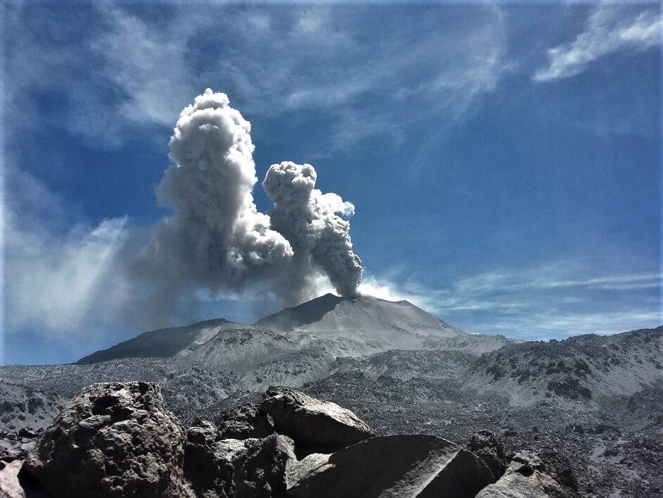
The Geophysical Institute of Peru (IGP) reports that the eruptive activity of the Sabancaya volcano remains at moderate levels, that is to say with the recording of an average of 66 daily explosions, with columns of ash and gas up to 2.5 km altitude above the summit of the volcano and their consequent dispersion. Therefore, for the following days, no significant change is expected in eruptive activity.
The IGP recorded and analyzed the occurrence of 1609 earthquakes of volcanic origin, associated with the circulation of magmatic fluids inside the Sabancaya volcano. An average of 91 explosions was recorded daily. During this period, Volcano-Tectonic (VT) earthquakes associated with rock fractures were located mainly in the East, and North-East of Sabancaya and presented magnitudes between M1.0 and M2.0.
The monitoring of the deformation of the volcanic structure using GNSS techniques (processed with fast orbits) does not present any significant anomalies. However, in general, an inflation process was observed in the northern sector (around the Hualca Hualca volcano). Visual surveillance made it possible to identify columns of gas and ash up to 2.5 km altitude above the summit of the volcano, which were scattered towards the South-East, South, East, North and North sectors. East of Sabancaya. Satellite recordings have identified the presence of 9 thermal anomalies (maximum value of 18 MW) associated with the presence of a lava body on the surface of the volcano’s crater.
RECOMMENDATIONS
• Keep the volcanic alert level in orange.
• Do not approach within a radius of less than 12 km from the crater.
Source : IGP.
Photo : Ingemmet.
La Réunion Island , Piton de la Fournaise :
Press release of May 11, 2021 – 6:15 a.m.
The eruption that started on 04/09/2021 at 7 p.m. (appearance of the tremor) continues. The amplitude of the volcanic tremor (indicator of a surface lava emission) continues its slow decrease initiated since May 2. However, its amplitude remains significant, still reaching 30% of the maximum amplitude observed during this eruption on April 13.
– The images from the OVPF and OVPF / IRT cameras over the last 24 hours show that:
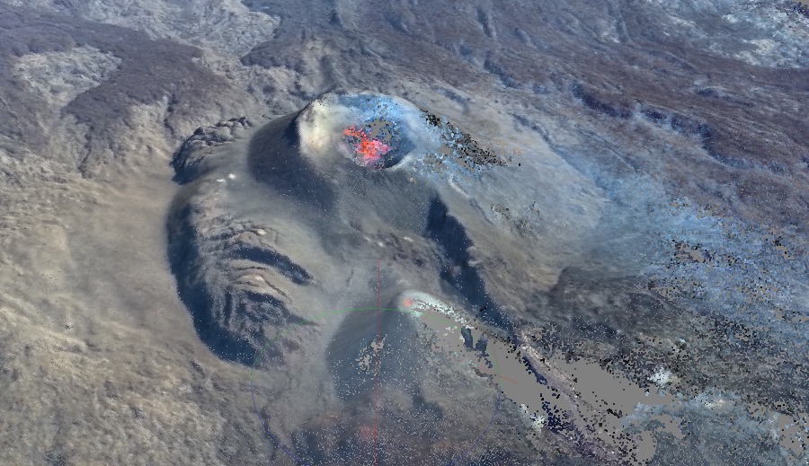
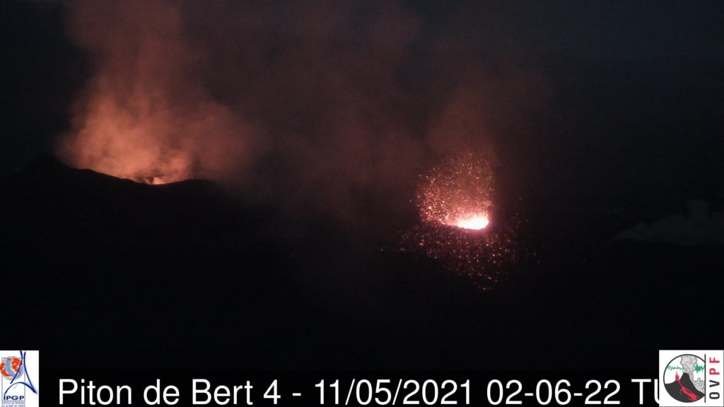
• the two cones are still active, with degassing which is always more marked and projections of lava still present at the level of the most downstream cone. The latest 3D reconstructions by stereophotogrammetric method show a base cone width of 226 m and a height of around 35 m for the main cone.
3D reconstruction of the eruptive site by stereophotogrammetric method from images acquired by Survol Réunion (© OVPF-IPGP- Survol Réunion).
• the flow of lava at the exit of the eruptive vents, occurs mainly in tunnels up to the upper limit of the large slopes, where resurgences of lava are visible on the surface.
• the flow front continues its slow progression in the Grandes Pentes. The last precise outline of the casting, deduced from the consistency data of InSAR acquisitions, dates back to 7
May, the flow was then located at 1200 m altitude and about 500 m from Piton Fréri (formed during the eruption of October 2019 and located at about 1000 m altitude, Piton that the flow has still not reached this day, confirming the slow progression of the casting front.
Shooting of the two eruptive cones on May 11 at 06:06 local time (02:06 UTC) (© OVPF-IPGP).
– Over the past 24 hours, 2 superficial volcano-tectonic earthquakes (between sea level and the surface) have been recorded, all located directly above the summit craters.
– The CO2 fluxes in the soil are still increasing in the far field (Plains region) and decreasing in the near field (Volcano Gîte) suggesting that deep recharge is continuing.
– The slight inflation (swelling) of the summit area seems to have stopped. This parameter will have to be confirmed in the coming days.
– Despite the good weather conditions, no estimate of the lava flow could be established by the HOTVOLC platform (OPGC – Clermont Auvergne University), because the flow of the
washing now almost entirely in a tunnel, considerably limits the thermal radiation of the flow.
Alert level: Alert 2-2
Source ; OVPF
Read the article : https://www.ipgp.fr/sites/default/files/ovpf_20210511_6h15_communique_eruption.pdf
Philippines , Taal :
TAAL VOLCANO BULLETIN 11 May 2021 08:00 A.M.
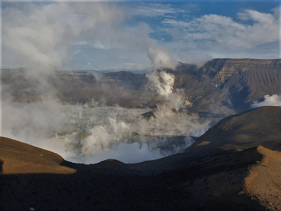
In the past 24-hour period, the Taal Volcano Network recorded one hundred forty-eight (148) volcanic earthquakes, including ninety-six (96) volcanic tremors having durations of one (1) minute to sixteen (16) minutes, fifty-two (52) low frequency volcanic earthquakes, and low-level background tremor that started since 9:05 AM on 08 April 2021. Activity at the Main Crater consisted of weak emission of steam-laden plumes from fumaroles or gas vents that rose five (5) meters. Sulfur dioxide (SO2) emission averaged 2325 tonnes/day on 10 May 2021. Temperature highs of 71.8°C and pH of 1.59 were last measured from the Main Crater Lake respectively on 04 March and 12 February 2021. Ground deformation parameters from electronic tilt, continuous GPS and InSAR monitoring continue to record a very slow and steady inflation and expansion of the Taal region that began after the January 2020 eruption. These parameters indicate persistent magmatic activity at shallow depths beneath the edifice.
Alert Level 2 (Increased Unrest) is currently maintained over Taal Volcano. DOST-PHIVOLCS reminds the public that at Alert Level 2, sudden steam-driven or phreatic explosions, volcanic earthquakes, minor ashfall, and lethal accumulations or expulsions of volcanic gas can occur and threaten areas within and around TVI. DOST-PHIVOLCS strongly recommends that entry must be strictly prohibited into Taal Volcano Island, Taal’s Permanent Danger Zone or PDZ, especially the vicinities of the Main Crater and the Daang Kastila fissure, and occupancy and boating on Taal Lake. Local government units are advised to continuously assess and strengthen the preparedness of previously evacuated barangays around Taal Lake in case of renewed unrest. Civil aviation authorities must advise pilots to avoid flying close to the volcano as airborne ash and ballistic fragments from sudden explosions and wind-remobilized ash may pose hazards to aircraft. DOST-PHIVOLCS is closely monitoring Taal Volcano’s activity and any new significant development will be immediately communicated to all stakeholders.
Source : DOST-PHIVOLCS
Photo : William Enriquez
Chile , Nevados de Chillan :
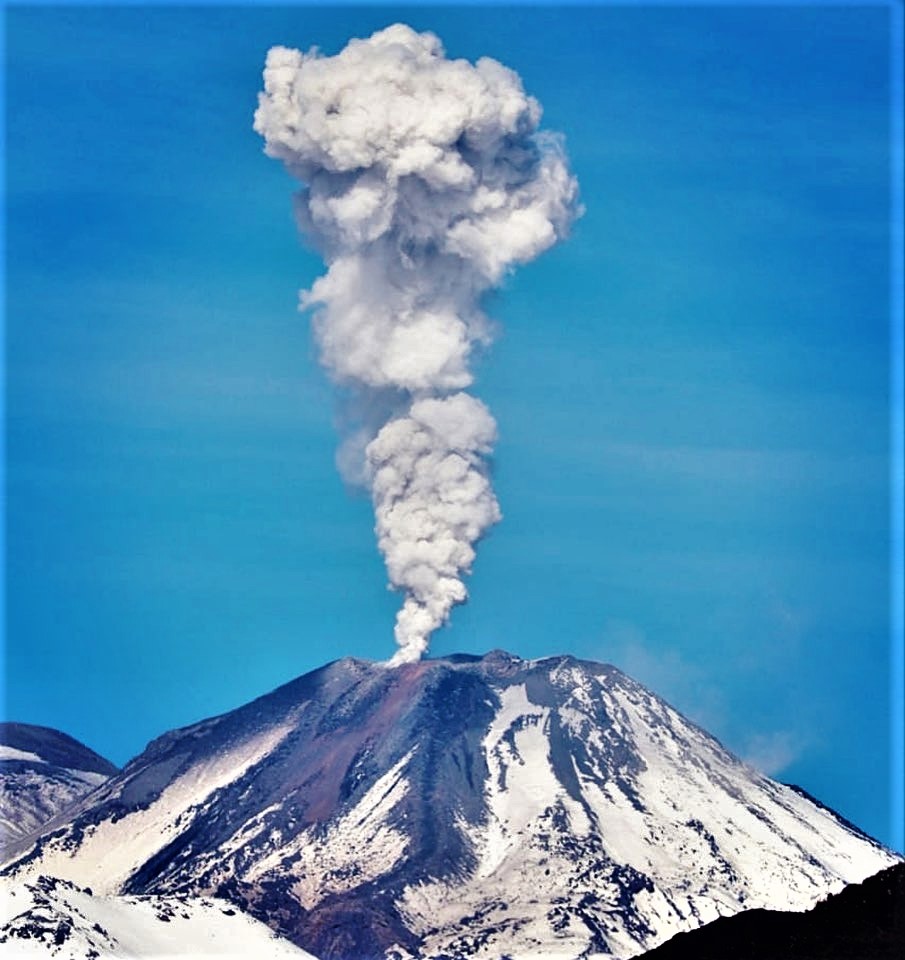
Special Report on Volcanic Activity (REAV), Ñuble region, Nevados de Chillán volcanic complex, May 09, 2021, 11:15 a.m. local time (Continental Chile).
The National Service of Geology and Mines of Chile (Sernageomin) publishes the following PRELIMINARY information, obtained thanks to the monitoring equipment of the National Volcanic Monitoring Network (RNVV), processed and analyzed in the Volcanological Observatory of the Southern Andes ( Ovdas):
On Sunday May 09, at 10:24 a.m. local time (2:24 p.m. UTC), the monitoring stations installed near the Nevados de Chillán volcanic complex recorded an earthquake associated with fluid dynamics in the volcanic system (long period type).
The characteristics of the earthquake after its analysis are as follows:
ORIGINAL TIME: 10:24 a.m. local time (2:24 p.m. UTC)
LATITUDE: 36.871 ° S
LONGITUDE: 71.368 ° W
DEPTH: 2.0 km
REDUCED DISPLACEMENT: 512 (cm2)
ACOUSTIC SIGNAL: 2.0 Pa reduced to 1 km.
The characteristics associated with surface activity are as follows:
MAXIMUM HEIGHT OF THE COLUMN: 1200 m above the point of emission.
DIRECTION OF DISPERSAL: North.
The volcanic technical alert remains at the Yellow level.
Source : Sernageomin .
Photo : Volcanologia Esia /Josefauna.
Saint Vincent , Soufrière Saint Vincent :
Soufriere St. Vincent – SCIENTIFIC UPDATE 10/05/21 6:00PM
– Seismic activity at La Soufrière, St Vincent has remained low since the tremor associated with the explosion and ash venting on 22 April.
– In the last 24 hours, only a few long-period earthquakes have been recorded.
– Measurements of the sulphur dioxide flux at La Soufrière were carried out by boat off the west coast yesterday (9 May) with the assistance of the coastguard.
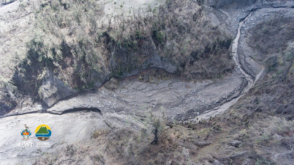
A bit lower down the Rabacca valley. There is some green grass to the top middle of the photo suggesting that tephra fallout in that area may have been either less or already washed out. It shows more clearly the possible height of the water when the lahar originally came down in the valley defined by the brown section of damaged or dead vegetation that run throughout the valley following more or less the riverbed. Photo credit: Jawid Collins, UWITV.
– Several traverses were completed and yielded an average SO2 flux of 208 tons per day.
– The volcano continues to be in a state of unrest. Escalation in activity can still take place with little or no warning.
– Caution should be taken in crossing river valleys on the volcano due to the increased risk of lahars (mudflows) during periods of rainfall on the volcano.
– The volcano is at alert level ORANGE.
Source : UWI.
Photo: Jawid Collins, UWITV.
Guatemala , Pacaya :
Activity:
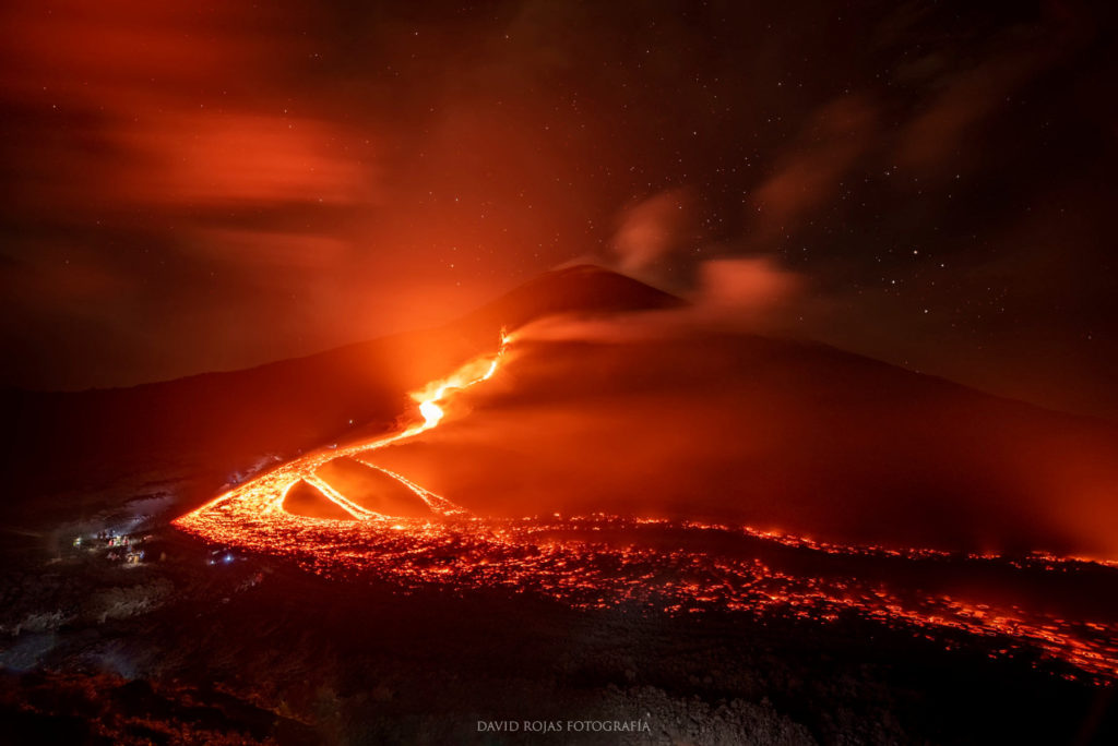
The Pacaya volcano observatory reports a constant degassing of white and blue color (water vapor and sulphurous gas) both in the crater of the Mackenney cone and in the crack on the northwest flank. Strombolian activity sporadically generates explosions in the upper part of the crack, raising the incandescent material to heights of between 50 and 100 meters.
Faint noises resembling airplane turbines are also heard. The lava flow emerging from this fissure continues to move slowly westward, with an approximate length of 2,150 meters with its front located south of the area known as La Breña. Detachments of glowing boulders continue to occur throughout the flow, especially where the slope is greater. The seismic stations around the volcano record internal tremors, associated with the movement of magma inside the volcanic building and with periods of outgassing in the crater.
Source : Insivumeh.
Photo : David Rojas Fotografía

