November 01 , 2020.
Alaska , Katmai :
58°16’44 » N 154°57’12 » W,
Summit Elevation 6716 ft (2047 m)
Current Volcano Alert Level: NORMAL
Current Aviation Color Code: GREEN
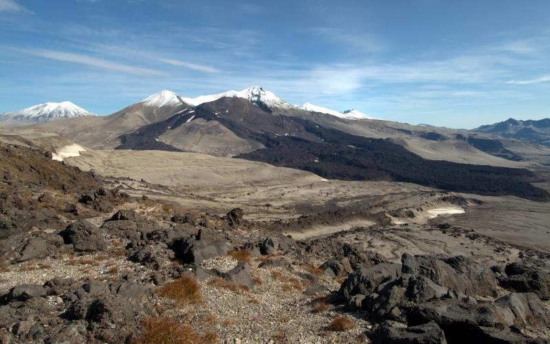
Strong northwesterly winds in the vicinity of Katmai and the Valley of Ten Thousand Smokes have picked up loose volcanic ash erupted during the 1912 Novarupta-Katmai eruption and carried it to the southeast toward the southern part of Kodiak Island today. The National Weather Service has issued a SIGMET for this low-level event and suggests that the maximum cloud height is 5,000 ft above sea level.
This phenomenon is not the result of recent volcanic activity and occurs during times of high winds and dry snow-free conditions in the Katmai area and other young volcanic areas of Alaska. No eruption is in progress. All of the volcanoes of the Katmai area (Snowy, Griggs, Katmai, Novarupta, Trident, Mageik, Martin) remain at color code GREEN.
Resuspended volcanic ash should be considered hazardous and could be damaging to aircraft and health.
Source : Kvert .
Photo : Cyrus Read.
Indonesia , Sinabung :
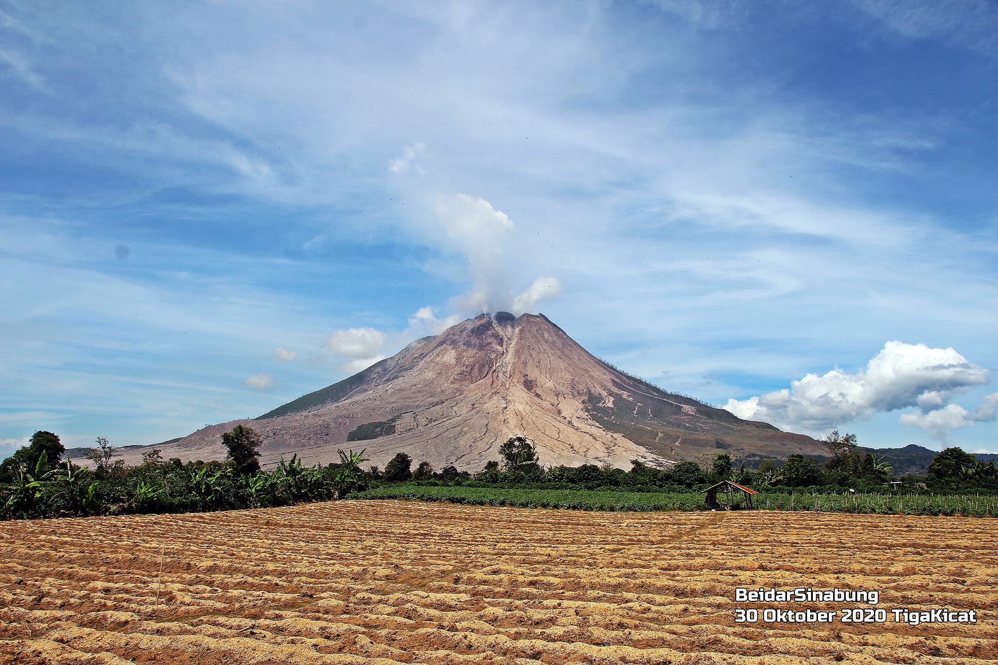
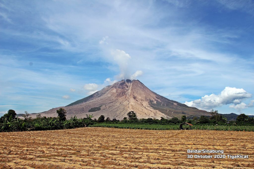
The activity level has been at level III (SIAGA) since May 20, 2019 at 10:00 a.m. WIB. The Sinabung volcano (2460 m above sea level) has been erupting since 2013. The last eruption occurred on September 5, 2020, causing a column of gray eruption reaching 800 meters above the summit.
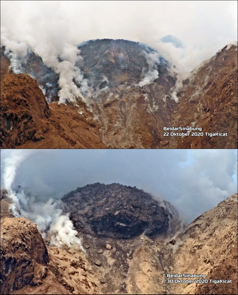
Growth of the Sinabung lava dome.
The volcano was clearly visible until it was covered in fog. We observe that the smoke from the crater is white with low to high pressure, low to thick intensity, 50-200 m high above the crater. Two hot avalanche clouds were observed with a slide distance of 1500 m and avalanches with a slide distance of 200-1000 m to the east and southeast. The weather is sunny, cloudy to rainy, with weak to strong winds to the east and southeast. Air temperature 17-27 ° C
According to the seismographs of October 31, 2020, it was recorded:
1 hot cloud avalanche earthquake
65 avalanche earthquakes
19 emissions earthquake
11 low frequency earthquakes
16 hybrid / multiphase earthquakes.
Recommendations:
The public and visitors / tourists should not carry out activities in the villages that have been relocated, as well as within a radial radius of 3 km around the summit of G. Sinabung, with a sector radius of 5 km for the southern sector -East and 4 km for the East-North sector.
In the event of ash rain, people are advised to wear masks when leaving the house to reduce the health effects of volcanic ash. Secure the drinking water facilities and clean the roof of the house from dense volcanic ash so that it does not collapse.
People who live near the rivers flowing down from Mount Sinabung should be aware of the dangers of lahars.
Source : PVMBG.
Photos : Firdaus Surbakti / Beidar Sinabung .
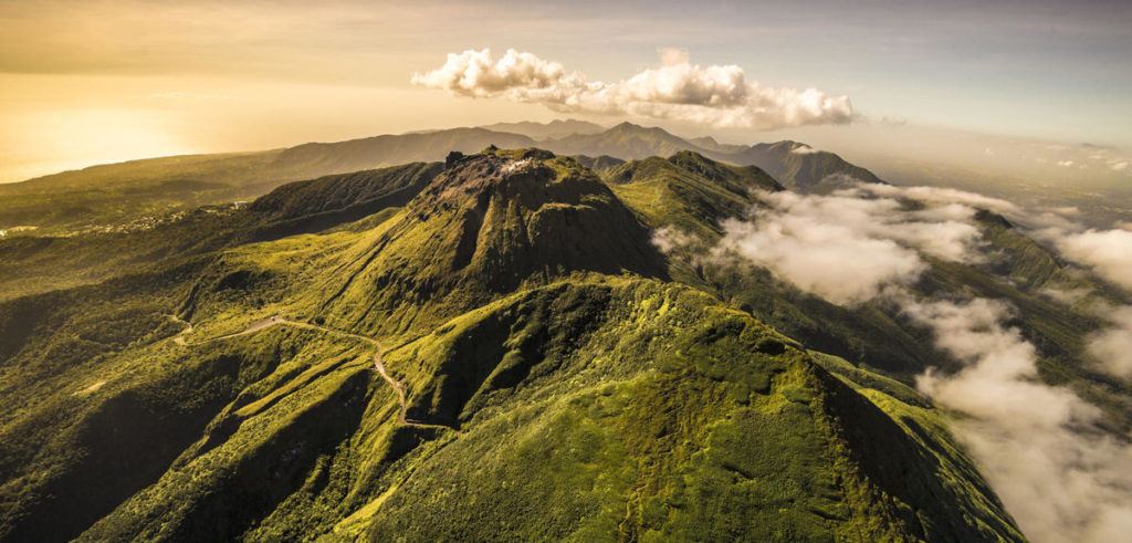
Guadeloupe , La Soufrière :
Report of volcanic activity , Saturday, 31 october 2020, 07:00 (local time)
End of the sequence of earthquakes in the area of La Soufrière of Guadeloupe – Basse Terre
The sequence of volcanic earthquakes that began in the area of La Soufrière volcano on Tuesday, 27 October 2020 at 3:27 pm, local time (Tuesday, 27 October 2020, 19:27, Universal Time UT *), ended on Saturday, 31 october 2020 at 05:00 am (Saturday, 31 october 2020 at 09:00 Universal Time, UT*). During this sequence 327 earthquakes were recorded.
The earthquakes are of very low magnitude (M <1) and none of them has been reported felt by the population. The events are located at a depth of <2.5 km under the summit of the dome of La Soufrière.
The alert level remains: yellow, vigilance.
Source : OVSG-IPGP directorship
Photo : A.-Brusini-hemis-fr.
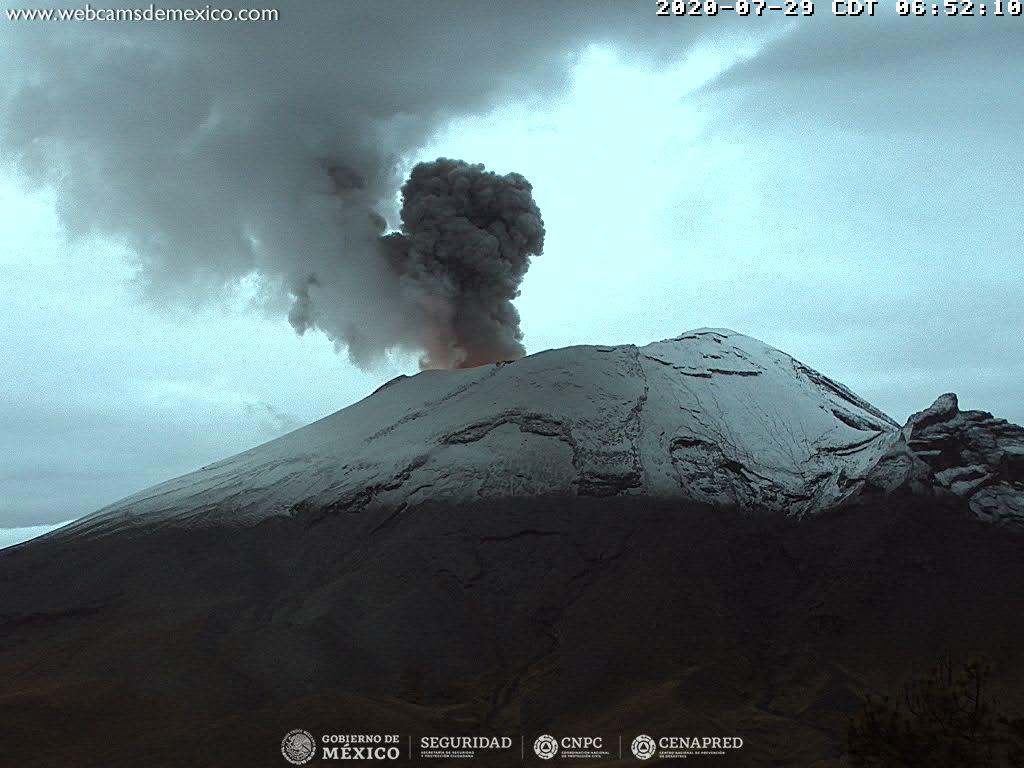
Mexico , Popocatepetl :
October 31, 11:15 a.m. (October 31, 5:15 p.m. GMT)
During the last 24 hours, according to the monitoring systems of the Popocatépetl volcano, 465 exhalations accompanied by volcanic gas emissions and sometimes slight amounts of ash have been identified. In addition, 30 minutes of tremor were recorded.
At the time of this report, a slight emission of gas is observed which disperses towards the North-West.
CENAPRED urges not to go as close as possible to the volcano and in particular to the crater, because of the danger posed by the fall of ballistic fragments and, in the event of heavy rains, to stay away from the bottom of the ravines due to the danger of mudslides and debris.
The Popocatépetl volcanic alert semaphore is in YELLOW PHASE 2.
Source : Cenapred .
Photo : Archive webcamdemexico.
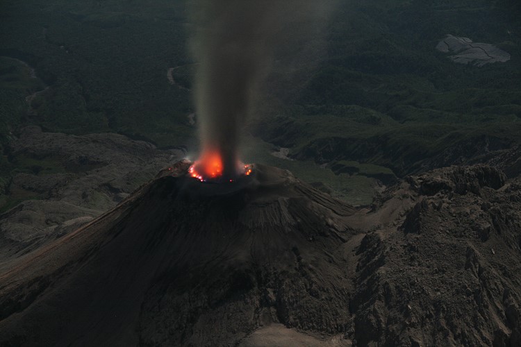
Guatemala , Santiaguito :
Activity:
An emission of white fumaroles is observed in the crater of the Caliente dome, mainly water vapor at an altitude of 3000 m above sea level (9843 feet). Seismic stations record explosions mainly accompanied by ash at an altitude of about 3,400 meters (11,155 feet) which travel up to 1 km southwest of the Caliente dome.
Some explosions generate noise from an airplane turbine due to the pressure of the magmatic gases. On the western and southwest flanks of the Caliente dome, constant low to moderate boulder avalanches are reported. An incandescence was observed at night in the crater of the Caliente dome. (The recommendations of the special bulletin BESAN of the Santiaguito volcano n ° 75-2020 remain in force).
Source : Insivumeh .
Photo : Marc Szeglat , 2009 , wikimedia

