September 10 , 2020.
Chile , Copahue :
37.856°S, 71.183°W
Elevation 2953 m
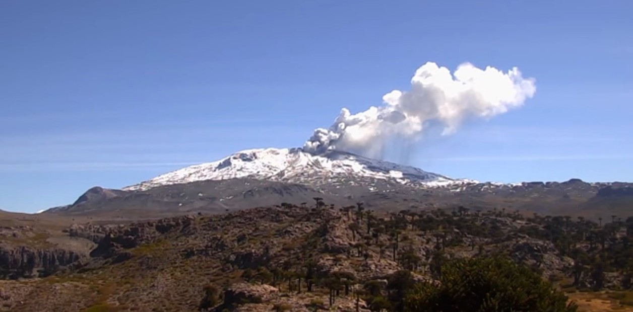
SERNAGEOMIN reported continuing activity at Copahue during 16-31 August. Webcams recorded gas-and-ash plumes rising as high as 1.7 km, sometimes associated with nighttime crater incandescence. The plumes drifted in multiple directions as far as 4.3 km N, 9 km NE, 8 km E, 4 km SE, 4 km SW, 9 km W, and 4.4 km NW. Sulfur dioxide emissions were high, averaging 2,641 tonnes per day (ranging from 2,029 to 3,253 tonnes per day), with a high value of 4,627 on 27 August. The Alert Level was remained at Yellow (the second lowest level on a four-color scale). ONEMI maintained the Yellow Alert (the middle level on a three-color scale) for residents of the Alto Biobío municipality and access to an area within 1 km of El Agrio Crater was restricted to the public.

During the period evaluated, the volcano-tectonic (VT) seismicity remained stable compared to the previous period, remaining at values considered low for this volcano.
The highest energy event had a local magnitude (ML) of 2.0 and was located 4.4 km north (N) of the crater at a depth of 2.2 km.
The seismicity associated with the movement of fluids inside the volcano (LP and TR types) showed an increase compared to the previous period, both in the number of events and in the energy released.
It was also possible to observe a continuity in the continuous tremor signal, which exhibited oscillating variations throughout the period, both in spectral content and in amplitude, probably related to the surface activity in the crater.
The occurrence of 133 discrete explosive activity (EX) events stands out, as evidenced by the surface activity shown by the volcano.
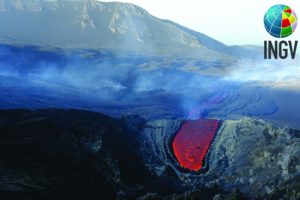
The images provided by the IP cameras made it possible to observe an almost constant column of degassing and particles, which reached a maximum height of 1680 m above the crater.
In addition, for several nights, it was possible to observe intense incandescent activity, associated with surface activity in the crater.
A total of ten (10) satellite anomalies of sulfur dioxide (SO2) emissions were reported for the period.
A thermal alert associated with the crater was recorded on August 21, using Sentinel 2-L2A image processing.
The SO2 emissions recorded on the surface by the DOAS stations showed average values of 2,641 tons / day with a maximum value of 4,627 tons / day on August 27, a value considered high for this volcano.
Source : GVP , Segemar.
Photo : Dario G. Lazo , clarin.com .
Solomon Islands , Kavachi :
8.991°S, 157.979°E
Elevation -20 m
Satellite data showed discolored water around Kavachi possibly beginning in early September; by 7 September discolored plumes in the water were visible E of the submarine cone.
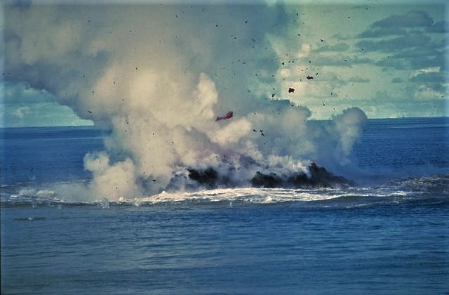
Named for a sea-god of the Gatokae and Vangunu peoples, Kavachi is one of the most active submarine volcanoes in the SW Pacific, located in the Solomon Islands south of Vangunu Island about 30 km N of the site of subduction of the Indo-Australian plate beneath the Pacific plate. Sometimes referred to as Rejo te Kvachi (« Kavachi’s Oven »), this shallow submarine basaltic-to-andesitic volcano has produced ephemeral islands up to 1 km long many times since its first recorded eruption during 1939. Residents of the nearby islands of Vanguna and Nggatokae (Gatokae) reported « fire on the water » prior to 1939, a possible reference to earlier eruptions. The roughly conical edifice rises from water depths of 1.1-1.2 km on the north and greater depths to the SE. Frequent shallow submarine and occasional subaerial eruptions produce phreatomagmatic explosions that eject steam, ash, and incandescent bombs. On a number of occasions lava flows were observed on the ephemeral islands.
Source : GVP.
Photo : W.G. Muller, 1977 (courtesy of Deni Tuni, Ministry of Lands, Energy and Mineral Resources, Solomon Islands)., wikipedia.
Ecuador , Sangay :
2.005°S, 78.341°W
Elevation 5286 m
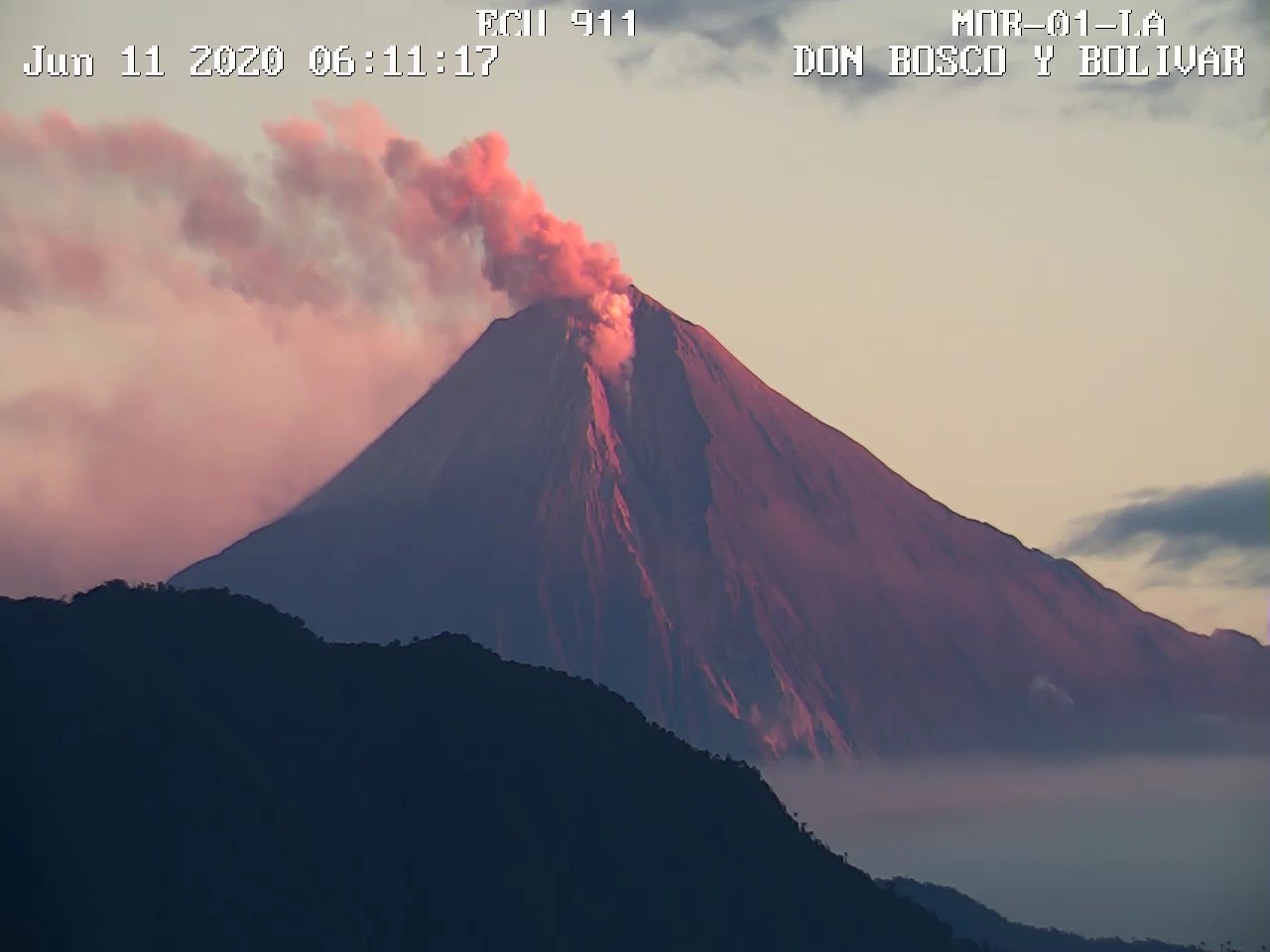
IG reported a high level of activity at Sangay during 2-8 September. Seismicity was characterized by high levels of explosions, harmonic tremor, long-period earthquakes, and signals indicating emissions. Weather clouds often prevented visual observations of the volcano, but the Washington VAAC and IG webcams recorded daily ash plumes that rose 600-1,500 m above the summit and drifted NW, W, and S. Lahars were periodically generated by heavy rains. On 2 September pyroclastic flows descended the SE flank.
DAILY REPORT OF THE STATE OF SANGAY VOLCANO, Tuesday September 08, 2020.
Surface activity level: High, Surface trend: No change.
Internal activity level: High, Internal trend: Increasing.
Seismicity: From September 07, 2020, 11:00 to September 08, 2020, 11:00:
Long period type events: 28
Explosions: 13
Emission tremor: 10
Harmonic tremor: 1
Rains / lahars:
As of noon yesterday, there were signs associated with mudslides and debris caused by the rains in the area.
** In case of heavy rains, lahars can be generated in the Volcán, Upano rivers and other tributaries **
Emission / ash column: No emission was however observed, the Washington VAAC reported 4 emission alerts observed by satellites reaching
heights of up to 1200 meters above crater level. Their direction was constant west
Other monitoring parameters: FIRMS recorded 1 thermal alert on the Sangay in the last 24 hours.
Observations: The climatic conditions of the sector prevented any direct observations of surface activity.
Alert level: yellow.
Source : GVP , IGEPN.
Photo : Archive Ecu911
Japan , Suwanosejima :
29.638°N, 129.714°E
Elevation 796 m
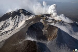
JMA reported periodic nighttime incandescence at Suwanosejima’s Ontake Crater during 28 August-4 September, and there was a total of 11 eruptions. An eruption at 0234 on 4 September generated a grayish white ash plume that rose 1.3 km above the crater rim before entering weather clouds. The Alert Level remained at 2 (on a 5-level scale).
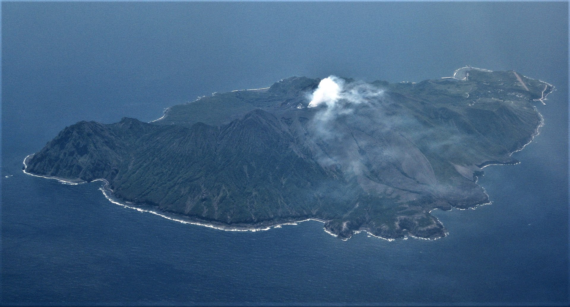
The 8-km-long, spindle-shaped island of Suwanosejima in the northern Ryukyu Islands consists of an andesitic stratovolcano with two historically active summit craters. The summit of the volcano is truncated by a large breached crater extending to the sea on the east flank that was formed by edifice collapse. Suwanosejima, one of Japan’s most frequently active volcanoes, was in a state of intermittent strombolian activity from Otake, the NE summit crater, that began in 1949 and lasted until 1996, after which periods of inactivity lengthened. The largest historical eruption took place in 1813-14, when thick scoria deposits blanketed residential areas, and the SW crater produced two lava flows that reached the western coast. At the end of the eruption the summit of Otake collapsed forming a large debris avalanche and creating the horseshoe-shaped Sakuchi caldera, which extends to the eastern coast. The island remained uninhabited for about 70 years after the 1813-1814 eruption. Lava flows reached the eastern coast of the island in 1884. Only about 50 people live on the island.
Source : GVP .
Photo : Ray Go.
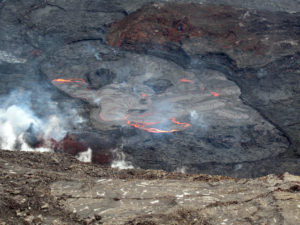
Japan , Nishinoshima :
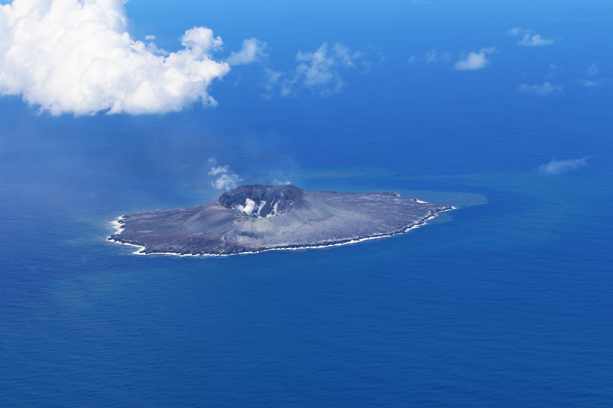
Experts have noticed a recent change in the composition of volcanic ash spewing from the island.
The volcano’s magma is likely rising from greater depths beneath the island, and future developments could involve a collapse of the crater peak in the middle of the island, leading to a subsidence of the entire island, according to an expert.
The ongoing spell of activity that started late last year has been intense.
The average daily lava output has hovered around three to four times the corresponding figure from the 2013-2015 period. In late June, lava output peaked at 4.62 million cubic meters, or more than 20 times the levels from the previous period, according to estimates by the University of Tokyo’s Earthquake Research Institute (ERI) based on data from the Himawari-8 meteorological satellite.
The huge volumes of lava being spewed out have increased the landmass of the island by 40 percent from 2.89 square km in May 2019 to 4.1 square km on Aug. 14 this year, according to the Meteorological Research Institute on the basis of satellite images.
A shift has also been observed in the mode of its eruption.
Nishinoshima mainly emitted only lava until June, but it began to discharge huge volumes of volcanic ash in late July. The entire island ended up covered in brownish ash several meters thick.
ERI’s analysis of volcanic ash collected aboard a vessel in July by the Japan Meteorological Agency showed its content of silicon dioxide (silica) had dropped from 60 percent or so to about 55 percent.
The analysis also showed magnesium, calcium and other ingredients had grown in content and resulted in higher magma densities.
Yoshihiko Tamura, a principal researcher of volcanology with the Japan Agency for Marine-Earth Science and Technology (JAMSTEC), said the shift in Nishinoshima’s activity mode evokes the process of an eruption more than 20,000 years ago at Sumisujima island (Smith Rocks), located between central Tokyo and Nishinoshima.
Magma gushing out of Sumisujima had a shallow origin during the initial phase of the eruption, but the magma gradually began to rise from greater depths.

When the magma undergoes a sharp drop in pressure, it comes to a sort of “boil,” causing an explosive eruption. A magma chamber emptied out by an intense eruption may no longer be able to withstand the weight of the island itself, causing the volcano body to subside over a broad expanse.
That is how a caldera measuring about 10 km across was likely formed on the seabed around Sumisujima island, leaving only part of the rock jutting above the sea surface.
The entire Nishinoshima island could cave in and sink beneath the ocean in the event of a caldera eruption, Tamura said.
“I cannot say if Nishinoshima will continue to grow in size or succumb to a caldera eruption,” he said. “Anyway, a collapse of the island body could trigger a tsunami, so it is essential to monitor the future course of the activity from the viewpoint of disaster management and disaster reduction.”
Source : Ashahi.com .
Read the full article : http://www.asahi.com/ajw/articles/13681089?fbclid=IwAR0vzZL_LEYslouM_ckqz-IlCpAxlwGDn8mLds19MO8bZic6X7ZoSmM2bV4
Photos : Japan coast guard.