September 06 , 2020.
Indonesia , Merapi :
Mount Merapi activity report, August 28 to September 3, 2020.
OBSERVATION RESULT
Visual
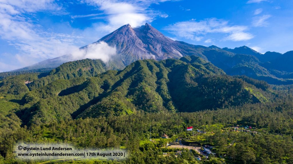
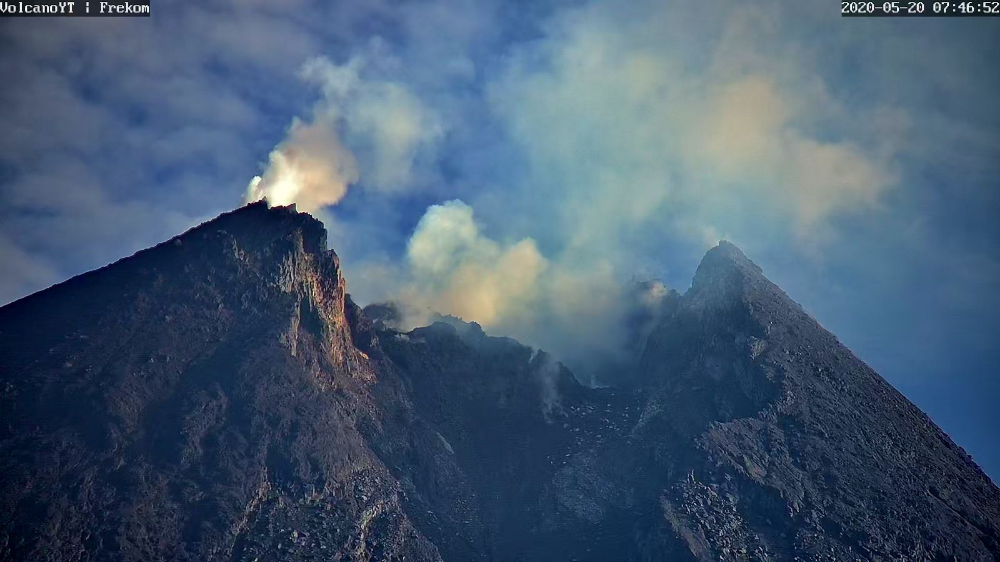
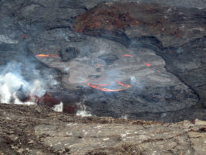
The weather around Mount Merapi is generally sunny in the morning and at night, while the afternoon until evening is foggy. There is white smoke, thin to thick with low pressure. A maximum smoke height of 250 m was observed from the Mount Merapi observation post in Babadan on August 29, 2020 at 8:10 a.m.
Morphological analysis of the crater area based on photos of the Southeast sector showed no change in the morphology of the dome. The volume of the lava dome based on measurements using aerial photography with drones from July 26, 2020 is 200,000 m3.
Seismicity
This week, the seismicity of Mount Merapi recorded:
20 earthquakes of emissions (DG),
1 deep volcanic earthquake (VTA),
7 shallow volcanic earthquakes (VTB),
73 multiphase earthquakes (MP),
4 low frequency earthquakes (LF),
23 avalanche earthquakes (RF),
10 tectonic earthquakes (TT).
The seismic intensity this week is relatively the same as last week.
Deformation
The deformation of Mount Merapi which was monitored by EDM this week showed a shortening of the monitoring distance of around 2cm.
Rain and lahars
This week, there was rain at Mount Merapi Observation Post with the highest rainfall intensity of 59mm / hour for 45 minutes at Kaliurang Post on September 3, 2020. There was no report lahars or additional flow in the rivers that descend from Mount Merapi.
Conclusion
Based on the results of visual and instrumental observations, it is concluded that:
1. The lava dome is currently in stable condition.
2. The volcanic activity of Mount Merapi is still quite high and is at the “WASPADA” activity level.
Source : BPPTKG.
Photos : Oystein Lund Andersen , Archive Frekom .
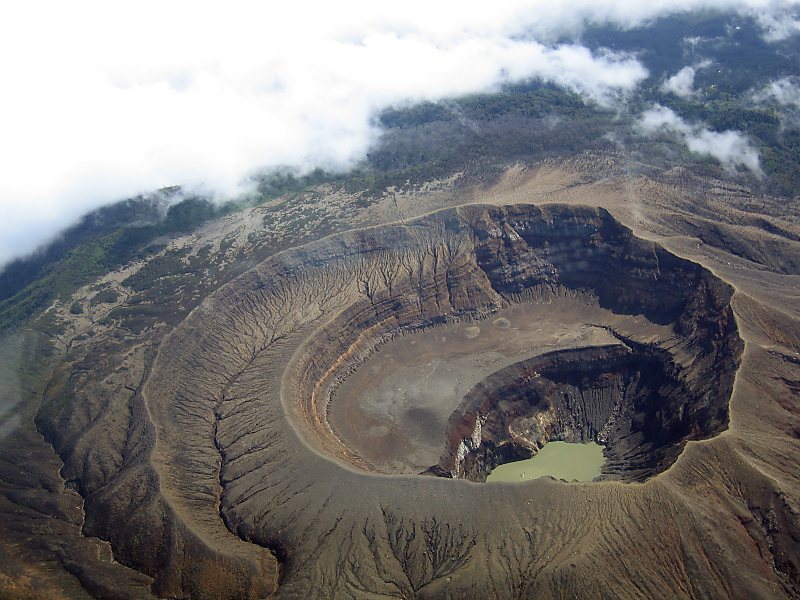
El Salvador , Santa Ana (Ilamatepec) :
Location: shared by the departments of Santa Ana and Sonsonate
Altitude: 2381 meters above sea level
Type of volcano: Stratovolcano
Type of activity: Vulcanian – Strombolian
Last eruption: October 1, 2005
The seismic vibration of the volcano remained between 18 and 23 RSAM units per day on average, that is to say in the normal range. As for earthquakes associated with rock fractures, four were recorded during the month. One of them, with a magnitude of M1.8, at a depth of 3.9 km, was located north of the crater, about 1 km. Due to its depth and spectral characteristics, shape and phases, it is interpreted as an earthquake caused by weathered fracture of the rock of the hydrothermal system. In addition, 42 earthquakes linked to the movements of hydrothermal fluids were recorded. Concerning Sulfur Dioxide (SO2) emissions, measured with DOAS equipment, they fluctuated between 153 and 505 tonnes per day, with an average of 254 tonnes / d, the threshold being 300 tonnes / d.
According to the analysis of monitoring data, the volcano remains with latent activity.
Source : Marn .
Photo : José Fernández, U.S Air Force
Chile , Nevados of Chillan :
Special report on volcanic activity (REAV), Region of Ñuble, volcanic complex of Nevados de Chillán
05 September 2020, 10:05 Local time (Continental Chile).
The National Service of Geology and Mines of Chile (Sernageomin) publishes the following PRELIMINARY information, obtained thanks to the monitoring equipment of the National Volcanic Surveillance Network (RNVV), processed and analyzed at the Volcanological Observatory of the Andes of the South (Ovdas):
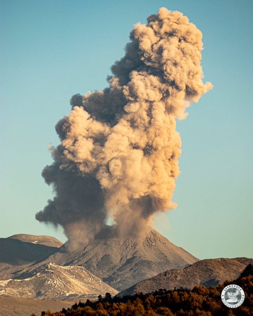
Yesterday, Saturday 05 September at 09:31 local time (13:31 UTC), the monitoring stations installed in the vicinity of the volcanic complex of Nevados de Chillán recorded an earthquake associated with the dynamics of fluids in the volcanic system (long period type)
The characteristics of the earthquake after its analysis are as follows:
ORIGINAL TIME: 09:31 local time (13:31 UTC)
LATITUDE: 36.867 ° S
LONGITUDE: 71.373 ° W
DEPTH: 0.3 km
REDUCED DISPLACEMENT: 597 (cm * cm)
OBSERVATIONS:
Due to the weather conditions in the area, it was not possible to verify the surface activity of the active crater.
The volcanic technical alert remains at the Yellow level.
Source : Sernageomin.
Photo : Josefauna.
Costa Rica , Turrialba / Poas / Rincon de la Vieja :
Daily report of the state of volcanoes. Date: September 04, 2020, Updated at: 12:58:00 PM.
Turrialba volcano:
No eruption is reported.
Seismic activity is similar compared to yesterday.
At the time of this report, the winds are blowing northwesterly.
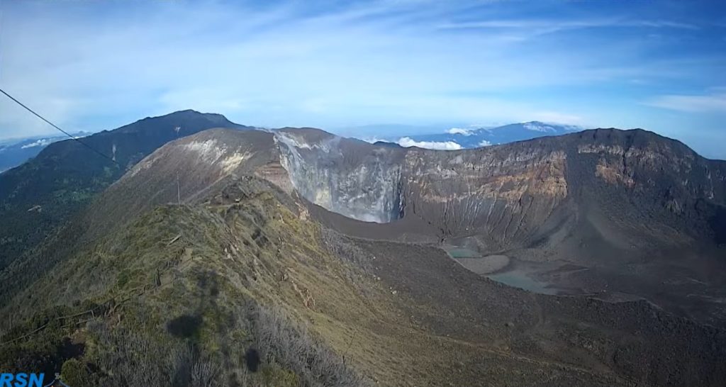
The seismograph network continues to record long-period, low-amplitude (LP) type earthquakes associated with the transfer of fluids (water, gas, steam) in the conduits and cracks of the volcano. The fumarolic activity concentrated in the western crater generates a plume rich in water vapor and poor in magmatic gases. No ash emission is observed.
Poas volcano:
No eruption is reported.
Seismic activity is similar compared to yesterday.
At the time of this report, the winds are blowing northeasterly.
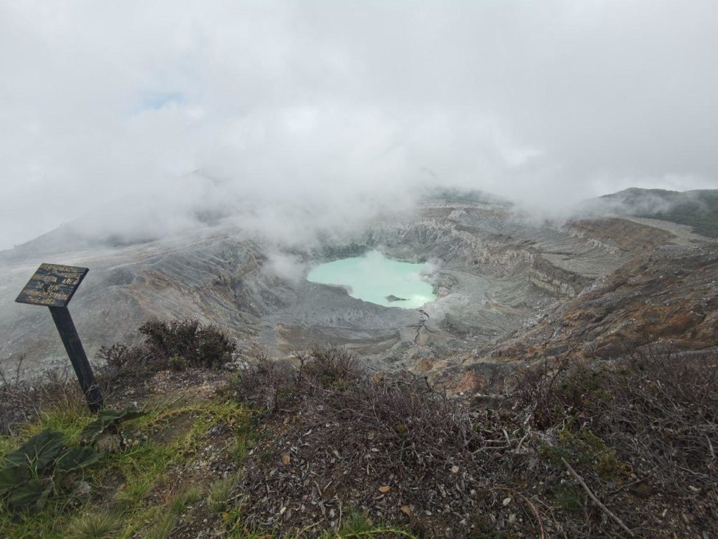
The seismographs record a very low level of volcanic seismic activity with volcanic earthquakes of long period (LP) type of very low amplitude, associated with low temperature fumarolic activity (around 120 ° Celsius) which is observed mainly in the region of the acid crater lake and in Mouth B (Bocca Azufrada) where an abundant amount of bright yellow elemental sulfur is deposited.
Rincon de la Vieja volcano:
No eruption is reported.
Seismic activity is similar compared to yesterday.
At the time of this report, the winds are blowing west.
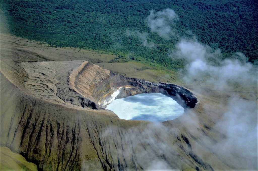
Rincón seismographs record low amplitude tremors related to the transport of fluids (water, gas, steam, magma ??) through conduits and cracks. On September 3, 2020, ICE geologist Waldo Taylor and his colleagues were atop Rincón de la Vieja for maintenance of a cortical deformation station (GPS) and observed low water level in the hyperacid lake of the active crater, as well as a strong degassing and convection activity by underwater fumaroles in this lake. The temperature of the lake is around 60 degrees Celsius. The subaerial fumaroles near the lake on the western inner wall of the crater are also vigorous with temperatures of around 120 degrees Celsius. Another observation made by Taylor’s group is the high water level at Laguna Jilgueros, near the active crater in the southeast. The Ojo de Agua Santuarium, 4 km north of the active crater, now shows in September 2020 the highest electrical conductivity (ion content caused by the interaction of magma and rock with acidic and hot water) observed between January 2019 and September 2020 (1400 uS / cm at the start of 2019 and 2600 uS / cm today 4 September 2020). A maximum temperature of 32.3 Celsius is also recorded, one of the highest recorded over the period 2018-2020. The typical temperature of the Ojo de Agua Santuarium is around 30 degrees Celsius. All these instrumental and field observations suggest that the Rincón is at a peak of activity and that the sudden appearance of phreatic-phreato-magmatic eruptions is very likely to occur.
It is therefore recommended to be careful along river beds and on bridges, as well as to comply with the recommendations of the National Commission for Emergencies and Risk Prevention CNE and local emergency committees.
Source : Ovsicori .
Photos : RSN , RSN , Federico Chavarría-Kopper – Ovsicori

