June 26 , 2020.
Japan , Asama :
Japan’s Meteorological Agency has raised the volcanic alert for Mt. Asama in eastern Japan to level 2, restricting access to the vicinity of the crater, as volcanic activity has increased in recent days.
Mt. Asama straddles Nagano and Gunma prefectures.
Level 2 is the second-lowest alert on a scale of 5.
The alert was raised on Thursday afternoon, with relatively minor eruptions possible in the near future. The Agency warns that an eruption could send large cinders and a flow of super-heated gas and molten rocks down to areas within 2 kilometers of the crater.
Since last Saturday, the Agency has detected continued shifting of the ground under the volcano, as well as an increase in volcanic earthquakes that are close to the surface.
A total of 59 such earthquakes were recorded on Wednesday, and 69 had been detected on Thursday as of 2 p.m.
Last August, a minor eruption occurred at Mt. Asama when the eruption alert was at its lowest, level 1. The alert was then raised to level 3, with access to the mountain restricted. In November, the alert was lowered to level 1 again.
Source : 3.nhk.or.jp.
Photo : Nautiljon
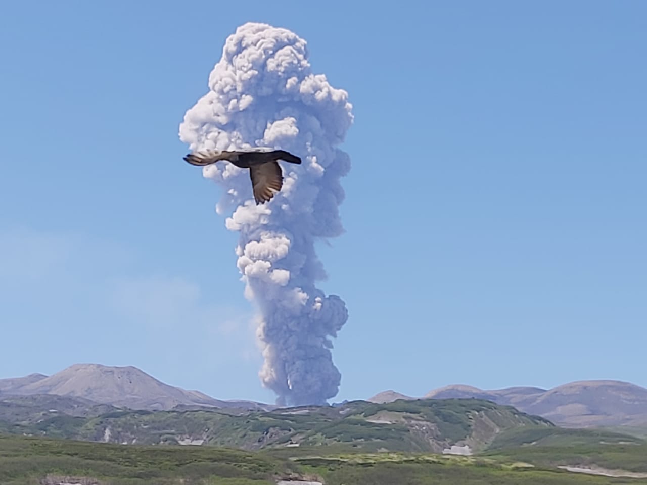
Russia / Kuril Islands , Ebeko :
VOLCANO OBSERVATORY NOTICE FOR AVIATION (VONA)
Issued: June 25 , 2020 .
Volcano: Ebeko (CAVW #290380)
Current aviation colour code: ORANGE
Previous aviation colour code: orange
Source: KVERT
Notice Number: 2020-135
Volcano Location: N 50 deg 41 min E 156 deg 0 min
Area: Northern Kuriles, Russia
Summit Elevation: 3791.68 ft (1156 m)
Volcanic Activity Summary:
A moderate eruptive activity of the volcano continues. According to visual data by volcanologists from Severo-Kurilsk, explosion sent ash up to 3.0 km a.s.l., an ash cloud is drifting to the west of the volcano.
A moderate eruptive activity of the volcano continues. Ash explosions up to 19,700 ft (6 km) a.s.l. could occur at any time. Ongoing activity could affect low-flying aircraft and airport of Severo-Kurilsk.
Volcanic cloud height: 9840 ft (3000 m) AMSL Time and method of ash plume/cloud height determination: 20200625/0538Z – Visual data
Other volcanic cloud information: Distance of ash plume/cloud of the volcano: 6 mi (10 km)
Direction of drift of ash plume/cloud of the volcano: W
Source : Kvert .
Photo : Leonid Kotenko, / volcanodiscovery.
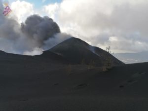
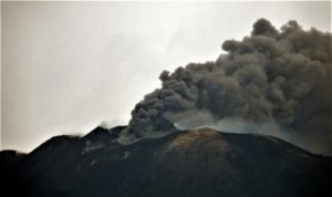
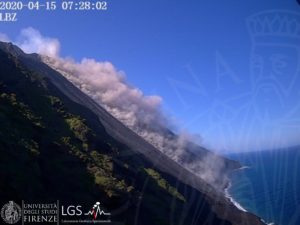
Costa Rica , Turrialba / Poas / Rincon de la Vieja / Irazu / Miravalles :
Weekly bulletin from the volcanic monitoring program, June 22, 2020.
Turrialba volcano:
Lat: 10.025 ° N; Long: 83,767 ° W;
Height: 3340 m above sea level
Current activity level: 2 (active volcano)
Potentially associated hazards: gas, ash emission, Proximal ballistic projections.
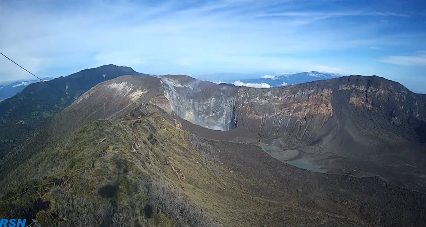
3 small ash emissions between 5 and 15 min long were detected on June 25 and 26, 2020. The seismicity has remained stable with a slight decrease since May. The contraction and subsidence of the Turrialba-Irazú massif continues. The CO2 / SO2 ratio has stopped increasing since the beginning of the month and is now showing a slight downward trend. The SO2 flux still shows a certain variability around normal values (<200 t / d). Emissions of ash are associated with a water / magma interaction process due to the heavy rains of recent weeks.
Poas Volcano:
Lat: 10.2 ° N; Long: 84 233 ° W;
Height: 2780 m above sea level
Current activity level: 2 (active volcano)
Potentially associated hazards: gas, phreatic eruptions, Proximal ballistic projections.
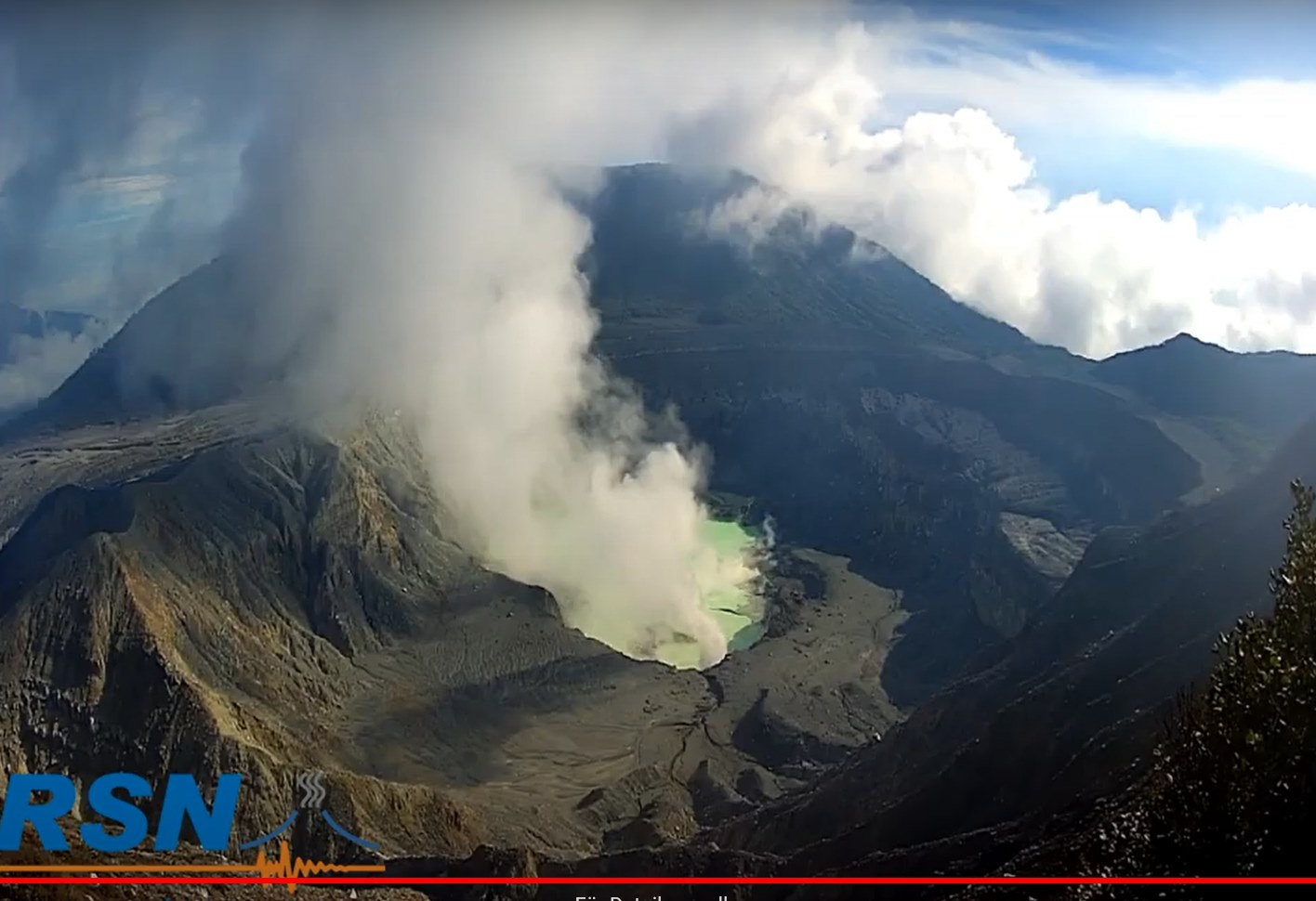
No eruption was detected. The number of daily LP type events fluctuates, sporadic VT type events are recorded, seismic activity remains variable and dominated by hydrothermal processes. Small inflation is detected but does not represent a significant deformation of the volcano. The CO2 / SO2 and H2S / SO2 gas ratios remain variable within the normal range of values. The flow of SO2 is stable between 100 and 150 t / d. The level of the lake has remained stable despite heavy rains.
Rincon de la Vieja volcano:
Lat: 10.83 ° N; Long: 85.324 ° W;
Height: 1895 m above sea level
Current activity level: 3 (erupting volcano)
Potentially associated hazards: gas, phreatic eruptions, Proximal ballistic projections, lahars.
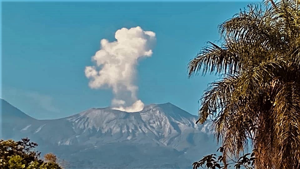
A decrease in the seismic activity of the volcano is confirmed, with levels similar to those in early March 2020. The number of daily eruptions and exhalations has greatly decreased. The tremor fell to a low amplitude background level on June 21. The RSAM has continued to decline since the end of May 2020. The geodetic measurements show no significant deformation. The modal analysis of the ashes of May 26, 2020 did not show an increase in the magmatic contribution. No thermal anomaly was detected by the MODIS analysis.
Irazu volcano:
Lat: 9.979 ° N; Long: 83.852 ° W;
Altitude: 3432 m above sea level
Current activity level: 1 (active)
Potentially associated hazards: landslides.
A seismic sequence was detected in the tower sector on June 22. The main landslide continues with strong acceleration.
Miravalles Volcano:
Lat: 10.44 ° N; Long: 85.09 ° W; Altitude: 2028 meters above sea level
Current activity level: 0 (asleep)
Potentially Associated Hazards: Earthquakes.
A sequence of VT type events between 8 and 13 km deep began on June 18 and 19. Such a swarm has been recorded several times since 2008, sometimes with felt earthquakes. Due to the depth and type of focal mechanism, it is not considered to be associated with reinjection by geothermal exploitation in the area.
Source : Ovsicori .
Photos : RSN , RSN , Maurice Gutiérrez , RSN , Trip advisor .
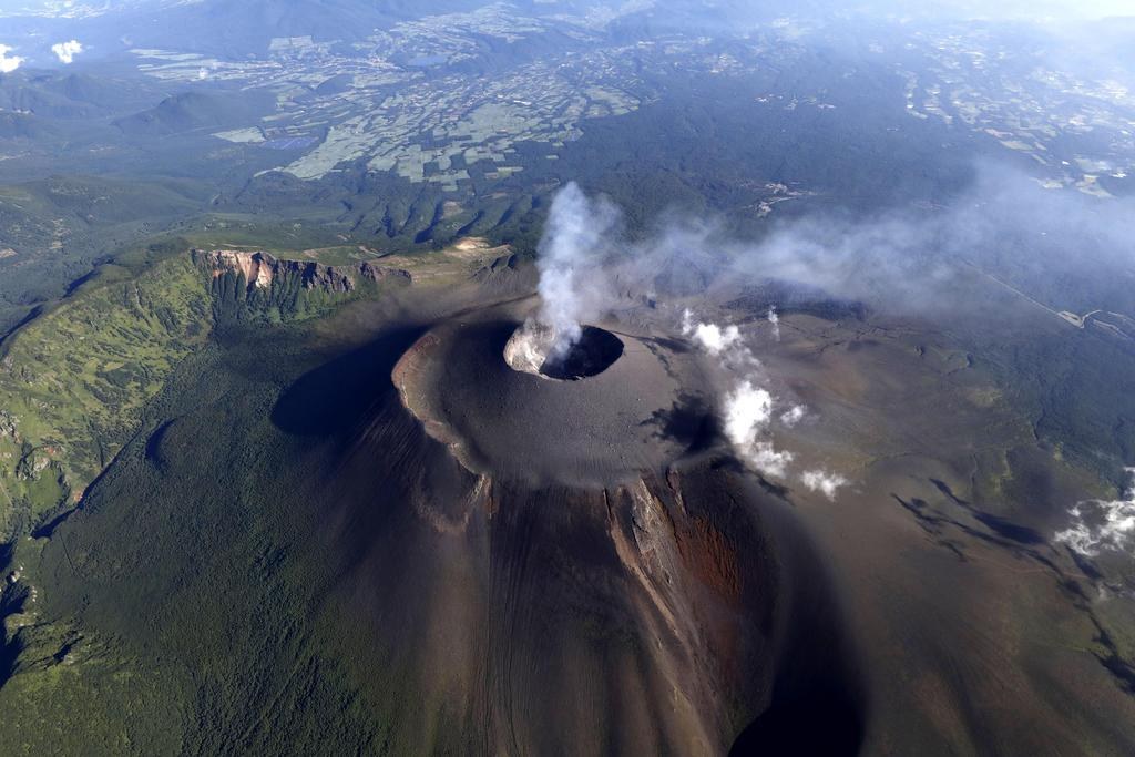
Hawaii , Mauna Loa :
19°28’30 » N 155°36’29 » W,
Summit Elevation 13681 ft (4170 m)
Current Volcano Alert Level: ADVISORY
Current Aviation Color Code: YELLOW
Activity Summary:
Mauna Loa Volcano is not erupting. Rates of deformation and seismicity have not changed significantly over the past week and remain above long-term background levels.
Observations:
During the past week, HVO seismometers recorded 153 small-magnitude earthquakes on the volcano. Most of these earthquakes occurred at shallow depths of less than 8 kilometers (~5 miles) below sea level. The largest earthquake was a magnitude 2.7 (M2.7) event that occurred on the upper southeast flank, south of the northeast rift zone, on June 20. A second 2.7 (M2.7) earthquake occurred in the south caldera on June 19.
An early morning view looking north across Moku‘āweoweo, Mauna Loa’s summit caldera, from a spot near the summit cabin on the volcano’s south caldera rim. Frost covered much of the caldera floor that was still shadowed, and weak steaming issued from the usual areas. Overall, there were no significant changes observed at the summit. The 1940 and 1949 cones are visible in the sunlit area at left, and the gap that connects the caldera to South Pit is visible at the far left. Photos by M. Patrick, 09-08-2019.
Global Positioning System (GPS) measurements show long-term slowly increasing summit inflation, consistent with magma supply to the volcano’s shallow storage system.
Gas concentrations and fumarole temperatures at both the summit and the Sulphur Cone on the Southwest Rift Zone remain stable at ~1 ppm SO2 and 97 C (206 F). An elevated CO2 source was reported last week on June 17 on the lower southwest rift zone, but the excess CO2 is believed to be plants decaying from a homeowner’s recent landscaping, and not volcanic in origin.
Webcams show no changes to the landscape.
Source : HVO.