June 07 , 2020.
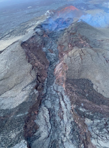
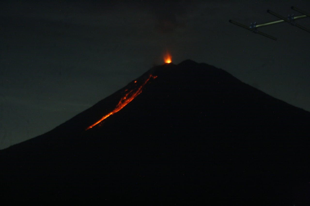
Chile , Nevados of Chillan :
Region Del Ñuble, Nevados de Chillán volcanic complex, 06 June 2020, 04:50 Local time (continental Chile).
The National Geological and Mining Service of Chile (Sernageomin) publishes the following PRELIMINARY information, obtained by the surveillance teams of the National Volcanic Surveillance Network (RNVV), processed and analyzed at the Andean Volcanological Observatory of Sur (Ovdas):
Yesterday, Saturday 06 June at 04:17 local time (08:17 UTC), the monitoring stations installed near the volcanic complex of Nevados de Chillán recorded an earthquake associated with the dynamics of fluids in the volcanic system (type long period).

Explosion of the Chillán volcano 04 June at 16:11 hrs. View from the El Caracol sector in San Fabián de Alico, region of Ñuble.
The characteristics of the earthquake after its analysis are as follows:
TIME OF ORIGIN: 04:17 local time (08:17 UTC)
LATITUDE: 36,856 ° S
LENGTH: 71.376 ° W
DEPTH: 6.0 km
REDUCED DISPLACEMENT: 511 (cm * cm)
ACOUSTIC SIGNAL: 9.1 Pascals (Pa) reduced to 1 km
In addition, the characteristics of the associated surface activity are as follows:
MAXIMUM COLUMN HEIGHT: exceeds 760 meters above the emission point (exceeds Portezuelo)
DIRECTION OF DISPERSION: North-East (NE)
OBSERVATIONS:
Basal pyroclastic flows distributed mainly towards the North, the North-West, the East and the South-East are observed.
The volcanic technical alert remains at the level: ORANGE.
Source : Sernageomin .
Photo : Josefauna.
Philippines , Kanlaon / Mayon / Taal :
KANLAON VOLCANO BULLETIN 07 June 2020 08:00 A.M.

Kanlaon Volcano’s seismic monitoring network recorded three (3) volcanic earthquakes during the 24-hour observation period. Moderate emission of white steam-laden plumes that rose 300 meters before drifting northeast and southeast was observed. Ground deformation data from continuous GPS measurements indicate a slight deflation of the lower and mid slopes since January 2020. Short-term electronic tilt monitoring on the southeastern flanks recorded continuing deflation on the lower slopes but inflation on the mid slopes since April 2020. These parameters indicate that hydrothermal or magmatic activity is occurring beneath the edifice.
MAYON VOLCANO BULLETIN 07 June 2020 08:00 A.M.

Mayon Volcano’s seismic monitoring network did not detect any volcanic earthquake during the 24-hour observation period. Moderate emission of white steam-laden plumes drifting west-southwest to north was observed. Sulfur dioxide (SO2) emission was last measured at an average of 178 tonnes/day on 02 June 2020. Electronic tilt data indicated non-steady inflation of the middle to upper edifice that began in late 2019. This follows an inflationary trend that has been recorded by continuous GPS monitoring since the middle of 2019.
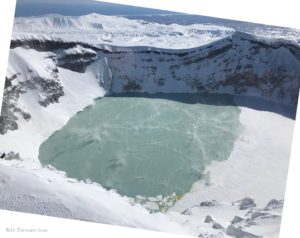
TAAL VOLCANO BULLETIN 07 June 2020 08:00 A.M.
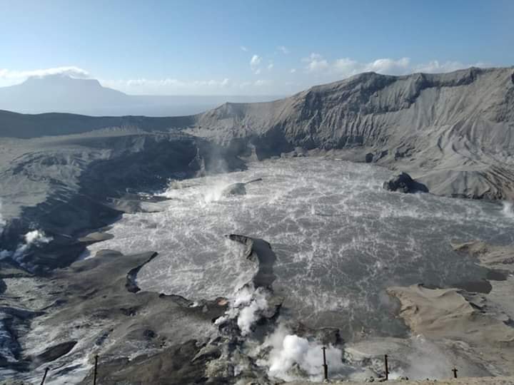
In the past 24-hour period, the Taal Volcano Network recorded three (3) volcanic earthquakes that are associated mainly with rock-fracturing processes beneath and around the edifice. Weak steaming or fumarolic activity that drifted southwest was observed from vents on the Main Crater and fissure vents along the Daang Kastila Trail.
Source : Phivolcs.
Photos : Phivolcs , Czar Dancel / Manila Bulletin , Quezon Trending News .
Indonesia , Semeru :
VOLCANO OBSERVATORY NOTICE FOR AVIATION – VONA.
Issued: June 06 , 2020
Volcano: Semeru (263300)
Current Aviation Colour Code: ORANGE
Previous Aviation Colour Code: orange
Source: Semeru Volcano Observatory
Notice Number: 2020SMR58
Volcano Location: S 08 deg 06 min 29 sec E 112 deg 55 min 12 sec
Area: East java, Indonesia
Summit Elevation: 11763 FT (3676 M)
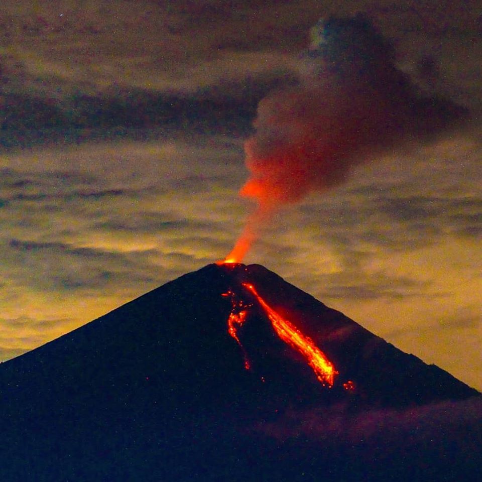
Volcanic Activity Summary:
Eruption with volcanic ash cloud at 23h31 UTC (06h31 local)
Volcanic Cloud Height:
Best estimate of ash-cloud top is around 13043 FT (4076 M) above sea level, may be higher than what can be observed clearly. Source of height data: ground observer.
Other Volcanic Cloud Information:
Ash cloud moving to north
Remarks:
Seismic activity is characterized by eruption, avalanche and gas emission earthquakes
Level of activity at level II (WASPADA). The Semeru volcano (3676 m above sea level) is experiencing a continuous eruption. Explosive and effusive eruptions have been recorded, causing lava flows to the south and southeast slopes, and glowing rock emissions around the summit crater.
The volcano is covered with fog. There is no smoke from the crater. The weather is cloudy to rainy, weak to strong winds in the North, South, South-West and West …
According to the seismographs of June 6, 2020, it was recorded:
62 eruption earthquakes
22 emission earthquakes.
1 Deep volcanic earthquake.
2 distant tectonic earthquakes
Recommendation:
The community must not carry out activities within a radius of 1 km and in the area up to 4 km in the South-South-East slope sector of the active crater which is an opening area of the active crater of G. Semeru (Jongring Seloko) as a channel for sliding warm clouds.
Source : Magma Indonésie , PVMBG.
Photos : @visit.pronojiwo , PVMBG.
Costa Rica , Rincon de la Vieja :
Since June 04, 2020, a continuous eruption has been recorded on the Rincon de la Vieja volcano, with a column that rises to 1600 meters above the height of the crater and to 3516 m of altitude. (11532.48 ft).
Seismic activity is similar to that of yesterday.
At the time of this report, the winds were blowing north.
At 11:46 p.m. yesterday, an eruption was recorded that produced a column that rose at least 1,600 meters high. The winds are blowing in a northern direction, which is why a fall of ash has been reported in the areas surrounding the volcano towards the North side. The seismicity changed after the eruption, going from a tremor in bands to a continuous tremor which stopped at 3 am today. The deformation signal from the volcanic building remains below the detection level. Chemical analyzes of the ash spilled last week mainly suggest hydrothermal activity with very little magmatic interaction.
At 10:58:00 local time on June 06, 2020, an eruption is recorded on the Rincon de la Vieja volcano, the height reached by the column is unknown due to the visibility conditions of the site.
Duration of activity: 1 minute.
Seismic activity is similar to that of yesterday.
The wind direction is unknown at this time.
A 1 Hz main frequency band tremor is detected. Small eruptions are still observed. Last arrival at 10.58 am.
Source : Ovsicori .
Photo : Chris Allen.