February 24 , 2020.
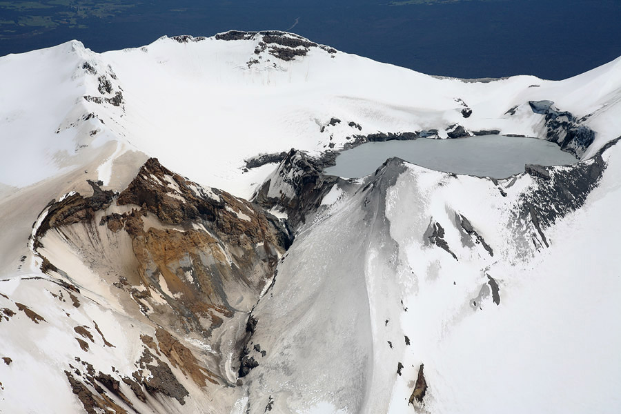
New Zealand , Ruapehu :
Mt Ruapehu: Minor seismic activity recorded .Published: Mon Feb 24 2020 4:00 PM
Volcanic Alert Level remains at 1
Aviation Colour Code remains at Green
A short-lived episode of volcanic earthquakes occurred beneath Mt Ruapehu last Saturday 22 – Sunday 23 February. The earthquake episode has ended.
On Saturday 22 and Sunday 23 February, GeoNet seismographs detected a sequence of seismic events beneath Mt Ruapehu. GNS Science volcanologists have categorised them as volcanic earthquakes. The larger events at the start of the episode are approximately magnitude 1.5 and later, smaller events are too small to be located by GeoNet’s earthquake detection-location system.
The seismic recordings indicate a source beneath the summit area, which is normal for volcanic earthquakes and volcanic tremor at Ruapehu. The sequence now appears to be over.
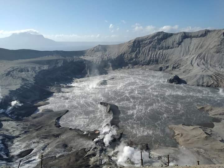
The Crater Lake (Te Wai ā-moe) temperature has been around 24-25 ºC for the last few months.
GeoNet monitors Mt Ruapehu via a network of seismic and acoustic sensors, GPS receivers, sensors in the lake and visits to the lake area. These include gas flights over Ruapehu for measuring gas emission and a monitoring visit to Te Wai ā-moe to collect water and gas samples as weather allows.
It is not unusual to observe volcanic earthquakes on Ruapehu and other episodes of increased seismic activity were observed during March 2018, April 2016 and September 2017. None of these resulted in a sustained increase in volcanic unrest.
The Volcanic Alert Level, therefore, remains at Level 1. The Volcanic Alert Level reflects the current level of volcanic activity and is not a forecast of future activity. There is no change in the Aviation Colour Code from Green.
GNS Science and the National Geohazards Monitoring Centre continues to closely monitor Mt Ruapehu for further signs of activity.
Source : Geonet / Agnes Mazot / Duty Volcanologist.
Photo : Geonet .
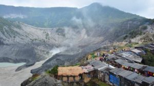
Philippines , Taal / Mayon :
TAAL VOLCANO BULLETIN 24 February 2020 8:00 A.M.
Activity in the Main Crater in the past 24 hours has been characterized by weak emission of steam-laden plumes rising 50-100 meters high before drifting northeast. The Taal Volcano Network recorded thirty-two (32) volcanic earthquakes that are associated with rock fracturing processes beneath and around the edifice.
MAYON VOLCANO BULLETIN 24 February 2020 08:00 A.M.
Mayon Volcano’s seismic monitoring network recorded five (5) volcanic earthquakes during the 24-hour observation period. Moderate emission of white steam-laden plumes that crept downslope before drifting west was observed. Sulfur dioxide (SO2) emission was measured at an average of 478 tonnes/day on 23 February 2020. Recent electronic tilt data showed inflation of the middle to upper portions of the volcanic edifice that began in the last quarter of 2019. This follows an inflationary trend that began in February 2019 as recorded by continuous GPS monitoring.
Source : Phivolcs .
Photo : TAAL , Quezon Trending News.
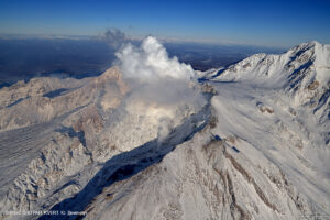
Chile , Nevados de Chillan :
Special volcanic activity report (REAV) Ñuble Region, Nevados de Chillán Volcanic Complex, January 30, 2020, 4:00 p.m. Local time (mainland Chile).
The National Geological and Mining Service of Chile (Sernageomin) discloses the following PRELIMINARY information, obtained with the monitoring equipment of the National Volcanic Monitoring Network (RNVV), processed and analyzed at the Andean Volcanological Observatory of South (OVDAS):
On Sunday February 23, at 1:04 a.m. local time (04:04 UTC), the monitoring stations installed near the Nevados de Chillán Volcanic Complex recorded a volcano-tectonic earthquake (VT), associated with a material fracture rigid inside the volcanic building, located 3.3 km east-south-east of the Nicanor crater.
The characteristics of the earthquake are as follows:
TIME OF ORIGIN: 1:04 a.m. local time (4:04 a.m. UTC)
LATITUDE: 36 8855 ° S
LONGITUDE: 71 3478 ° W
DEPTH: 3.8 km
LOCAL MAGNITUDE: 3.3
OBSERVATIONS:
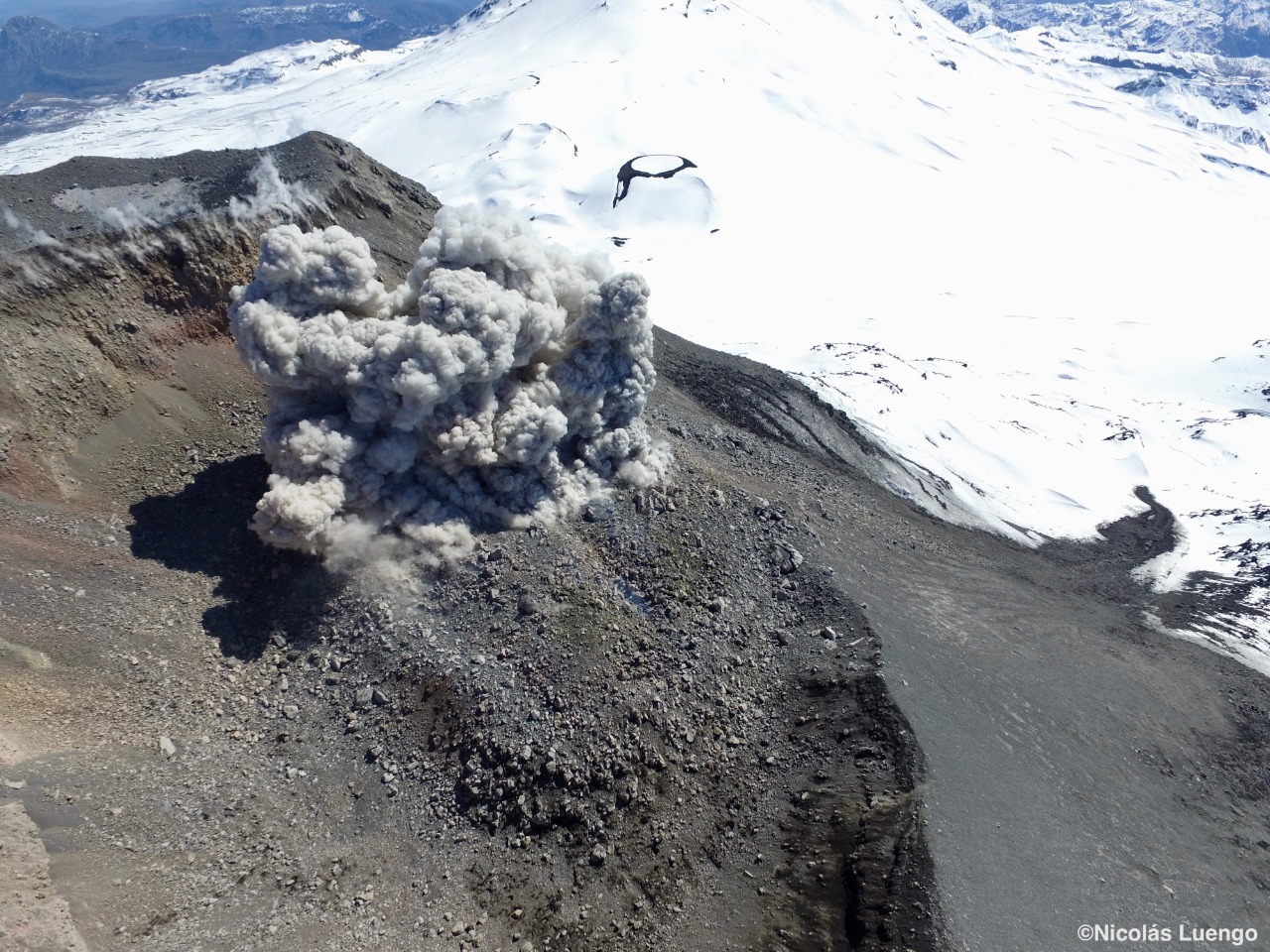
The event was preceded by 4 smaller magnitude fracturing earthquakes. No surface activity associated with the described event has been recorded.
The volcanic technical alert is maintained at the level: Orange level.
Source : Sernageomin.
Photo : Nicolas Luengo.
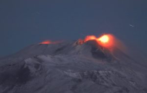
Mexico , Popocatepetl :
February 23, 11:00 a.m. (February 23, 5:00 p.m. GMT).
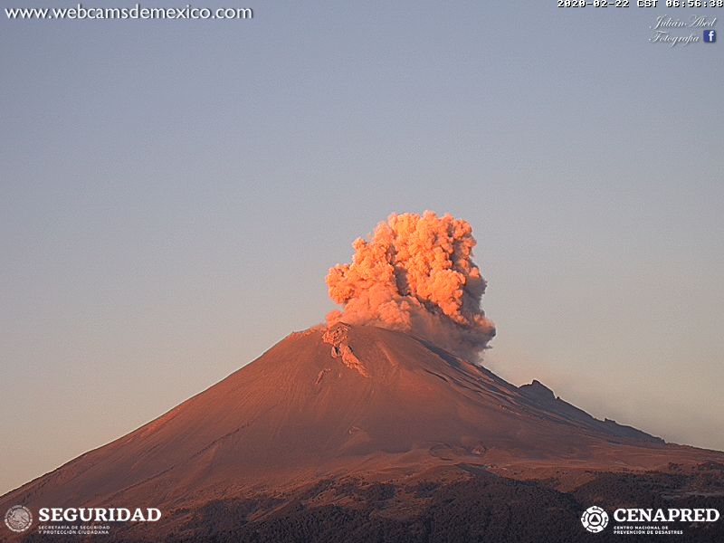
According to the monitoring systems of the Popocatepetl volcano, 130 exhalations have been identified with emissions of water vapor, gas and slight amounts of ash, as well as two moderate explosions, one yesterday at 9:23 p.m. and another today at 12:00 a.m. : 44. During the latter, incandescent materials were observed on the slopes of the northeast side of the volcano. There were also three minor explosions today at 02:31, 03:01 and 03:14 hrs. The explosions had a low ash content and dispersed to the northwest. 349 minutes of tremors were also recorded.
This morning, the volcano is visible, all emissions will be dispersed to the West.
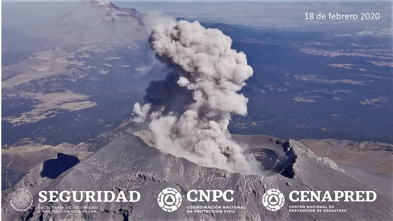
On February 18, with the support of the National Guard, a reconnaissance overflight was carried out towards the crater of the Popocatepetl volcano. During this overview, specialists from the National Center for Disaster Prevention (CENAPRED) of the National Coordination for Civil Protection and researchers from the Geophysics Institute of UNAM were able to observe the morphological conditions of the volcano. The internal crater maintains a diameter of 350 m and its approximate depth is 100 to 150 m, which is covered with tephra. In general, no substantial change is observed.
CENAPRED urges NOT to APPROACH the volcano and especially the crater, because of the danger of falling ballistic fragments, and in case of heavy rain, to stay far from the bottom of the ravines because of the danger of mudslides and debris .
The Popocatépetl volcanic signaling light is in YELLOW PHASE 2.
Source et photos : Cenapred .